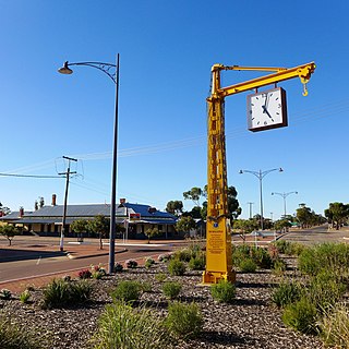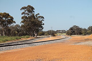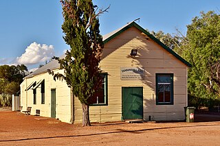
Narembeen is a town in the Wheatbelt region of Western Australia. It is 286 km, almost due east, from Perth, the capital of WA. It is the major settlement in the Shire of Narembeen, in which the major industries are growing cereal crops and raising cattle and sheep. The surrounding areas produce wheat and other cereal crops. The town is a receival site for Cooperative Bulk Handling.

Dalwallinu is a town in the Wheatbelt region of Western Australia, located 248 km from Perth via the Great Northern Highway. Agriculture and supporting industries are the town's primary economic activities. The town is the first town on the Wildflower Way, a tourist route that stretches north to Mullewa. The town has an elevation of 335 metres (1,099 ft). At the 2016 census, Dalwallinu had a population of 699.

Narrikup is a small town between Albany and Mount Barker in the Great Southern region of Western Australia. At the 2006 census, Narrikup had a population of 515.

Beverley is a town in the Wheatbelt region of Western Australia, 133 kilometres (83 mi) south-east of the state capital, Perth, between York and Brookton on the Great Southern Highway. It is on the Great Southern railway line.

Brookton is a town in the Wheatbelt region of Western Australia, 138 kilometres (86 mi) from the state capital, Perth via the Brookton Highway where it crosses the Great Southern Highway. The town is on the Great Southern railway line. It is within, and is the seat of government for, the Shire of Brookton. At the 2016 census, Brookton had a population of 975.

Yilliminning is a small town located in the southern Wheatbelt region of Western Australia, 212 kilometres (132 mi) southeast of the state capital, Perth and 23 kilometres (14 mi) east of Narrogin. At the 2006 census, Yilliminning had a population of 337.

Yornaning is a small town located in the Wheatbelt region of Western Australia, on Great Southern Highway, between Pingelly and Narrogin.

Yealering is a town in the Wheatbelt region of Western Australia, approximately 220 km south-east of Perth between the towns of Wickepin and Corrigin. It is located beside the lake of the same name. While the town's population is small, it services a large agricultural district in the northern Wickepin Shire. At the 2016 census, Yealering had a population of 104.
Harrismith is a small town in the Wheatbelt region of Western Australia, approximately 260 kilometres (162 mi) south-east of Perth between the towns of Wickepin and Kulin.

Pingelly is a town and shire located in the Wheatbelt region of Western Australia, 158 kilometres (98 mi) from Perth via the Brookton Highway and Great Southern Highway. The town is also located on the Great Southern railway line.
Piesseville is a small town in the Wheatbelt region of Western Australia, 211 kilometres (131 mi) south-east of Perth on the Great Southern Highway between Narrogin and Wagin. It is also on the Great Southern Railway. At the 2016 census, Piesseville had a population of 59.
Nyabing is a small town in the Great Southern region of Western Australia. The name is of Aboriginal origin and is thought to derive from the Aboriginal word "ne-yameng", which is the name of an everlasting flower Rhodanthe manglesii.
Hendon is a rural town and locality in the Southern Downs Region, Queensland, Australia. In the 2016 census, the locality of Hendon had a population of 200 people.
Redmond is a town in the Great Southern region of Western Australia. It is located 399 km south-south-east of Perth and the closest populated town is Albany.

Pithara is a small town in the wheatbelt region of Western Australia. It is located about 240 km north of Perth, in the Shire of Dalwallinu. At the 2011 census, Pithara had a population of 257, a 25% fall from the previous 2006 census.

Yandanooka is a small town in the Mid West region of Western Australia. The town is located between Mingenew and Three Springs on the Midlands Road.
Nanson is a small town in the Mid West region of Western Australia, between the city of Geraldton and the town of Northampton. The town is situated on the banks of the Chapman River in the Chapman Valley. At the 2006 census, Nanson had a population of 386.
Walgoolan is a small town located in the eastern Wheatbelt region of Western Australia. It is situated between Merredin and Bodallin along the Great Eastern Highway.
Muradup is a small town in the Great Southern region of Western Australia located between Kojonup and Boyup Brook. The town is situated along the Balgarup River.
Muntadgin is a townsite off the Great Eastern Highway on Brissenden Road, situated between the towns of Bruce Rock and Southern Cross in the Wheatbelt region of Western Australia. At the 2016 census, Muntadgin had a population of 51.


