Narembeen is a town in the Wheatbelt region of Western Australia. It is 286 km, almost due east, from Perth, the capital of WA. It is the major settlement in the Shire of Narembeen, in which the major industries are growing cereal crops and raising cattle and sheep. The surrounding areas produce wheat and other cereal crops. The town is a receival site for Cooperative Bulk Handling.

Kalannie is a small town in the Shire of Dalwallinu, in the Wheatbelt region of Western Australia, approximately 259 kilometres (161 mi) north-east of the state capital, Perth.

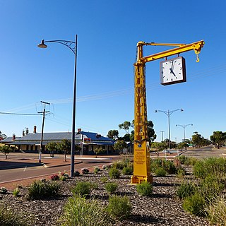
Tammin is a town in the central agricultural region of Western Australia, 184 kilometres (114 mi) east of Perth and midway between the towns of Cunderdin and Kellerberrin on the Great Eastern Highway.

Burracoppin is a townsite on the Great Eastern Highway, east of Merredin in the Wheatbelt region of Western Australia.

Wyalkatchem is a town in the central Wheatbelt region, 192 kilometres (119 mi) east-north-east of Perth, 35 kilometres (22 mi) east of Dowerin and 44 kilometres (27 mi) south of Koorda. At the 2021 census, Wyalkatchem had a population of 358.

Doodlakine is a town 220 km (140 mi) east of Perth, Western Australia. It is within the Shire of Kellerberrin along the Great Eastern Highway. The town has a crossing loop for trains on the Perth-to-Kalgoorlie railway and serves as a stop on the MerredinLink rural train service.

Meckering is a town 130 kilometres (80.8 mi) east of Perth, Western Australia along the Great Eastern Highway. Meckering is located within the Shire of Cunderdin.

Yealering is a town in the Wheatbelt region of Western Australia, approximately 220km south-east of Perth between the towns of Wickepin and Corrigin. It is located beside the lake of the same name. While the town's population is small, it services a large agricultural district in the northern Wickepin Shire. At the 2016 census, Yealering had a population of 104.

Trayning is a town in the north-eastern Wheatbelt region of Western Australia, 236 kilometres (147 mi) east of the state capital, Perth, on the Nungarin–Wyalkatchem Road. At the 2006 census, Trayning had a population of 122.

Nungarin is a town located in the north east of the Wheatbelt region of Western Australia, approximately 278 kilometres (173 mi) east of Perth and 39 kilometres (24 mi) north of Merredin. It is the main town in the Shire of Nungarin. At the 2006 census, Nungarin had a population of 142.

Ardath is a small town in the Wheatbelt region of Western Australia 20 kilometres (12 mi) south of the town of Bruce Rock.

Koorda is a town in the north eastern Wheatbelt region of Western Australia, approximately 236 kilometres (147 mi) east of Perth and 43 kilometres (27 mi) north of Wyalkatchem at the northeastern end of the Cowcowing Lakes. It is the main town in the Shire of Koorda. At the 2016 census Koorda had a population of 414. The surrounding areas produce wheat and other cereal crops. The town is a receival site for Cooperative Bulk Handling.
Baandee is a small town located in the Wheatbelt region of Western Australia, about halfway between the towns of Kellerberrin and Merredin on the Great Eastern Highway, approximately 230 kilometres (143 mi) from Perth, the state capital.

Miling is a small town in the Shire of Moora, 200 kilometres (124 mi) north of Perth, Western Australia. At the 2021 census, it had a population of 101.

Pithara is a small town in the Wheatbelt region of Western Australia. It is located about 240 km north of Perth, in the Shire of Dalwallinu. At the 2011 census, Pithara had a population of 257, a 25% fall from the previous 2006 census.

Yelbeni is a small town 222 km east-northeast of Perth, Western Australia along the Nungarin-Wyalkatchem Road situated in the Wheatbelt region of Western Australia. At the 2006 census, Yelbeni had a population of 118.
Welbungin is a small town located just off the Koorda–Southern Cross road 287 km (178 mi) from Perth in the Wheatbelt region of Western Australia.

Korrelocking is a small town situated between Wyalkatchem and Trayning in the Wheatbelt region of Western Australia. At the 2006 census, Korrelocking had a population of 76.
Walgoolan is a small town located in the eastern Wheatbelt region of Western Australia. It is situated between Merredin and Bodallin along the Great Eastern Highway.
Muntadgin is a townsite off the Great Eastern Highway on Brissenden Road, situated between the towns of Bruce Rock and Southern Cross in the Wheatbelt region of Western Australia. At the 2016 census, Muntadgin had a population of 51.


