Pantapin, Western Australia

Last updated

Pantapin
Western Australia
Australia Western Australia location map.svg
Red pog.svg
Pantapin
Coordinates 31°57′00″S117°39′00″E / 31.95000°S 117.65000°E / -31.95000; 117.65000 Coordinates: 31°57′00″S117°39′00″E / 31.95000°S 117.65000°E / -31.95000; 117.65000
Population141 (2006 census) [1]
Established1913
Postcode(s) 6384
Elevation344 m (1,129 ft)
Location
LGA(s) Shire of Quairading
State electorate(s) Central Wheatbelt
Federal Division(s) O'Connor

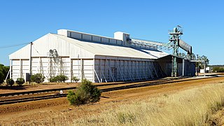
Pantapin is a small town in the Wheatbelt region of Western Australia.

Wheatbelt (Western Australia) region in Western Australia

The Wheatbelt is one of nine regions of Western Australia defined as administrative areas for the state's regional development, and a vernacular term for the area converted to agriculture during colonisation. It partially surrounds the Perth metropolitan area, extending north from Perth to the Mid West region, and east to the Goldfields-Esperance region. It is bordered to the south by the South West and Great Southern regions, and to the west by the Indian Ocean, the Perth metropolitan area, and the Peel region. Altogether, it has an area of 154,862 square kilometres (59,793 sq mi).

Western Australia State in Australia

Western Australia is a state occupying the entire western third of Australia. It is bounded by the Indian Ocean to the north and west, and the Southern Ocean to the south, the Northern Territory to the north-east, and South Australia to the south-east. Western Australia is Australia's largest state, with a total land area of 2,529,875 square kilometres, and the second-largest country subdivision in the world, surpassed only by Russia's Sakha Republic. The state has about 2.6 million inhabitants – around 11 percent of the national total – of whom the vast majority live in the south-west corner, 79 per cent of the population living in the Perth area, leaving the remainder of the state sparsely populated.

The town originated as a railway siding that was planned in 1912 as part of the Quairading to Bruce Rock line. The town was initially named Ulakain, after a nearby well, and was gazetted under that name in 1914.

Quairading, Western Australia Town in Western Australia

Quairading is a Western Australian town located in the Wheatbelt region. It is the seat of government for the Shire of Quairading.

Bruce Rock, Western Australia Town in Western Australia

Bruce Rock is a town in the Eastern Wheatbelt region of Western Australia, approximately 243 kilometres (151 mi) east of Perth and 48 kilometres (30 mi) southwest of Merredin. It is the main town in the Shire of Bruce Rock.

The name proved problematic causing mail and goods to go missing, according to the residents and was changed in 1921. [2]

Related Research Articles

Wongan Hills, Western Australia Town in Western Australia

Wongan Hills is a town in the Shire of Wongan-Ballidu, in the Wheatbelt region of Western Australia. The town is approximately 182 km north of the state capital Perth, at an altitude of 286 metres.

Tammin, Western Australia Town in Western Australia

Tammin is a town in the central agricultural region of Western Australia, 184 kilometres (114 mi) east of Perth and midway between the towns of Cunderdin and Kellerberrin on the Great Eastern Highway.

Walpole, Western Australia Town in Western Australia

Walpole is a town in the south-western region of Western Australia, located approximately 430 kilometres (270 mi) south southeast of Perth and 66 kilometres (41 mi) west of Denmark.

Meckering, Western Australia Town in Western Australia

Meckering is a town 130 km east of Perth, Western Australia along the Great Eastern Highway. Meckering is located within the Shire of Cunderdin.

Lancelin, Western Australia Town in Western Australia

Lancelin is a small fishing and tourist town 127 km north of Perth, Western Australia. It is within the Shire of Gingin at the end of Wanneroo Road, and a few kilometres from the start of the Indian Ocean Drive.

Shire of Quairading Local government area in Western Australia

The Shire of Quairading is a local government area in the Wheatbelt region of Western Australia, about 170 kilometres (106 mi) east of the state capital, Perth. The Shire covers an area of 2,018 square kilometres (779 sq mi), and its seat of government is the town of Quairading.

Lake King, Western Australia Town in Western Australia

Lake King is a town in the Eastern Wheatbelt region of Western Australia, 464 kilometres (288 mi) from Perth along State Route 107 between Wagin and Ravensthorpe.

Bonnie Rock, Western Australia Town in Western Australia

Bonnie Rock is a small town in the Wheatbelt region of Western Australia.

Bullaring, Western Australia Town in Western Australia

Bullaring is a small town located in the Wheatbelt region of Western Australia.

Bungulla, Western Australia Town in Western Australia

Bungulla is a small town located on the Great Eastern Highway in the central Wheatbelt region of Western Australia.

Gabbin, Western Australia Town in Western Australia

Gabbin is a small town in the Wheatbelt region of Western Australia.

Kondut, Western Australia Town in Western Australia

Kondut is a small town in Wheatbelt region of Western Australia.

Kulja, Western Australia Town in Western Australia

Kulja is a small town in the Wheatbelt region of Western Australia. The town is situated along the Bonnie Rock to Burakin Road.

Kwolyin, Western Australia Town in Western Australia

Kwolyin is a small town in the Wheatbelt region of Western Australia.

Manmanning, Western Australia Town in Western Australia

Manmanning is a small Wheatbelt town in Western Australia.

Pingaring, Western Australia Town in Western Australia

Pingaring is a small town in the Wheatbelt region of Western Australia.

Shackleton, Western Australia Town in Western Australia

Shackleton is a small town in the Wheatbelt region of Western Australia.

Wannamal, Western Australia Town in Western Australia

Wannamal is a small town in the Wheatbelt region of Western Australia.

Watheroo, Western Australia Town in Western Australia

Watheroo is a small town in the Wheatbelt region of Western Australia. In 2016 it had 181 residents according to the 2016 census census.

Dandaragan, Western Australia Town in Western Australia

Dandaragan is a small town in the Wheatbelt region of Western Australia. The name of Dandaragan was first recorded in 1850 as the name of a nearby gulley and spring or watering hole known as Dandaraga spring. The word is Indigenous Australian in origin and is thought to mean good kangaroo country.

References

  1. Australian Bureau of Statistics (25 October 2007). "Pantapin (State Suburb)". 2006 Census QuickStats. Retrieved 11 October 2008.
  2. Western Australian Land Information Authority. "History of country town names – P" . Retrieved 4 October 2008.