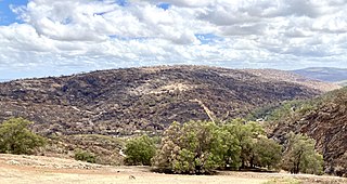
The Darling Scarp, also referred to as the Darling Range or Darling Ranges, is a low escarpment running north–south to the east of the Swan Coastal Plain and Perth, Western Australia. The escarpment extends generally north of Bindoon, to the south of Pemberton. The adjacent Darling Plateau goes easterly to include Mount Bakewell near York and Mount Saddleback near Boddington. It was named after the Governor of New South Wales, Lieutenant-General Ralph Darling.

Mundaring is a suburb located 34 km east of Perth, Western Australia on the Great Eastern Highway. The suburb is located within the Shire of Mundaring.

Great Eastern Highway is a 590-kilometre-long (370 mi) road that links the Western Australian capital of Perth with the city of Kalgoorlie. A key route for road vehicles accessing the eastern Wheatbelt and the Goldfields, it is the western portion of the main road link between Perth and the eastern states of Australia. The highway forms the majority of National Highway 94, although the alignment through the Perth suburbs of Guildford and Midland, and the eastern section between Coolgardie and Kalgoorlie are not included. Various segments form parts of other road routes, including National Route 1, Alternative National Route 94, and State Route 51.

The Eastern Railway is the main railway route between Fremantle and Northam in Western Australia. It opened in stages between 1881 and 1893. The line continues east to Kalgoorlie as the Eastern Goldfields Railway.

Bellevue is an eastern suburb of Perth, Western Australia in the local government areas of the City of Swan and the Shire of Mundaring. It is at the foot of the slopes of Greenmount, a landmark on the Darling Scarp that is noted in the earliest of travel journals of the early Swan River Colony.

Greenmount is a locality and a geographical feature in the Shire of Mundaring, Western Australia, on the edge of the Darling Scarp. It is a vital point in the transport routes from the Swan Coastal Plain into the hinterland of Western Australia.

The Helena River is a tributary of the Swan River in Western Australia. The river rises in country east of Mount Dale and flows north-west to Mundaring Weir, where it is dammed. It then flows west until it reaches the Darling Scarp.

The Railway Reserves Heritage Trail – also on some maps as Rail Reserve Heritage Trail or Rail Reserves Historical Trail, and frequently referred to locally as the Bridle Trail or Bridle Track – is within the Shire of Mundaring in Western Australia.

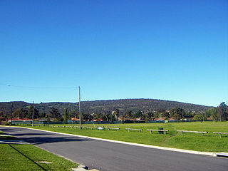
Swan View is an eastern suburb of Perth, Western Australia. Its local government areas are the City of Swan and the Shire of Mundaring. It is 25 kilometres (16 mi) from Perth in the Perth Hills on the edge of the Darling Scarp, just to the west of the John Forrest National Park, east of Roe Highway and north of the Great Eastern Highway.
Wooroloo is a town on the outer fringe of the Perth metropolitan region, located off Great Eastern Highway in the eastern part of the Shire of Mundaring. At the 2006 census, Wooroloo had a population of 254.
Bailup is a Western Australian locality and rural residential estate located 62 kilometres (39 mi) north-east of the state capital, Perth, along Toodyay Road. The population recorded at the 2016 census was 40. The area is split between the Shire of Toodyay and Shire of Mundaring, the latter of which contains most of the land area.

Swan Hills is an electoral district of the Legislative Assembly in the Australian state of Western Australia.

Great Eastern Highway Bypass is a limited-access dual carriageway linking Great Eastern Highway and Roe Highway in Perth, Western Australia. Together with a section of Roe Highway, it bypasses the historical Guildford and Midland localities, through which the original, urban and slower Great Eastern Highway passes.

Perth Hills is a term used primarily for marketing purposes to identify the part of the Darling Scarp and hinterland east of the scarp that lies within the Shire of Mundaring, City of Swan, and the City of Kalamunda and as part of the constituent bodies belonging to the Eastern Metropolitan Regional Council of Perth, Western Australia.

Kalamunda Road is a minor arterial road linking the historic suburb of South Guildford with the Darling Scarp suburb of Kalamunda, in Perth, Western Australia.
Red Hill is a suburb of Perth, Western Australia. It has Toodyay Road pass through it on the way up the Darling Scarp. It is in the City of Swan local government area. At the 2011 Australian Census the suburb recorded a population of 98.
Helena Vale was the original name for Midland Junction in Western Australia between 1885 and 1901. It was also the earlier name of the Midland Junction Municipality between 1895 and 1901. The name has been long associated with the area between Midland and the Darling Scarp.

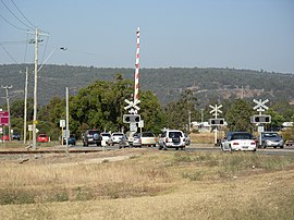
Swan View railway station, Perth was a railway station of significance on the Eastern Railway in Western Australia. In all working timetables during the operation of this line, the station was the point of control for the Swan View Tunnel.
Tourist Drives in Western Australia are routes through areas of scenic or historic significance, designated by route markers with white numbers on a brown shield. Tourist Drives were introduced into Western Australia while Eric Charlton was the state government Minister for Transport in the 1990s. The 28 numbered routes collectively traverse more than 2,000 kilometres (1,200 mi) across the state. In addition to the Tourist Drives, there are unnumbered routes such as the Golden Pipeline Heritage Trail, and local governments may designate and maintain local scenic drives, generally unnamed and unnumbered.
The 2021 Wooroloo bushfire was a fast moving bushfire that started on 1 February in Wooroloo, 45 kilometres (28 mi) north-east of the Perth central business district, in the Shire of Mundaring, Western Australia. By 2 February, the bushfire emergency had spread to Shires of Chittering and Northam, and the City of Swan. It had destroyed at least 86 houses and 2 fire trucks. By 6 February, the bushfire had travelled 26 km (16 mi) from its source. The fire coincided with a five day lockdown of the Perth metropolitan region that started at 6pm on 31 January, due to a case of COVID-19 outside of hotel quarantine. In July 2021, WA Police charged a man with a breach of duty and carrying out an activity that could cause a fire, alleging that he used an angle grinder that caused sparks.