
The City of Wanneroo is a local government area with city status in the northern suburbs of Perth, Western Australia. It is centred approximately 25 kilometres (15.5 mi) north of Perth's central business district and forms part of the northern boundary of the Perth metropolitan area. Wangara encompasses the federal divisions of Cowan, Moore and Pearce.
Rivervale is an inner eastern suburb of Perth, Western Australia. It is near the Swan River, 5 kilometres (3 mi) from the Perth central business district, and within the City of Belmont.

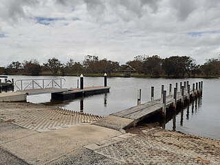
Como is a suburb of Perth, Western Australia. Its local government area is the City of South Perth. The suburb has a population of 12,423. Canning Highway divides the suburb.

Nowergup is a rural locality about 40 kilometres (25 mi) north of Perth, Western Australia. It is in the local government area of the City of Wanneroo.

Serpentine is a town located 55 kilometres (34 mi) south-southeast of Perth, the capital of Western Australia, and 7 km south of Mundijong.

Bullsbrook is a suburb of Perth, Western Australia in the outer metropolitan area. It is located in the City of Swan. The original Bullsbrook townsite is located slightly west of the current town, on the 17 km mark of the Midland Railway. Bullsbrook is also home to the RAAF Pearce airbase, a major training facility for the Royal Australian Air Force. The suburb is situated on the Great Northern Highway, 25 kilometres north of the Midland Strategic Regional Centre. It is well serviced by several major transport networks including the Great Northern Highway, Railway Parade and the Brand Highway to the north, Chittering Road to the east and Neaves Road to the west. Bullsbrook is also adjacent to the State rail network, providing an opportunity for the development of an intermodal freight transport hub. The site is further strengthened by linkage to the planned Perth-Darwin National Highway via Stock Road.

East Perth is an inner suburb of Perth, Western Australia, located next to the Perth central business district. Claise Brook and Claisebrook Cove are within the suburb. Formerly characterised by industrial land uses and urban blight, the redevelopment of East Perth was, and remains, the largest inner-city urban renewal project in the state. The design of the new residential neighbourhoods was strongly influenced by the new urbanism movement.

Canning Vale is a southern suburb of Perth, 16 km (9.9 mi) from the central business district. Its local government areas are the City of Canning and the City of Gosnells.

Alkimos is a coastal suburb of Perth, Western Australia, located 42 kilometres (26 mi) north-northwest of Perth's central business district. It is part of the City of Wanneroo local government area.
Carramar is a suburb of Perth, Western Australia, located within the City of Wanneroo and it is situated 30 km from the Perth CBD. Its postcode is 6031, and it came into being, together with Tapping to the south, in 1995 as a subdivision of Neerabup.

Eglinton is a locality in the Western Australian capital city of Perth, approximately 44 kilometres (27 mi) north of Perth's central business district on the Indian Ocean. For the most part, the suburb is covered in native banksia woodland, scrubland and heath typical of the Swan Coastal Plain. However, in recent years, there has been growth in residential estates, with a town centre to be built in the near future. There are also plans for the Joondalup railway line to be extended through the suburb with Eglinton railway station to be located inside Allara estate.
Wattleup is a southern suburb of Perth, Western Australia, located within the City of Cockburn. In the mid 1990's to the early 2000's, planning was undertaken to redevelop the suburb as part of the Hope Valley-Wattleup Redevelopment Project, also known as "Latitude 32". This was to involve the acquisition and demolition of the townsite, and its rezoning and redevelopment for industrial use. The townsite of Wattleup was located at the western end of the suburb, at the intersection of Wattleup Road and Rockingham Road. Wattleup had many market gardens in the past. They provided agricultural produce for the town of Fremantle.

Singleton is an outer southern suburb of Perth, the capital city of Western Australia, located within the City of Rockingham. It is the southernmost suburb of the Perth Metropolitan Area and is actually closer to the regional city Mandurah than either Perth CBD or Rockingham. The area is under a development near the school, Singleton Primary, and near the main oval, Laurie Stanford Reserve. There is a petrol service station, a small shopping centre, and a school.
Bailup is a Western Australian locality and rural residential estate located 62 kilometres (39 mi) north-east of the state capital, Perth, along Toodyay Road. The population recorded at the 2021 census was 54. The area is split between the Shire of Toodyay and Shire of Mundaring, the latter of which contains most of the land area.
Coodanup is a south-eastern suburb of Mandurah, Western Australia. Its local government area is the City of Mandurah.
The Lakes is an outer northeastern locality of Perth, the capital city of Western Australia, located within the Shire of Mundaring. It is located 51 kilometres (32 mi) east of the Perth CBD, at the junction of the Great Eastern Highway and the Great Southern Highway, and is the easternmost suburb within the Metropolitan Region Scheme. At the 2011 census, The Lakes had a population of 45.

Belmont is a suburb of Perth, the capital city of Western Australia, and is located 7 kilometres (4 mi) east of Perth's central business district (CBD) on the southern bank of the Swan River. Its local government area is the City of Belmont.

Cockburn Central is a suburb of Perth, the capital city of Western Australia, and is 24 kilometres (15 mi) south of Perth's central business district (CBD) along the Kwinana Freeway. Its local government area is the City of Cockburn, and it is intended by the Government to serve as a regional centre for the area. It was approved as a name by the Geographic Names Committee in 2007.

Perth is a suburb in the Perth metropolitan region, Western Australia that includes both the central business district of the city, and a suburban area spreading north to the northern side of Hyde Park. It does not include the separate suburbs of Northbridge or Highgate. Perth is split between the City of Perth and the City of Vincent local authorities, and was named after the city of the same name in Scotland.

Hopeland is an outer suburb of the Western Australian capital city of Perth, located in the Shire of Serpentine-Jarrahdale. In the 2016 census, it had a population of 336 people. It was established in 1923 as Group 46 of the Group Settlement Scheme on Peel Estate; the name was in use for some time and it was established as a suburb name on 1 May 1997.
