Carine is a suburb of Perth, the capital city of Western Australia, and is located 14 kilometres (9 mi) north of Perth's central business district (CBD) between Marmion Avenue and Mitchell Freeway. Its local government area is the City of Stirling.
Dianella is a suburb of Perth, Western Australia. It is within the local government area of the City of Stirling.

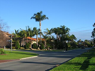
Hamersley is a residential suburb 14 kilometres north-northwest of the central business district of Perth, the capital of Western Australia, and six kilometres (4 mi) from the Indian Ocean. The suburb adjoins two major arterial roads—Mitchell Freeway to the west and Reid Highway to the south—and is within the City of Stirling local government area. It was built during the late 1960s and 1970s as part of the Government of Western Australia's response to rapidly increasing land prices across the metropolitan area.

Mirrabooka is a suburb of Perth, Western Australia. Its local government area is the City of Stirling. At the 2021 census it had a population of 8,000 people.

Mount Lawley is an inner northern suburb of Perth, Western Australia. The suburb is bounded by the Swan River to the east, Vincent, Harold and Pakenham Streets to the south, Central Avenue and Alexander Drive to the north, and Norfolk Street to the west.

Bassendean is a north-eastern suburb of Perth, Western Australia. Its local government area is the Town of Bassendean.
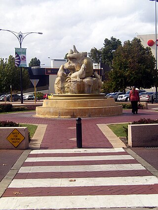
Morley is a suburb of Perth, within the City of Bayswater local government area, situated approximately 10 kilometres (6 mi) northeast of the Perth central business district. It contains the Galleria Shopping Centre, one of Perth's larger shopping centres. Galleria bus station is located in the car park of the shopping centre. From the late 1950s, Morley began to develop as a major shopping and commercial centre.

Ballajura is a suburb of Perth, Western Australia, in the City of Swan local government area. Ballajura is located 14 kilometres (8.7 mi) north of the Perth central business district. Situated on its side of its western boundary with Koondoola is Emu Swamp.
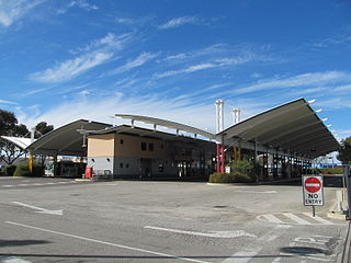
Galleria bus station, formerly Morley bus station, is a Transperth bus station located next to the Galleria Shopping Centre in Morley, Western Australia. It has 17 stands and is served by 17 Transperth routes operated by Path Transit, Swan Transit and Transdev WA.
Eden Hill is an eastern suburb of Perth, Western Australia, located within the Town of Bassendean. The origin of its name is unknown, either coming from a farm in the area or an estate name used by Henry Brockman when he subdivided the area in 1892. It was approved as a suburb in 1954. The Swan Valley Nyungah Community was in the area.
Embleton is a suburb of Perth, the capital city of Western Australia, located 7 kilometres (4.3 mi) north-east of the central business district, between the suburbs of Morley and Bayswater. Its local government area is the City of Bayswater.

Noranda is a suburb of Perth, Western Australia, located in the City of Bayswater.

Wangara is a light industrial suburb of Perth, Western Australia, located within the City of Wanneroo.

Caversham is a suburb of Perth, Western Australia, located in the City of Swan.

Malaga is a suburb of Perth, Western Australia, approximately 11 kilometres (6.8 mi) north of the CBD, in the City of Swan.

Beechboro is a suburb of Perth, Western Australia, located within the City of Swan.

Nedlands is a western suburb of Perth, the capital city of Western Australia. It is a part of the local government areas of the City of Nedlands and the City of Perth. It is about 7 kilometres (4 mi) from the Perth CBD via either Thomas Street or Mounts Bay Road.
Kiara is a suburb of Perth, Western Australia, situated approximately 11 kilometres (7 mi) northeast of Perth's central business district and 8 kilometres (5 mi) from Midland, and located within the City of Swan local government area.

Perth is a suburb in the Perth metropolitan region, Western Australia that includes both the central business district of the city, and a suburban area spreading north to the northern side of Hyde Park. It does not include the separate suburbs of Northbridge or Highgate. Perth is split between the City of Perth and the City of Vincent local authorities, and was named after the city of the same name in Scotland.
Bennett Springs is a northeastern suburb of Perth, Western Australia, located in the City of Swan. Formed from parts of the suburbs of Beechboro, Whiteman and West Swan, it was originally a subdivision from Beechboro until April 2011 when it was gazetted following a 10-year campaign by residents. The suburb was named after Matilda Bennett, the wife of John Septimus Roe.
