
Mirrabooka is a suburb of Perth, Western Australia. Its local government area is the City of Stirling. At the 2021 census it had a population of 8,000 people.

Bassendean is a north-eastern suburb of Perth, Western Australia. Its local government area is the Town of Bassendean.

Redcliffe is a suburb of Perth, Western Australia, located in the City of Belmont local government area.

Bellevue is an eastern suburb of Perth, Western Australia in the local government areas of the City of Swan and the Shire of Mundaring. It is at the foot of the slopes of Greenmount, a landmark on the Darling Scarp that is noted in the earliest of travel journals of the early Swan River Colony.

East Guildford railway station is a Transperth railway station 14 km from Perth railway station, in Western Australia, on the Midland Line.

Bassendean railway station is a Transperth station located in Bassendean, 10.8 kilometres (6.7 mi) north-east of Perth railway station, on the Midland Line.

Burswood is an inner southeastern suburb of Perth, Western Australia, located immediately across the Swan River from Perth's central business district (CBD). Its local government area is the Town of Victoria Park. Burswood is the location of the State Tennis Centre, Perth Stadium, Belmont Park Racecourse, and the Crown Perth casino and hotel complex.

Ascot is a suburb of Perth, covering a narrow strip of land along the southern bank of the Swan River approximately 10 kilometres (6 mi) east of the Perth central business district. Its local government area is the City of Belmont.

Guildford is a suburb of Perth, Western Australia, 12 km northeast of the city centre within the City of Swan. Guildford was founded in 1829 as one of the earliest settlements of the Swan River Colony. It is one of only three towns in the metropolitan area listed on the Register of the National Trust.

Swan View is an eastern suburb of Perth, Western Australia. Its local government areas are the City of Swan and the Shire of Mundaring. It is 25 kilometres (16 mi) from Perth in the Perth Hills on the edge of the Darling Scarp, just to the west of the John Forrest National Park, east of Roe Highway and north of the Great Eastern Highway.

Midvale is a suburb of Perth, Western Australia, which is split between the City of Swan and the Shire of Mundaring. Its postcode is 6056.
High Wycombe is a suburb of Perth, Western Australia, within the City of Kalamunda. High Wycombe lies east of the Perth CBD at the base of the Darling Scarp. Formerly part of Maida Vale, the suburb was officially declared on 2 June 1978; its name, which was first used in 1958 by a subdivider, Western Agencies, refers to the town in Buckinghamshire where one of the partners in the firm was born.

Melville is a suburb of Perth, Western Australia located within the likewise named City of Melville.
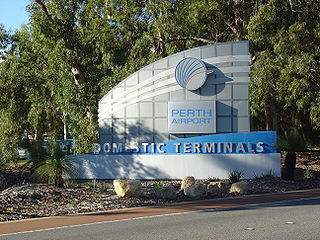
Perth Airport is an eastern suburb of Perth, the capital city of Western Australia. Its local government areas are the City of Belmont, the City of Swan (north) and the City of Kalamunda (east). It is located approximately 12 km east of the central business district. The suburb is the home of Perth Airport, the main international airport of Perth.

Belmont is a suburb of Perth, the capital city of Western Australia, and is located 7 kilometres (4 mi) east of Perth's central business district on the southern bank of the Swan River. Its local government area is the City of Belmont.

East Fremantle is a suburb of Perth, Western Australia, located 13 kilometres (8.1 mi) south-west of the central business district. The suburb is mainly residential, and is coterminous with the Town of East Fremantle local government area.

Hazelmere is a suburb of Perth, 14 kilometres (9 mi) east of the Perth central business district, in the City of Swan.

South Guildford is a suburb of Perth, Western Australia, located in the City of Swan local government area.

Perth is a suburb in the Perth metropolitan region, Western Australia that includes both the central business district of the city, and a suburban area spreading north to the northern side of Hyde Park. It does not include the separate suburbs of Northbridge or Highgate. Perth is split between the City of Perth and the City of Vincent local authorities, and was named after the city of the same name in Scotland.

Midland is a suburb in the Perth metropolitan region, as well as the regional centre for the City of Swan local government area that covers the Swan Valley and parts of the Darling Scarp to the east. It is situated at the intersection of Great Eastern Highway and Great Northern Highway. Midland is almost always regarded as a suburb of Perth, being only 16 km (10 mi) away from the city centre.

