Balga is a suburb of Perth, the capital city of Western Australia, 13 kilometres (8 mi) north of Perth city's central business district (CBD). Its local government area is the City of Stirling. Mark Irwin is the current mayor.
Carine is a suburb of Perth, the capital city of Western Australia, and is located 14 kilometres (9 mi) north of Perth's central business district (CBD) between Marmion Avenue and Mitchell Freeway. Its local government area is the City of Stirling.

Mount Lawley is an inner northern suburb of Perth, Western Australia. The suburb is bounded by the Swan River to the east, Vincent, Harold and Pakenham Streets to the south, Central Avenue and Alexander Drive to the north, and Norfolk Street to the west.

Nollamara is a suburb of Perth, Western Australia. Its local government area is the City of Stirling.

Redcliffe is a suburb of Perth, Western Australia, located in the City of Belmont local government area.

Bellevue is an eastern suburb of Perth, Western Australia in the local government areas of the City of Swan and the Shire of Mundaring. It is at the foot of the slopes of Greenmount, a landmark on the Darling Scarp that is noted in the earliest of travel journals of the early Swan River Colony.

Midland railway station is the terminus of the Midland line in Perth. Western Australia. It is operated by Transperth and is connected with the feeder bus services that utilise the adjacent bus terminal in Midland.

Burswood is an inner southeastern suburb of Perth, Western Australia, located immediately across the Swan River from Perth's central business district (CBD). Its local government area is the Town of Victoria Park. Burswood is the location of the State Tennis Centre, Perth Stadium, Belmont Park Racecourse, and the Crown Perth casino and hotel complex.

Alfred Cove is a southern suburb of Perth, Western Australia. Its local government area is the City of Melville.

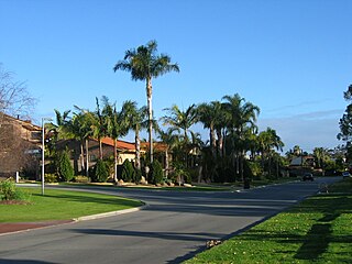
Ascot is a suburb of Perth, covering a narrow strip of land along the southern bank of the Swan River approximately 10 kilometres (6 mi) east of the Perth central business district. Its local government area is the City of Belmont.

Woodbridge is a suburb of Perth, Western Australia, located within the City of Swan local government area. Formerly part of Midland and previously informally named West Midland, its name, which was officially gazetted on 1 March 2001, is from Governor James Stirling's original 1829 land grant which he named after his wife's family property near Guildford in England.

Swan View is an eastern suburb of Perth, Western Australia. Its local government areas are the City of Swan and the Shire of Mundaring. It is 25 kilometres (16 mi) from Perth in the Perth Hills on the edge of the Darling Scarp, just to the west of the John Forrest National Park, east of Roe Highway and north of the Great Eastern Highway.

Midvale is a suburb of Perth, Western Australia, which is split between the City of Swan and the Shire of Mundaring. Its postcode is 6056.
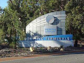
Perth Airport is an eastern suburb of Perth, the capital city of Western Australia. Its local government areas are the City of Belmont, the City of Swan (north) and the City of Kalamunda (east). It is located approximately 12 km east of the central business district. The suburb is the home of Perth Airport, the main international airport of Perth.

Baskerville is an outer northeastern rural suburb of Perth, Western Australia, in the Swan Valley region, 31 km from Perth's central business district via Midland and Great Northern Highway. Nearly all of it is under cultivation with viticulture being the main economic activity, and several well-established Swan Valley wineries are based here. Its local government area is the City of Swan.

Hazelmere is a suburb of Perth, 14 kilometres (9 mi) east of the Perth central business district, in the City of Swan. Bordered by Roe Highway to the east, and the Great Eastern Highway Bypass to the south, Hazelmere is at the northern edge of Perth Airport land.
Kiara is a suburb of Perth, Western Australia, situated approximately 11 kilometres (7 mi) northeast of Perth's central business district and 8 kilometres (5 mi) from Midland, and located within the City of Swan local government area.

South Guildford is a suburb of Perth, Western Australia, located in the City of Swan local government area.

Fremantle is a Western Australian suburb located in Perth at the mouth of the Swan River, and is situated 18 kilometres (11 mi) from the Perth central business district. One of the original settlements of the Swan River Colony established in 1829 is within the area known today as this suburb.

Midland is a suburb and historic town of Perth, Western Australia, located 15 km (9.3 mi) northeast of Perth's central business district. It is the administrative seat and commercial centre of the City of Swan local government area. It is also a designated strategic metropolitan centre for the larger Perth metropolitan area.
