
The City of Bayswater is a local government area in the Western Australian capital city of Perth, about 7 kilometres (4 mi) northeast of Perth's central business district. The city covers an area of 34.6 square kilometres (13.4 sq mi) and had a population of 69,283 as at the 2021 Census. The City of Bayswater is a member of the Eastern Metropolitan Regional Council.
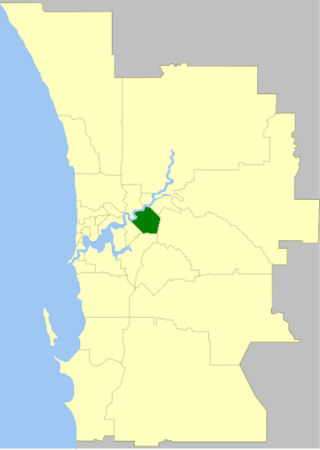
The City of Belmont is a local government area in the inner eastern suburbs of the Western Australian capital city of Perth, located about 8 kilometres (5 mi) east of Perth's central business district on the south bank of the Swan River. The City covers an area of 39.8 square kilometres (15.4 sq mi), maintains 225 km of roads and had a population of almost 40,000 as at the 2016 Census.]
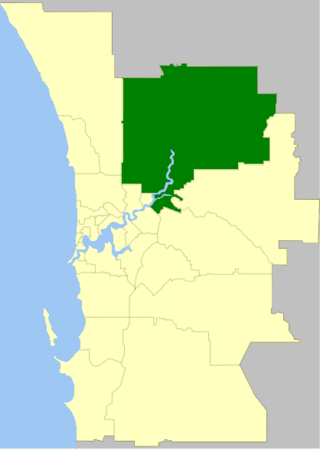
The City of Swan is a local government area of Western Australia. It is in the eastern metropolitan region of Perth and includes the Swan Valley and 42 suburbs. It is centred approximately 20 km north-east of the Perth central business district. The City covers an area of 1,042 km2 and had an estimated population of 155,653 in 2020.

The Town of Victoria Park is a local government area of Western Australia. It covers an area of 17.62 km² in metropolitan Perth, the capital of Western Australia. It had a population of approximately 35,000 as at the 2016 census.

The City of Wanneroo is a local government area with city status in the northern suburbs of Perth, Western Australia. It is centred approximately 25 kilometres (15.5 mi) north of Perth's central business district and forms part of the northern boundary of the Perth metropolitan area. Wanneroo encompasses the federal divisions of Cowan, Moore and Pearce.

Ballajura is a suburb of Perth, Western Australia, in the City of Swan local government area. Ballajura is located 14 kilometres (8.7 mi) north of the Perth central business district. Situated on its side of its western boundary with Koondoola is Emu Swamp.

Applecross is an affluent riverside suburb of Perth, Western Australia, bounded by Canning Highway and the Swan River. It is located within the City of Melville.
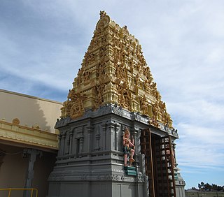
Canning Vale is a southern suburb of Perth, 22 km (13.7 mi) from the central business district. Its local government areas are the City of Canning and the City of Gosnells.
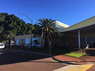
Embleton is a suburb of Perth, the capital city of Western Australia, located 7 kilometres (4.3 mi) north-east of the central business district, between the suburbs of Morley and Bayswater. Its local government area is the City of Bayswater.

Neerabup is a rural locality in Perth, the capital of Western Australia, within the local government area of the City of Wanneroo.

Orelia is a southern suburb of Perth, Western Australia, located within the City of Kwinana.

Aubin Grove is a suburb of Perth, Western Australia in the City of Cockburn. The suburb was approved in 2003.

Caversham is a suburb of Perth, Western Australia, located in the City of Swan.

The Shire of Mount Marshall is a local government area in the Wheatbelt region of Western Australia, about 80 kilometres (50 mi) north-northwest of Merredin and about 300 kilometres (186 mi) northeast of the state capital, Perth. The Shire covers an area of 10,190 square kilometres (3,934 sq mi), and its seat of government is the town of Bencubbin.

Henley Brook is an outer rural suburb of Perth, Western Australia, part of the Swan Valley wine region. The Ellen brook and Swan River meet in the northeastern corner of the suburb. This is also the farthest upstream Captain Stirling's 1827 exploration reached before deciding on the settlement site of the new colony in 1829. The All Saints Church, the oldest church in Western Australia, is also at this site.

Pingelly is a town and shire located in the Wheatbelt region of Western Australia, 158 kilometres (98 mi) from Perth via the Brookton Highway and Great Southern Highway. The town is also located on the Great Southern railway line.
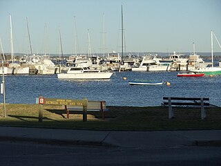
Mosman Park is a western suburb of Perth, Western Australia on the north bank of the Swan River in the local government area of the Town of Mosman Park. It was historically known as Buckland Hill (1889–1909), then Cottesloe Beach (1909–1930) and again Buckland Hill (1930–1937). From 1937 it was named Mosman Park, derived from Mosman in Sydney, the birthplace of Richard Yeldon, a member of the Buckland Hill Road Board. Mosman Park is now considered an affluent suburb, but prior to the 1970s was one of Perth's major industrial centres.
Aveley is a suburb of Perth, Western Australia, east of Ellenbrook and south of The Vines. In 1897 George Hardey Barrett Lennard, grandson of Edward Pomeroy Barrett-Lennard, purchased a property in the area of which is now Aveley, naming it "Belhus" after his family's estate in Belhus, Essex, England. The name "Aveley", deriving from the eponymous town where the estate was located, was approved as a suburb name on 6 September 2006, before which the area was part of Ellenbrook. It is bordered by Gnangara Road and Lake Yakine to the south, a small part of West Swan Road, the Ellen Brook and Chateau Place to the east, The Broadway, Doig Road, and Cashman Avenue to the north, and Henley Brook Avenue to the west. The suburb is accessible from Henley Brook Avenue, The Promenade, Gnangara Road, and West Swan Road.
Mooliabeenee is a locality in Western Australia, east of Gingin, within the Shire of Chittering.
Brabham is a suburb located about 21 km (13 mi) north-east of Perth's central business district. The suburb is located in the City of Swan just south of Henley Brook, formerly being a part of that suburb before it was gazetted in May 2011. The suburb was named after Australian motor racing personality Sir Jack Brabham who competed in the 1962 Australian Grand Prix, held at the nearby Caversham Airfield. The suburb is part of the City of Swan's urban growth corridor and is bordered by Park Street to the north, Murray Street to the east, Harrow Street to the south and Drumpellier Drive and Isoondon Street to the west. It is located in the Whiteman Ward of the City of Swan.


