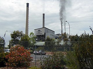
Bannister, Western Australia

Last updated

Bannister
Western Australia
Bannister, Western Australia
Coordinates 32°40′S116°33′E / 32.66°S 116.55°E / -32.66; 116.55
Population72 (SAL 2021) [1]
Postcode(s) 6390
Area421.1 km2 (162.6 sq mi)
Location
LGA(s) Shire of Boddington
State electorate(s) Central Wheatbelt
Federal division(s) O'Connor
Localities around Bannister:
Mount Wells North Bannister North Bannister
Mount Wells Bannister Wandering
Wuraming Boddington Crossman

Bannister is a rural locality, predominately located within the Shire of Boddington in the Peel Region of Western Australia. A smaller part of the locality, located on the eastern side of the Albany Highway, is within the Shire of Wandering in the Wheatbelt region of the state. The locality is also home to the majority of the Boddington Gold Mine operations. [2] [3]

The Shire of Boddington and the locality of Bannister are located on the traditional land of the Wiilman people of the Noongar nation. [4] [5]

The name Bannister was originally applied to another townsite between Williams and Narrogin, which was surveyed in 1844 but no subdivision was carried out and the reserve cancelled in 1910. [6] The modern Bannister locality is named after the Bannister River.

The site of the original police station house and coach house on Albany Highway is now occupied by the Riverside Roadhouse, which is a stop on the Transwa bus services to Albany and Esperance. [7]

Related Research Articles

<span class="mw-page-title-main">Shire of Plantagenet</span> Local government area in Western Australia

The Shire of Plantagenet is a local government area in the Great Southern region of Western Australia, managed from the town of Mount Barker, 360 kilometres (224 mi) south of Perth and 50 kilometres (31 mi) north of Albany. The shire covers an area of 4,792 square kilometres (1,850 sq mi) and includes the communities of Narrikup, Rocky Gully, Kendenup and Porongurup.

<span class="mw-page-title-main">Shire of West Arthur</span> Local government area in Western Australia

The Shire of West Arthur is a local government area in the Wheatbelt region of Western Australia, generally to the west of Albany Highway about 200 kilometres (124 mi) south-east of Perth, the state capital. The Shire covers an area of 2,834 square kilometres (1,094 sq mi) and its seat of government is the town of Darkan. Industries within the Shire, worth approximately $45 million per year to the State's economy, are dominated by wool and sheep, and also include timber, grain, forestry, beef, pigs, cattle hide tanning, engineering and earthmoving.

<span class="mw-page-title-main">Shire of East Pilbara</span> Local government area in Western Australia

The Shire of East Pilbara is one of the four local government areas in the Pilbara region of Western Australia. With an area of 372,571 square kilometres (143,850 sq mi), larger than the Australian states of Victoria and Tasmania combined, it is the largest local government region in Australia. The Shire's seat of government, and home to nearly half the Shire's population, is the town of Newman in the shire's south-west.

Crossman is a locality in the Shire of Boddington in the Peel Region of Western Australia, 125 kilometres (78 mi) south-southeast of the state capital, Perth, along Albany Highway, and 12 kilometres (7.5 mi) east of Boddington.

<span class="mw-page-title-main">Shire of Wandering</span> Local government area in the Wheatbelt region of Western Australia

The Shire of Wandering is a local government area in the Wheatbelt region of Western Australia, and, with a population of 444 as at the 2016 census, is one of the nation's smallest. It covers an area of 1,901 square kilometres (734 sq mi) generally to the east of Albany Highway about 120 kilometres (75 mi) south-east of Perth, the state capital. The Shire's seat of government is the town of Wandering.

<span class="mw-page-title-main">Shire of Wickepin</span> Local government area in the Wheatbelt region of Western Australia

The Shire of Wickepin is a local government area in the Wheatbelt region of Western Australia, east of Narrogin and about 220 kilometres (137 mi) southeast of the state capital, Perth. The Shire covers an area of 2,042 square kilometres (788 sq mi), and its seat of government is the town of Wickepin.

<span class="mw-page-title-main">Shire of Boddington</span> Local government area in Western Australia

The Shire of Boddington is a local government area in the Peel region of Western Australia, about 120 kilometres (75 mi) south-east of the state capital, Perth. The Shire covers an area of 1,901 square kilometres (734 sq mi), and its seat of government is the town of Boddington.

<span class="mw-page-title-main">Shire of Narrogin</span> Local government area in the Wheatbelt region in Western Australia

The Shire of Narrogin is a local government area in the Wheatbelt region of Western Australia, about 190 kilometres (118 mi) south-east of the state capital, Perth. The seat of government is in the town of Narrogin. Until 2016, when the two entities merged, the Narrogin townsite was governed by a separate local government area, the Town of Narrogin.

<span class="mw-page-title-main">Shire of Toodyay</span> Local government area in Western Australia

The Shire of Toodyay is a local government area in the Wheatbelt region of Western Australia, beyond the north-eastern limits of the Perth metropolitan area. The Shire covers an area of 1,694 square kilometres (654 sq mi), and its seat of government is the town of Toodyay.

<span class="mw-page-title-main">Shire of Kojonup</span> Local government area in the Great Southern region of Western Australia

The Shire of Kojonup is a local government area in the Great Southern region of Western Australia, about 250 kilometres (155 mi) southeast of the state capital, Perth, along Albany Highway. The Shire covers an area of 2,932 square kilometres (1,132 sq mi) and its seat of government is the town of Kojonup.

<span class="mw-page-title-main">Shire of Dalwallinu</span> Local government area in the Wheatbelt region of Western Australia

The Shire of Dalwallinu is a local government area in the Wheatbelt region of Western Australia, about 250 kilometres (155 mi) NNE of Perth, the state capital. The Shire covers an area of 7,236 square kilometres (2,794 sq mi) and its seat of government is the town of Dalwallinu.

<span class="mw-page-title-main">Shire of Cranbrook</span> Local government area in Western Australia

The Shire of Cranbrook is a local government area in the Great Southern region of Western Australia, about 92 kilometres (57 mi) north of Albany and about 320 kilometres (200 mi) south-southeast of the state capital, Perth. The Shire covers an area of 3,277 square kilometres (1,265 sq mi), and its seat of government is the town of Cranbrook.

<span class="mw-page-title-main">Shire of Denmark</span> Local government area in Western Australia

The Shire of Denmark is a local government area in the Great Southern region of Western Australia, about 55 kilometres (34 mi) west of Albany and about 420 kilometres (261 mi) south-southeast of the state capital, Perth. The Shire of Denmark covers an area of 1,860 square kilometres (718 sq mi), and its seat of government is located in the townsite and locality of Denmark.

<span class="mw-page-title-main">Shire of Jerramungup</span> Local government area in the Great Southern region of Western Australia

The Shire of Jerramungup is a local government area in the Great Southern region of Western Australia, about 180 kilometres (112 mi) northeast of Albany and about 440 kilometres (273 mi) southeast of the state capital, Perth. The Shire covers an area of 6,507 square kilometres (2,512 sq mi) with Bremer Bay its largest town. The seat of government is the town of Jerramungup.

<span class="mw-page-title-main">Shire of Ravensthorpe</span> Local government area in Western Australia

The Shire of Ravensthorpe is a local government area in the southern Goldfields-Esperance region of Western Australia, about halfway between the city of Albany and the town of Esperance and about 530 kilometres (329 mi) southeast of the state capital, Perth. The Shire covers an area of 13,551 square kilometres (5,232 sq mi), and its seat of government is the town of Ravensthorpe.

Schroeder is a small townsite located in the South West region of Western Australia in the Shire of Augusta-Margaret River and Shire of Nannup.

Lower Hotham is a rural locality located in the Shire of Boddington in the Peel Region of Western Australia. The Hotham River flows though the locality, joining the Williams River in the southern parts of Lower Hotham.
<span class="mw-page-title-main">Upper Murray, Western Australia</span> Locality in the Shire of Boddington, Western Australia

Upper Murray is a rural locality located in the Shire of Boddington in the Peel Region of Western Australia. The Murray River traverses the locality from its eastern to its western border.

<span class="mw-page-title-main">Wuraming, Western Australia</span> Locality in the Shire of Boddington, Western Australia

Wuraming is a rural locality located in the Shire of Boddington in the Peel Region of Western Australia. The locality is almost completely forested except for a section in the north-east where parts of the Boddington Gold Mine operation are located.

Gwindinup is a small town and locality of the Shire of Capel in the South West region of Western Australia, located along the South Western Highway and the Preston River.

References

  1. Australian Bureau of Statistics (28 June 2022). "Bannister (WA) (suburb and locality)". Australian Census 2021 QuickStats. Retrieved 28 June 2022.  OOjs UI icon edit-ltr-progressive.svg
  2. "SLIP Map". maps.slip.wa.gov.au. Landgate . Retrieved 11 August 2023.
  3. "NationalMap". nationalmap.gov.au. Geoscience Australia . Retrieved 11 August 2023.
  4. "Wiilman". www.boodjar.sis.uwa.edu.au. University of Western Australia . Retrieved 11 August 2023.
  5. "Wiilman (WA)". www.samuseum.sa.gov.au. South Australian Museum . Retrieved 11 August 2023.
  6. "Bannister Townsite, Carter's Crossing". inherit.stateheritage.wa.gov.au. Heritage Council of Western Australia. Retrieved 11 August 2023.
  7. GS1 timetable (PDF) [ permanent dead link ] (8 May 2018) and GE1 timetable (PDF) Archived 28 August 2007 at the Wayback Machine (20 November 2017). Retrieved on 14 June 2018.