The Peel region is one of the nine regions of Western Australia. It is located on the west coast of Western Australia, about 75 km (47 mi) south of the state capital, Perth. It consists of the City of Mandurah, and the Shires of Boddington, Murray, Serpentine-Jarrahdale and Waroona.

The Shire of Murray is a local government area of Western Australia. It has an area of 1,710.1 square kilometres (660.3 sq mi) and is located in the Peel Region about 80 kilometres (50 mi) south of the Perth CBD.

The Pinjarra to Narrogin railway was a 153 kilometre cross-country railway line built between the towns of Pinjarra and Narrogin in Western Australia.
Muradup is a small town and locality in the Shire of Kojonup, Great Southern region of Western Australia. Muradup is located between Kojonup and Boyup Brook, and is situated along the Balgarup River. The Narlingup Nature Reserve is located in the west of Muradup.

Birchmont is a rural locality of the Shire of Murray in the Peel Region of Western Australia, located on the eastern shore of the Harvey Estuary.
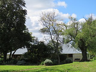
Blythewood is a rural locality of the Shire of Murray in the Peel Region of Western Australia.
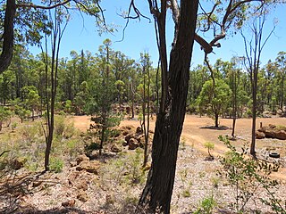
Etmilyn is a rural locality of the Shire of Murray in the Peel Region of Western Australia, located within the Dwellingup State Forest.
Holyoake is a rural locality of the Shire of Murray in the Peel Region of Western Australia, located within the Dwellingup State Forest.
Myara is a rural locality of the Shire of Murray in the Peel Region of Western Australia, located on the northern shore of the North Dandalup Dam.

Point Grey is a rural locality of the Shire of Murray in the Peel Region of Western Australia, located on the eastern shore of the Harvey Estuary and the southern shore of the Peel Inlet.
Solus is a rural locality of the Shire of Murray in the Peel Region of Western Australia.
Teesdale is a rural locality of the Shire of Murray in the Peel Region of Western Australia.

West Coolup is a rural locality of the Shire of Murray in the Peel Region of Western Australia, located on the eastern shore of the Harvey Estuary.
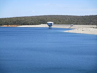
Whittaker is a rural locality of the Shire of Murray in the Peel Region of Western Australia. North Dandalup Dam and its reservoir are located within the locality in its north-western corner.
Bannister is a rural locality, predominately located within the Shire of Boddington in the Peel Region of Western Australia. A smaller part of the locality, located on the eastern side of the Albany Highway, is within the Shire of Wandering in the Wheatbelt region of the state. The locality is also home to the majority of the Boddington Gold Mine operations.
Wuraming is a rural locality located in the Shire of Boddington in the Peel Region of Western Australia. The locality is almost completely forested except for a section in the north-east where parts of the Boddington Gold Mine operation are located.

North Greenbushes is a rural locality and small town of the Shire of Bridgetown–Greenbushes in the South West region of Western Australia.
Muja is a rural town and locality of the Shire of Collie in the South West region of Western Australia. The western part of the locality is dominated by coal mining and the coal-fired Muja Power Station while the eastern part is rural and forested.

Glen Mervyn is a rural locality of the Shire of Donnybrook–Balingup in the South West region of Western Australia. The Preston River and the Donnybrook–Boyup Brook Road run through the centre of the locality from east to west. The Glen Mervyn Dam and reservoir is located on the north-eastern boundary of the locality, with the dam itself being located on the Mumballup side of the border.
Myrup is a locality of the Shire of Esperance in the Goldfields-Esperance region of Western Australia. The Coolgardie–Esperance Highway forms its western border of Myrup. The eastern part of the townsite of Shark Lake is located in the west of Myrup, while the Woody Lake Nature Reserve is located in the south-west.

