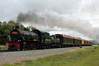
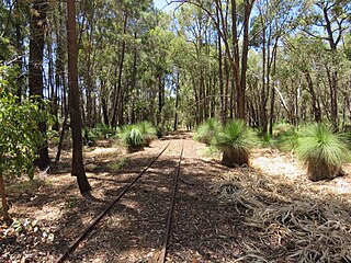
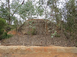
The Hotham Valley Tourist Railway is a tourist and heritage railway in the Peel region of Western Australia.
Crossman is a locality in the Shire of Boddington in the Peel Region of Western Australia, 125 kilometres (78 mi) south-southeast of the state capital, Perth, along Albany Highway, and 12 kilometres (7.5 mi) east of Boddington.

The Shire of Boddington is a local government area in the Peel region of Western Australia, about 120 kilometres (75 mi) south-east of the state capital, Perth. The Shire covers an area of 1,901 square kilometres (734 sq mi), and its seat of government is the town of Boddington.
Meelon is a small townsite in the Peel region of Western Australia, located between Pinjarra and Dwellingup within the Shire of Murray. At the 2011 census, Meelon had a population of 224.

The Ongerup Branch railway, also known as the Tambellup, Gnowangerup to Ongerup railway is a former railway line in the Great Southern region of Western Australia.

The Mullewa–Meekatharra railway was a section of the Northern Railway in Western Australia.
The Meekatharra to Wiluna railway was a 113-mile (182 km) branch line of the Western Australian Government Railways that extended the Mullewa – Meekatharra railway from Meekatharra to Wiluna. Wiluna was the furthest rail terminus from Perth on the Western Australian Government Railways system. Paroo was the highest station, at 1,916 feet (584 m) above sea level; the highest point on the Western Australian railway network, west of Paroo, was 2,134 feet (650 m).
Brookton to Corrigin railway was a railway line in the Wheatbelt region of Western Australia, between Brookton and Corrigin.
Etmilyn is a rural locality of the Shire of Murray in the Peel Region of Western Australia, located within the Dwellingup State Forest.
Holyoake is a rural locality of the Shire of Murray in the Peel Region of Western Australia, located within the Dwellingup State Forest.
Inglehope is a rural locality of the Shire of Murray in the Peel Region of Western Australia, located within the Dwellingup State Forest.
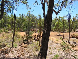
Wuraming is a rural locality located in the Shire of Boddington in the Peel Region of Western Australia. The locality is almost completely forested except for a section in the north-east where parts of the Boddington Gold Mine operation are located.

The Donnybrook–Katanning railway was a railway line in the South West and Great Southern regions of Western Australia, between Donnybrook and Katanning.

The Merredin to Narrogin railway line was a railway line in the Wheatbelt region of Western Australia, between Merredin and Narrogin. The line was also known as the West Merredin to Narrogin via Corrigin railway.

The Merredin to Yilliminning railway line was a railway line connecting Merredin to Yilliminning via Kondinin. Also known as the West Merredin to Yilliminning via Kondinin railway, it was 260 kilometres (160 mi) long. At its northern end, at Merredin, it connected to the Eastern Goldfields Railway while, at the southern terminus at Yilliminning, it connected to the Merredin to Narrogin railway line. From Yilliminning, this line continued to Narrogin, 23 kilometres (14 mi) further west, where the line intersected the Great Southern Railway.

The Wagin to Newdegate railway line is a railway line in the Wheatbelt region of Western Australia, connecting Wagin via Lake Grace to Newdegate, where the line terminates. The line is 180 kilometres (110 mi) long. At Lake Grace, a 94-kilometre (58 mi) branch line to Hyden exists, while, at Wagin, the railway line connects to the Great Southern Railway and the Wagin to Bowelling railway line. Formerly, at Wagin, it also connected to the now inactive railway line to Bowelling.
The Katanning to Pingrup railway line was a state government-owned and WAGR-operated railway line connecting Katanning to Pingrup via Nyabing in the Great Southern region of Western Australia. The railway line was 95 kilometres (59 mi) long. At its western end, at Katanning, it connected to the Great Southern Railway. At Katanning, it also connected to the Donnybrook–Katanning railway, which closed in 1982.
The Wagin to Bowelling railway line was a state government-owned and WAGR-operated railway line in the Wheatbelt region of Western Australia, connecting Wagin via Bokal to Bowelling. The line was 102 kilometres (63 mi) long. At Wagin, the railway line connected to the Great Southern Railway and the Wagin to Newdegate railway line while, at Bowelling, it connected to the Brunswick Junction to Narrogin railway line.

The Brunswick Junction to Narrogin railway line is a partially operational railway line in the South West and Wheatbelt regions of Western Australia, connecting Brunswick Junction via Collie and Bowelling to Narrogin.

The Avon Yard to Mullewa railway line is a 429-kilometre (267 mi) long railway line operated by Arc Infrastructure in the Mid West and Wheatbelt regions of Western Australia, connecting the Avon Yard at Northam with Mullewa. The 104-kilometre (65 mi) section of the railway line from Perenjori to Dalwallinu is, as of 2024, not in operation while the sections north, Perenjori to Mullewa, and south, Dalwallinu to Northam, are.

