Merredin to Narrogin railway line

Last updated

Merredin to Narrogin railway line
WA part railway network map 1935.jpg
The Merredin to Narrogin line is right-of-centre on the map.
Overview
StatusClosed
Locale Wheatbelt, Western Australia
Termini
Service
Operator(s) Western Australian Government Railways
History
Commenced1908
Opened14 September 1914 (1914-09-14)
Technical
Line length216 km (134 mi)
Track gauge 1,067 mm (3 ft 6 in)
Merredin to Narrogin railway line
Main locations
Merredin to Narrogin railway line
Invisible Square.svg
Mapscaleline.svg
150km
100miles
Narrogin
5
Invisible Square.svg
Route map

Contents

BSicon exCONTg.svg
BSicon exSTR.svg
BSicon CONTgq.svg
BSicon eABZq+l.svg
BSicon eABZql.svg
BSicon BHFq.svg
BSicon CONTfq.svg
216
Merredin
BSicon exHST.svg
201
Ulva
BSicon exHST.svg
194
Korbel
BSicon exHST.svg
189
Korbelka
BSicon exHST.svg
185
Belka
BSicon exHST.svg
176
Jura
BSicon exHST.svg
168
Bruce Rock
BSicon exCONTgq.svg
BSicon exABZgr.svg
BSicon exHST.svg
158
Yalbarrin
BSicon exHST.svg
149
Ardath
BSicon exHST.svg
136
Babakin
BSicon exHST.svg
124
Bilbarin
BSicon exHST.svg
117
Nornakin
BSicon exBHF.svg
108
Corrigin
BSicon exCONTgq.svg
BSicon exABZgr.svg
BSicon exHST.svg
98
Dilling
BSicon exKRZt.svg
No. 2 Rabbit-proof fence
BSicon exHST.svg
84
Bullaring
BSicon exHST.svg
77
Stretton
BSicon exHST.svg
68
Yealering
BSicon exHST.svg
53
Malyalling
BSicon exHST.svg
43
Wickepin
BSicon exHST.svg
28
Ockley
BSicon exABZgl.svg
BSicon exCONTfq.svg
BSicon exHST.svg
23
Yilliminning
BSicon exHST.svg
15
Boundain
BSicon CONTgq.svg
BSicon eABZql.svg
BSicon eABZq+l.svg
BSicon BHFq.svg
BSicon CONTfq.svg
0
Narrogin
BSicon exSTR.svg
BSicon exCONTf.svg

The Merredin to Narrogin railway line was a railway line in the Wheatbelt region of Western Australia, between Merredin and Narrogin. The line was also known as the West Merredin to Narrogin via Corrigin railway. [1]

History

The Narrogin-Wickepin Railway Act 1907, an act by the Parliament of Western Australia assented to on 20 December 1907, authorised the construction of the railway line from Narrogin to Wickepin. [2] A second act, the Wickepin-Merredin Railway Act 1911, assented to in 16 February 1911, authorised the construction of the railway line extension from Wickepin to Merredin. [3]

The line was built in separate sections over five years: [4]

It was constructed by the Western Australian Public Works Department.

It connected the Great Southern Railway route with the Eastern Railway.

The link via Corrigin was 216 kilometres (134 mi) long. [6] [7]

Arc Infrastructure deems the railway line to be part of its Grain Freight Rail Network, which, in 2017, accounted for 50 percent of its network but only ten percent of its freight. The entire Merredin to Narrogin line was classified as tier 3. [8]

In 2021, it was estimated that it would cost A$317.3 million to upgrade the Narrogin to Merredin railway line to reopen it. [9]

Alternate route via Kondinin

A second railway route between Merredin and Narrogin existed further east, via Kondinin. The official name of this line was the West Merredin to Yilliminning via Kondinin railway. It joined the West Merredin to Narrogin via Corrigin railway at Yilliminning, 23 kilometres (14 mi) east of Narrogin. [6] [7]

Legacy

The two railway lines running in parallel between Merredin to Narrogin still exist, but are designated as "Not in use" on the Arc Infrastructure map in 2024. [10] The status as Tier 3 lines has been discussed irregularly in the 2000s. [11] At the southern terminus of the line, the Narrogin Railway Station, built in 1907, is on the Western Australian State Register of Heritage Places. The heritage listed installations at Narrogin also include a goods shed, a signal cabin, a foot bridge and a number of associated houses. [12]

The heritage listed Wickepin Railway Precinct dates back to 1909, when the railway from Narrogin to Wickepin was completed. Apart from the railway station it also includes a goods sheet, a water tank and loading yards and a ramp. [13] Also heritage listed within the Shire of Wickepin are the Yealering Railway siding and the site of the former Toolibin Railway siding. [14] [15]

The Railway Water Tank at Corrigin is listed on the State Register of Heritage Places [16] and part of the larger and also heritage listed Corrigin Railway Precinct. [17] Also within the Shire of Corrigin are the heritage listed Bilbarin Railway Reserve group, which consist of sheep yards, a bagged wheat depot and a goods sheet. [18]

In the Shire of Bruce Rock, a number of sites of the former railway line are on the shire's heritage list: the Bruce Rock Railway Station precinct, the Ardath Railway precinct, Babakin and Kwolyin railway sidings, and the site of the Belka Railway Reserve. [19] Bruce Rock itself was an important railway junction as the Narrogin to Merredin line intersected the York–Bruce Rock railway line there. [20]

At the northern terminus, at Merredin, four entries related to the railways are on the State Register of Heritage Places: the Merredin Railway Station, the Railway Water Tank, the Railway Dam and the Railway Housing Precinct. [21]

Related Research Articles

<span class="mw-page-title-main">Wheatbelt (Western Australia)</span> Region of Western Australia

The Wheatbelt is one of nine regions of Western Australia defined as administrative areas for the state's regional development, and a vernacular term for the area converted to agriculture during colonisation. It partially surrounds the Perth metropolitan area, extending north from Perth to the Mid West region, and east to the Goldfields–Esperance region. It is bordered to the south by the South West and Great Southern regions, and to the west by the Indian Ocean, the Perth metropolitan area, and the Peel region. Altogether, it has an area of 154,862 square kilometres (59,793 sq mi).

<span class="mw-page-title-main">Yealering, Western Australia</span> Town in Western Australia

Yealering is a town in the Wheatbelt region of Western Australia, approximately 220km south-east of Perth between the towns of Wickepin and Corrigin. It is located beside the lake of the same name. While the town's population is small, it services a large agricultural district in the northern Wickepin Shire. At the 2016 census, Yealering had a population of 104.

<span class="mw-page-title-main">Shire of Wickepin</span> Local government area in the Wheatbelt region of Western Australia

The Shire of Wickepin is a local government area in the Wheatbelt region of Western Australia, east of Narrogin and about 220 kilometres (137 mi) southeast of the state capital, Perth. The Shire covers an area of 2,042 square kilometres (788 sq mi), and its seat of government is the town of Wickepin.
<span class="mw-page-title-main">Shire of Narrogin</span> Local government area in the Wheatbelt region in Western Australia

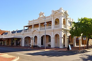
The Shire of Narrogin is a local government area in the Wheatbelt region of Western Australia, about 190 kilometres (118 mi) south-east of the state capital, Perth. The seat of government is in the town of Narrogin. Until 2016, when the two entities merged, the Narrogin townsite was governed by a separate local government area, the Town of Narrogin.

Bilbarin is a small town in the Shire of Corrigin in the Wheatbelt region of Western Australia.

<span class="mw-page-title-main">Ongerup Branch Railway</span> Former railway line in Western Australia

The Ongerup Branch railway, also known as the Tambellup, Gnowangerup to Ongerup railway is a former railway line in the Great Southern region of Western Australia.

<span class="mw-page-title-main">Pinjarra to Narrogin railway</span> Former railway line in Western Australia

The Pinjarra to Narrogin railway was a 153 kilometre cross-country railway line built between the towns of Pinjarra and Narrogin in Western Australia.

Brookton to Corrigin railway was a railway line in the Wheatbelt region of Western Australia, between Brookton and Corrigin.

<span class="mw-page-title-main">Donnybrook–Katanning railway</span> Former railway line in Western Australia

The Donnybrook–Katanning railway was a railway line in the South West and Great Southern regions of Western Australia, between Donnybrook and Katanning.
<span class="mw-page-title-main">Muja, Western Australia</span> Locality in the Shire of Collie, Western Australia

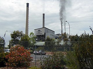
Muja is a rural town and locality of the Shire of Collie in the South West region of Western Australia. The western part of the locality is dominated by coal mining and the coal-fired Muja Power Station while the eastern part is rural and forested.

Beelerup is a rural locality of the Shire of Donnybrook–Balingup in the South West region of Western Australia, along the Preston River.

<span class="mw-page-title-main">Lowden, Western Australia</span> Locality in the Shire of Donnybrook–Balingup, Western Australia

Lowden is a rural locality of the Shire of Donnybrook–Balingup in the South West region of Western Australia. The Preston River and the Donnybrook–Boyup Brook Road run through the centre of the locality from east to west.

<span class="mw-page-title-main">Merredin to Yilliminning railway line</span> Railway line in Western Australia

The Merredin to Yilliminning railway line was a railway line connecting Merredin to Yilliminning via Kondinin. Also known as the West Merredin to Yilliminning via Kondinin railway, it was 260 kilometres (160 mi) long. At its northern end, at Merredin, it connected to the Eastern Goldfields Railway while, at the southern terminus at Yilliminning, it connected to the Merredin to Narrogin railway line. From Yilliminning, this line continued to Narrogin, 23 kilometres (14 mi) further west, where the line intersected the Great Southern Railway.

<span class="mw-page-title-main">Wagin to Newdegate railway line</span> Railway line in Western Australia

The Wagin to Newdegate railway line is a railway line in the Wheatbelt region of Western Australia, connecting Wagin via Lake Grace to Newdegate, where the line terminates. The line is 180 kilometres (110 mi) long. At Lake Grace, a 94-kilometre (58 mi) branch line to Hyden exists, while, at Wagin, the railway line connects to the Great Southern Railway and the Wagin to Bowelling railway line. Formerly, at Wagin, it also connected to the now inactive railway line to Bowelling.

The Katanning to Pingrup railway line was a state government-owned and WAGR-operated railway line connecting Katanning to Pingrup via Nyabing in the Great Southern region of Western Australia. The railway line was 95 kilometres (59 mi) long. At its western end, at Katanning, it connected to the Great Southern Railway. At Katanning, it also connected to the Donnybrook–Katanning railway, which closed in 1982.

The Wagin to Bowelling railway line was a state government-owned and WAGR-operated railway line in the Wheatbelt region of Western Australia, connecting Wagin via Bokal to Bowelling. The line was 102 kilometres (63 mi) long. At Wagin, the railway line connected to the Great Southern Railway and the Wagin to Newdegate railway line while, at Bowelling, it connected to the Brunswick Junction to Narrogin railway line.

<span class="mw-page-title-main">Brunswick Junction to Narrogin railway line</span> Partially operational railway line in Western Australia

The Brunswick Junction to Narrogin railway line is a partially operational railway line in the South West and Wheatbelt regions of Western Australia, connecting Brunswick Junction via Collie and Bowelling to Narrogin.

<span class="mw-page-title-main">Avon Yard to Mullewa railway line</span> Railway line in Western Australia

The Avon Yard to Mullewa railway line is a 429-kilometre (267 mi) long railway line operated by Arc Infrastructure in the Mid West and Wheatbelt regions of Western Australia, connecting the Avon Yard at Northam with Mullewa. The 104-kilometre (65 mi) section of the railway line from Perenjori to Dalwallinu is, as of 2024, not in operation, having closed in the late 1990s, while the sections north, Perenjori to Mullewa, and south, Dalwallinu to Northam, are.
<span class="mw-page-title-main">Goomalling to West Merredin railway line</span> Railway line in Western Australia

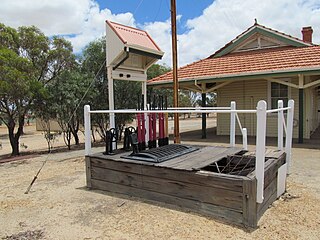
The Goomalling to West Merredin railway line is a 183-kilometre (114 mi) long railway line operated by Arc Infrastructure in the Wheatbelt region of Western Australia, connecting Goomalling with West Merredin. Only the western part of the railway line, the 66-kilometre (41 mi) section from Goomalling to Wyalkatchem, is operational, while the 117-kilometre (73 mi) section from Wyalkatchem to West Merredin is not in use.

<span class="mw-page-title-main">Amery to Kalannie railway line</span> Railway line in Western Australia

The Amery to Kalannie railway line is a 98-kilometre (61 mi) long railway line operated by Arc Infrastructure in the Wheatbelt region of Western Australia, connecting Amery with Kalannie.

References

  1. Section 59 Narrogin - West Merredin Via Corrigin in "Back Along the Line" (PDF). Retrieved 17 July 2024.
  2. "Narrogin-Wickepin Railway Act 1907". www.legislation.wa.gov.au. Government of Western Australia. 20 December 1907. Retrieved 30 July 2024.
  3. "Wickepin-Merredin Railway Act 1911". www.legislation.wa.gov.au. Government of Western Australia. 16 February 1911. Retrieved 30 July 2024.
  4. Opening dates for sections from 12. Construction of the W.A. Government Railways network, 1879 - 1931, pages 208-210 Gunzburg, Adrian; Austin, Jeff; Rail Heritage WA; Gunzburg, Adrian (2008), Rails through the bush : timber and firewood tramways and railway contractors of Western Australia (2nd ed.), Rail Heritage WA, ISBN   978-0-9803922-2-7
  5. "Narrogin-Wickepin Railway". Western Mail (Western Australia) . Vol. XXIV, no. 1, 210. Western Australia. 6 March 1909. p. 5. Retrieved 17 July 2024 via National Library of Australia.
  6. 1 2 "Public Transport Authority: Railway System: April 2019" (PDF). Public Transport Authority. Retrieved 26 July 2024.
  7. 1 2 "Railway map of Western Australia, 1952". Trove. Retrieved 26 July 2024.
  8. "Issues Paper" (PDF). www.arcinfra.com. Arc Infrastructure. 17 November 2017. Retrieved 27 August 2024.
  9. Bree Swift (22 May 2021). "Budget raises hope of Tier 3 upgrades". Farm Weekly . Retrieved 26 August 2024.
  10. "Arc Map Network" (PDF). Retrieved 27 July 2024.
  11. "WA rail upgrade after record grain harvest" . Retrieved 27 July 2024.
  12. "Narrogin Railway Station". inherit.stateheritage.wa.gov.au. Heritage Council of Western Australia. Retrieved 27 July 2024.
  13. "Wickepin Railway Precinct". inherit.stateheritage.wa.gov.au. Heritage Council of Western Australia. Retrieved 27 July 2024.
  14. "Yealering Railway siding". inherit.stateheritage.wa.gov.au. Heritage Council of Western Australia. Retrieved 27 July 2024.
  15. "Toolibin Railway Siding". inherit.stateheritage.wa.gov.au. Heritage Council of Western Australia. Retrieved 27 July 2024.
  16. "Railway Water Tank, Corrigin". inherit.stateheritage.wa.gov.au. Heritage Council of Western Australia. Retrieved 27 July 2024.
  17. "Corrigin Railway Precinct". inherit.stateheritage.wa.gov.au. Heritage Council of Western Australia. Retrieved 27 July 2024.
  18. "Bilbarin Railway Reserve Group". inherit.stateheritage.wa.gov.au. Heritage Council of Western Australia. Retrieved 27 July 2024.
  19. "Heritage list search results: Shire of Bruce Rock". inherit.stateheritage.wa.gov.au. Heritage Council of Western Australia. Retrieved 28 July 2024.
  20. "Bruce Rock Railway Station Precinct". inherit.stateheritage.wa.gov.au. Heritage Council of Western Australia. Retrieved 28 July 2024.
  21. "Shire of Merredin State Register of Heritage Places". inherit.stateheritage.wa.gov.au. Heritage Council of Western Australia. Retrieved 28 July 2024.