Lake Muir is a rural locality of the Shire of Manjimup in the South West region of Western Australia. The South Western Highway forms the south-western border of the locality while the Muir Highway forms its northern one. Parts of Shannon National Park as well as most of Lake Muir National Park and all of Lake Muir and Boyndaminup National Park are located in the locality of Lake Muir.

Birchmont is a rural locality of the Shire of Murray in the Peel Region of Western Australia, located on the eastern shore of the Harvey Estuary.
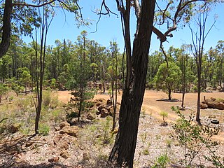
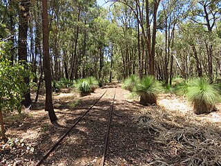
Etmilyn is a rural locality of the Shire of Murray in the Peel Region of Western Australia, located within the Dwellingup State Forest.
Holyoake is a rural locality of the Shire of Murray in the Peel Region of Western Australia, located within the Dwellingup State Forest.
Inglehope is a rural locality of the Shire of Murray in the Peel Region of Western Australia, located within the Dwellingup State Forest.
Myara is a rural locality of the Shire of Murray in the Peel Region of Western Australia, located on the northern shore of the North Dandalup Dam.

Point Grey is a rural locality of the Shire of Murray in the Peel Region of Western Australia, located on the eastern shore of the Harvey Estuary and the southern shore of the Peel Inlet.
Solus is a rural locality of the Shire of Murray in the Peel Region of Western Australia.
Teesdale is a rural locality of the Shire of Murray in the Peel Region of Western Australia.

West Coolup is a rural locality of the Shire of Murray in the Peel Region of Western Australia, located on the eastern shore of the Harvey Estuary.
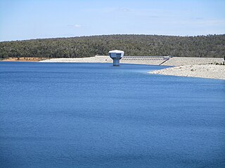
Whittaker is a rural locality of the Shire of Murray in the Peel Region of Western Australia. North Dandalup Dam and its reservoir are located within the locality in its north-western corner.

Kulikup is a rural locality and small town of the Shire of Boyup Brook in the South West region of Western Australia.
Winnejup is a rural locality of the Shire of Bridgetown–Greenbushes in the South West region of Western Australia. The Blackwood River runs through the locality from east to west.
Picton is a suburb of the City of Bunbury in the South West region of Western Australia. Both the South Western Highway and the South Western Railway dissect the suburb from east to west.
Reinscourt is a semi-rural locality of the City of Busselton in the South West region of Western Australia, located on the Vasse River in the south-east of Busselton. The southern border of the locality is formed by the Bussell Highway.
Stirling Estate is a rural locality of the Shire of Capel in the South West region of Western Australia, located on Geographe Bay. In the south, a section of the Tuart Forest National Park is located within the locality. The Capel River flows through the locality, with its mouth located at the boundary of Stirling Estate and Peppermint Grove Beach.
Argyle is a rural locality of the Shire of Donnybrook–Balingup in the South West region of Western Australia. The South Western Highway and the Preston River run alongside each other through the locality.

Lowden is a rural locality of the Shire of Donnybrook–Balingup in the South West region of Western Australia. The Preston River and the Donnybrook–Boyup Brook Road run through the centre of the locality from east to west.
Upper Capel is a rural locality of the Shire of Donnybrook–Balingup in the South West region of Western Australia. The locality borders the South Western Highway at the north-east while the Capel River flows through it in the south-west.
Wilgarrup is a rural locality of the Shire of Manjimup in the South West region of Western Australia. The South Western Highway runs through the locality from north to south, as does the Wilgarrup River, a tributary of the Warren River.

