
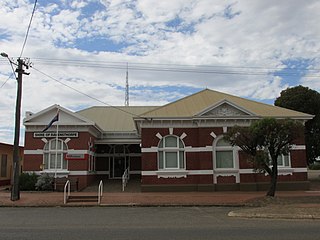
The Shire of Plantagenet is a local government area in the Great Southern region of Western Australia, managed from the town of Mount Barker, 360 kilometres (224 mi) south of Perth and 50 kilometres (31 mi) north of Albany. The shire covers an area of 4,792 square kilometres (1,850 sq mi) and includes the communities of Narrikup, Rocky Gully, Kendenup and Porongurup.

The Shire of Bridgetown–Greenbushes is a local government area in the South West region of Western Australia, about 80 kilometres (50 mi) southeast of Bunbury and about 260 kilometres (162 mi) south of the state capital, Perth. The Shire covers an area of 1,340 square kilometres (517 sq mi), and its seat of government is the town of Bridgetown.

The City of Bunbury is a local government area in the South West region of Western Australia, covering an area of 65.7 square kilometres (25.4 sq mi) along the coast about 180 kilometres (112 mi) south of Perth, the capital of Western Australia. The City of Bunbury is one of four local governments comprising the Greater Bunbury urban area. As at the 2016 Census, the City of Bunbury had an estimated population of almost 32,000.

The Shire of Boyup Brook is a local government area located in the South West region of Western Australia, about 270 kilometres (168 mi) southeast of Perth, the state capital. The Shire covers an area of 2,829 square kilometres (1,092 sq mi) and its seat of government is the town of Boyup Brook.

The Shire of Cranbrook is a local government area in the Great Southern region of Western Australia, about 92 kilometres (57 mi) north of Albany and about 320 kilometres (200 mi) south-southeast of the state capital, Perth. The Shire covers an area of 3,277 square kilometres (1,265 sq mi), and its seat of government is the town of Cranbrook.
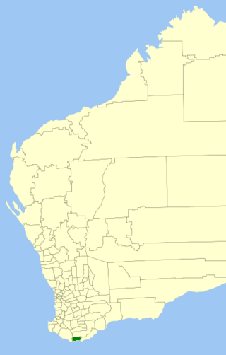
The Shire of Denmark is a local government area in the Great Southern region of Western Australia, about 55 kilometres (34 mi) west of Albany and about 420 kilometres (261 mi) south-southeast of the state capital, Perth. The Shire of Denmark covers an area of 1,860 square kilometres (718 sq mi), and its seat of government is located in the townsite and locality of Denmark.

The Shire of Jerramungup is a local government area in the Great Southern region of Western Australia, about 180 kilometres (112 mi) northeast of Albany and about 440 kilometres (273 mi) southeast of the state capital, Perth. The Shire covers an area of 6,507 square kilometres (2,512 sq mi) with Bremer Bay its largest town. The seat of government is the town of Jerramungup.
The Shire of Ravensthorpe is a local government area in the Great Southern region of Western Australia, about halfway between the city of Albany and the town of Esperance and about 530 kilometres (329 mi) southeast of the state capital, Perth. The Shire covers an area of 13,551 square kilometres (5,232 sq mi), and its seat of government is the town of Ravensthorpe.

The Shire of Woodanilling is a local government area in the Great Southern region of Western Australia, about 30 kilometres (19 mi) south of Wagin and about 260 kilometres (162 mi) south-southeast of the state capital, Perth. The Shire covers an area of 1,129 square kilometres (436 sq mi), and its seat of government is the town of Woodanilling.

Birchmont is a rural locality of the Shire of Murray in the Peel Region of Western Australia, located on the eastern shore of the Harvey Estuary.
Blythewood is a rural locality of the Shire of Murray in the Peel Region of Western Australia.
Etmilyn is a rural locality of the Shire of Murray in the Peel Region of Western Australia, located within the Dwellingup State Forest.
Holyoake is a rural locality of the Shire of Murray in the Peel Region of Western Australia, located within the Dwellingup State Forest.
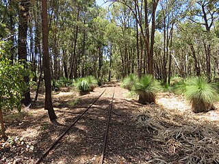
Inglehope is a rural locality of the Shire of Murray in the Peel Region of Western Australia, located within the Dwellingup State Forest.
Myara is a rural locality of the Shire of Murray in the Peel Region of Western Australia, located on the northern shore of the North Dandalup Dam.

Point Grey is a rural locality of the Shire of Murray in the Peel Region of Western Australia, located on the eastern shore of the Harvey Estuary and the southern shore of the Peel Inlet.
Teesdale is a rural locality of the Shire of Murray in the Peel Region of Western Australia.

West Coolup is a rural locality of the Shire of Murray in the Peel Region of Western Australia, located on the eastern shore of the Harvey Estuary.
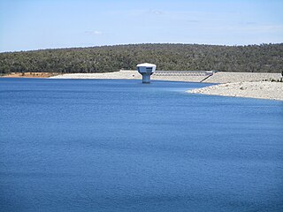
Whittaker is a rural locality of the Shire of Murray in the Peel Region of Western Australia. North Dandalup Dam and its reservoir are located within the locality in its north-western corner.
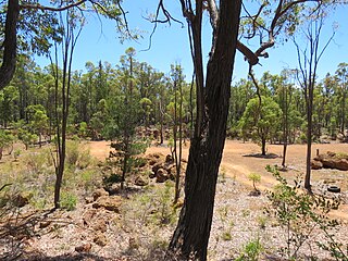
Mount Lindesay is a rural locality of the Shire of Denmark in the Great Southern region of Western Australia. The Denmark River forms the locality's western boundary. Mount Lindesay is almost completely covered by the Mount Lindesay National Park and the actual mountain, Mount Lindesay, is located in the south-west of the locality.
