
The townsite of Tambellup is located in the Great Southern region of Western Australia, 317 km south-east of Perth on the Great Southern Highway where it crosses the Gordon River. It is 23 km south of Broomehill.

Perenjori is a townsite in the northern agricultural region, 348 kilometres (216 mi) north of Perth and 39 kilometres (24 mi) south-east of Morawa. It is located on the Wongan Hills to Mullewa railway line which was opened in 1915. Perenjori was approved as the name of a siding in April 1913, and later that year the government decided to establish a townsite there. Perenjori townsite was gazetted in 1916.

The townsite of Piawaning is located in the northern agricultural region, 160 km north-east of Perth and 28 km north-east of New Norcia. At the 2006 census, Piawaning had a population of 309.

Bolgart is a townsite north of Toodyay in Western Australia. It is in the Shire of Victoria Plains.

Tammin is a town in the central agricultural region of Western Australia, 184 kilometres (114 mi) east of Perth and midway between the towns of Cunderdin and Kellerberrin on the Great Eastern Highway.
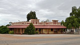
Moorine Rock is located in the eastern agricultural region of Western Australia, 347 km east of Perth and 22 km west south west of Southern Cross.
Yerecoin is a small town located in the Wheatbelt region of Western Australia, in the Shire of Victoria Plains,156 kilometres (97 mi) north-northeast of the state capital, Perth.

Doodlakine is a town 220 km (140 mi) east of Perth, Western Australia. It is within the Shire of Kellerberrin along the Great Eastern Highway. The town has a crossing loop for trains on the Perth-to-Kalgoorlie railway and serves as a stop on the MerredinLink rural train service.

Meckering is a town 130 kilometres (80.8 mi) east of Perth, Western Australia along the Great Eastern Highway. Meckering is located within the Shire of Cunderdin.

Bruce Rock is a town in the eastern Wheatbelt region of Western Australia, approximately 243 kilometres (151 mi) east of Perth and 48 kilometres (30 mi) southwest of Merredin. It is the main town in the Shire of Bruce Rock.

Hines Hill is a town located 240 km (150 mi) east of Perth, between the towns of Merredin and Doodlakine in Western Australia. The town is situated on the Great Eastern Highway and also on the edge of Lake Baandee. The town has one of the first privately owned weighbridges in Western Australia is located close to the town.

Yealering is a town in the Wheatbelt region of Western Australia, approximately 220km south-east of Perth between the towns of Wickepin and Corrigin. It is located beside the lake of the same name. While the town's population is small, it services a large agricultural district in the northern Wickepin Shire. At the 2016 census, Yealering had a population of 104.

Trayning is a town in the north-eastern Wheatbelt region of Western Australia, 236 kilometres (147 mi) east of the state capital, Perth, on the Nungarin–Wyalkatchem Road. At the 2006 census, Trayning had a population of 122.

Bullaring is a small town located in the Shire of Corrigin in the Wheatbelt region of Western Australia.

Latham is a small town in the Mid West region of Western Australia. It is named after Latham Rock, a large granite rock close to the townsite. The rock was named for an early pastoralist who established a watering place for stock being droved through the area.
Manmanning is a small Wheatbelt town in Western Australia.
Pingaring is a small town in the Wheatbelt region of Western Australia.
Pingrup is a small town in the Great Southern region of Western Australia.

Yoting is a small town located between Quairading and Bruce Rock in the Wheatbelt region of Western Australia.
Canna is a small town in the Mid West region of Western Australia. It is located between the towns of Morawa and Mullewa on the Mullewa-Wubin Road. At the 2006 census, Canna had a population of 81.

