
Lincoln National Park is a protected area in the Australian state of South Australia located about 249 kilometres (155 mi) west of the state capital of Adelaide and about 9.5 kilometres (5.9 mi) south of the municipal seat of Port Lincoln. It consists of a mainland area on the Jussieu Peninsula on the south eastern tip of Eyre Peninsula and a number of nearby islands. The national park contains significant sites of natural, indigenous and early European heritage.

Port Lincoln is a city on the Lower Eyre Peninsula in the Australian state of South Australia. It is situated on the shore of Boston Bay, which opens eastward into Spencer Gulf. It is the largest city in the West Coast region, and is located approximately 280 km as the crow flies from the State's capital city of Adelaide. In June 2018 Port Lincoln had an estimated population of 16,326, having grown at an average annual rate of 0.55% year-on-year over the preceding five years. The city is reputed to have the most millionaires per capita in Australia. The town claims to be the "Seafood Capital of Australia".

Port Augusta is a small city in South Australia. Formerly a seaport, it is now a road traffic and railway junction city mainly located on the east coast of the Spencer Gulf immediately south of the gulf's head and about 322 kilometres (200 mi) north of the state capital, Adelaide. The suburb of Port Augusta West is located on the west side of the gulf on the Eyre Peninsula. Other major industries included, up until the mid-2010s, electricity generation. At June 2018, the estimated urban population was 13,799,> having declined at an average annual rate of -0.53% over the preceding five years.

The Eyre Peninsula is a triangular peninsula in South Australia. It is bounded on the east by Spencer Gulf, the west by the Great Australian Bight, and the north by the Gawler Ranges.

Wallaroo is a port town on the western side of Yorke Peninsula in South Australia, 160 kilometres (100 mi) northwest of Adelaide. It is one of the three Copper Triangle towns famed for their historic shared copper mining industry, and known together as "Little Cornwall", the other two being Kadina, about 8 kilometres (5 mi) to the east, and Moonta, about 18 kilometres (11 mi) south. In 2015, Wallaroo had an estimated population of 4,010.

Hawker is a town and a locality in the Flinders Ranges area of South Australia, 365 kilometres (227 mi) north of Adelaide. It is in the Flinders Ranges Council, the state Electoral district of Stuart and the federal Division of Grey. At the 2016 census, the locality had a population of 341 of which 237 lived in its town centre.
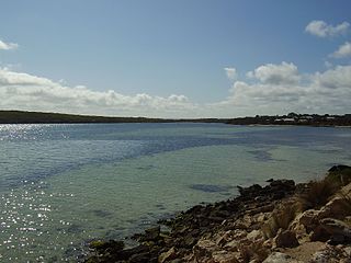
Coffin Bay, originally Coffin's Bay, is a town at the southern extremity of the Eyre Peninsula, a wheat growing area of South Australia. At the 2016 census, Coffin Bay had a population of 611.
Minnipa is a small town serving the local grain growing community located on South Australia's Eyre Peninsula.
Booborowie is a locality in South Australia. It is located 200 km (124 mi) north of Adelaide. At the 2016 census, the Booborowie district had a population of 218.

Memory Cove Wilderness Protection Area is a protected area in the Australian state of South Australia located on the south east tip of Jussieu Peninsula on Eyre Peninsula and on a number of nearby islands about 25 km (16 mi) south-south east of Port Lincoln. It was established in 2004 on land previously part of the Lincoln National Park. The protection area contains significant sites of natural, indigenous and early European heritage.
Pinkawillinie is a locality in the north of Eyre Peninsula in South Australia. It is a rural grain and grazing area in marginal country near Goyder's Line. It draws its name from the cadastral Hundred bearing the same name which is mostly included in the modern bounded locality, however the locality includes several other Hundreds and the Pinkawillinie Conservation Park.
Inneston is a locality in the Australian state of South Australia located on the south-western end of Yorke Peninsula about 155 kilometres west of the state capital of Adelaide. Historically, it is notable as a site for the mining of gypsum and since 1970, the majority of the land within the current extent of the locality is within the protected area called the Innes National Park.
Yarrah is a rural locality in the Far North region of South Australia. The eastern section of Yarrah lies within the Flinders Ranges Council, while the western section lies in the Pastoral Unincorporated Area.

Lincoln National Park is a locality located on the Jussieu Peninsula at the southern tip of the Eyre Peninsula in the Australian state of South Australia about 250 kilometres west of the state capital of Adelaide and about 13 kilometres south of the city of Port Lincoln.

Kiana is a coastal locality on the Eyre Peninsula of South Australia, situated within the District Council of Lower Eyre Peninsula. The modern boundaries were formally established in October 2003, with it being named after the cadastral Hundred of Kiana. The modern locality only covers the northern half of the hundred; the southern half is the locality of Mount Hope. The hundred itself was given an Aboriginal name by Governor William Jervois in 1879.
Moody Tank Conservation Park is a protected area located in the Australian state of South Australia on the Eyre Peninsula about 26 kilometres north-east of Cummins.
Conservation reserves of South Australia is a class of protected area used in the Australian state of South Australia where crown land under the control of the responsible minister has been dedicated for conservation purposes. This class of protected area has been in use as early as 1985 and as of 2016, there are fifteen conservation reserves that cover an area of 194.7 square kilometres or less than 1% of South Australia's land area.
Peachna Conservation Park is a protected area in the Australian state of South Australia located on Eyre Peninsula in the gazetted locality of Tooligie about 100 kilometres (62 mi) north of Port Lincoln and about 30 kilometres (19 mi) south of Lock.
Barwell Conservation Park is a protected area in the Australian state of South Australia located on Eyre Peninsula in the gazetted localities of Palkagee and Polda about 140 kilometres (87 mi) north of Port Lincoln and about 15 kilometres (9.3 mi) west of Lock.
Wanilla Land Settlement Conservation Park is a protected area located in the Australian state of South Australia on the Eyre Peninsula in the gazetted locality of Wanilla on the southern side of the Wanilla town centre.
