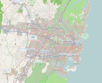
Chipping Norton Lake | |
---|---|
Chipping Norton Lake | |
Location | Chipping Norton, Sydney, New South Wales |
Coordinates | 33°54′S150°57′E / 33.900°S 150.950°E Coordinates: 33°54′S150°57′E / 33.900°S 150.950°E |
Type | Artificial |
Primary inflows | Georges River |
Basin countries | Australia |
Built | c. 1980 |
Max. length | 1 km (0.62 mi) |
Surface area | 49 hectares (120 acres) |
Surface elevation | 0 m (0 ft) AHD |
Frozen | never |
Islands | 4 |
Settlements | City of Liverpool |
Chipping Norton Lake is a 49-hectare (120-acre) artificial lake and regional park located in the Sydney suburb of Chipping Norton, New South Wales, Australia. It is a part of the Georges River system. Chipping Norton Lake is managed by Liverpool City Council. [1] The lake is an important recreational area for Liverpool, City of Canterbury-Bankstown and Fairfield City Council.
The Chipping Norton Lake area was inhabited by the Tharawal and Darug people before European settlement. The land surrounding Georges River (there was no lake at that time) was given to Thomas Moore, an early settler and carpenter for the colony. He established farmland around the river. In the 1950s, sand was mined around the lake area. The mining caused irreversible environmental destruction, and the area remained lifeless after the sand was mined. In the late 1970s it was decided to flood the mine, leaving a large lake. [2] Vegetation was planted around the lake to make a wildlife reserve. [3]
There are over fifty different kinds of birds around the lake including pelicans, purple swamphens, egrets, maned ducks, pacific black ducks, sacred ibis, and pardalote; making birdwatching quite popular. The surrounding forests are filled with sedgelands, reeds and mangroves and the other native trees include the swamp oak, forest red gum, blue box, grey box, bangalay and rough barked apple. The alluvial woodland vegetation is another striking feature of the lake as it is an endangered ecological community. [4]
The City of Liverpool, City of Canterbury-Bankstown and the City of Fairfield work together to manage the wildlife refuge and recreation areas of Chipping Norton Lake. There are four islands within the lake that serve as wildlife refuges for native birds and visitor access is prohibited. Bull sharks have been sighted in the lake. [5]
Chipping Norton Lake has a regional park located on Homestead Avenue, providing cycleways, barbecue facilities, picnic areas, playground equipment, boat ramps, sporting fields and the Georges River Environment Education Centre. There is also a beach in the lake called Grand Flaneur Beach at Homestead Park. Although swimming is permitted at the beach, it is not recommended because of poor water quality. The Chipping Norton Lake also have a number of walkways. [1]
Watercraft are permitted on Chipping Norton Lake. however, a strict speed limit of eight knots applies. The Lake also features a community hall that can be hired by residents or community groups for birthday parties, christenings, barmitzvahs, weddings or any other type of function. The hall can accommodate up to 100 people and has an upstairs balcony with views across the lake and surrounding parkland.
The lake is surrounded by a number of parks, recreational areas and/or reserves:
East side:
West side:
Georges River National Park is a protected Australian National Park, under the management of the NSW National Parks and Wildlife Service. The park falls in the regions of the Sutherland Shire Council and Bankstown City Council. Located in the city of Sydney, 25 km south-west of the CBD, surrounded by neighbouring suburbs of Lugano, Illawong, Alfords Point, Padstow Heights, Revesby Heights, Picnic Point and Sandy Point. The primary use of the park is to service for recreational activities such as; bush walking, picnics, barbeques, boating, fishing, and water/jet skiing. The park is Segmented into 15 sectors along the riverbanks of the Georges River, encompassing 514 hectares (1,270-acres), housing many native aquatic and terrestrial Australian flora and fauna. The traditional custodians are the Dharug people located on the north side of the river, and Dharawal people located on the south of the river.
The Georges River, also known as Tucoerah River, is an intermediate tide-dominated drowned valley estuary, located to the south and west of Sydney, New South Wales, Australia.
Georges Hall, a suburb of local government area City of Canterbury-Bankstown, is located 24 kilometres south-west of the Sydney central business district in the state of New South Wales, Australia, and is part of the South-western Sydney region.
Greater Western Sydney (GWS) is a large region of the metropolitan area of Greater Sydney, New South Wales, Australia that generally embraces the north-west, south-west, central-west, and far western sub-regions within Sydney's metropolitan area and encompasses 13 local government areas: Blacktown, Canterbury-Bankstown, Camden, Campbelltown, Cumberland, Fairfield, Hawkesbury, Hills Shire, Liverpool, Parramatta, Penrith, Wollondilly and the western portion of the City of Parramatta Council. It includes Western Sydney, which has a number of different definitions, although the one consistently used is the region composed of the nine local government authorities which are all members of the Western Sydney Regional Organisation of Councils (WSROC). The NSW Government's Office of Western Sydney uses the broader Greater Western Sydney definition to refer to the region.
South Western Sydney is a region of the metropolitan area in southwest Sydney, New South Wales, Australia. It is part of the predominantly working class area of Greater Western Sydney. The region lies in the Cumberland Plain.
Canterbury is a suburb extending across south-western Sydney and the Inner West, in the state of New South Wales, Australia. Canterbury is located 10.5 kilometres (6.5 mi) south-west of the Sydney central business district in the City of Canterbury-Bankstown.
Liverpool railway station is a heritage-listed railway station located on the Main South line, serving the Sydney suburb of Liverpool in Australia. It is served by Sydney Trains T2 Inner West & Leppington, T3 Bankstown and T5 Cumberland services. It was added to the New South Wales State Heritage Register on 2 April 1999.
Moorebank is a suburb of Sydney, in the state of New South Wales, Australia. Moorebank is located 27 kilometres south-west of the Sydney central business district in the local government area of the City of Liverpool.
Lansvale is a suburb of Sydney, in the state of New South Wales, Australia 28 kilometres south-west of the Sydney central business district, the other side of Chipping Norton and its lake, in the local government areas of the City of Fairfield and is part of the South-western Sydney region.
Chipping Norton is a suburb of Sydney, in the state of New South Wales, Australia. Chipping Norton is 27 kilometres south-west of the Sydney central business district, in the local government area of the City of Liverpool and is part of the Greater Western Sydney region
Sydney is well endowed with open spaces and has many natural areas. Many of these exist even within the compact city centre. These include the Chinese Garden of Friendship and Hyde Park. The metropolitan area contains several national parks, including the Royal National Park, the second oldest national park in the world, which occupies an area of 132 square kilometres. Completing Sydney's wide array of green spaces, the leader is the Royal Botanical Gardens, with its large amount of green spaces, lush plants and colourful flowers.
Prospect Creek, an urban watercourse of the Georges River catchment, is located in the western and Canterbury-Bankstown regions of Sydney, in New South Wales, Australia.
Cabramatta Creek, an urban watercourse of the Georges River catchment, is located in the south-western region of Sydney, in New South Wales, Australia.
The geography of Sydney is characterised by its coastal location on a basin bordered by the Pacific Ocean to the east, the Blue Mountains to the west, the Hawkesbury River to the north and the Woronora Plateau to the south. Sydney lies on a submergent coastline on the east coast of New South Wales, where the ocean level has risen to flood deep river valleys (rias) carved in the Sydney sandstone. Port Jackson, better known as Sydney Harbour, is one such ria.
The Cumberland Plain, an IBRA biogeographic region, is a relatively flat region lying to the west of Sydney CBD in New South Wales, Australia. Cumberland Basin is the preferred physiographic and geological term for the low-lying plain of the Permian-Triassic Sydney Basin found between Sydney and the Blue Mountains, and it is a structural sub-basin of the Sydney Basin.
The metropolis of Sydney is informally subdivided into a number of geographic regions. These areas sometimes, but not always, roughly coincide with official boundaries of suburbs, local government authorities, or cadastral units, and some of the customary regions do not have well defined boundaries at all. Some commonly referred to regions overlap: for example, "Canterbury-Bankstown" is often referred to as a region, but it is also part of the "South Western Sydney" region. The regions themselves are not used as a formal jurisdiction, and do not have administrative or legislative bodies.
The Western Sydney Parklands is an urban park system and a nature reserve located in Sydney, New South Wales, Australia. The NSW government has spent around $400 million for the park. The park is governed by the NSW National Parks and Wildlife Service and is listed under the National Parks and Wildlife Act 1974. The Parklands begin in the north in the City of Blacktown, cross the City of Fairfield, and end in the City of Liverpool.
The Cumberland Plain Woodland is one of six main indigenous woodland communities of Sydney, New South Wales, Australia, that comprises an open tree canopy, a groundcover with grasses and herbs, usually with layers of shrubs and/or small trees. Situated in the Cumberland Plain, it is made up of dry sclerophyll woodlands, grasslands and/or forests, reminiscent of Mediterranean forests and temperate grasslands.
The Homestead is a heritage-listed residence at Charlton Avenue, Chipping Norton, City of Liverpool, Sydney, New South Wales, Australia. It was built from 1884 to 1893. It is also known as Chipping Norton Homestead. The property is owned by the Chipping Norton Lakes Authority. It was added to the New South Wales State Heritage Register on 2 April 1999.
The Chipping Norton Islands consist of four small lake islands that are found within Chipping Norton Lake in western Sydney, New South Wales, Australia.