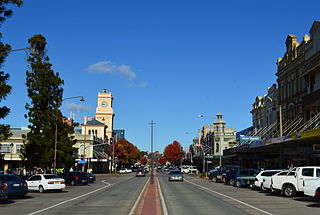
Goulburn is a regional city in the Southern Tablelands of the Australian state of New South Wales, approximately 195 kilometres (121 mi) south-west of Sydney, and 90 kilometres (56 mi) north-east of Canberra. It was proclaimed as Australia's first inland city through letters patent by Queen Victoria in 1863. Goulburn had a population of 23,835 at June 2018. Goulburn is the seat of Goulburn Mulwaree Council.

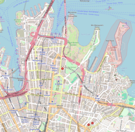
Central is a heritage-listed railway station located in the centre of Sydney, New South Wales, Australia. The station is the largest and busiest railway station in Australia and serves as a major transport interchange for NSW TrainLink inter-city rail services, Sydney Trains commuter rail services, Sydney light rail services, bus services, and private coach transport services. The station is also known as Sydney Terminal. The property was added to the New South Wales State Heritage Register on 2 April 1999. It recorded 85.4 million passenger movements in 2018 and serves over 250,000 people daily.

Wynyard railway station is a heritage-listed underground commuter rail station located in the north-west precinct of the Sydney central business district, in New South Wales, Australia. The station opened on 28 February 1932 to coincide with the opening of the Sydney Harbour Bridge.

St James railway station is a heritage-listed underground commuter rail station that is located on the City Circle, at the northern end of Hyde Park in the Sydney central business district of New South Wales, Australia. It is served by Sydney Trains T2 Inner West & Leppington, T3 Bankstown & T8 Airport & South line services. It is named after the nearby St James' Church. It was added to the New South Wales State Heritage Register on 2 April 1999.

North Sydney is a suburb and major commercial district on the Lower North Shore of Sydney, New South Wales, Australia. It is located three kilometres north of the Sydney central business district and is the administrative centre for the local government area of North Sydney Council.

John Job Crew Bradfield was an Australian engineer best known as the chief proponent of the Sydney Harbour Bridge, of which he oversaw both the design and construction. He worked for the New South Wales Department of Public Works from 1891 to 1933. He was the first recipient of an engineering doctorate from the University of Sydney, in 1924. Other notable projects with which he was associated include the Cataract Dam, the Burrinjuck Dam, and Brisbane's Story Bridge. The Harbour Bridge formed only one component of the City Circle, Bradfield's grand scheme for the railways of central Sydney, a modified version of which was completed after his death. He was also the designer of an unbuilt irrigation project known as the Bradfield Scheme, which proposed that remote areas of western Queensland and north-eastern South Australia could be made fertile by the diversion of rivers from North Queensland.

Museum railway station is a heritage-listed underground commuter rail station that is located on the City Circle route at the southern end of Hyde Park in the Sydney central business district of New South Wales, Australia. The station is served by Sydney Trains T2 Inner West & Leppington and T3 Bankstown T8 Airport & South lines. The station is named after the nearby Australian Museum. It was added to the New South Wales State Heritage Register on 2 April 1999.

Milsons Point railway station is a heritage-listed railway station located on the North Shore line, serving the Sydney suburb of Milsons Point in New South Wales, Australia. It is served by Sydney Trains T1 North Shore line services. The station is located above ground, accessible via stairs and a lift, in Milsons Point, in the North Sydney Council local government area of New South Wales, Australia. It was designed and built by the Sydney Harbour Bridge Branch of the NSW Department of Public Works. The property was added to the New South Wales State Heritage Register on 2 April 1999.

Macquarie Street is a street in the central business district of Sydney in New South Wales, Australia. Macquarie Street extends from Hyde Park at its southern end to the Sydney Opera House at its northern end. Apart from connecting these two major landmarks, the key government institutions of the state of New South Wales are all located on this street.

Watsons Bay is a harbourside, eastern suburb of Sydney, in the state of New South Wales, Australia. Watsons Bay is located 11 km north-east of the Sydney central business district, in the local government area of the Municipality of Woollahra.

Goulburn railway station is a heritage-listed railway station on the Main South line in New South Wales, Australia. Opened on 19 May 1869, it serves the city of Goulburn. It was added to the New South Wales State Heritage Register on 2 April 1999.

The Hyde Park Barracks, Sydney is a heritage-listed former barracks, hospital, convict accommodation, mint and courthouse and now museum and cafe located at Macquarie Street in the Sydney central business district, in the City of Sydney local government area of New South Wales, Australia. Originally constructed between 1817 and 1819 as a brick building and compound to house convict men and boys, it was designed by convict architect Francis Greenway. It is also known as the Mint Building and Hyde Park Barracks Group and Rum Hospital; Royal Mint – Sydney Branch; Sydney Infirmary and Dispensary; Queen's Square Courts; Queen's Square. The site is managed by the Sydney Living Museums, an agency of the Government of New South Wales, as a living history museum open to the public.
Australian non-residential architectural styles are a set of Australian architectural styles that apply to buildings used for purposes other than residence and have been around only since the first colonial government buildings of early European settlement of Australia in 1788.

Queen's Square is a public square in central Sydney, Australia. The square is located at the junction of King Street with Phillip Street and Macquarie Street. It is bounded on the south by St James Road and Prince Albert Road.

The Paddington Reservoir is a heritage-listed public park located at 255a Oxford Street in the inner eastern Sydney suburb of Paddington. It was designed by Edward Bell and built from 1864 to 1866 and operated as a water reservoir which accepted water from the Botany Swamps pumping station for supply to parts of Sydney between 1866 and 1899. In the twentieth century the site variously functioned as a service station and storage and mechanical workshop site. In 2006 work commenced to convert the site into a sunken garden and park. It is also known as Walter Read Reserve; Paddington Reservoir Gardens; Reservoir Gardens. The property is owned by City of Sydney. It was added to the New South Wales State Heritage Register on 2 April 1999.
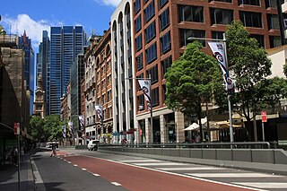
York Street is a street in the Sydney central business district in New South Wales, Australia. York Street runs 1.050 kilometres (0.652 mi) in a north to south direction only and is used predominantly by buses from the northern districts of Sydney.
Parramatta Sand Body Conservation Area and Military Barracks Site is a heritage-listed archaeological site relating to both Aboriginal and European occupation at George and Harris Streets, Harris Park, City of Parramatta, Sydney, New South Wales, Australia. It was added to the New South Wales State Heritage Register on 8 July 2011.

The Woollahra Reservoir or WS022 is a heritage-listed underground reservoir at 5R Oxford Street, Centennial Park, New South Wales, Australia. It was designed and built by the NSW Public Works Department. The property is owned by Sydney Water. A sign attached to a building on the site states that this is known as "Centennial Park number 1 Water Reservoir Underground WS0022". The reservoir is adjacent to Centennial Park Reservoir. This reservoir is closer to York Street than Centennial Park Reservoir. The area is enclosed by a high fence and a sign on the main gate states: WARNING KEEP OUT" and that trespassers may be prosecuted.

The Centennial Park Reservoir or WS001 is a heritage-listed underground reservoir at 3R Oxford Street, Centennial Park, New South Wales, Australia. It was designed and built by NSW Public Works Department from 1896 to 1898. The property is owned by Sydney Water.
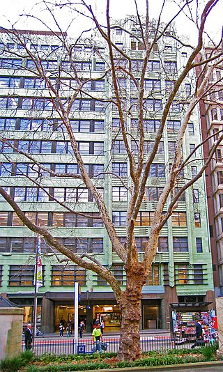
The Transport House is a heritage-listed office building located at 19-31 York Street in the Sydney central business district, in the City of Sydney local government area of New South Wales, Australia. It is also known as Railway House; Greenhouse; and the Wynyard SRA Offices. The property is privately owned. It was added to the New South Wales State Heritage Register on 2 April 1999.