
Arncliffe is a suburb in southern Sydney, in the state of New South Wales, Australia. Arncliffe is located 11 kilometres south of the Sydney central business district, in the local government area of the Bayside Council.
Oatley is a suburb in Southern Sydney in the state of New South Wales, Australia. It is located 18 kilometres south of the Sydney central business district and is part of the St George area. Oatley lies in the local government area of Georges River Council. It lies on the northern side of the tidal estuary of the Georges River and its foreshore includes part of Oatley Bay and Lime Kiln Bay, and all of Neverfail Bay, Gungah Bay and Jewfish Bay.

Kogarah is a suburb of Southern Sydney, in the state of New South Wales, Australia. Kogarah is located 14 kilometres south-west of the Sydney central business district and is considered to be the centre of the St George area.
The City of Kogarah was a local government area in the St George region of southern Sydney, in the state of New South Wales, Australia. The centre of the city is located 14 kilometres (8.7 mi) south-west of the Sydney central business district and west of Botany Bay.
Sans Souci is a Southern Sydney suburb in the state of New South Wales, Australia. Sans Souci is 17 kilometres south of the Sydney central business district and lies across the local government areas of the Bayside Council and the Georges River Council. It is part of the St George area.
Mulgoa is a village, located in the local government area of the City of Penrith, in the region of western Sydney, in the state of New South Wales, Australia. Mulgoa is located approximately 66 kilometres (41 mi) west of the Sydney central business district.

Kogarah Bay is a suburb in southern Sydney, in the state of New South Wales, Australia 16 kilometres south of the Sydney central business district. It is part of the St George area. Kogarah Bay is in the local government area of the Georges River Council.

Wolli Creek is a suburb in southern Sydney, in the state of New South Wales, Australia. It sits beside the Wolli Creek and Cooks River waterways. Wolli Creek is situated between the suburbs of Arncliffe and Tempe, 10 kilometres south of the Sydney central business district and is part of the St George area. Wolli Creek is in the local government area of Bayside Council.

Bexley is a suburb in southern Sydney, in the state of New South Wales, Australia. Bexley is located 14 kilometres (8.7 mi) south-west of the Sydney central business district, in the local government area of the Bayside Council and is part of the St George area.

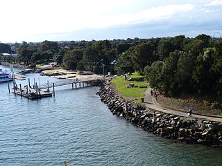
Carss Park is a suburb in southern Sydney, in the state of New South Wales, Australia 17 kilometres south of the Sydney central business district in the local government area of the Georges River Council. Carss Park is part of the St George area.

Kogarah is an electoral district of the Legislative Assembly in the Australian state of New South Wales. The electorate is located in St George. It is represented by Chris Minns of the Australian Labor Party.

Sydney is well endowed with open spaces and has many natural areas. Many of these exist even within the compact city centre. These include the Chinese Garden of Friendship and Hyde Park. The metropolitan area contains several national parks, including the Royal National Park, the second oldest national park in the world, which occupies an area of 132 square kilometres. Completing Sydney's wide array of green spaces, the leader is the Royal Botanical Gardens, with its large amount of green spaces, lush plants and colourful flowers.

Vaucluse House is a heritage-listed residence, colonial farm and country estate and now tourist attraction, house museum and public park located at 69a Wentworth Road, Vaucluse in the Municipality of Woollahra local government area of New South Wales, Australia. Completed between 1803 and 1839 in the Gothic Revival style, its design was attributed to William Charles Wentworth and built by Sir Henry Browne Hayes and W. C. Wentworth. The property is owned by the Historic Houses Trust of New South Wales, an agency of the Government of New South Wales. The site was added to the New South Wales State Heritage Register on 2 April 1999.

Oatley Pleasure Grounds is a bush park located in Oatley, New South Wales. The whole park is 3.4 hectares.

Georges River Council is a local government area located in the St George region of Sydney located south of the CBD, in New South Wales, Australia. The Council was formed on 12 May 2016 from the merger of the Hurstville City Council and Kogarah City Council.
Wilsons Farm House is a heritage-listed former residence at 310 West Botany Street, Rockdale, Bayside Council, New South Wales, Australia. It was built from 1855 to 1856 by James Wilson. The property is owned by Bayside Council. It was added to the New South Wales State Heritage Register on 2 April 1999.

Carss Cottage is a heritage-listed former cottage and park ranger's residence and now historical museum locate in Carss Bush Park at 74 Carwar Avenue, Carss Park, Georges River Council, New South Wales, Australia. It was built during 1865 by Scottish masons. The property is owned by the Georges River Council. It was added to the New South Wales State Heritage Register on 2 April 1999.

The Kellys Bush Park is a heritage-listed bushland, partly on the former site of smelting works, at Nelson Parade, Hunters Hill in the Municipality of Hunter's Hill local government area of New South Wales, Australia. It is also known as Weil Park and The Smelting Company. The property is owned by Department of Planning and Environment, a department of the Government of New South Wales. It was added to the New South Wales State Heritage Register on 2 April 1999.

The Ashfield Reservoir is a heritage-listed reservoir located at Holden Street, Ashbury, City of Canterbury-Bankstown, New South Wales, Australia. It was designed and built by the Metropolitan Board of Water Supply and Sewerage. It is also known as Ashfield Reservoir (Elevated) and WS 0003. The property is owned by Sydney Water. It was added to the New South Wales State Heritage Register on 15 November 2002.

Riverview House is a heritage-listed former orchard and now residence at 135 Marsden Road, West Ryde in the City of Ryde local government area of New South Wales, Australia. It was built from 1860 to 1878 by George Spurway. The property is privately owned. It was added to the New South Wales State Heritage Register on 2 April 1999.

