Related Research Articles

The Lane Cove National Park is a protected national park that is located within metropolitan Sydney, in New South Wales, Australia. The 372-hectare (920-acre) national park is situated about 10 kilometres (6.2 mi) north-west of the Sydney central business district and features various vegetation types, such as, wet and dry sclerophyll forest, heathland, mangroves and tidal flats. The park consists of land near the banks of the Lane Cove River, which flows generally south-east into Sydney Harbour. It also extends to the outskirts of Pennant Hills and Wahroonga at its northern boundaries.

Ryde is an English seaside town and civil parish on the north-east coast of the Isle of Wight. It had a population of 32,072 at the time of the 2011 Census. Its growth as a seaside resort followed after the villages of Upper Ryde and Lower Ryde were merged in the 19th century. The influence of that period can be seen in the town's central and seafront architecture. As a resort, Ryde has expansive sands revealed at low tide. The wide beach necessitates the listed pier for a regular passenger ferry service to the mainland. It is the fourth longest in the United Kingdom and the oldest survivor.

Rhodes is a suburb of Sydney, in the state of New South Wales, Australia. Rhodes is located 16 kilometres west of the Sydney central business district, in the local government area of the City of Canada Bay. It was formerly part of Concord Municipality until a merger with Drummoyne Council to form Canada Bay in December 2000.
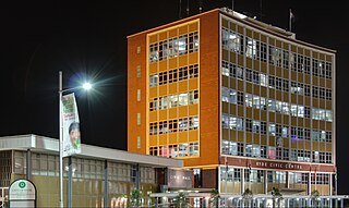
Ryde is a suburb of Sydney, New South Wales, Australia. Ryde is located 13 km north-west of the Sydney central business district and 8 km east of Parramatta. Ryde is the administrative centre of the local government area of the City of Ryde and part of the Northern Suburbs area. It lies on the north bank of the Parramatta River.

The Lane Cove River, a northern tributary of the Parramatta River, is a tide-dominated, drowned valley estuary west of Sydney Harbour, located in Sydney, New South Wales, Australia. The river is a tributary of the Parramatta River, winding through a bushland valley. It joins Parramatta River at Greenwich and Woolwich, where together they form an arm of Sydney Harbour.
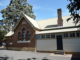
North Ryde is a suburb of Sydney, in the state of New South Wales, Australia. North Ryde is located 15 kilometres north-west of the Sydney central business district, in the local government area of the City of Ryde. North Ryde is in the Northern Suburbs region of Sydney.

Macquarie Park is a suburb in northern Sydney, New South Wales, Australia. Macquarie Park is located 13 kilometres north-west of the Sydney central business district in the local government area of the City of Ryde. Macquarie Park is part of the Northern Suburbs region.

East Ryde is a suburb in the Northern Suburbs of Sydney, in the state of New South Wales, Australia. East Ryde is located 12 kilometers north-west of the Sydney central business district, in the local government area of the City of Ryde. East Ryde sits on the western bank of the Lane Cove River. East Ryde shares the postcode of 2113 with adjacent suburb of North Ryde though it does not have a Post Office of its own.

Meadowbank is a suburb of Sydney, New South Wales, Australia. Meadowbank is located 15 kilometres west of the Sydney central business district, in the local government area of the City of Ryde and part of the Northern Suburbs area. Meadowbank sits in a valley on the northern bank of the Parramatta River.

Melrose Park is a suburb of Sydney, Australia, located 17 kilometres north-west of the Sydney central business district, and is split between the local government areas of the City of Ryde and the City of Parramatta. It is part of the Northern Suburbs area. Melrose Park sits on the northern bank of the Parramatta River.
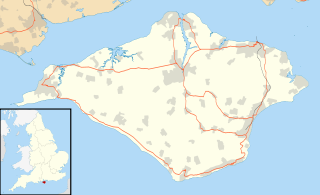
Binstead is a village on the Isle of Wight. It is located in the northeast of the Island, 1 1⁄2 miles (2.4 km) west of Ryde on the main road A3054 between Ryde and Newport. In the 2011 Census Binstead had been incorporated within Ryde whilst still retaining its electoral ward, Binsted and Fishbourne.
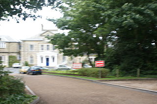
Ryde School with Upper Chine is a co-educational ISC independent day and boarding school in the seaside town of Ryde, on the Isle of Wight. Among the school's former pupils are the author Philip Norman and the former world-record holder as the youngest cross-Atlantic yachtsman, Seb Clover.

Top Ryde City is a shopping centre in the suburb of Ryde in the Northern Suburbs of Sydney.

The Northern Suburbs is the metropolitan area on the northern bank of the Parramatta River in Sydney, New South Wales, Australia beginning with suburbs in line with or east of West Pennant Hills and ending with suburbs west of the Lane Cove National Park, south of Hornsby. This area includes suburbs in the local government areas of Hornsby Shire, City of Ryde, the Municipality of Hunter's Hill, and parts of the City of Parramatta.

Puckpool is a small coastal settlement on the outskirts of Ryde on the Isle of Wight. The area is best known for Puckpool Park, a park with an 18-hole putting green, 12 hole mini golf and two tennis courts. Puckpool Battery is located within the boundaries of the park; this is an old Palmerston Fort built in 1865.

Charity Creek, a northern tributary of the Parramatta River, is a creek west of Sydney Harbour, located in Sydney, New South Wales, Australia. It joins Parramatta River at Meadowbank Park, Meadowbank.
Smalls Creek, a northern tributary of the Parramatta River, is a creek west of Sydney Harbour, located in Sydney, New South Wales, Australia. It joins Parramatta River at Meadowbank Park, Meadowbank.
Terrys Creek, an urban watercourse that is part of the Lane Cove River catchment, is located in Northern Suburbs region of Sydney, Australia. It was named after Edward Terry who served as the first mayor of Eastwood municipality.
Gladesville Ryde Magic Football Club is an Australian semi-professional football club based in North Ryde, New South Wales. The club currently has senior squads competing in the NSW National Premier League 3 and youth squads competing in the NSW National Premier League 2. The club also has a number of junior squads who compete in the Football NSW Skills Acquisitions Program.

Peter Board High School, known from 1962-1985 as North Ryde High School, is a former government-funded co-educational comprehensive secondary day school, that was located in North Ryde, a lower north shore suburb of Sydney, New South Wales, Australia. The school opened in 1962 and closed in 1998.