
The Parramatta River is an intermediate tide-dominated, drowned valley estuary located in Sydney, New South Wales, Australia. With an average depth of 5.1 metres (17 ft), the Parramatta River is the main tributary of Sydney Harbour, a branch of Port Jackson. Secondary tributaries include the smaller Lane Cove and Duck rivers.

Balmain is a suburb in the Inner West of Sydney, New South Wales, Australia. Balmain is located 2 km (1.2 mi) west of the Sydney central business district, in the local government area of the Inner West Council. It sits on a small peninsula that juts out of Sydney Harbour, directly opposite Milsons Point.

Cremorne Point is a harbourside suburb on the Lower North Shore of Sydney, New South Wales, Australia. Cremorne is located 6 kilometres north of the Sydney central business district, in the local government areas of North Sydney Council.

The Municipality of Leichhardt was a local government area in the inner-west region of Sydney, New South Wales, Australia. It is about 10 kilometres (6.2 mi) west of the Sydney central business district. On 12 May 2016, Leichhardt merged with Marrickville Council and the Municipality of Ashfield to form the Inner West Council.

Balmain East is a suburb in the Inner West of Sydney, in the state of New South Wales, Australia. Balmain East is located three kilometres west of the Sydney central business district, in the local government area of the Municipality of Leichhardt.

Birchgrove is a suburb in the Inner West of Sydney, in the state of New South Wales, Australia. Birchgrove is located five kilometres west of the Sydney central business district, in the local government area of the Inner West Council.
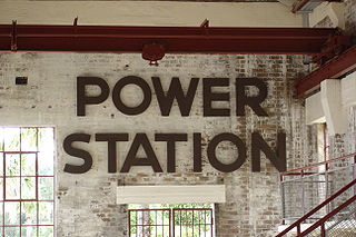
The Balmain Power Station was located at Iron Cove, 4 km (2 mi) from Sydney in New South Wales, Australia. The station no longer exists and residential properties now occupy the site. This plant is often confused with the White Bay Power Station, the remains of which are still standing in Rozelle.
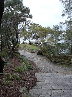
Yurulbin Park is a 0.61-hectare (1.5-acre) public open space located at the end of Yurulbin Point on the Balmain Peninsula in the suburb of Birchgrove in the Inner West Council local government area in Sydney, New South Wales, Australia.

The Dry Dock Hotel is a heritage-listed pub located in Balmain, a suburb in the inner west region of Sydney, in the state of New South Wales, Australia. The pub is the oldest licensed hotel in Balmain and one of a number of establishments which formed an integral part of the shipbuilding and industrial heritage of the local area.

The Royal Oak Hotel is a pub located in Balmain, a suburb in the inner west region of Sydney, in the state of New South Wales, Australia. The pub has historical links with the union movement and is one of a number of buildings which formed an integral part of the shipbuilding and industrial history of the local area.
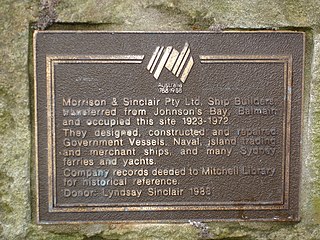
Morrison & Sinclair was a Sydney, New South Wales based company and one of the great ship and boat-building names of Port Jackson. The company was founded in the early 1890s and ceased trading in 1970.
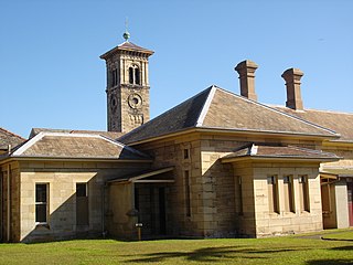
Callan Park, with the heritage listed name Callan Park Conservation Area & Buildings, is a 60-hectare (150-acre) heritage listed site in Lilyfield, a suburb in the Inner West Council in the Inner West of Sydney, in the state of New South Wales, Australia.
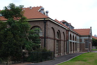
The Lever Brothers Factory in the Sydney, Australia suburb of Balmain was a soap factory which operated from 1895 until 1988. It employed many people from the local area and its large industrial buildings were a prominent feature of the landscape. Most of the site was demolished in 1996 to make way for a new apartment complex and only three of the original buildings remain.

Mort's Dock is a former dry dock, slipway, and shipyard in Balmain, New South Wales, Australia. It was the first dry dock in Australia, opening for business in 1855 and closing more than a century later in 1959. The site is now parkland. The surviving remnants were added to the New South Wales State Heritage Register on 14 January 2011.

Glebe Island was a major port facility in Sydney Harbour and, in association with the adjacent White Bay facility, was the primary receiving venue for imported cars and dry bulk goods in the region until 2008. It is surrounded by White, Johnstons, and Rozelle Bays. Whilst retaining its original title as an "island", it has long been infilled to the shoreline of the suburb of Rozelle and connected by the Glebe Island Bridge to Pyrmont.

Bellevue is a heritage-listed former residence and timber yard and now cafe located at 55–57 Leichhardt Street in the inner city Sydney suburb of Glebe Point in the City of Sydney local government area of New South Wales, Australia. It was designed by Ambrose Thornley Junior and built in 1896 for William Jarrett who lived in the adjoining house. It is also known as site of former Venetia (demolished) and 55 Leichhardt Street. The property is owned by the City of Sydney Council. It was added to the New South Wales State Heritage Register on 2 April 1999.

Hampton Villa is a heritage-listed residence at 12b Grafton Street, Balmain, Inner West Council, New South Wales, Australia. It was built c. 1847-1849 by Edward Hunt; the design is uncertain, but has been attributed to John Verge. Among its notable residents was Henry Parkes, tenant from 1888 to 1892. The villa replaced an earlier building known as Hampton Cottage. It was added to the New South Wales State Heritage Register on 27 May 2005.

Louisaville is a heritage-listed residence at 2 Wells Street, Balmain, Inner West Council, Sydney, New South Wales, Australia. It is also known as Inglefield House. It was built by William Carss. It was added to the New South Wales State Heritage Register on 2 April 1999.
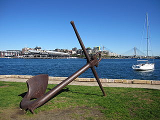
Iloura Reserve is a heritage-listed public reserve on the site of a former timber yard at 10-20 Weston Street, Balmain East, Inner West Council, Sydney New South Wales, Australia. Following the resumption of the timber yard for public space in the 1960s, the present reserve was designed and laid out by landscape architect Bruce Mackenzie and constructed in two stages: stage one in 1970 and stage two in 1981. It is also known as Peacock Point and Illoura. The reserve is owned by the Inner West Council. It was added to the New South Wales State Heritage Register on 29 November 2013.

Fenwick & Co Boat Store is a heritage-listed former shipwright's yard at 2-8 Weston Street, Balmain East, Inner West Council, Sydney, New South Wales, Australia. It was built from 1875 to 1885. It is also known as Fenwick & Co. Building and Bell's Store. The property is owned by the Inner West Council. It was added to the New South Wales State Heritage Register on 9 June 2000.


