Sydney Harbour Foreshore Authority

Last updated

Sydney Harbour Foreshore Authority
QE2 Sydney1.jpg
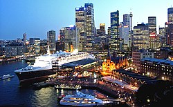
Parts of Circular Quay and The Rocks, administered by the Sydney Harbour Foreshore Authority.
Statutory authority overview
Formed1 February 1999
Dissolved1 July 2016
Superseding agency
Jurisdiction White Bay Power Station, Darling Harbour, The Rocks, Luna Park Sydney, Circular Quay, Rozelle Rail Yards in Sydney, New South Wales
Headquarters66 Harrington Street, The Rocks, New South Wales
Minister responsible
Parent Statutory authority Department of Finance, Services and Innovation
Key document
Website shfa.nsw.gov.au

Sydney Harbour Foreshore Authority (SHFA) was a statutory authority that owned and managed some of the Government of New South Wales most significant Sydney harbour foreshore assets, including Sydney's heritage and cultural precincts at The Rocks and Darling Harbour. The Foreshore Authority was also place manager for a number of culturally significant sites in Sydney, including Rozelle Rail Yards, White Bay Power Station and Ballast Point Park.

Contents

History

The authority was formed in 1998 under the Sydney Harbour Foreshore Authority Act, 1998 to consolidate the works and functions of the City West Development Corporation, Darling Harbour Authority and Sydney Cove Authority. [1] In September 2015 the NSW Government announced that the Sydney Harbour Foreshore Authority's functions would be consolidated with Government Property NSW (Property NSW), as part of a move to consolidate government approaches to property and precinct management, including removing duplication of functions. The Statute Law (Miscellaneous Provisions) Act, 2015 took effect on 1 July, consolidating all functions of the SHFA into Property NSW. [2] [3]

Chairs

Role

The Authority's mandate was to:

The Authority managed commercial and retail leases, providing security, cleaning, building maintenance and other facility management services, and had the responsibility for heritage protection, including over 100 New South Wales State Heritage listed items.

The Authority had previously been responsible for managing specific areas of foreshore land in Sydney, including Barangaroo (managed by the Barangaroo Delivery Authority) and the Darling Quarter retail and commercial redevelopment at Darling Harbour.

As a part of the Department of Finance and Services (New South Wales) cluster, it was autonomously administered by a Board that reported to the New South Wales Minister for Finance, Services and Property.

Related Research Articles

Darling Harbour

Darling Harbour is a harbour adjacent to the city centre of Sydney, New South Wales, Australia that is made up of a large recreational and pedestrian precinct that is situated on western outskirts of the Sydney central business district.

Port Jackson Body of water in Sydney, Australia

Port Jackson, consisting of the waters of Sydney Harbour, Middle Harbour, North Harbour and the Lane Cove and Parramatta Rivers, is the ria or natural harbour of Sydney, New South Wales, Australia. The harbour is an inlet of the Tasman Sea. It is the location of the Sydney Opera House and Sydney Harbour Bridge. The location of the first European settlement and colony on the Australian mainland, Port Jackson has continued to play a key role in the history and development of Sydney.

King Street Wharf Wharf in Sydney, Australia

King Street Wharf, is a mixed-use tourism, commercial, residential, retail and maritime development on the eastern shore of Darling Harbour, an inlet of Sydney Harbour, Australia. Located on the western side of the city's central business district, the complex served as a maritime industrial area in the early and mid 20th century. It was redeveloped as part of extensive urban renewal projects around Sydney Harbour in the 1980s and 90s. The complex is host to a cluster of nine wharves, with the first two wharves currently in use by private ferry operator Captain Cook Cruises and a third recently decommissioned by Sydney Ferries.

Chinatown, Sydney New South Wales, Australia

Chinatown is an urban enclave situated in the southern part of the Sydney Central Business District, in New South Wales, Australia. It comprises the majority of the Haymarket suburb, between Central station and Darling Harbour. It is part of the local government area of the City of Sydney, and is Australia's largest Chinatown.

Pyrmont Bridge Heritage-listed bridge across Crockle Bay in Sydney, Australia

The Pyrmont Bridge, a heritage-listed swing bridge across Cockle Bay, is located in Darling Harbour, part of Port Jackson, west of the central business district in the City of Sydney local government area of New South Wales, Australia. Opened in 1902, the bridge initially carried motor vehicle traffic via the Pyrmont Bridge Road between the central business district and Pyrmont. Since 1981 the bridge has carried pedestrian and bicycle traffic only, as motor vehicles were diverted to adjacent freeway overpasses. The bridge was added to the New South Wales State Heritage Register on 28 June 2002, the centenary of its opening.

Chinese Garden of Friendship

The Chinese Garden of Friendship is a heritage-listed 1.03-hectare (3-acre) Chinese garden at 1 Harbour Street, in the Sydney Central Business District, City of Sydney, New South Wales, Australia. Modelled after the classic private gardens of the Ming Dynasty, the garden offers an insight into Chinese heritage and culture. It was designed by Guangzhou Garden Planning & Building Design Institute, Tsang & Lee, and Edmond Bull & Corkery and built from 1986 to 1988 by Gutteridge Haskins & Davey; the Darling Harbour Authority; Imperial Gardens; Leightons; and Australian Native Landscapes. The gardens were added to the New South Wales State Heritage Register on 5 October 2018.

Barangaroo was the second wife of Bennelong, who was interlocutor between the Aboriginal people and the early British colonists in New South Wales. Barangaroo was a member of the Cammeraygal clan. While Bennelong spent considerable time in the British settlement in Sydney, Barangaroo maintained her way of life with her people.

Barangaroo, New South Wales Suburb of Sydney, New South Wales, Australia

Barangaroo is an area of central Sydney, New South Wales, Australia. It is located on the north-western edge of the Sydney central business district and the southern end of the Sydney Harbour Bridge. It is part of the local government area of the City of Sydney. The area was used for fishing and hunting by Indigenous Australians prior to colonial settlement. The area is inclusive of The Hungry Mile, the name harbourside workers gave to the docklands area of Darling Harbour East during The Great Depression, where workers would walk from wharf to wharf in search of a job, often failing to find one.

Barangaroo ferry wharf

Barangaroo ferry wharf is a ferry wharf located on the eastern side of Darling Harbour, in Sydney, Australia. The wharf is the major public transport link of the Barangaroo precinct, situated west of the Sydney central business district. The complex consists two wharves, with provision for a third wharf in the future. It is serviced by Sydney Ferries' F3 Paramatta River and F4 Pyrmont Bay services. The wharf opened on 26 June 2017.

Pyrmont Bay ferry services

The Pyrmont Bay ferry service, officially known as F4 Pyrmont Bay, is a commuter ferry service in Sydney, New South Wales. Part of the Sydney Ferries network, it is operated by Transdev Sydney Ferries and services the Lavender Bay and Darling Harbour areas. It began operation on 25 October 2020, and replaced the western half of the F4 Cross Harbour ferry service. Emerald-class ferries and SuperCat ferries operate the service.

Overseas Passenger Terminal

The Overseas Passenger Terminal (OPT), known officially as the Sydney Cove Passenger Terminal, is a public passenger terminal servicing cruise ships and ocean liners located in Circular Quay, Sydney, Australia. Whilst commercial shipping operations on and around the site date from 1792, the current primary structure and waterfront promenade date from 1958, with subsequent on-going alterations and land reclamation throughout the latter part of the 20th century. The current design retains the black steel portal frame trusses of the original 1958 structure, with major additions completed in 1988 in the Post-War International Style through the collaboration of Sydney architects Lawrence Nield and Peter Tonkin.

The Goods Line

The Goods Line is an 800 m-long (2,625 ft) linear park and shared pedestrian pathway and cycleway in the suburb of Ultimo, in the City of Sydney, New South Wales, Australia. The corridor connects Railway Square to Darling Harbour in the south and passes both the University of Technology Sydney Broadway campus and the Australian Broadcasting Corporation Sydney head office. The Goods Line terminates in the north at the corner of Sussex and Hay Streets, in the Sydney central business district.

Fortune of War Hotel Heritage-listed pub in Sydney, Australia

The Fortune of War Hotel is a heritage-listed pub located at 137 George Street, in the inner city Sydney suburb of The Rocks in the City of Sydney local government area of New South Wales, Australia. It was designed by the Tooth & Co. resident architect and built in 1922 by H. J. & H. W. Thompson. The property is owned by Property NSW, an agency of the Government of New South Wales. It was added to the New South Wales State Heritage Register on 10 May 2002.

Campbells Stores

The Campbell's Stores is a heritage-listed former warehouse building in the inner city Sydney suburb of The Rocks in the City of Sydney local government area of New South Wales, Australia. The Victorian Georgian building previously served as store houses and maritime bonded warehouses. It was built from 1850 to 1861. It faces Campbells Cove, an inlet in the north-west of Sydney Cove. In the 1970s, along with the general decline of commercial shipping activities in Sydney Cove, the building was converted for use as tourist-orientated restaurants and bars.

Argyle Cut Historic road in New South Wales, Australia

The Argyle Cut is a heritage-listed roadway and road cutting located at Argyle Street in the inner-city Sydney suburb of The Rocks in the City of Sydney local government area of New South Wales, Australia. It was built from 1843 to 1868 with convict and paid labour. The property is owned by the Sydney Harbour Foreshore Authority, an agency of the Government of New South Wales. It was added to the New South Wales State Heritage Register on 10 May 2002.

Property NSW is a statutory body of the Government of New South Wales that manages the State's significant property portfolio and its places. Formed on 1 July 2016, Property NSW encompasses the entities of the former Government Property NSW (GPNSW), the former Sydney Harbour Foreshore Authority (SHFA), Teacher Housing Authority of NSW (THA) and Waste Assets Management Corporation (WAMC).

Metcalfe Bond Stores

The Metcalfe Bond Stores is a heritage-listed former bond store and warehouse and now shops and offices located at 68-84 George Street in the inner city Sydney suburb of The Rocks in the City of Sydney local government area of New South Wales, Australia. It was built from 1912 to 1916. It is also known as New Metcalfe Bond Stores. The property is owned by Property NSW, an agency of the Government of New South Wales. It was added to the New South Wales State Heritage Register on 10 May 2002.

121 George Street, The Rocks Heritage-listed building in Sydney, Australia

121 George Street, The Rocks is a heritage-listed retail building and former terrace house and shops located at 121 George Street, in the inner city Sydney suburb of The Rocks in the City of Sydney local government area of New South Wales, Australia. It was built during 1880 for Thomas Playfair. It is also known as Baker's Oven - Shop and residence. The property is owned by Property NSW, an agency of the Government of New South Wales. It was added to the New South Wales State Heritage Register on 10 May 2002.

Urban renewal in Sydney

The urban renewal of Sydney is an ongoing land redevelopment process that is creating and reviving new urban centres across Sydney, Australia. Urban renewal refers to the refurbishment of derelict buildings, streets or neighbourhoods and is accompanied with the process of gentrification attributed by changes in land use and deindustrialisation of areas. In 2020, there are several projects underway and planned including Barangaroo, The Bays Precinct and Green Square.

References

  1. "AGENCY#1092: Sydney Harbour Foreshore Authority". Agency. NSW State Records & Archives. Retrieved 27 April 2018.
  2. "Property NSW". Property NSW. NSW Government. Retrieved 27 April 2018.
  3. Robertson, James (2 October 2015). "Fears over Sydney harbour foreshore sell-off". The Sydney Morning Herald. Retrieved 27 April 2018.
  4. "Sydney Harbour Foreshore Authority Annual Report 2010 –11" (PDF). Sydney Harbour Foreshore Authority. NSW Government. Retrieved 26 September 2015.
  5. NSW Government Gazette No 110 of 6 September 2013, p. 3954.
  6. Perrottet, Dominic (23 June 2015). "NSW Government Appoints New Chair to Sydney Harbour Foreshore Authority". Department of Finance, Services and Innovation. NSW Government. Retrieved 27 April 2018.