Greater Western Sydney (GWS) is a large region of the metropolitan area of Greater Sydney, New South Wales (NSW), Australia that generally embraces the north-west, south-west, central-west, far western and the Blue Mountains sub-regions within Sydney's metropolitan area and encompasses 11 local government areas: Blacktown, Blue Mountains, Camden, Campbelltown, Cumberland, Fairfield, Hawkesbury, Liverpool, Parramatta, Penrith and Wollondilly. It includes Western Sydney, which has a number of different definitions, although the one consistently used is the region composed of ten local government authorities, most of which are members of the Western Sydney Regional Organisation of Councils (WSROC). The NSW Government's Office of Western Sydney calls the region "Greater Western Sydney".

The Division of Fowler is an Australian electoral division in the state of New South Wales.

The Fairfield City Council is a local government area in the west of Sydney, in the state of New South Wales, Australia. The council was first incorporated as the "Municipal District of Smithfield and Fairfield" on 8 December 1888, and the council's name was changed to the "Municipality of Fairfield" in 1920, before being proclaimed a city in 1979. The City of Fairfield comprises an area of 102 square kilometres (39 sq mi) and as of the 2021 census had a population of 208,475. The mayor of the City of Fairfield is Cr. Frank Carbone, the first popularly-elected independent mayor of Fairfield.

Smithfield is a suburb of Sydney, in the state of New South Wales, Australia. Smithfield is located 31 kilometres (19 mi) west of the Sydney central business district, in the local government areas of the City of Fairfield and Cumberland Council. Located in the Greater Western Sydney region, the suburb is one of the largest in Fairfield City by area.

The City of Liverpool is a local government area, administered by Liverpool City Council, located in the south-west of Sydney, in the state of New South Wales, Australia. The area encompasses 305.5 square kilometres (118.0 sq mi) and its administrative centre is located in the suburb of Liverpool.

Carramar is a suburb of Sydney, in the state of New South Wales, Australia. Carramar is located 30 kilometres west of the Sydney central business district, in the local government area of the City of Fairfield and is part of the South Western Sydney region.
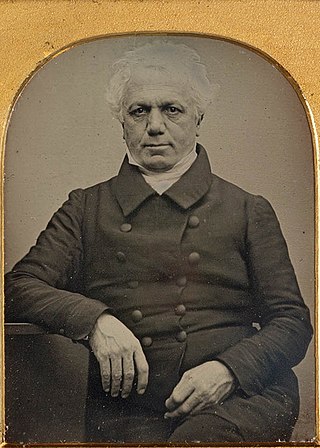
William Bland was a prominent public figure in the colony of New South Wales. A surgeon by profession, he arrived in Australia as a convict but played an important role in the early years of Australian healthcare, education and science.

Prospect Creek is an urban watercourse of the Georges River catchment that is located in the western region of Sydney, in New South Wales, Australia. As Prospect Reservoir forms a part of the Sydney metropolitan water supply, the flow of the creek is regulated in accordance with the operational requirements of Sydney Water.

The City of Brisbane is a local government area (LGA) which comprises the inner portion of Greater Brisbane, the capital of Queensland, Australia. Its governing body is the Brisbane City Council.

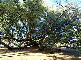
Rosford Street Reserve, or Rosford Reserve, is an urban park and nature reserve situated in the western suburbs of Sydney, New South Wales, Australia. The reserve contains an open grassland, woodlands and recreational areas surrounded by native plants, such as eucalyptus trees. Janice Crosio Oval is a fenced sports ground incorporated within the reserve. The park is one of the largest in the Fairfield LGA area.
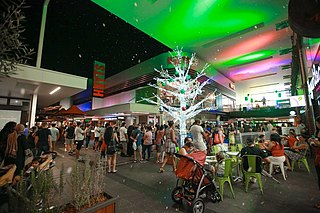
Stockland Wetherill Park is a shopping mall in Wetherill Park, Sydney, Australia. Being an indoor and outdoor shopping centre, it is 47th-largest by area in the country. Costing $142 million to build, the centre was established in 1983 and has been through four phases of redevelopment, with the major one completed in September 2016, where it had undergone a $228 million renovation with some 5,600 m2 (60,000 sq ft) of retail space.
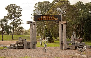
Fairfield Showground is a multi-purpose indoor-outdoor venue situated in Prairiewood, New South Wales, Australia. Since in the 1970s, it has been a popular venue for multicultural festivals, horse racing, carnivals, markets and club meets attracting as many as 20,000 people. Situated in western Sydney, the showground has around 10,000 sqm of undercover exhibition space and it is overall 33 hectares in size, with parking spaces for over 600 vehicles.
The King George V Avenue of Memorial English Oaks is a heritage-listed memorial avenue at King George V Memorial Avenue (East), Tamworth, Tamworth Regional Council, New South Wales, Australia. It was designed by Tamworth Council and Community and built during 1936 by Tamworth Progress Association, Tamworh Rotary, Tamworth Community and Council. It is also known as Lower Nemingha Road. It was added to the New South Wales State Heritage Register on 12 March 2014.
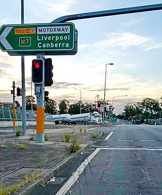
The Horsley Drive is a 13-kilometre (8.1 mi) urban sealed road located in the City of Fairfield in Greater Western Sydney, New South Wales, Australia. The road's northwestern terminus is located at the entrance of Western Sydney Parklands in Horsley Park and its southeastern terminus at its intersection with Hume Highway in Carramar.
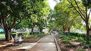
Fairfield Park Precinct, or Fairfield Park, is an urban park situated in the western suburbs of Sydney, New South Wales, Australia. Situated to the south of Fairfield CBD, the park contains an open grassland, bushland, picnic spots, playgrounds, indoor and outdoor sport facilities, and recreational areas within the vicinity of native plants, such as eucalyptus trees.
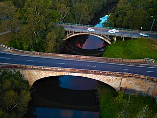
The Lennox River is the proposed name for a waterway located in Sydney's South-Western Suburbs. The existing waterway is the tidal reach of Prospect Creek, a tributary of the Georges River. A proposal has been made to upgrade and reclassify the waterway as a 'river'. The proposed river would be 6.5 kilometres (4 mi) long, starting at the confluence of Orphan School Creek and Prospect Creek at Fairfield and flowing to the Georges River emptying into Dhurawal Bay at Garrison Point.

Dai Trang Le is a Vietnamese-born Australian politician currently serving as the federal member for Fowler and councillor for Fairfield/Cabravale Ward.

Francesco Giuseppe Carbone is an Australian politician. He has served as mayor of Fairfield in New South Wales since 2012.

Western Sydney Community (WSC), officially known as Dai Le & Frank Carbone W.S.C., is an Australian political party founded in 2023 by independent MP Dai Le and Fairfield mayor Frank Carbone. The party plans to contest electorates in the Greater Western Sydney region at the 2025 federal election.
This is a list of results for the 2021 New South Wales local elections in Outer Sydney including the Central Coast, though the region is considered to be separate from Greater Sydney.