Governor Phillip Tower

Last updated

Governor Phillip Tower
GPT from the Botanic Gardens.jpg
Governor Phillip Tower
General information
TypeCommercial skyscraper
Location Central business district, Sydney, New South Wales, Australia
Construction started1990
Completed1993
Owner
Height
Architectural227 metres (745 ft) (official height)
Antenna spire254 metres (833 ft) (unofficial height)
Technical details
Floor count62
Floor area55,000 square metres (590,000 sq ft)
Design and construction
Architect(s) Denton Corker Marshall
Structural engineer Ove Arup Partners
Main contractor Grocon Constructors Pty Ltd

The Governor Phillip Tower, the Governor Macquarie Tower, and the Museum of Sydney are the main elements of a large development in the central business district of Sydney, New South Wales, Australia. Completed in 1994, the property development complex occupies an elevated site in the north-east area of the central business district. The complex incorporates the site of the first Government House, one of Australia's earliest and most significant sites of European heritage. The address is 1 Farrer Place, Sydney. Designed by architects Denton Corker Marshall and built by Australia's largest privately owned construction company Grocon, at the time of its completion it was regarded as achieving new standards for Sydney commercial architecture in terms of finish quality and design.

Contents

The northern end of the site, which faces Bridge Street, contains the remains of the first Government House. Integral to the development was the conservation of the archaeological remains and their incorporation into the Museum of Sydney, which was built and opened alongside the development.

The complex comprises five main components: Governor Phillip Tower, Governor Macquarie Tower, First Government House Plaza, the Museum of Sydney, and two rows of terraces converted to boutique office space.

History

With construction starting only months after the arrival of the British First Fleet in 1788, the First Government House dates from the very start of Australian European History. It was the first substantial building to be constructed in Australia. The elevated site was prominent, overlooking Sydney Cove, and the building was at the centre of its colonial government and commerce for the first 60 years. [1] It was demolished in 1845 although significant foundation remains have now been conserved and interpreted. The First Government House site is one of six sites in the Sydney area listed on the Australian Department of the Environment National Heritage List.

The northern Bridge Street end of the site remained vacant for 50 years. In the 1970s and 80s criticism grew over the hole in the prestigious centre of Sydney's finance district, an area of imposing sandstone buildings and colonial history, with several modern premium office towers interspersed. In 1982 a development application for a high rise office building was approved but archaeological investigations in 1983 revealed parts of the footings of First Government House. A new-found awareness around Australia of the nation's history was emerging at the time, and the suggestion of a high rise office building on the top of such a significant historical site met with wide opposition.[ citation needed ]

The Government of New South Wales found a solution by transferring floor space from the area containing the historical foundation to space immediately behind to the south. Space owned by developer Sid Londish was used, who masterminded the amalgamation of the whole site, making the project commercially viable. The resultant site covers a whole block bound by Bridge, Bent, Phillip and Young Streets.[ citation needed ]

Property developments

Governor Phillip Tower

Governor Phillip Tower dominates the site. It sits 10 floors above street level on a series of large zinc-plated transfer beams atop a 4-level sandstone-clad podium (upon which Governor Macquarie Tower also sits). This maximises views, and hence rentals, for all levels. Opinion, however, is mixed on how well this massive 10-storey base contributes to the building's relationship with the street.

The façade is of grey granite and glass used to achieve an expensive and highly detailed finish. The steel-bladed roof features have been dubbed the milk-crate.

At 227 m (745 ft), it is the third tallest building in the city by roof height and sixth by architectural height, although the taller MLC Centre and World Tower are both only fractionally taller at 228 m (748 ft). When measured to the tip of the building's antenna, it stands at a height of 254 m (833 ft), although this measurement is deemed unofficial as antennas are excluded from official heights as per the CTBUH's measurement standards. It is arguably the most visually dominating building on the Sydney CBD skyline. From many prominent angles, and significantly from most Sydney Harbour viewpoints, it appears as the tallest building on the skyline by a large margin; however, this is perspective illusion.

Governor Macquarie Tower

Governor Macquarie Tower
Governor Phillip Tower
General information
Type Skyscraper
Location Central business district, Sydney, New South Wales, Australia
Construction started1990
Completed1993
Owner
Technical details
Floor count41
Floor area30,500 square metres (328,000 sq ft)
Design and construction
Architect(s) Denton Corker Marshall
Structural engineer Ove Arup Partners
Main contractor Grocon Constructors Pty Ltd

Governor Macquarie Tower stands at 41 stories and is adjacent and south of Governor Phillip Tower. It has identical façade treatments but its form and massing are significantly different with no dramatic roof structure, and it has staggered, rather than sheer lines. The primary tenant is the New South Wales Government including the Premier's Office. It occupies the site of the former Legal & General building which at the time was the tallest building to have been demolished in Sydney.

The main entry to both buildings is from Farrer Place. They share a large and impressive foyer, which links the two buildings and provides another entrance from Phillip Street.

First Government House and Museum of Sydney

First Government House Plaza is an open-air public space and part of the Museum of Sydney, situated at Bridge Street end. The design is minimalist and disciplined, intended to evoke a sense of the site's past. Paving covers most of the First Government House remains. However, the individual pavers can be removed and the remains viewed through a glass pyramid. The outline of the original building is marked through the paving pattern.

Reaction

Criticism of the complex has included the vast, even oppressive scale of the main tower, particularly at street level, and a perceived awkward and disjointed relationship between the two towers.

Architecturally, the museum and plaza are considered by many to be the most successful aspect of the development. And although the massive and dominating structure's relationship to the street has often been questioned, it is widely recognised as a development of very high quality; “This is no cheap, slap-stick developer job. Nor is it post-modern New York deco pastiche...one of the most interesting and important building developments that Sydney has seen...and adding a great deal of intellectual content and game-playing.” said architectural critic Francesca Morrison. [2]

The tower was featured throughout the film Mission: Impossible 2 (2000) as the headquarters of the fictional BioCyte company. [3]

See also

Related Research Articles

<span class="mw-page-title-main">Sydney Conservatorium of Music</span> Music faculty of the University of Sydney

The Sydney Conservatorium of Music is a heritage-listed music school in Macquarie Street, Sydney, New South Wales, Australia. It is one of the oldest and most prestigious music schools in Australia. Located adjacent to the Royal Botanic Gardens on the eastern fringe of the Sydney central business district, the conservatorium is a faculty of the University of Sydney, and incorporates the community-based Conservatorium Open Academy and the Conservatorium High School. In addition to its secondary, undergraduate, post-graduate and community education teaching and learning functions, the conservatorium undertakes research in various fields of music. The building was added to the New South Wales State Heritage Register on 14 January 2011.

<span class="mw-page-title-main">Macquarie Place Park</span> Heritage-listed park in Sydney, Australia

The Macquarie Place Park, also known as the Macquarie Place Precinct, is a heritage-listed small triangular urban park located in the Sydney central business district in the City of Sydney local government area of New South Wales, Australia. The former town square and milestone and now memorial, public park and monument is situated on the corner of Bridge Street and Loftus Street. It is named in honour of Governor Lachlan Macquarie. The precinct includes The Obelisk or Macquarie Obelisk, the Sirius anchor and gun/cannon, the Statue of Thomas Sutcliffe Mort, the historic Underground Public Conveniences and the Christie Wright Memorial Fountain. The property was added to the New South Wales State Heritage Register on 5 March 2010.

<span class="mw-page-title-main">The Domain, Sydney</span> Park in Sydney, Australia

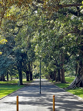
The Domain is a heritage-listed 34-hectare (84-acre) area of open space located on the eastern fringe of the Sydney central business district, in the City of Sydney local government area of New South Wales, Australia. Separating the central business district from Woolloomooloo, The Domain adjoins the Royal Botanic Gardens and is managed by the Royal Botanic Gardens Trust, a division of the NSW Office of Environment and Heritage, an agency of the Government of New South Wales. The Domain is used as a venue for outdoor concerts, open-air events, large political gatherings and rallies, as well as being used daily by the people of Sydney for exercise and relaxation. Along with the Royal Botanic Gardens, The Domain was added to the New South Wales State Heritage Register on 2 April 1999.

<span class="mw-page-title-main">Macquarie Street, Sydney</span> Street in Sydney, Australia

Macquarie Street is a street in the central business district of Sydney in New South Wales, Australia. Macquarie Street extends from Hyde Park at its southern end to the Sydney Opera House at its northern end. Apart from connecting these two major landmarks, the key government institutions of the state of New South Wales are all located on this street.

Denton Corker Marshall is an international architecture practice based in Melbourne, Australia.

<span class="mw-page-title-main">Sydney central business district</span> Suburb of Sydney, New South Wales, Australia

The Sydney central business district (CBD) is the historical and main commercial centre of Sydney. The CBD is Sydney's city centre, or Sydney City, and the two terms are used interchangeably. Colloquially, the CBD or city centre is often referred to simply as "Town" or "the City". The Sydney city centre extends southwards for about 3 km (2 mi) from Sydney Cove, the point of first European settlement in which the Sydney region was initially established. Due to its pivotal role in Australia's early history, it is one of the oldest established areas in the country.

<span class="mw-page-title-main">Royal Botanic Garden, Sydney</span> Botanic gardens in Sydney, New South Wales, Australia

The Royal Botanic Garden, Sydney is a heritage-listed major 30-hectare (74-acre) botanical garden, event venue and public recreation area located at Farm Cove on the eastern fringe of the Sydney central business district, in the City of Sydney local government area of New South Wales, Australia.

<span class="mw-page-title-main">Sydney Mint</span> Heritage-listed building in Sydney

The Sydney Mint in Sydney, New South Wales, Australia, is the oldest surviving public building in the Sydney central business district. Built between 1811 and 1816 as the southern wing of the Sydney Hospital, it was then known as the Rum Hospital. In 1854 a mint was established on the site with the hospital building used to house mint staff as well as providing a residence for the Deputy Mint Master. A coining factory was built at the rear. Both of these structures have exceptional heritage significance and have been associated with major events in the colonial history of New South Wales.

<span class="mw-page-title-main">Sydney Observatory</span> Historic site in New South Wales, Australia

The Sydney Observatory is a heritage-listed meteorological station, astronomical observatory, function venue, science museum, and education facility located on Observatory Hill at Upper Fort Street, in the inner city Sydney suburb of Millers Point in the City of Sydney local government area of New South Wales, Australia. It was designed by William Weaver (plans) and Alexander Dawson (supervision) and built from 1857 to 1859 by Charles Bingemann & Ebenezer Dewar. It is also known as The Sydney Observatory; Observatory; Fort Phillip; Windmill Hill; and Flagstaff Hill. It was added to the New South Wales State Heritage Register on 22 December 2000.

<span class="mw-page-title-main">Hyde Park Barracks, Sydney</span> Heritage-listed building in Sydney, Australia

The Hyde Park Barracks, Sydney is a heritage-listed former barracks, hospital, convict accommodation, mint and courthouse and now museum and cafe located at Macquarie Street in the Sydney central business district, in the City of Sydney local government area of New South Wales, Australia. Originally built from 1811 to 1819 as a brick building and compound to house convict men and boys, it was designed by convict architect Francis Greenway. It is also known as the Mint Building and Hyde Park Barracks Group and Rum Hospital; Royal Mint - Sydney Branch; Sydney Infirmary and Dispensary; Queen's Square Courts; Queen's Square. The site is managed by the Sydney Living Museums, an agency of the Government of New South Wales, as a living history museum open to the public.

<span class="mw-page-title-main">Museum of Sydney</span> Museum in Sydney, Australia

The Museum of Sydney is a historical collection and exhibit, built on the ruins of the house of New South Wales' first Governor, Arthur Phillip, on the present-day corner of Phillip and Bridge Street, Sydney.

<span class="mw-page-title-main">Architecture of Sydney</span> Overview of the architecture in Sydney

The architecture of Sydney, Australia’s oldest city, is not characterised by any one architectural style, but by an extensive juxtaposition of old and new architecture over the city's 200-year history, from its modest beginnings with local materials and lack of international funding to its present-day modernity with an expansive skyline of high rises and skyscrapers, dotted at street level with remnants of a Victorian era of prosperity.

<span class="mw-page-title-main">Parliament House, Sydney</span> House of parliament for State of New South Wales, Australia

The Parliament House in Sydney is a heritage-listed complex of buildings housing the Parliament of the state of New South Wales, Australia. The building is located on the east side of Macquarie Street in Sydney, the state capital. The façade consists of a two-storey Georgian building, the oldest public building in the City of Sydney, flanked by two Neo-gothic additions containing the parliamentary chambers. These buildings are linked to a 1970s 12-storey block at the rear, facing onto the Domain. It is also known as Parliament of New South Wales, Parliamentary Precincts and the Rum Hospital.

<span class="mw-page-title-main">Bridge Street, Sydney</span> Street in Sydney, Australia

Bridge Street is a street in the central business district of Sydney in New South Wales, Australia. Bridge Street runs for 500 metres (1,600 ft) in a west–east direction with traffic flowing in both directions. It is situated in the northern portion of the central business district. The western terminus of Bridge Street is at George Street, with the eastern terminus at Macquarie Street, adjacent to the Chief Secretary's Building. From west to east, Bridge Street crosses Pitt and Phillip streets.

<span class="mw-page-title-main">St John's Cathedral, Parramatta</span> Church in New South Wales, Australia

St John's Cathedral is a heritage-listed, Anglican cathedral in Parramatta, City of Parramatta, Sydney, New South Wales, Australia. St John's was given the status of provisional cathedral of the Anglican Diocese of Sydney in 1969, and designated a Regional Cathedral in 2011 for the Western Region. It was added to the New South Wales State Heritage Register on 5 March 2010.

<span class="mw-page-title-main">First Government House, Sydney</span> Heritage-listed site in Sydney, Australia

The First Government House was the first residence for the Governors of New South Wales located at 41 Bridge Street, in the Sydney central business district in the City of Sydney local government area of New South Wales, Australia. It was built from 1788 to 1789 and used until 1845, after which it was demolished in 1846. Some of the site is now occupied by the Museum of Sydney. Its construction was attributed to James Bloodsworth. It is also known as First Government House Site, Museum of Sydney and A Rum Rebellion Site. It was added to the New South Wales State Heritage Register on 10 December 1999; and on 19 August 2005 the site was listed on the National Heritage List.

The State Office Block was a landmark modernist skyscraper complex on a block bounded by Phillip Street, Bent Street and Macquarie Street in the central business district of Sydney. Completed in 1965 and designed in the modernist International style by Ken Woolley from the NSW Government Architect's Office, the 128-metre-high building took the title of the tallest building in Australia from the nearby AMP Building until 1967, when Harry Seidler's 170m Australia Square tower was completed. Designed to hold offices of the NSW Government, including the cabinet and the Premier's office, the State Office Block was demolished in 1997 to make way for Renzo Piano's Aurora Place development.

<span class="mw-page-title-main">Sydney Cove West Archaeological Precinct</span> Historic site in New South Wales, Australia

Sydney Cove West Archaeological Precinct is a heritage-listed precinct that contains The Rocks police station, the Museum of Contemporary Art Australia, car park, parks, shops and roads located at 112-156 George Street, in the inner city Sydney suburb of The Rocks in the City of Sydney local government area of New South Wales, Australia. The precinct previously contained a commissariat store, Maritime Services Board offices, dockyard and Department of Labour & Industry offices. Buildings in the precinct were developed in various stages since 1797 to date, with heritage-listed buildings dating from 1797 to 1939. The precinct is also known as the Museum of Contemporary Art, Maritime Services Board, Colonial Government naval dockyard, Commissariat Stores, Colonial Hospital, Kings and Queens Wharf and First Fleet Park. The property is owned by Property NSW, an agency of the Government of New South Wales. It was added to the New South Wales State Heritage Register on 5 August 2011.

References

  1. Department of Environment and Heritage, Australian Government, "Factsheet" Archived 2006-08-22 at the Wayback Machine . Retrieved 31 December 2013
  2. Francesca Morrison: Sydney: A Guide To Recent Architecture, Ellipsis London Ltd., 1997, 316 pages, ISBN   3-89508-645-2
  3. Mission: Impossible II (2000) - IMDb , retrieved 15 June 2022

Coordinates: 33°51′50″S151°12′40″E / 33.863859°S 151.211202°E / -33.863859; 151.211202