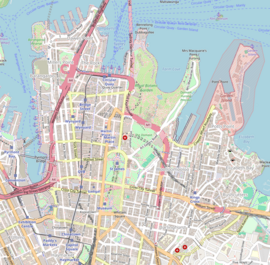
Bondi Junction is an eastern suburb of Sydney, in the state of New South Wales, Australia. It is 6 kilometres east of the Sydney central business district and is part of the local government area of Waverley.

Haymarket is an inner city suburb of Sydney, New South Wales, Australia. It is located at the southern end of the Sydney central business district in the local government area of the City of Sydney. Haymarket includes much of Sydney's Chinatown, Thaitown and Railway Square localities. Haymarket is adjacent to Darling Harbour and is surrounded by the suburbs of Ultimo, Chippendale, Surry Hills and the Sydney CBD.

Kirribilli is a suburb of Sydney, New South Wales, Australia. One of the city's most established and affluent neighbourhoods, it is located three kilometres north of the Sydney central business district, in the local government area administered by North Sydney Council. Kirribilli is a harbourside suburb, sitting on the Lower North Shore of Sydney Harbour. Kirribilli House is one of the two official residences of the Prime Minister of Australia.

Hunters Hill is a suburb of the lower north shore of Sydney, in the state of New South Wales, Australia. Hunters Hill is located 9 kilometres (5.6 mi) north-west of the Sydney central business district and is the administrative centre for the local government area of the Municipality of Hunter's Hill.
Randwick is a suburb in the Eastern Suburbs of Sydney, in the state of New South Wales, Australia. Randwick is located 6 kilometres south-east of the Sydney central business district and is the administrative centre for the local government area of the City of Randwick. The postcode is 2031.
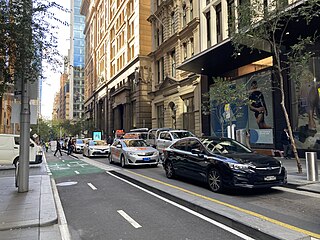
Pitt Street is a major street in the Sydney central business district in New South Wales, Australia. The street runs through the entire city centre from Circular Quay in the north to Waterloo, although today's street is in two disjointed sections after a substantial stretch of it was removed to make way for Sydney's Central railway station. Pitt Street is well known for the pedestrian only retail centre of Pitt Street Mall, a section of the street which runs from King Street to Market Street.
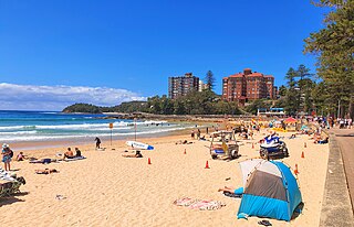
Manly Beach is a beach situated among the Northern Beaches of Sydney, Australia, in Manly, New South Wales. From north to south, the three main sections are Queenscliff, North Steyne, and South Steyne.

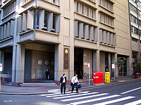
George Street is a street in the central business district of Sydney.

Macquarie Street is a street in the central business district of Sydney in New South Wales, Australia. Macquarie Street extends from Hyde Park at its southern end to the Sydney Opera House at its northern end. Apart from connecting these two major landmarks, the key government institutions of the state of New South Wales are all located on this street.

The Tank Stream is a heritage-listed former fresh water tributary of Sydney Cove and now tunnel and watercourse located in the Sydney central business district, in the City of Sydney local government area of New South Wales, Australia. The Tank Stream was the fresh water supply for the fledgling colony of New South Wales in the late 18th century. Today it is little more than a storm water drain. It originated from a swamp to the west of present-day Hyde Park and at high tide entered Sydney Cove at what is now the intersection of Bridge and Pitt Streets in the Sydney central business district. The catchment was 65 hectares, corresponding roughly the size of the Sydney central business district. It was added to the New South Wales State Heritage Register on 2 April 1999.

Alexandria is an inner southern suburb of Sydney, New South Wales, Australia. Alexandria is located 5 kilometres south of the Sydney central business district and is part of the local government area of the City of Sydney. The postcode is 2015.

North Bondi is a coastal, eastern suburb of Sydney, in the state of New South Wales, Australia 7 kilometres east of the Sydney central business district, in the local government area of Waverley Council.

Little Bay is a suburb in the Eastern Suburbs of Sydney, in the state of New South Wales, Australia. Little Bay is located 14 kilometres south-east of the Sydney central business district and is part of the local government area of the City of Randwick.
Bondi is a suburb of eastern Sydney, in the state of New South Wales, Australia, seven kilometres east of the Sydney central business district, in the local government area of Waverley Council.

Chifley Tower is a skyscraper in Sydney, Australia. It was designed by New York City-based architects Travis McEwen and Kohn Pedersen Fox, with John Rayner as project architect. At a height of 244 metres, Chifley Tower was the tallest building in Sydney from 1992 to 2019. It was surpassed in height by Crown Sydney in 2020 along with the Salesforce Tower and One Sydney Harbour in 2022.

St James Parish, Cumberland is one of the 57 parishes of Cumberland County, New South Wales, a cadastral unit for use on land titles. It is one of the four small parishes in the Sydney city area, which is named after the Anglican church of St James, which was consecrated in 1824. The name St James is also used today for the railway station in the same area.
St Philip Parish is one of the 57 parishes of Cumberland County, New South Wales, a cadastral unit for use on land titles. It is located on the western part of the original colony at Sydney Cove, which was to the west of the Tank Stream. It is one of the four small parishes in the Sydney city area and is named after the church of St Philip's. It includes the southern end of the Sydney Harbour Bridge, The Rocks, Dawes Point and Millers Point. It is bounded by Sydney Harbour in the north, King Street in the south, George Street in the south-east, and what was once the Tank Stream in the east. The northern end of Darling Harbour is the boundary in the west. It includes Wynyard railway station.

The Bennelong Apartments is a residential apartment building and multi-use complex on the east side of Sydney's Circular Quay. The buildings were designed by Andrew Andersons and PTW Architects, and completed in 1998.

The following outline is provided as an overview of and topical guide to Sydney:

Sydney Cove West Archaeological Precinct is a heritage-listed precinct that contains The Rocks police station, the Museum of Contemporary Art Australia, car park, parks, shops and roads located at 112–156 George Street, in the inner city Sydney suburb of The Rocks in the City of Sydney local government area of New South Wales, Australia. The precinct previously contained a commissariat store, Maritime Services Board offices, dockyard and Department of Labour & Industry offices. Buildings in the precinct were developed in various stages since 1797 to date, with heritage-listed buildings dating from 1797 to 1939. The precinct is also known as the Museum of Contemporary Art, Maritime Services Board, Colonial Government naval dockyard, Commissariat Stores, Colonial Hospital, Kings and Queens Wharf and First Fleet Park. The property is owned by Property NSW, an agency of the Government of New South Wales. It was added to the New South Wales State Heritage Register on 5 August 2011.