Old Windsor Road

Last updated

Old Windsor Road

Cumberland Highway

Old Windsor Road.jpg
Old Windsor Road circa 1913
Location map Australia Sydney.png
Red pog.svg
Northwest end
Red pog.svg
Southeast end
Coordinates
General information
TypeRoad
Length11.8 km (7.3 mi) [1]
Opened1794
Gazetted August 1928 (as Main Road 180) [2]
August 1988 (as State Highway 13, Cumberland Highway) [3]
Route number(s)
  • AUS Alphanumeric Route A2.svg A2 (2013–present)
    (Kellyville–Seven Hills)
  • AUS Alphanumeric Route A40.svg A40 (2013–present)
    (Seven Hills–Northmead)
  • Concurrency:
  • AUS Alphanumeric Route A28.svg A28 (2013–present)
    (Constitution Hill–Northmead)
Former
route number
  • Australian state route 40.svg State Route 40 (2007–2013)
    Entire route
  • AUS Metroad 2.svg Metroad 2 (1997–2013)
    (Kellyville–Seven Hills)
  • AUS Metroad 7.svg Metroad 7 (1993–2005)
  • Australian state route 77.svg State Route 77 (1988–1993)
    (Constitution Hill–Northmead)
Major junctions
Northwest endAUS Alphanumeric Route A2.svg Windsor Road
Kellyville, Sydney
 
Southeast endAUS Alphanumeric Route A28.svgAUS Alphanumeric Route A40.svg Briens Road
Northmead, Sydney

Old Windsor Road is a notable and historic road in Sydney, Australia. It starts from Kellyville, New South Wales and ends at Northmead, New South Wales, just north of Parramatta, and acts as part of a main arterial between Parramatta and Windsor. A section at its southeastern end is a constituent part of Cumberland Highway.

Contents

Route

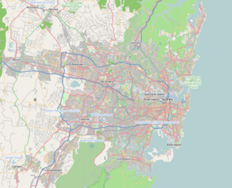
Old Windsor Road commences at the intersection with Windsor Road in Kellyville, and runs in a southeasterly direction as a dual-carriageway, 4-lane road, widening to 6 lanes at the intersection with Seven Hills Road, narrowing back to 4 lanes at the intersection with Abbott Road and the southbound ramps to M2 Hills Motorway, then widening again to 6 lanes at Fitzwilliam Road. It meets Cumberland Highway at the intersection of Hart Drive in Constitution Hill and continues in a southeasterly direction as part of Cumberland Highway, before meeting and merging into Briens Road at an intersection in Northmead; Cumberland Highway continues east along Briens Road.

The North-West T-way runs alongside the entire length of Old Windsor Road. Windsor is connected to Parramatta via the 31-kilometre-long (19 mi) Windsor Road cycleway, with much of its route via the North-West T-way, adjacent to the Old Windsor Road.

History

Old Windsor Road was part of the original Windsor Road, which opened in 1794. [4] This was the second main road built for the colony of Sydney to connect Parramatta and Windsor—a distance of 23 miles and 16 chains (37.33 km). [5] The northern section of Windsor Road and Old Windsor Road used to be continuous until 1812, when a new alignment of Windsor Road from Kellyville to Northmead was completed. As a result, the southern section of the original Windsor Road was renamed Old Windsor Road, meeting the new alignment of Windsor Road at a T-junction.

The passing of the Main Roads Act of 1924 [6] through the Parliament of New South Wales provided for the declaration of Main Roads, roads partially funded by the State government through the Main Roads Board (later the Department of Main Roads, and eventually Transport for NSW). Main Road No. 180 was declared along this road on 8 August 1928, from the intersection with Great Western Highway just west of Parramatta, to the intersection with (New) Windsor Road at Kellyville. [2] However this was quickly revoked, when it the northern end was truncated to end at the boundary of the old City of Holroyd local government area on 8 May 1929, [7] and then abolished completely in 1930.

The construction of Stage 4 of the Parramatta Bypass (completed in December 1981) realigned the Westmead section of Old Windsor Road to feed it directly into Briens Road; the previous alignment was downgraded into a number of residential streets (today Ferndale Close, Hart Drive, Fulton Avenue, Darcy Road, and Hawkesbury Road to end at Great Western Highway). The southeastern end of the road, from the intersection with Hart Drive in Constitution Hill to its terminus at the intersection with Briens Road at Northmead, was declared as part of Cumberland Highway on 26 August 1988; State Highway 13 (previously declared to run through Parramatta via Pennant Hills Road and Church Street) was altered to use this new route, with Main Road 635 declared along the section from Hart Drive to Seven Hills Road in Seven Hills; [3] Main Road 635 was extended further north along the remaining length of the road to meet Windsor Road in Kellyville on 15 February 1991. [8]

With the opening of M2 Hills Motorway in 1997, Metroad 2 was realigned to run along Old Windsor Road from the motorway terminus at Seven Hills to Kellyville (and continuing along Windsor Road to Windsor); the junction at Kellyville was reconstructed so that the northern section of Windsor Road became continuous with Old Windsor Road again at a T-junction. [9] In 2007, the intersection with Norwest Boulevard at Bella Vista was upgraded into an interchange to allow an underpass for Old Windsor Road.

The passing of the Roads Act of 1993 [10] through the Parliament of New South Wales updated road classifications and the way they could be declared within New South Wales. Under this act, Old Windsor Road today retains its declaration as Highway 13 from the intersection with Hart Drive in Constitution Hill to the intersection with Briens Road at Northmead, and as Main Road 635 Hart Drive to the intersection with Windsor Road at Kellyville. [11]

As part of Cumberland Highway, the section between Constitution Hill and its southeastern end at Northmead was allocated State Route 77 in 1988, replaced by Metroad 7 in 1993; Metroad 7 was removed when Westlink M7 opened in 2005. With the opening of M2 Hills Motorway in 1997, Metroad 2 was realigned to use the northern section of Old Windsor Road, between the motorway's exit ramps in Seven Hills and its northwestern end in Kellyville. State Route 40 was realigned in 2007 from Windsor Road to Old Windsor Road along its entire length. With the conversion to the newer alphanumeric system in 2013, Metroad 2 was replaced with route A2 from Kellyville to Seven Hills, State Route 40 was replaced with route A40 from Seven Hills to Northmead, and the section gazetted as Cumberland Highway was also re-allocated as part of route A28. [12]

Almost all of its original concrete markers have disappeared with the extensive road widening. One section has been restored to its original state as it passes Rouse Hill House and Rouse Hill Public School, with the traffic diverted onto a new section of road. [5]

Major intersections

LGALocationkm [1] miDestinationsNotes
BlacktownThe Hills boundary Kellyville RidgeStanhope GardensBeaumont HillsKellyville quadripoint0.00.0AUS Alphanumeric Route A2.svg Windsor Road (A2 north, unallocated east)  Windsor, Baulkham Hills Northwestern terminus of road, route A2 continues north along Windsor Road
GlenwoodBella Vista boundary4.42.7Norwest Boulevard  Glenwood, Norwest
to AUS Alphanumeric Route M7.svg Westlink M7 (M7)  Rooty Hill, Prestons
Single-point urban interchange
GlenwoodBella VistaKings Langley tripoint5.83.6AUS Alphanumeric Route M7.svg Westlink M7 (M7)  Beecroft, North Ryde Half-diamond interchange, eastbound entrance and westbound exit only
Bella VistaKings LangleySeven HillsBaulkham Hills quadripoint6.44.0Seven Hills Road  Seven Hills, Baulkham Hills
Seven HillsBaulkham Hills boundary7.34.5Abbot Road (west)  Seven Hills Northern terminus of route A40
AUS Alphanumeric Route M2.svg M2 Hills Motorway (M2 east)  Beecroft, North Ryde
Parramatta Old ToongabbieConstitution Hill boundary10.16.3Fitzwilliam Road  Toongabbie
Constitution HillNorthmead boundary11.37.0AUS Alphanumeric Route A28.svg Hart Drive (Cumberland Highway)  Wentworthville, Smithfield, Liverpool Western terminus of concurrency with route A28
Toongabbie Creek 11.47.1Bridge (no known official name)
Parramatta Northmead 11.87.3AUS Alphanumeric Route A28.svgAUS Alphanumeric Route A40.svg Briens Road (Cumberland Highway) (A28/A40)  Wahroonga, Ryde, Clyde Southeastern terminus of road
Routes A28 and A40 continue east along Briens Road
1.000 mi = 1.609 km; 1.000 km = 0.621 mi

See also

Related Research Articles

<span class="mw-page-title-main">National Highway (Australia)</span> Highway system in Australia

The National Highway is a system of roads connecting all mainland states and territories of Australia, and is the major network of highways and motorways connecting Australia's capital cities and major regional centres.

<span class="mw-page-title-main">Great Western Highway</span> Highway in New South Wales

Great Western Highway is a 202-kilometre-long (126 mi) state highway in New South Wales, Australia. From east to west, the highway links Sydney with Bathurst, on the state's Central Tablelands.

Metroads were the primary road routes serving the Sydney and Brisbane metropolitan areas from the 1990s to the early 2010s. The Metroads formed a network of radial and circumferential routes throughout the cities, simplifying navigation. Metroads have been progressively phased out in both Sydney and Brisbane, replaced by alphanumeric route numbers. Brisbane is the only city currently retaining the Metroad system.

<span class="mw-page-title-main">A6 (Sydney)</span>

The A6 is an arterial road linking Cumberland Highway at Carlingford and Princes Highway at Heathcote, via Lidcombe and Bankstown. It was formerly designated as Metroad 6, which was one of the Sydney Metroads.

<span class="mw-page-title-main">A4/M4 (Sydney)</span>

The A4, A44 and M4 are a collection of arterial routes in Sydney, New South Wales that connect the Inner West of Sydney with the outer western suburbs.

<span class="mw-page-title-main">A3 (Sydney)</span>

The A3 is a major metropolitan arterial route in Sydney, formerly designated Metroad 3. The A3 runs from its intersection with the A8 at Mona Vale at the north end, to the southerly of its two intersections with the A1, Princes Highway, at Blakehurst. The highest speed limit on the A3 is 90 km/h (56 mph) on Mona Vale Road.

The M2 is a route in Sydney, New South Wales, Australia, that links Sydney suburbs from Artarmon in the south-east to Bella Vista in the north-west. The route consists of two separately named motorways, the M2 Hills Motorway and the Lane Cove Tunnel.

<span class="mw-page-title-main">A9 (Sydney)</span>

The A9 is the outer western Sydney Bypass connecting Campbelltown to Windsor. It was formerly designated Metroad 9, which was one of Sydney's Metroads.

<span class="mw-page-title-main">Cumberland Highway</span>

Cumberland Highway is a 34-kilometre (21 mi) long urban highway located in Sydney, New South Wales, Australia. The highway links Pacific Highway and Pacific Motorway (M1) at Pearces Corner, Wahroonga in the northeast with Hume Highway at Liverpool in the southwest. This name covers a few consecutive roads and is widely known to most drivers, but the entire allocation is also known – and signposted – by the names of its constituent parts: Pennant Hills Road, James Ruse Drive, Briens Road, Old Windsor Road, Hart Drive, Freame Street, Emert Street, Jersey Road, Betts Road, Warren Road, Smithfield Road, Palmerston Road, (New) Cambridge Street, Joseph Street and Orange Grove Road. The entire length of Cumberland Highway is designated part of route A28.

<span class="mw-page-title-main">Hills District, New South Wales</span> Region in New South Wales, Australia

The Hills District is a region of Sydney, within the northern part of the Greater Western Sydney region of Sydney, in the state of New South Wales, Australia. Stretching from the M2 Hills Motorway in the south to the Hawkesbury River in the north and Old Windsor Road in the west to Pennant Hills Road in the east, its constituent suburbs are located in the local government areas of The Hills Shire, and parts of Hornsby Shire and City of Parramatta.

<span class="mw-page-title-main">Kellyville Ridge, New South Wales</span> Suburb of Sydney, New South Wales, Australia

Kellyville Ridge is a suburb of Sydney, in the state of New South Wales, Australia. Kellyville Ridge is located 41 kilometres north-west of the Sydney central business district in the local government area of City of Blacktown. It is part of Greater Western Sydney.

<span class="mw-page-title-main">Pennant Hills Road</span> Highway in Sydney, Australia

Pennant Hills Road is a 16.1-kilometre-long (10.0 mi) arterial road located in Sydney, New South Wales, Australia. The road links the suburb of Wahroonga in the northeast, to the major central business district of Parramatta in the southwest. Apart from a small section at its southwestern end, it is a constituent part of Cumberland Highway, and is designated part of route A28.

<span class="mw-page-title-main">M4 Motorway (Sydney)</span> Motorway in Sydney

The M4 Motorway is a 52.6-kilometre (32.7 mi) partially tolled dual carriageway motorway in Sydney, New South Wales that is designated the M4 route marker. The M4 designation is part of the wider A4 and M4 route designation, the M4 runs parallel/below ground to the Great Western Highway and Parramatta Road (A44).

<span class="mw-page-title-main">M5 Motorway (Sydney)</span> Motorway in Sydney, Australia

The M5 Motorway is a 29-kilometre (18 mi) motorway located in Sydney, New South Wales that is part of the Sydney Orbital Network.

The M1 in, Queensland, Australia, is a major urban road corridor. It connects the Sunshine Coast hinterland to Tugun, near the New South Wales and Queensland border, via the following corridors:

The North-West T-way is a continuous series of bus-only lanes and bus roadways between Parramatta, Blacktown and Rouse Hill in Western Sydney. Opened in stages between March and November 2007, the 24 km (14.9 mi) T-way was the second bus rapid transit route to be built in Sydney after the Liverpool–Parramatta T-way.

<span class="mw-page-title-main">James Ruse Drive</span> Road in Sydney, Australia

James Ruse Drive is a 6.4-kilometre-long (4.0 mi) limited-access urban highway located to the east and north of Parramatta, in Western Sydney, New South Wales, Australia. Originally a series of disconnected urban streets, it was later upgraded to act as a bypass of central Parramatta.

<span class="mw-page-title-main">A8 (Sydney)</span> Road in New South Wales, Australia

The A8 is one of Sydney, Australia's metropolitan arterial routes, formerly designated Metroad 10. The A8 route runs for 23 kilometres from North Sydney to Mona Vale. The route includes parts of several different roads.

<span class="mw-page-title-main">Windsor Road</span> Road in Sydney, Australia

Windsor Road is a notable road in the Hills District of Sydney. It starts from Windsor, New South Wales and ends at Northmead, New South Wales. However, Windsor Road is not continuous. The northern section of Windsor Road is continuous with Old Windsor Road instead, designated route A2. The southern section of Windsor Road forms a T-junction with route A2 at Kellyville.

References

  1. 1 2 Google (19 August 2022). "Old Windsor Road" (Map). Google Maps . Google. Retrieved 19 August 2022.
  2. 1 2 "Main Roads Act, 1924-1927". Government Gazette of the State of New South Wales. No. 110. National Library of Australia. 17 August 1928. pp. 3814–20. Archived from the original on 3 August 2022. Retrieved 1 August 2022.
  3. 1 2 "State Roads Act". Government Gazette of the State of New South Wales. No. 138. National Library of Australia. 26 August 1988. p. 4505. Archived from the original on 16 January 2023. Retrieved 16 January 2023.
  4. Old Windsor Road and Windsor Road Heritage Precincts , Roads and Transport Authority, Published on 16 November 2010, Retrieved on 16 July 2013
  5. 1 2 Crofts, Robert and Sandra (31 May 2013). "Parramatta to Windsor Series". Discovering Australia's Historical Milemarkers and Boundary Stones. Xlibris Corporation. pp. 86–89. ISBN   978-1483636917.
  6. State of New South Wales, An Act to provide for the better construction, maintenance, and financing of main roads; to provide for developmental roads; to constitute a Main Roads Board Archived 11 August 2022 at the Wayback Machine 10 November 1924
  7. "Main Roads Act, 1924-1929". Government Gazette of the State of New South Wales. No. 68. National Library of Australia. 24 May 1929. p. 2138. Archived from the original on 19 January 2023. Retrieved 19 January 2023.
  8. "State Roads Act". Government Gazette of the State of New South Wales. No. 31. National Library of Australia. 15 February 1991. pp. 1441–3. Archived from the original on 19 January 2023. Retrieved 19 January 2023.
  9. "Old Windsor Road & Windsor Road: History and Development". Ozroads. Retrieved 17 June 2013.[ self-published source ]
  10. State of New South Wales, An Act to make provision with respect to the roads of New South Wales; to repeal the State Roads Act 1986, the Crown and Other Roads Act 1990 and certain other enactments; and for other purposes. Archived 11 August 2022 at the Wayback Machine 10 November 1924
  11. Transport for NSW (August 2022). "Schedule of Classified Roads and Unclassified Regional Roads" (PDF). Government of New South Wales. Retrieved 1 August 2022.
  12. "Road number and name changes in NSW" (PDF). Roads & Maritime Services . Government of New South Wales. 2012. Archived from the original (PDF) on 25 March 2016. Retrieved 7 November 2016.