Albion Street, Surry Hills

Last updated

Albion Street, Surry Hills

1 Durham Hall97.jpg
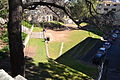
Durham Hall on Albion Street
Location map Australia Sydney.png
Red pog.svg
Western end
Red pog.svg
Eastern end
Coordinates
General information
TypeStreet
Length850 m (0.5 mi)
Major junctions
Western end Elizabeth Street
Surry Hills
  Crown Street
Bourke Street
Eastern endFlinders Street
Surry Hills
Location(s)
LGA(s) City of Sydney
Major suburbs Surry Hills

Albion Street is a street in Sydney, New South Wales, Australia in the local government area of the City of Sydney. It runs east-west from Elizabeth Street to Flinders Street, and is approximately one kilometre long. [1]

Contents

The street is notable for its historical background and heritage-listed buildings and sites. It includes both commercial and residential buildings, a number of which have heritage listings at state or federal levels. The street encompasses a wide variety of styles, including Victorian and Federation styles, as well as significant examples of ecclesiastical architecture.

Points of interest

See also

References

  1. Gregory's Sydney Street Directory (2002) Maps F-G
  2. "Carlingford Terrace". New South Wales Heritage Database. Office of Environment & Heritage . Retrieved 18 September 2011.
  3. "Durham Hall". New South Wales State Heritage Register . Department of Planning & Environment. H00221. Retrieved 18 May 2018. CC BY icon.svg Text is licensed by State of New South Wales (Department of Planning and Environment) under CC BY 4.0 licence .
  4. The Heritage of Australia, Macmillan Company, 1981, p.2/90
  5. Heritage of Australia, p.2/90
  6. "Frog Hollow Reserve". New South Wales Heritage Database. Office of Environment & Heritage . Retrieved 18 September 2011.
  7. "Children's Court". New South Wales Heritage Database. Office of Environment & Heritage . Retrieved 18 September 2011.
  8. "Women's Hospital". New South Wales Heritage Database. Office of Environment & Heritage . Retrieved 18 September 2011.
  9. "Chinese Presbyterian Church". New South Wales Heritage Database. Office of Environment & Heritage . Retrieved 18 September 2011.
  10. Heritage of Australia, p.2/90
  11. "Terrace Cottages". New South Wales State Heritage Register . Department of Planning & Environment. H00064. Retrieved 13 October 2018. CC BY icon.svg Text is licensed by State of New South Wales (Department of Planning and Environment) under CC BY 4.0 licence .
  12. Heritage of Australia, p.2/90
  13. "Cottage". New South Wales State Heritage Register . Department of Planning & Environment. H00443. Retrieved 18 May 2018. CC BY icon.svg Text is licensed by State of New South Wales (Department of Planning and Environment) under CC BY 4.0 licence .
  14. Heritage of Australia, p.2/90
Template:Attached KML/Albion Street, Surry Hills
KML is from Wikidata