Leichhardt is a suburb in the Inner West of Sydney, in the state of New South Wales, Australia. Leichhardt is located 5 kilometres west of the Sydney central business district (CBD) and is the administrative centre for the local government area (LGA) of the Inner West Council. The suburb is bordered by Haberfield to the west, Annandale to the east, Lilyfield to the north and Petersham, Lewisham and Stanmore to the south.

Chinatown is an urban enclave situated in the southern part of the Sydney central business district, in New South Wales, Australia. It comprises the majority of the Haymarket suburb, between Central station and Darling Harbour. It is part of the local government area of the City of Sydney, and is Australia's largest Chinatown.

Museum railway station is a heritage-listed underground commuter rail station that is located on the City Circle route at the southern end of Hyde Park in the Sydney central business district of New South Wales, Australia. The station is served by Sydney Trains T2 Inner West & Leppington and T3 Bankstown T8 Airport & South lines. The station is named after the nearby Australian Museum. It was added to the New South Wales State Heritage Register on 2 April 1999.

Oxford Street is a major thoroughfare in Sydney, New South Wales, Australia, running from the south-east border of the Sydney central business district to Bondi Junction in the Eastern Suburbs. Close to the CBD in particular, the street is lined with numerous shops, bars and nightclubs. After the 1980s, Oxford Street garnered a reputation as Sydney's primary nightclub strip and subsequently saw a large increase in the number of crimes committed in the area. However, the 2014 lockout laws saw many nightclubs close and the crime rate drop as Sydney's nightlife hubs moved to Darling Harbour and Newtown. The lockout laws ended in 2020 with a focus on small bars and restaurants. Many nightclubs reopened in 2021 especially around Taylor Square.

Parramatta Road is the major historical east-west artery of metropolitan Sydney, New South Wales, Australia, connecting the Sydney CBD with Parramatta. It is the easternmost part of the Great Western Highway. Since the 1990s its role has been augmented by the City West Link and M4 Motorway.

George Street is a street in the central business district of Sydney.

Canterbury is a suburb of western Sydney, in the state of New South Wales, Australia. Canterbury is located 10.5 kilometres (6.5 mi) south-west of the Sydney central business district in the City of Canterbury-Bankstown.

Liverpool ONE is a shopping, residential, and leisure complex in Liverpool, England. The project involved the redevelopment of 42 acres of land in the city centre. It is a retail-led development anchored by the department store John Lewis. Debenhams had previously been an anchor tenant until the closure of its Liverpool One store in March 2021, with Marks & Spencer taking its place in mid-2023. Additional elements include leisure facilities, apartments, offices, public open spaces, restaurants, and transport improvements. The completion of Liverpool ONE significantly boosted the local economy, while lifting Liverpool into the top five most popular retail destinations in the UK.

Kyeemagh is a suburb in southern Sydney, in the state of New South Wales, Australia. It is 12 kilometres south of the Sydney central business district, on the western shore of Botany Bay. Kyeemagh is in the local government area of the Bayside Council and is part of the St George area.

The Downing Centre is a major heritage-listed former department store and now courthouse complex in Sydney, New South Wales, Australia. It features state government courts, including the Local Court, the District Court, and a law library known as the Downing Centre Library. The Downing Centre forms part of the Department of Communities and Justice and houses court services and sheriffs offices.

Elizabeth Street is a major street in the central business district of Sydney in New South Wales, Australia. The street continues south of the central business district (CBD), through the inner city suburbs of Surry Hills, Redfern and Waterloo, before terminating in Zetland. Elizabeth Street lies within the City of Sydney local government area.

The Headrow is an avenue in Leeds city centre, West Yorkshire, England.

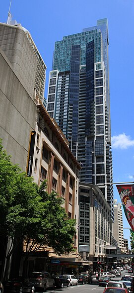
Castlereagh Street is a 1.6-kilometre-long (1 mi) major street located in the Sydney central business district in New South Wales, Australia. The street runs in a north-to-south, in a one way direction only.

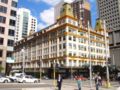
Mark Foy's Limited or Mark Foy's was a department store in Sydney, New South Wales, Australia, founded by Francis Foy and his brother Mark Foy. The department store was named after their father, Mark Foy (senior), and traded between 1885 and 1980.

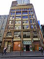
Rowe Street is a narrow laneway in the central business district of Sydney in New South Wales, Australia. Originally, Rowe Street ran between Castlereagh Street and Pitt Street, parallel to Martin Place. However, it now runs east–west off Pitt Street. Rowe Street was named in honour of Thomas Rowe, a prominent architect in New South Wales.

Market Street is a street in the city centre of Sydney in New South Wales, Australia. It runs from Sussex Street near Darling Harbour in the west, to Elizabeth Street at St James railway station in the east.
World Square is a large shopping centre and urban development in the Sydney Central Business District.[1]

The Galeries is a shopping centre in Sydney, New South Wales, Australia. It was formerly known as The Galeries Victoria until renamed in early 2013. It is located in the heart of the Sydney central business district, bounded by George, Pitt and Park Streets. The shopping centre sits below the Citigroup Centre office tower and beside the Sydney Hilton Hotel.

Clayton Square Shopping Centre is an inner-city shopping centre located in Liverpool, England. It is in close proximity to Liverpool Lime Street and Liverpool Central railway stations. It is the city's fourth largest shopping centre behind Liverpool One, St. John's Shopping Centre and Metquarter. Clayton Square sees tough competition from the likes of Liverpool One, St.Johns, Metquarter, Church Street, Lord Street and Bold Street.

The Melbourne central business district in Australia is home to numerous lanes and arcades. Often called "laneways", these narrow streets and pedestrian paths date mostly from the Victorian era, and are a popular cultural attraction for their cafes, bars and street art.