Victoria Street, East Sydney

Last updated

Victoria Street

1StVincentsCollege2.JPG
St Vincent's College, Potts Point
Victoria Street, East Sydney
OSM central Sydney.png
Red pog.svg
Northern end
Red pog.svg
Southern end
Coordinates
General information
TypeStreet
Length1.6 km (1.0 mi)
Major junctions
Northern endGrantham Street
Potts Point, Sydney
 
Southern end Oxford Street
Darlinghurst, Sydney
Location(s)
LGA(s) City of Sydney
Major suburbs Potts Point, Darlinghurst

Victoria Street is a suburban street located in the inner eastern suburbs of Sydney, in the City of Sydney local government area of New South Wales, Australia. From south to north, Victoria Street goes through the suburbs of Darlinghurst, Potts Point and the locality of Kings Cross. It is 1.6 kilometres (0.99 mi) in length. [1] In the section in Darlinghurst, the street is one-way, from north to south only.

Contents

Description

At its southern end, Victoria Street starts at Oxford Street, Darlinghurst. It goes north through the locality of Kings Cross, where it forms a large intersection with Darlinghurst Road. Further north, it continues through Potts Point to terminate at Grantham Street, above Woolloomooloo Bay. The street is a mixture of residential and commercial buildings, with a number of old, Victorian homes that have been converted to backpackers' hostels. Between Earl Street and Grantham Street, Potts Point, the some buildings on both sides of the street are listed on the local government heritage register. [2]

Points of interest

Terraced homes in Federation Filigree style 1TerracedHomes8.JPG
Terraced homes in Federation Filigree style
Characteristic three-storey terraced homes with wrought iron 1TerracedHomes4.JPG
Characteristic three-storey terraced homes with wrought iron
Single-storey sandstone cottage 1SandstoneCottage1.JPG
Single-storey sandstone cottage
Embarkation Park

The park is situated at the far northern end of the street and was constructed on the roof of the Australian Defence Force car-park in Cowper Wharf Roadway. It provides the locals with some breathing space, with harbour views.

Terraced Homes

Roughly opposite Embarkation Park, there is a terrace of homes designed in the Federation Filigree style, using woodwork instead of the more usual wrought iron. [3] They are an unusual sight in Sydney, where terraced homes are almost invariably designed in Victorian styles.

Juanita Nielsen's House

Juanita Nielsen's House, located at 202 Victoria Street, Potts Point, is one of a group of three terrace houses erected in the 1850s on the site of the former Telford Lodge estate. Purchased by Juanita Nielsen in 1968, a journalist and great-granddaughter of businessman Mark Foy, Nielsen disappeared after she strongly opposed the redevelopment of the Potts Point/King Cross area and the intimidation and eviction of working-class tenants of the area and the adjoining suburb of Woolloomooloo. The house is listed on the New South Wales State Heritage Register. [4]

St Vincent's College, Potts Point

St Vincent's College is situated on the corner of Victoria Street and Challis Avenue. It was founded in 1858 by Irish Sisters of Charity and was known as the Victoria Street Roman Catholic School. Its cluster of brick buildings makes a distinctive landmark.

Butler, McElhone and Hordern Stairs

These three sets of stairs are located on the west side of the street and provide access to the Woolloomooloo area. They are all heritage-listed. [5]

Darlinghurst Fire Station

Situated at the intersection of Victoria Street and Darlinghurst Road, this station was designed by the Government Architect, Walter Liberty Vernon, in the Federation Free Style, utilising a familiar combination of brick and sandstone.

St John's Anglican Church, Darlinghurst

St John's Anglican Church was completed in 1858, with nave and aisles designed by J. F. Hilly. Many later additions were designed by Edmund Blacket. The church is heritage-listed. [6] The rectory was designed by Hilly and built c.1858, and is also heritage-listed.

Rough Edges

Immediately south of the church, this is a drop-in centre run by St John's Church and staffed by volunteers.

Green Park Hotel

This hotel was built in 1893 of red brick and was largely influenced by the Federation Queen Anne style, with some Free Classical details.

St Vincent's Hospital, Sydney

St Vincent's Hospital was founded in 1857 by the Sisters of Charity. It was originally located at the site of St Vincent's College, but was later moved to Darlinghurst. The main hospital building was designed by Wardell and Denning in the Inter-War Free Classical Style and built in 1921. It has been described as having "Therapeutic verandas integrated into free classical colonnades." [7] The Sacred Heart Hospice, located on the opposite side of the street, was founded in 1890. The Garvan Institute of Medical Research together with the Kinghorn Cancer Centre, and the Victor Chang Cardiac Research Institute are all co-located on Victoria Street. St Vincent's Private Hospital and Clinic is located towards the street's southern terminus.

Green Park

This park is located opposite the hospital, occupying a site between Victoria Street and Darlinghurst Road.

See also

Related Research Articles

<span class="mw-page-title-main">Darlinghurst, New South Wales</span> Suburb of Sydney, New South Wales, Australia

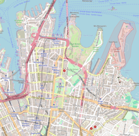
Darlinghurst is an inner-city, eastern suburb of Sydney, New South Wales, Australia. Darlinghurst is located immediately east of the Sydney central business district (CBD) and Hyde Park, within the local government area of the City of Sydney. It is often colloquially referred to as "Darlo".

<span class="mw-page-title-main">Surry Hills, New South Wales</span> Suburb of Sydney, New South Wales, Australia

Surry Hills is an inner-city suburb of Sydney, in the state of New South Wales, Australia. Surry Hills is immediately south-east of the Sydney central business district in the local government area of the City of Sydney. Surry Hills is surrounded by the suburbs of Darlinghurst to the north, Chippendale and Haymarket to the west, Moore Park and Paddington to the east and Redfern to the south. It is often colloquially referred to as "Surry".

<span class="mw-page-title-main">Potts Point, New South Wales</span> Suburb of Sydney, New South Wales, Australia

Potts Point is a small and densely populated suburb in inner-city Sydney, New South Wales, Australia. Potts Point is located 2 kilometres (1.2 mi) east of the Sydney central business district and is part of the local government area of the City of Sydney.

<span class="mw-page-title-main">Woolloomooloo</span> Suburb of Sydney, New South Wales, Australia

Woolloomooloo is a harbourside, inner-city eastern suburb of Sydney, New South Wales, Australia. Woolloomooloo is 1.5 kilometres east of the Sydney central business district, in the local government area of the City of Sydney. It is in a low-lying, former docklands area at the head of Woolloomooloo Bay, on Sydney Harbour. The Domain sits to the west, the locality of East Sydney is near the south-west corner of the suburb and the locality of Kings Cross is near the south-east corner. Potts Point is immediately to the east.

<span class="mw-page-title-main">Kings Cross, New South Wales</span> Place in New South Wales, Australia

Kings Cross is an inner-city locality of Sydney, New South Wales, Australia. It is located approximately 2 kilometres east of the Sydney central business district, in the local government area of the City of Sydney. It is bounded by the suburbs of Potts Point, Elizabeth Bay, Rushcutters Bay and Darlinghurst.

<span class="mw-page-title-main">Paddington, New South Wales</span> Suburb of Sydney, Australia

Paddington is an upscale inner-city area of Sydney, in the state of New South Wales, Australia. Located 3 kilometres (1.9 mi) east of the Sydney central business district, Paddington lies across two local government areas. The portion south of Oxford Street lies within the City of Sydney, while the portion north of Oxford Street lies within the Municipality of Woollahra. It is often colloquially referred to as "Paddo".

<span class="mw-page-title-main">William Street, Sydney</span> Road in Sydney, Australia

William Street is a 1.4-kilometre-long (0.87 mi) major thoroughfare in Sydney, New South Wales, Australia.

<span class="mw-page-title-main">Architecture of Sydney</span> Overview of the architecture in Sydney

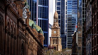
The architecture of Sydney, Australia’s oldest city, is not characterised by any one architectural style, but by an extensive juxtaposition of old and new architecture over the city's 200-year history, from its modest beginnings with local materials and lack of international funding to its present-day modernity with an expansive skyline of high rises and skyscrapers, dotted at street level with remnants of a Victorian era of prosperity.

Australian non-residential architectural styles are a set of Australian architectural styles that apply to buildings used for purposes other than residence and have been around only since the first colonial government buildings of early European settlement of Australia in 1788.

<span class="mw-page-title-main">Mortimer Lewis</span>

Mortimer William Lewis was an English-born architect, surveyor and public servant who migrated to Australia and became Colonial Architect in the colony of New South Wales from 1835 to 1849. Lewis was responsible for designing and overseeing many government buildings in Sydney and rural New South Wales, many of which are heritage listed.

<span class="mw-page-title-main">Albion Street, Surry Hills</span> Street in Sydney, Australia

Albion Street is a street in Sydney, New South Wales, Australia in the local government area of the City of Sydney. It runs east-west from Elizabeth Street to Flinders Street, and is approximately one kilometre long.

<span class="mw-page-title-main">St John's Anglican Church, Darlinghurst</span> Church in New South Wales, Australia

The St John's Anglican Church, officially known as the Church of St. John the Evangelist, is a heritage-listed active Anglican church located at 120 Darlinghurst Road in the Sydney suburb of Darlinghurst, New South Wales, Australia. The church and its associated buildings were added to the New South Wales State Heritage Register on 2 April 1999. It was also listed on the former Register of the National Estate.

<span class="mw-page-title-main">Bomera and Tarana</span> Historic site in New South Wales, Australia

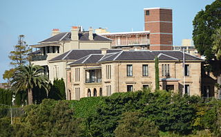
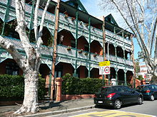
Bomera and Tarana are two jointly heritage-listed residences at 1 Wylde Street in the inner city Sydney suburb of Potts Point in the City of Sydney local government area of New South Wales, Australia. Bomera was designed by John F. Hilly and built in 1856 with alterations by Sheerin & Hennessy and built by Wheelwright & Alderson c. 1902. Tarana was designed by Edward H. Buchanan and built by John Alexander Oag in 1889, with additions including a third storey designed by Sheerin & Hennessy in 1907. The houses are also known as Boomera and Taranah. The property was added to the New South Wales State Heritage Register on 23 June 2000.

<span class="mw-page-title-main">Juanita Nielsen's House</span> Historic site in New South Wales, Australia

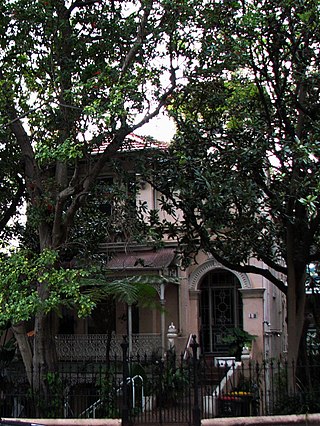
Juanita Nielsen's House is the heritage-listed former house of murdered activist and journalist Juanita Nielsen at 202 Victoria Street in the inner city Sydney suburb of Potts Point in the City of Sydney local government area of New South Wales, Australia. It was built from 1855 and designed in the Federation filigree. It was added to the New South Wales State Heritage Register on 27 June 2014.

<span class="mw-page-title-main">Oakleigh, Potts Point</span> Former boarding house in Sydney, Australia

Oakleigh is a heritage-listed residence and former boarding house at 18 Ward Avenue in the inner city Sydney suburb of Potts Point in the City of Sydney local government area of New South Wales, Australia. It was built c. 1880 on the former estate of the now-demolished Goderich Lodge. It was added to the New South Wales State Heritage Register on 2 April 1999.

<span class="mw-page-title-main">55 Victoria Street, Potts Point</span> Historic site in New South Wales, Australia

55 Victoria Street is a heritage-listed residence and former boarding house and Catholic Women's Association hostel located at 55 Victoria Street in the inner city Sydney suburb of Potts Point in the City of Sydney local government area of New South Wales, Australia. It was built in 1875. It was added to the New South Wales State Heritage Register on 2 April 1999.

<span class="mw-page-title-main">Tusculum, Potts Point</span> Historic site in New South Wales, Australia

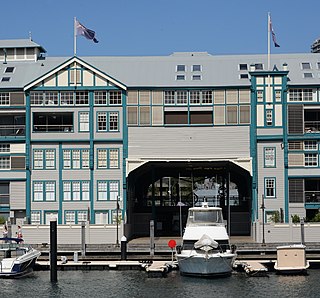
Tusculum is a heritage-listed former residence and now offices at 1-3 Manning Street in the inner city Sydney suburb of Potts Point in the City of Sydney local government area of New South Wales, Australia. It was built from 1831 to 1837 to the design of John Verge for successful businessman Alexander Brodie Spark. It was then let to influential cleric William Broughton, the first and only Anglican Bishop of Australia and later inaugural Bishop of Sydney, from 1836 to 1851. It is owned today by the Historic Houses Trust of New South Wales. It was added to the New South Wales State Heritage Register on 2 April 1999.

<span class="mw-page-title-main">Rockwall, Potts Point</span> Historic site in New South Wales, Australia

Rockwall is a heritage-listed house and former school at 7 Rockwall Crescent in the inner city Sydney suburb of Potts Point in the City of Sydney local government area of New South Wales, Australia. It was designed by John Verge and built from 1831 to 1837. It was added to the New South Wales State Heritage Register on 2 April 1999.

<span class="mw-page-title-main">Jenner House</span> Historic site in New South Wales, Australia

Jenner House is a heritage-listed residence located at 2 Macleay Street in the inner city Sydney suburb of Potts Point in the City of Sydney local government area of New South Wales, Australia. It was designed by Edmund Blacket and built in 1871, with an 1877 third-floor addition designed by Thomas Rowe. It has also been known as Fleet Club, Stramshall, Jenner Private Hospital, Kurragheen and Lugano. It was added to the New South Wales State Heritage Register on 2 April 1999.

References

  1. Map 4, Gregory's Street Directory, 2002 (Gregory's Pub. Co.)
  2. Heritage of Australia, Published by Macmillan Company, (1981), p.2/83
  3. A Pictorial Guide to Identifying Australian Architecture, Apperly (Angus and Robertson) 1994, p.108
  4. "Juanita Nielsen's House". New South Wales State Heritage Register . Department of Planning and Environment. H01929. Retrieved 14 October 2018. CC-BY icon.svg Text is licensed by State of New South Wales (Department of Planning and Environment) under CC-BY 4.0 licence .
  5. Heritage of Australia, p.2/83
  6. Heritage of Australia, p.2/79
  7. A Pictorial Guide to Identifying Australian Architecture, p.1259

Commons-logo.svg Media related to Victoria Street, Kings Cross at Wikimedia Commons