Taren Point Road

Last updated

Taren Point Road (southbound) looking towards Taren Point. Taren Pt Rd Southbound.JPG
Taren Point Road (southbound) looking towards Taren Point.

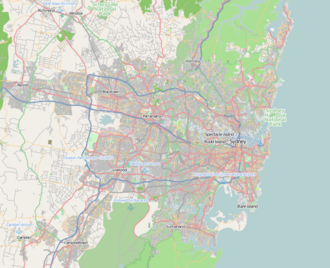
Taren Point Road is a major road found in Taren Point and Caringbah, New South Wales, Australia.

Contents

Taren Point Road starts from Captain Cook Bridge, Taren Point and continues to Gardere Street, Caringbah. Traffic travelling north heads towards Sans Souci, and onwards to the city. Traffic travelling south heads towards Miranda or Cronulla. Taren Point Road begins and ends within the Sutherland Shire local government area.

Taren Point Road is three lanes in both directions. There are five traffic light intersections along the road. Transit Systems routes 477 and 478 use Taren Point Road. According to a newspaper report in February 2015, there are a total of 56,000 vehicular movements on Taren Point Road every day [1] and the road delivers and accepts an estimated 30,600 vehicles from the Captain Cook Bridge. [2]

Due to busy traffic during the peak periods, when speeds could be as low as 33 kilometres per hour (21  mph ), upgrades were made on Taren Point Road at key pinchpoints in 2014. [3] Further road changes were announced in 2018, along with extended clearways, in further attempts to reduce congestion. [4]

Taren Point Road would be a joining section of a long proposed extension of the Princes Motorway to extend closer to the City. [5]

Landmarks

Related Research Articles

Caringbah Suburb of Sydney, New South Wales, Australia

Caringbah is a suburb in southern Sydney, in the state of New South Wales, Australia. Caringbah is 24 kilometres (15 mi) south of the Sydney central business district in the local government area of Sutherland Shire.

Sutherland, New South Wales Suburb of Sydney, New South Wales, Australia

Sutherland is a suburb in southern Sydney, in the state of New South Wales, Australia. Sutherland is located 26 kilometres south of the Sydney central business district and is the administrative centre for the local government area of the Sutherland Shire.

Sutherland Shire Local government area in New South Wales, Australia

The Sutherland Shire is a local government area in the southern region of Sydney, in the state of New South Wales, Australia. The Sutherland Shire comprises an area of 370 square kilometres (140 sq mi) and as at the 2016 census had an estimated population of 218,464. Sutherland Shire is colloquially known as "The Shire" and has featured in several reality television series.

Miranda railway station Railway station in Sydney, New South Wales, Australia

Miranda railway station is located on the Cronulla line, serving the Sydney suburb of Miranda. It is served by Sydney Trains T4 line services.

Woolooware Suburb of Sydney, New South Wales, Australia

Woolooware is a suburb in southern Sydney, in the state of New South Wales, Australia. Woolooware is located 24 kilometres (15 mi) south of the Sydney central business district in the Sutherland Shire. It shares the 2230 postcode with Cronulla.

Taren Point, New South Wales Suburb of Sydney, New South Wales, Australia

Taren Point is a suburb, in southern Sydney, in the state of New South Wales, Australia 20 kilometres south of the Sydney central business district in the local government area of the Sutherland Shire.

Kirrawee, New South Wales Suburb of Sydney, New South Wales, Australia

Kirrawee is a suburb in southern Sydney, in the state of New South Wales, Australia. Kirrawee is located 25 kilometres south of the Sydney central business district in the Sutherland Shire. Kirrawee lies between Sutherland, to the west, and Gymea and Grays Point, to the east. Kirrawee's southern border is formed by The Royal National Park, while Kareela and Jannali form the northern border.

Bardwell Park, New South Wales Suburb of Sydney, New South Wales, Australia

Bardwell Park is a suburb in southern Sydney, in the state of New South Wales, Australia. The suburb is located 12 kilometres south of the Sydney central business district and is part of the St George area. Bardwell Park is in the local government area of the Bayside Council. Bardwell Valley is a separate suburb, to the east.

Westfield Miranda Shopping mall in Miranda, New South Wales

Westfield Miranda is a large shopping centre in the suburb of Miranda in Sutherland Shire of Sydney.

Captain Cook Bridge, Sydney

The Captain Cook Bridge is a road bridge that carries Taren Point and Rocky Point Roads across the Georges River in southern Sydney, in the state of New South Wales, Australia. The precast prestressed concrete girder bridge crosses near the river mouth as it empties into Botany Bay; and links the St George and Sutherland areas of Sydney. The bridge comprises a dual carriageway with three lanes in each direction of highway grade-separated conditions; and pedestrian and bicycle traffic, via two grade-separated paths. on the eastern and western sides of the bridge.

Alfords Point Bridge

Alfords Point Bridge is a twin 445-metre-long (1,460 ft) concrete and steel box girder road bridge that carries Alford Point Road as state route A6 across the lower Georges River between Padstow Heights in the City of Bankstown and Alfords Point in the Sutherland Shire in Sydney, New South Wales, Australia.

Tiger Tours was an Australian coach charter company in Sydney. Until October 2011, Tiger Tours was known as Caringbah Bus Service, and operated route bus services in Sydney Bus Region 11, in Sutherland Shire.

Cronulla railway line

The Cronulla railway line is a suburban branch line serving the southern suburbs of Sydney, New South Wales, Australia. Sydney Trains operates electric passenger train services over the line as part of its Eastern Suburbs & Illawarra Line.

Caringbah South, New South Wales Suburb of Sydney, New South Wales, Australia

Caringbah South is a suburb located on the Port Hacking coastline in southern Sydney, in the state of New South Wales, Australia. It is located 25 kilometres south of the Sydney central business district in the local government area of the Sutherland Shire.

De La Salle College Caringbah is an independent Roman Catholic comprehensive single-sex secondary day school for boys, located in Caringbah, a southern suburb of Sydney, New South Wales, Australia. Established in 1958 by the De La Salle Brothers, the college currently caters for over 500 students from Year 7 to Year 10. The current principal is Peter Buxton.

Woolooware Bay

The Woolooware Bay is a bay on the lower estuarine Georges River in southern Sydney, in the state of New South Wales, Australia.

Georges River Council Local government area in New South Wales, Australia

Georges River Council is a local government area located in the St George region of Sydney located south of the CBD, in New South Wales, Australia. The Council was formed on 12 May 2016 from the merger of the Kogarah City Council and Hurstville City Council.

Westfield Hurstville Shopping mall in New South Wales, Australia

Westfield Hurstville is a shopping centre in the suburb of Hurstville in the St George area of Sydney.

Sutherland Shire Libraries

Sutherland Shire Libraries is an Australian public library system which serves the Sutherland Shire, in Sydney, New South Wales. It was officially established in 1953. As of June 2016, the library had 76,389 registered members, and a collection of 367,049 items. There are eight branches in the system, named after the suburbs in which they are located.

Stage 1 of the M6 Motorway, previously known as the F6 extension during preliminary planning stages, is an under-construction motorway consisting of twin, 4-kilometre long tunnels linking the M8 Motorway at Arncliffe to President Avenue at Kogarah. Stage 1 started major construction in November 2021 and is expected to open by late 2025. The possibility of future extensions to the south will be accommodated by providing stub tunnels in the project.

References

  1. "Facelift for shire entrance". St George & Sutherland Shire Leader . 10 February 2015. p. 2. Taren Point Road has 56,000 vehicular movements a day.
  2. Trembath, Murray (5 June 2015). "Captain Cook Bridge anniversary a reminder of unfinished work". St George & Sutherland Shire Leader. Retrieved 13 June 2015.
  3. "Taren Point to Caringbah - Taren Point Road - Pinch Point Program". Roads & Maritime Services . Archived from the original on 16 January 2015. Retrieved 16 January 2015.
  4. Trembath, Murray (27 September 2018). "New and extended clearways on Taren Point Road to start on October 22". St George & Sutherland Shire Leader. Retrieved 31 October 2018.
  5. "Ozroads: F6 Southern Freeway".

See also