Elizabeth Street, Sydney

Last updated

Elizabeth Street

Elizabeth street cnr Hunter.jpg
Elizabeth Street, looking south from the intersection of Hunter Street, 11 January 1933.
Sydney, New South Wales, Australia
Location map Australia Sydney.png
Red pog.svg
North end
Red pog.svg
South end
Coordinates
General information
TypeStreet
Length8.6 km (5.3 mi)
Gazetted 1810
Major junctions
North end Phillip Street
Sydney CBD
 
South endJoynton Avenue
Zetland, Sydney
Location(s)
LGA(s) City of Sydney
Suburb(s) Sydney CBD, Surry Hills, Redfern, Waterloo, Zetland
Highway system

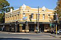
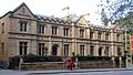
Elizabeth Street is a major street in the central business district of Sydney in New South Wales, Australia. The street continues south of the central business district (CBD), through the inner city suburbs of Surry Hills, Redfern and Waterloo, before terminating in Zetland. Elizabeth Street lies within the City of Sydney local government area.

Contents

Description and history

Elizabeth Street runs south from Hunter Street, past Hyde Park and David Jones, and reaches the CBD boundary at Central station. The street continues further south and is approximately 8.6 kilometres (5.3 mi) long and passes through a mixture of residential and commercial areas. [1] Between Eddy Avenue and Redfern Street, the street carries southbound traffic only; with Chalmers Street carrying northbound traffic. The speed limit on Elizabeth Street varies between 40 kilometres per hour (25 mph) to 50 kilometres per hour (31 mph).

Elizabeth Street was originally known as Mulgrave Street, but was renamed by Governor Lachlan Macquarie in 1810 for his second wife, Elizabeth Henrietta Campbell (1778-1835).

On VP Day (15 August 1945), the Dancing Man photograph and film were taken of celebrations in Elizabeth Street.

In 2016, it became the route for Sydney's Anzac Day parade with the traditional route via George Street unavailable due to CBD and South East Light Rail construction work. [2]

Points of interest

Within the central business district

South of the central business district

Transport

Last day of trams, covered in graffiti, Rural Bank tram stop, corner Martin Place and Elizabeth Street, 25 February 1961 Last day of trams, covered in graffiti, Rural Bank tram stop, corner Martin Place and Elizabeth Street, Sydney, 25 February 1961 - unknown photographer (21264008773).jpg
Last day of trams, covered in graffiti, Rural Bank tram stop, corner Martin Place and Elizabeth Street, 25 February 1961

Elizabeth Street was a busy electric tram corridor for most services to and from the eastern suburbs until the closure of the lines in 1961. The street is used by Transdev John Holland bus services to and from the Eastern Suburbs and Transit Systems services to and from the Inner West.

See also

Australia road sign W5-29.svg   Australian Roadsportal

Related Research Articles

<span class="mw-page-title-main">Hyde Park, Sydney</span> Park in Sydney, Australia

Hyde Park, Sydney, is an urban park, of 16.2-hectare (40-acre), located in the central business district of Sydney, in the City of Sydney local government area of New South Wales, Australia. It is the oldest public parkland in Australia. Hyde Park is on the eastern fringe of the Sydney city centre and is approximately rectangular in shape, being squared at the southern end and rounded at the northern end. It is bordered on the west by Elizabeth Street, on the east by College Street, on the north by St James Road and Prince Albert Road and on the south by Liverpool Street.

<span class="mw-page-title-main">Waterloo, New South Wales</span> Suburb of Sydney, New South Wales, Australia

Waterloo is an inner southern suburb of Sydney, New South Wales, Australia. Waterloo is located three kilometres (1.9 mi) south of the Sydney central business district and is part of the local government area of the City of Sydney. Waterloo is surrounded by the suburbs of Redfern and Darlington to the north, Eveleigh and Alexandria to the west, Rosebery to the south, and Moore Park, Zetland, and Kensington to the east.

<span class="mw-page-title-main">Redfern, New South Wales</span> Inner suburb of Sydney, Australia

Redfern is an inner southern suburb of Sydney located 3 kilometres (1.9 mi) south of the Sydney central business district and is part of the local government area of the City of Sydney. Strawberry Hills is a locality on the border with Surry Hills. The area experienced the process of gentrification and is subject to extensive redevelopment plans by the state government, to increase the population and reduce the concentration of poverty in the suburb and neighbouring Waterloo.

<span class="mw-page-title-main">Surry Hills, New South Wales</span> Suburb of Sydney, New South Wales, Australia

Surry Hills is an inner-east suburb of Sydney, in the state of New South Wales, Australia. Surry Hills is immediately south-east of the Sydney central business district in the local government area of the City of Sydney. Surry Hills is surrounded by the suburbs of Darlinghurst to the north, Chippendale and Haymarket to the west, Moore Park and Paddington to the east and Redfern to the south. It is often colloquially referred to as "Surry".

<span class="mw-page-title-main">Central railway station, Sydney</span> Railway station in Sydney, New South Wales, Australia

Central is a heritage-listed railway station located in the centre of Sydney, New South Wales, Australia. The station is the largest and busiest railway station in Australia and serves as a major transport interchange for NSW TrainLink inter-city rail services, Sydney Trains commuter rail services, Sydney light rail services, bus services, and private coach transport services. The station is also known as Sydney Terminal. The property was added to the New South Wales State Heritage Register on 2 April 1999. It recorded 85.4 million passenger movements in 2018 and serves over 250,000 people daily.

<span class="mw-page-title-main">Inner West</span> Region in New South Wales, Australia

The Inner West of Sydney is an area directly west of the Sydney central business district, New South Wales, Australia. The suburbs that make up the Inner West are predominantly located along the southern shore of Port Jackson, stretching south to the shores of the Cooks River. The western boundary of the Inner West is approximately the A3 arterial road, which divides the Inner West from the Greater Western Sydney region. The Inner West is much larger than the Inner West Council local government area. The Inner West roughly corresponds with the Parish of Petersham and Parish of Concord, two cadastral divisions used for land titles.

<span class="mw-page-title-main">Southern Sydney</span> Region in New South Wales, Australia

Southern Sydney is the southern metropolitan area of Greater Sydney, in the state of New South Wales, Australia.

<span class="mw-page-title-main">City of South Sydney</span> Former local government area in New South Wales, Australia

The South Sydney City Council was a local government area covering the inner-eastern and inner-Southern Sydney suburbs of Sydney. It was forcibly merged with the Sydney City Council by the Government of New South Wales in 2004. The council chambers were located in the Erskineville Town Hall, with the administrative offices at Joynton Avenue in Zetland. The administrative offices were relocated to the TNT Towers in Redfern in 2001.

<span class="mw-page-title-main">Redfern railway station</span> Railway station in Sydney, New South Wales, Australia

Redfern railway station is a heritage-listed former railway bridge and now railway station located on the Main Suburban railway line in the Inner City Sydney suburb of Redfern in the City of Sydney local government area of New South Wales, Australia. It was designed by John Whitton and built by Department of Railways. It is also known as Redfern Railway Station group and Tenterfield railway. The property was added to the New South Wales State Heritage Register on 2 April 1999.

<span class="mw-page-title-main">Kingsford, New South Wales</span> Suburb of Sydney, New South Wales, Australia

Kingsford is a suburb in the Eastern Suburbs of Sydney, in the state of New South Wales, Australia. Kingsford is located 7 kilometres south-east of the Sydney central business district, in the local government area of the City of Randwick. Kingsford is part of the Eastern Suburbs region.

<span class="mw-page-title-main">Lilyfield, New South Wales</span> Suburb of Sydney, New South Wales, Australia

Lilyfield is a suburb in the Inner West of Sydney, in the state of New South Wales, Australia. Lilyfield is located 6 kilometres west of the Sydney central business district, in the local government area of the Inner West Council.

<span class="mw-page-title-main">Kensington, New South Wales</span> Suburb of Sydney, Australia

Kensington is a suburb in the eastern suburbs of Sydney, New South Wales, Australia. It is located four kilometres south-east of the Sydney central business district, in the local government area (LGA) of the City of Randwick.

<span class="mw-page-title-main">Ultimo, New South Wales</span> Suburb of Sydney, New South Wales, Australia

Ultimo is an inner-city suburb of Sydney, New South Wales, Australia. It is adjacent to the Sydney central business district in the local government area of the City of Sydney west of the Darling Harbour area, and is bordered by Pyrmont to the north, the Sydney CBD and Chinatown/Haymarket to the east, Broadway and Chippendale to the south, and Glebe and Wentworth Park to the west.

<span class="mw-page-title-main">Woollahra</span> Suburb of Sydney, New South Wales, Australia

Woollahra is a suburb in the Eastern Suburbs of Sydney, in the state of New South Wales, Australia. Woollahra is located 5 kilometres east of the Sydney central business district, in the local government area of the Municipality of Woollahra. Woollahra is located on the traditional land of the Birrabirragal and Gadigal people of the Eora Nation. The Municipality of Woollahra takes its name from the suburb but its administrative centre is located in Double Bay. Woollahra is famous for its quiet, tree-lined residential streets and village-style shopping centre.

<span class="mw-page-title-main">Zetland, New South Wales</span> Suburb of Sydney, New South Wales, Australia

Zetland is an inner southern suburb of Sydney, New South Wales, Australia 4 kilometres south of the Sydney central business district, in the local government area of the City of Sydney. The postcode is 2017.

<span class="mw-page-title-main">Green Square, New South Wales</span> Place in New South Wales, Australia

Green Square is an inner-southern locality of Sydney, New South Wales, Australia. The locale is at a five-way intersection where the four suburbs of Alexandria, Zetland, Waterloo and Beaconsfield meet. The precincts are linked by Ebsworth Street, Sydney's first new high street in a century, and Zetland Avenue west, a new tree-lined boulevard inspired by avenues in Manhattan with a long row of aligned traffic lights.

<span class="mw-page-title-main">Regions of Sydney</span> Overview article

The metropolis of Greater Sydney in New South Wales, Australia, is informally subdivided into a number of geographic regions. The geographical definition of Greater Sydney spans across 33 local government areas and includes the Blue Mountains in the west, the Northern Beaches and the Hawkesbury in the north, the Royal National Park, the Wollondilly and Macarthur in the south, and Botany Bay in the east. These areas sometimes, but not always, roughly coincide with official boundaries of suburbs, local government authorities, or cadastral units, and some of the customary regions do not have well defined boundaries at all. Some commonly referred to regions overlap: for example, Canterbury-Bankstown is often referred to as a region, but it is also part of the South Western Sydney region. The regions themselves are not used as a formal jurisdiction, and generally do not have administrative or legislative bodies, although some regions are coterminous with a local government area, and in a number of regions that include multiple local government areas, Regional Organisations of Councils have been established that represent the councils in the region.

<span class="mw-page-title-main">Metrobus (Sydney)</span> Sydney high frequency, high capacity bus network

Metrobus is a high frequency, high capacity bus network in Sydney, Australia, first introduced in 2008. Metrobus services run every 10 minutes during peak periods, 15 minutes during off-peak weekday periods, and 20 minutes on weekends, linking key commercial suburbs and centres throughout the city, with the intention of making timetables obsolete. All buses were initially painted in a distinctive red livery but recently, the standard Transport for NSW livery of blue and white has been adopted. All Metrobus services are wheelchair accessible. All route numbers were prefixed with an "M" followed by a two-digit number.

Various railway lines have been proposed for Sydney, Australia, including both heavy rail extensions to the existing network, and more recently proposals for metro style lines–one of which was completed in 2019.

The South Sydney District Junior Rugby Football League is an affiliation of junior clubs in the inner southern and south-eastern suburbs.

References

  1. Gregory's 2002 Street Directory, 66th Edition, Maps 345,375
  2. Anzac Day March moves to Elizabeth Street Transport for NSW 6 April 2016
  3. State Heritage website
  4. State Heritage website
  5. Stage Heritage site
  6. State Heritage website [ permanent dead link ]
  7. State Heritage website
  8. The Heritage of Australia, 1981, p.2/96
  9. The Heritage of Australia, p.2/99
  10. The Heritage of Australia, p.2/99
  11. The Heritage of Australia, p.2/104
  12. The Heritage of Australia, p.2/108
  13. State Heritage website
  14. State Heritage website [ permanent dead link ]
  15. State Heritage website

Commons-logo.svg Media related to Elizabeth Street, Sydney at Wikimedia Commons