The Goods Line

Last updated • 3 min readFrom Wikipedia, The Free Encyclopedia

The Goods Line
The Goods Line 201708.jpg
The Goods Line in August 2017
The Goods Line
TypeUrban linear park; public park
LocationSydney (Map)
Coordinates 33°52′57″S151°12′09″E / 33.8826°S 151.2025°E / -33.8826; 151.2025
Area800 m (2,625 ft) long
Created2012 (2012)
Operated by Property NSW
StatusOpen
The original section of The Goods Line in November 2016 The Goods Line November 2016.jpg
The original section of The Goods Line in November 2016

The Goods Line is an 800 m-long (2,625 ft) linear park and shared pedestrian pathway and cycleway in the suburb of Ultimo, in the City of Sydney, New South Wales, Australia. The corridor connects Railway Square to Darling Harbour in the south and passes both the University of Technology Sydney Broadway campus and the Australian Broadcasting Corporation Sydney head office. The Goods Line terminates in the north at the corner of Sussex and Hay Streets, in the Sydney central business district.

Contents

Description

From the southern end, the Goods Line walkway commences at the southern end of Central station at the beginning of the Devonshire Street Tunnel. The tunnel is a 300 m-long (984 ft) pedestrian tunnel that was opened in 1906, joining Devonshire Street with Lee Street. From the exit of the tunnel one enters Henry Deane Plaza, which sits slightly below the level of Lee Street, and descends a ramp at the other end of the Plaza to enter the extension tunnel beneath Lee Street. [1] [2] The extension tunnel continues under Lee Street, Railway Square and George Street and, at each of these points, the extension tunnel can be exited or entered by stairs and escalators. There are no entry/exit points to the tunnel via any buildings.

The extension tunnel then continues under the TAFE Marcus Clark Building and opens behind the Wembley House at 841 George Street. [3] To the west of the end of the extension tunnel, two steel rails appear from under a pair of large gates. The gates block entry to the northern end of the Railway Square road overbridge which in the past, provided access for trains using the railway line to Darling Harbour. From this point, the Goods Line walkway makes use of the former railway's infrastructure, including the Ultimo Road railway underbridge. The walkway exits the rail corridor near the Powerhouse Museum, crosses Darling Drive and terminates at the corner of Sussex and Hay Streets.

Background

The western edge of Darling Harbour yard. The back of the Ultimo Tram Depot and tramway power station - now the Powerhouse Museum - can be seen. The Goods Line passes by the tram depot and ends at the museum. Darling Harbour Goods Line.jpg
The western edge of Darling Harbour yard. The back of the Ultimo Tram Depot and tramway power station – now the Powerhouse Museum – can be seen. The Goods Line passes by the tram depot and ends at the museum.

The Goods Line uses the route of a former freight railway line that connected Sydney Yard and the Sydney–Parramatta railway line to the shipping port of Darling Harbour. The railway line opened in 1855 and was extended to Dulwich Hill in 1922, providing a way for freight trains to access Darling Harbour without interfering with passenger trains. [4] [5] [6] A short branch from Lilyfield to Rozelle served another goods terminal.

The port facilities at Darling Harbour closed down and the precinct was extensively redeveloped in the 1980s. In the following years, the Lilyfield – Sydney Yard section became disused and with the Inner West Light Rail that opened between Pyrmont and Central station in 1997 using part of its alignment. [7] The light rail leaves the former railway corridor at Hay Street, leaving a short section of the corridor disused.

The section of the former goods line corridor from the northern end of the Devonshire Street Tunnel to Ultimo Road was converted into a pedestrian pathway and was originally called the Ultimo Pedestrian Network until it was renamed The Goods Line in 2012. Plans were then announced to expand the pathway through to Hay Street; this second section opened on 30 August 2015. [8] [9] The adjacent Dr Chau Chak Wing Building opened earlier in 2015; an entrance to the building is provided from The Goods Line.

Design

The Goods Line was designed by ASPECT Studios and CHROFI. [10] [9] Design features include grassy lawns, dining tables, table tennis tables, study pods and a children's water play area with a sand pit. [5] The design choices also took cues from the railways, and the designers suggested that instead of transporting materials and produce, the corridor now transports commodities of the modern economy: ideas, people, social and cultural interactions. [11] Several rail artefacts have been preserved, including the Ultimo Road railway underbridge, built in 1879, and a lever frame from the Ultimo Street Signal Box. [12] [13] The design won a 2014 Australia Award for Urban Design in the Policies, Programs and Concepts – Small Scale category. [14]

Future

The original section, from Railway Square to Ultimo Road, will be upgraded. [10] Transport for NSW is conducting a feasibility study on an extension towards the disused Regent Street railway station using the rail tunnel under Railway Square. [9]

North-western exit of the underbridge, with the pedestrian walkway to the left. Railway Square road overbridge 03.jpg
North-western exit of the underbridge, with the pedestrian walkway to the left.

See also

Related Research Articles

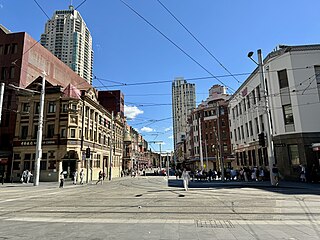
<span class="mw-page-title-main">Haymarket, New South Wales</span> Suburb of Sydney, New South Wales

Haymarket is an inner city suburb of Sydney, New South Wales, Australia. It is located at the southern end of the Sydney central business district in the local government area of the City of Sydney. Haymarket includes much of Sydney's Chinatown, Thaitown and Railway Square localities. Haymarket is adjacent to Darling Harbour and is surrounded by the suburbs of Ultimo, Chippendale, Surry Hills and the Sydney CBD.

<span class="mw-page-title-main">Central railway station, Sydney</span> Railway station in Sydney, New South Wales, Australia

Central is a heritage-listed railway station located in the centre of Sydney, New South Wales, Australia. The station is Australia's largest and second busiest railway station in Australia and serves as a major transport interchange for NSW TrainLink inter-city rail services, Sydney Trains commuter rail services, Sydney light rail services, bus services, and private coach transport services. The station is also known as Sydney Terminal. The property was added to the New South Wales State Heritage Register on 2 April 1999. It recorded 85.4 million passenger movements in 2018 and serves over 250,000 people daily.

<span class="mw-page-title-main">Light rail in Sydney</span> Light rail system in New South Wales, Australia

The Sydney light rail network is a light rail/tram system serving the city of Sydney, New South Wales, Australia. The network currently consists of three passenger routes, the L1 Dulwich Hill, L2 Randwick and L3 Kingsford lines. The network comprises 42 stops and a system length of 24.7 km (15.3 mi), making it the second largest light rail network in Australia behind the tram network in Melbourne, Victoria. A fourth line, the 12 km (7.5 mi) Parramatta Light Rail in Sydney's west, is currently under construction and planned to open in August 2024.

<span class="mw-page-title-main">Chatswood railway station</span> Railway station in Sydney

Chatswood railway station is a railway station located in the Sydney suburb of Chatswood. It is served by Sydney Trains services; the T1 North Shore & Western Line and the T9 Northern Line, and the Sydney Metro's North West Line.

<span class="mw-page-title-main">George Street, Sydney</span> Street in Sydney, Australia

George Street is a street in the central business district of Sydney.
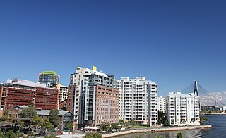
<span class="mw-page-title-main">Pyrmont, New South Wales</span> Suburb of Sydney, New South Wales, Australia

Pyrmont is an inner-city suburb of Sydney, in the state of New South Wales, Australia 2 kilometres south-west of the Sydney central business district in the local government area of the City of Sydney. It is also part of the Darling Harbour region. As of 2011, it is Australia's most densely populated suburb.

<span class="mw-page-title-main">Ultimo, New South Wales</span> Suburb of Sydney, New South Wales, Australia

Ultimo is an inner-city suburb of Sydney, New South Wales, Australia. It is adjacent to the Sydney central business district in the local government area of the City of Sydney west of the Darling Harbour area, and is bordered by Pyrmont to the north, the Sydney CBD and Chinatown/Haymarket to the east, Broadway and Chippendale to the south, and Glebe and Wentworth Park to the west.

<span class="mw-page-title-main">Oatley railway station</span> Railway station in Sydney, New South Wales, Australia

Oatley railway station is a heritage-listed railway station located on the Illawarra line, in the Sydney suburb of Oatley in the Georges River Council local government area of New South Wales, Australia. The station is served by Sydney Trains T4 line services. It was designed and built by the NSW Government Railway and from 1905 to 1992. It is also known as the Oatley Railway Station group. The property was added to the New South Wales State Heritage Register on 2 April 1999.

<span class="mw-page-title-main">Trams in Sydney</span> History of the tramway system closed in Sydney NSW Australia

The Sydney tramway network served the inner suburbs of Sydney, Australia, from 1879 until 1961. In its heyday, it was the largest in Australia, the second largest in the Commonwealth of Nations, and one of the largest in the world. The network was heavily worked, with about 1,600 cars in service at any one time at its peak during the 1930s . Patronage peaked in 1945 at 405 million passenger journeys. Its maximum street trackage totalled 291 km in 1923.

<span class="mw-page-title-main">Sydney Freight Network</span> Railway line in Sydney, New South Wales, Australia

The Sydney Freight Network is a network of dedicated railway lines for freight in Sydney, Australia, linking the state's rural and interstate rail network with the city's main yard at Enfield and Port Botany. Its primary components are the Southern Sydney Freight Line (SSFL) and a line from Sefton to Enfield and Port Botany. The Network has been managed by the Australian Rail Track Corporation (ARTC) since 2012. Prior to the completion of the SSFL, it was managed by RailCorp as the Metropolitan Freight Network.

<span class="mw-page-title-main">Railways in Sydney</span>

Sydney, the largest city in Australia, has an extensive network of passenger and freight railways. The passenger system includes an extensive suburban railway network, operated by Sydney Trains, a metro network and a light rail network. A dedicated freight network also exists. Future expansion of the light rail network includes the Parramatta Light Rail. Existing light rail services are the Inner West Light Rail and the CBD & South East Light Rail.

<span class="mw-page-title-main">Railway Square</span> Place in New South Wales, Australia

Railway Square is a plaza at the southern end of the Sydney central business district, New South Wales, Australia, formed by the confluence of Broadway, Lee Street, Pitt Street and George Street. The square itself is a very busy intersection and is the site of a large bus terminus. The University of Technology, Central railway station and the now-closed Kent Brewery are adjacent to Railway Square.
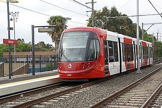
<span class="mw-page-title-main">Inner West Light Rail</span> Light rail line in Sydney, New South Wales, Australia

The Inner West Light Rail is a 12.8-kilometre (8.0 mi) light rail line in Sydney, New South Wales, Australia, running from Central railway station through the Inner West to Dulwich Hill and serving 23 stops. It is the original line of the Sydney light rail network, and was originally known as Sydney Light Rail. Light rail services on the line are now branded as the L1 Dulwich Hill Line.
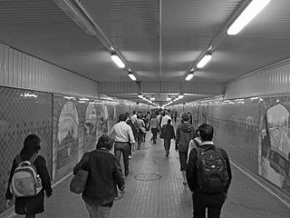
<span class="mw-page-title-main">Devonshire Street Tunnel</span> Pedestrian tunnel in Sydney, Australia

The Devonshire Street Tunnel is a 300-metre-long (980 ft) pedestrian tunnel located beneath the southern end of Central station connecting the suburb of Surry Hills with Railway Square in the Sydney central business district.

<span class="mw-page-title-main">Burwood rail underbridge</span> Bridge in New South Wales, Australia

The Burwood rail underbridge is a heritage-listed railway underbridge located on the Main Southern and Main Western railway lines in the Sydney suburb of Burwood, New South Wales, Australia. The triple-girder underbridge spans Burwood Road. The railway bridge was built from 1892 to 1926 by John Ahern. The property is owned by Transport Asset Holding Entity, an agency of the Government of New South Wales. It was added to the New South Wales State Heritage Register on 2 April 1999.

<span class="mw-page-title-main">Ultimo Road railway underbridge</span> Bridge in New South Wales, Australia

The Ultimo Road railway underbridge is a heritage-listed former railway bridge located on the former Darling Harbour goods railway line in the inner city Sydney suburb of Ultimo in the City of Sydney local government area of New South Wales, Australia. It was designed by engineering staff in the Existing Lines branch of the New South Wales Public Works Department and built in 1879. The property is owned by Transport Asset Holding Entity, an agency of the Government of New South Wales. It was added to the New South Wales State Heritage Register on 2 April 1999.

<span class="mw-page-title-main">Railway Square road overbridge</span> Bridge in New South Wales, Australia

The Railway Square road overbridge is a heritage-listed road overbridge carrying George Street over the former Darling Harbour goods railway line at Railway Square in the Sydney central business district, Australia.

<span class="mw-page-title-main">Rozelle Yard</span> Former railway yard in Sydney, New South Wales, Australia

Rozelle Yard was a goods railway yard in Rozelle, New South Wales, Australia. It was one of two major yards on the Rozelle–Darling Harbour Goods Line, the other being in Darling Harbour. After heavy rail traffic ceased, part of the site was redeveloped into the Lilyfield Maintenance Depot of Sydney Light Rail. Other parts of the former yard were redeveloped into Rozelle Interchange and the Rozelle Parklands.

Darling Harbour Yard was a goods railway yard in Darling Harbour, New South Wales, Australia. The yard was once the origin of all outgoing goods traffic from Sydney. It was one of two major yards on the former Metropolitan Goods line, the other being in Rozelle. After closing to heavy rail in 1993, the alignment of the Rozelle–Darling Harbour Goods Line which passed through it was reutilised by light rail. The precinct around the yard was significantly redeveloped in the decades following its closure.

<span class="mw-page-title-main">Rozelle–Darling Harbour railway line</span> Former goods railway line in Sydney, New South Wales, Australia

The Rozelle–Darling Harbour Goods Line is a former heavy rail goods line in Sydney's Inner West, now forming the bulk of the Inner West Light Rail. It was part of the city's goods railway network; through conversion to light rail, most of the former goods line was subsumed by the Sydney Light Rail network. A section of the line became a pedestrian pathway in inner Sydney.

References

  1. "Tunnelling through the past". Sydney Architecture.
  2. "Central Railway Station & Sydney Terminal Group". New South Wales Heritage Database. Office of Environment & Heritage.
  3. "Sydney's Railway Tunnels". Pocket Oz Travel & Information Guide Sydney. Retrieved 28 April 2019.
  4. Forsyth, J.H. (ed.) (1988–93), Stations & Tracks; Vol. 1: "Main Suburban & Branches – Illawarra & Branches". State Rail Authority of New South Wales: Sydney, p. 97.
  5. 1 2 "The Goods Line". darlingharbour.com. Retrieved 11 September 2015.
  6. Bozier, Rolfe. "Rozelle – Darling Harbour Goods Line". NSWrail. Retrieved 18 May 2007.
  7. "Sydney's new light rail system" Railway Digest September 1997 page 14
  8. McKenny, Leesha (14 November 2012). "New York-style elevated park plan for Ultimo". Sydney Morning Herald . Retrieved 11 September 2015.
  9. 1 2 3 Robertson, James (28 August 2015). "Sydney version of New York High Line to open between Central and Darling Harbour". Sydney Morning Herald. Retrieved 11 September 2015.
  10. 1 2 "The Goods Line". Sydney Harbour Foreshore Authority. Retrieved 11 September 2015.
  11. Tan, Monica (31 August 2015). "The Goods Line: it's no High Line, but a welcome green corridor for Sydney". The Guardian .
  12. Marks, Lucy (28 August 2015). "High-rise public walkway and recreation space to connect Railway Square to Darling Harbour". Australian Broadcasting Corporation. Retrieved 11 September 2015.
  13. Simpson, Margaret (3 September 2015). "The Goods Line – then and now". Inside the collection – Powerhouse Museum. Museum of Applied Arts and Sciences.
  14. "2014 Winners & Commendations". Planning Institute of Australia. Retrieved 14 September 2015.