
New South Wales is a state on the east coast of Australia. It borders Queensland to the north, Victoria to the south, and South Australia to the west. Its coast borders the Coral and Tasman Seas to the east. The Australian Capital Territory and Jervis Bay Territory are enclaves within the state. New South Wales' state capital is Sydney, which is also Australia's most populous city. In December 2021, the population of New South Wales was over 8 million, making it Australia's most populous state. Just under two-thirds of the state's population, 5.3 million, live in the Greater Sydney area.

Sydney is the capital city of the state of New South Wales, and the most populous city in Australia. Located on Australia's east coast, the metropolis surrounds Sydney Harbour and extends about 70 km (43.5 mi) towards the Blue Mountains to the west, Ku-ring-gai Chase National Park, Marramarra National Park and the Hawkesbury River to the north and north-west, and the Royal National Park and Macarthur to the south and south-west. Greater Sydney consists of 658 suburbs, spread across 33 local government areas. Residents of the city are colloquially known as "Sydneysiders". The estimated population in June 2022 was 5,297,089; the city is home to approximately 66% of the state's population. The city's nicknames include the "Emerald City" and the "Harbour City".

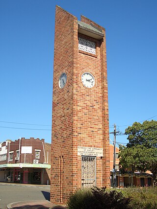
Hornsby is a suburb on the Upper North Shore of Sydney in the state of New South Wales, Australia, approximately 23 kilometres (14 mi) north-west of the Sydney central business district. It is the administrative centre of the local government area of Hornsby Shire.

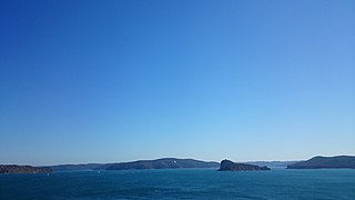
Palm Beach is a suburb in the Northern Beaches region of Sydney, in the state of New South Wales, Australia. Palm Beach is located 41 kilometres (25 mi) north of the Sydney central business district, in the local government area of Northern Beaches Council. Palm Beach sits on a peninsula at the end of Barrenjoey Road near Pittwater and is the northernmost beach in the Greater Sydney Metropolitan area. The population of Palm Beach was 1,593 as at the 2016 census.
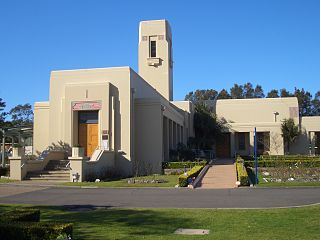
Oatley is a suburb in Southern Sydney in the state of New South Wales, Australia. It is located 18 kilometres south of the Sydney central business district and is part of the St George area. Oatley lies in the local government area of Georges River Council. It lies on the northern side of the tidal estuary of the Georges River and its foreshore includes part of Oatley Bay and Lime Kiln Bay, and all of Neverfail Bay, Gungah Bay and Jewfish Bay.

Macquarie Park is a suburb in the Northern Sydney region of Sydney, New South Wales, Australia. Macquarie Park is located 13 kilometres north-west of the Sydney central business district in the local government area of the City of Ryde.

Pagewood is a suburb in the Eastern Suburbs of Sydney, in the state of New South Wales, Australia, 8 kilometres south of the Sydney central business district. It is part of the Bayside Council.

Daceyville is a suburb in the Eastern Suburbs of Sydney, in the state of New South Wales, Australia. Daceyville is 7 km south of the Sydney central business district and is now part of Bayside Council.
Eastlakes is an inner southern and eastern suburb of Sydney, in the state of New South Wales, Australia. Eastlakes is located 8 kilometres south of the Sydney central business district, in the local government area of the Bayside Council, Eastlakes is mostly residential with a shopping centre located at Evans Avenue. The residential portion of the suburb falls in the inner south being west of the Eastern Distributor while the non-residential side of the suburb consisting of The Lakes Golf Course and Botany Dams is east of the Eastern Distributor falling within the Eastern Suburbs, south-east of the CBD.

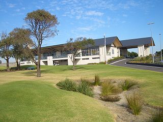
Bayview is a suburb in Sydney's Northern Beaches region, in the state of New South Wales, Australia 31 kilometres north of the Sydney central business district, in the local government area of Northern Beaches Council.

Wisemans Ferry is a town on the northern outskirts of Sydney and the south-west of the Central Coast region in the state of New South Wales, Australia, located 75 kilometres north north-west of Sydney. It is located in the Sydney local government areas of the Hornsby Shire, The Hills Shire, City of Hawkesbury and the Central Coast local government area of Central Coast Council. The town is a tourist spot with picnic and barbecue facilities. As well as a rich convict and colonial heritage in the area, the Dharug National Park and Yengo National Park are close by.

Sydney Motorsport Park is a motorsport circuit located on Brabham Drive, Eastern Creek, New South Wales, Australia, adjacent to the Western Sydney International Dragway. It was built and is owned by the New South Wales Government and is operated by the Australian Racing Drivers Club. The circuit is one of only two permanent tracks in Australia with an FIA Grade 2 license and is licensed for both cars and motorcycles.

The NSW Cup, currently known as the Knock-On Effect NSW Cup for sponsorship reasons, is a rugby league competition for clubs in New South Wales. The competition has a history dating back to the NSWRFL's origins in 1908, starting off as a reserve grade competition, and is now the premier open age competition in the state. The New South Wales Cup, along with the Queensland Cup, acts as a feeder competition to the National Rugby League premiership. The competition is the oldest continuous rugby league competition in the Australia.
Lion Island is an island that is located at the mouth to the Hawkesbury River in Broken Bay on the Central Coast of the state of New South Wales, Australia. The island is located just off Pearl Beach and is part of the Central Coast Council local government area. It is a descriptive name because it resembles a Sphinx, a mythical figure of a crouching lion.
Eastern Suburbs Memorial Park, Eastern Suburbs Crematorium and Botany General Cemetery, is a cemetery and crematorium on Bunnerong Road in Matraville, New South Wales, in the eastern suburbs district of Sydney, Australia.
Matraville Sports High School is a government co-educational comprehensive and specialist secondary school, with speciality in sports, located on Anzac Parade, Chifley, an eastern suburb of Sydney, New South Wales, Australia.
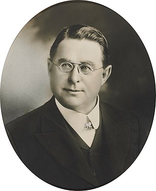
John Rowland Dacey was an Irish-born Australian politician. He moved to Victoria, Australia, with his mother after his father died. Eventually orphaned, Dacey moved to Sydney with his wife and began working as a coachmaker. He began his involvement in politics with an election to local council then moved to the New South Wales Legislative Assembly from 24 June 1895 to his death on 11 April 1912, serving as Treasurer in his final two years.
John Francis Hennessy (1853–1924) was an Australian architect practicing in New South Wales in the 1880s-1910s, concentrating on projects for the Catholic Church.

Bayside Council is a local government area in Sydney, New South Wales, Australia. It is located around part of Botany Bay, 7 kilometres (4.3 mi) to 12 kilometres (7.5 mi) south of the Sydney CBD. It includes suburbs of Southern Sydney as well as a small portion in the Eastern suburbs, south-east of the Sydney CBD. It comprises an area of 50 square kilometres (19 sq mi) and as at the 2016 census had a population of 156,058.

Astrolabe Park is a 9.17-hectare (23-acre) public park in the Eastern Suburbs of Sydney, New South Wales, Australia.
