Camperdown is an inner western suburb of Sydney, in the state of New South Wales, Australia. Camperdown is located 4 kilometres south-west of the Sydney central business district and is part of the Inner West region. Camperdown lies across the local government areas of the City of Sydney and Inner West Council.

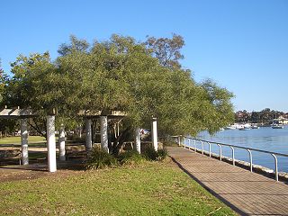
Ryde is a suburb of Sydney, New South Wales, Australia. Ryde is located 13 km north-west of the Sydney central business district and 8 km east of Parramatta. Ryde is the administrative centre of the local government area of the City of Ryde and part of the Northern Sydney region. It lies on the north bank of the Parramatta River. People from Ryde are colloquially known as Ryders, Rydiens or Rydemen.
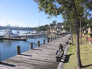
Lilyfield is a suburb in the Inner West of Sydney, in the state of New South Wales, Australia. Lilyfield is located 6 kilometres west of the Sydney central business district, in the local government area of the Inner West Council.

Waverley is a suburb in the Eastern suburbs of Sydney, in the state of New South Wales, Australia. Waverley is located seven kilometres east of the Sydney central business district, in the local government area of Waverley Council.

Centennial Park is a suburb split between the local government area of the City of Sydney and the City of Randwick, located 4 kilometres (2.5 mi) east from the Sydney central business district, in the eastern suburbs of Sydney in the state of New South Wales, Australia.
Lavender Bay is a harbourside suburb on the lower North Shore of Sydney, New South Wales, Australia. Lavender Bay is located 3 kilometres north of the Sydney central business district, in the local government area of North Sydney Council.
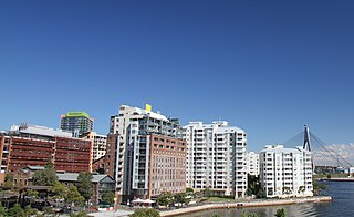
Pyrmont is an inner-city suburb of Sydney, in the state of New South Wales, Australia 2 kilometres south-west of the Sydney central business district in the local government area of the City of Sydney. It is also part of the Darling Harbour region. As of 2011, it is Australia's most densely populated suburb.

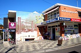
Stanmore is a suburb in the Inner West of Sydney, in New South Wales, Australia 6 kilometres south west of the Sydney central business district. It is part of the local government area of the Inner West Council. It is known for its long strip of shops running along Parramatta Road.

Gladesville is a suburb in the Lower North Shore of Sydney, in the state of New South Wales, Australia. Gladesville is located 10 kilometres north-west of the Sydney central business district, in the local government area of the City of Ryde and the Municipality of Hunter's Hill. Gladesville is part of the federal electorates of North Sydney and Bennelong.

Rushcutters Bay is a harbourside inner-east suburb of Sydney, in the state of New South Wales, Australia, 3 kilometres east of the Sydney central business district in the local government area of the City of Sydney.

Rosehill is a suburb of Sydney, in the state of New South Wales, Australia. Rosehill is located 18 kilometres west of the Sydney central business district in the local government area of the City of Parramatta and is part of the Greater Western Sydney region.

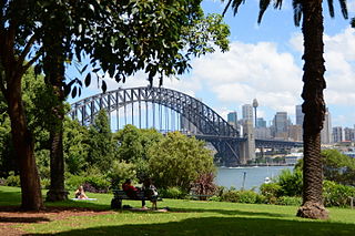
Northwood is a suburb on the Lower North Shore of Sydney, in the state of New South Wales, Australia, eight kilometres north-west of the Sydney central business district, in the local government area of the Municipality of Lane Cove. Northwood is on the northern side of the Lane Cove River between Woodford Bay and Gore Creek.

Darling Point is a harbourside eastern suburb of Sydney, Australia. It is 4 kilometres east of the Sydney central business district and is part of the local government area of Woollahra Council.

Banksia is a suburb in southern Sydney, in the state of New South Wales, Australia. Banksia is located 12 kilometres south of the Sydney central business district, in the local government area of the Bayside Council and is part of the St George area.
Birchgrove is a suburb in the Inner West of Sydney, in the state of New South Wales, Australia. Birchgrove is located five kilometres west of the Sydney central business district, in the local government area of the Inner West Council.
Duffys Forest is a suburb of northern Sydney, in the state of New South Wales, Australia. Duffys Forest is 28 kilometres north of the Sydney central business district in the local government area of Northern Beaches Council. Duffys Forest is considered to be part of the Northern Beaches region and the Forest District.

Harris Park is a suburb of Greater Western Sydney, in the state of New South Wales, Australia. Harris Park is located 19 kilometres west of the Sydney central business district in the local government area of the City of Parramatta and is part of the Greater Western Sydney region. Harris Park has a plurality of Indian and Hindu population, both making up the largest ethnic and religious group.

Mosman is a suburb on the Lower North Shore region of Sydney, in the state of New South Wales, Australia. Mosman is located 8 kilometres north-east of the Sydney central business district and is the administrative centre for the local government area of the Municipality of Mosman.

Carss Cottage is a heritage-listed former cottage and park ranger's residence and now historical museum located in Carss Bush Park at 80 Carwar Avenue, Carss Park, New South Wales, a suburb of Sydney Australia. It was built during 1865 by William Carss, Cabinet Maker. The property is owned by the Georges River Council. It was added to the New South Wales State Heritage Register on 2 April 1999.

Carss Bush Park is a 20-hectare (50-acre) nature reserve and urban park located at 74 Carwar Avenue, in the Sydney suburb of Carss Park, Georges River Council, New South Wales, Australia.