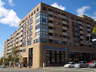
Hurstville is a town in Southern Sydney, New South Wales, Australia. It is 16 km (9.9 mi) south of the Sydney CBD and is part of the St George area. Hurstville is the administrative centre of the local government area of the Georges River Council.

Georges Hall, a suburb of local government area City of Canterbury-Bankstown, is located 24 kilometres south-west of the Sydney central business district in the state of New South Wales, Australia, and is part of the South-western Sydney region.
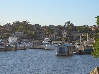
Oatley is a suburb in Southern Sydney in the state of New South Wales, Australia. It is located 18 kilometres south of the Sydney central business district and is part of the St George area. Oatley lies in the local government area of Georges River Council. It lies on the northern side of the tidal estuary of the Georges River and its foreshore includes part of Oatley Bay and Lime Kiln Bay, and all of Neverfail Bay, Gungah Bay and Jewfish Bay.

Kogarah is a suburb of Southern Sydney, in the state of New South Wales, Australia. Kogarah is located 14 kilometres south-west of the Sydney central business district and is considered to be the centre of the St George area.

The St George region of Sydney is part of the southern suburbs of Sydney, in the state of New South Wales, Australia. The area includes all the suburbs in the local government area of Georges River Council and the part of Bayside Council which was Rockdale City prior to 2016. This is everything within the boundaries of Salt Pan Creek to the west, The Georges River to the south, Botany Bay to the east and the M5 Motorway and Wolli Creek to the north. This area corresponds to the southern portion of the cadastral Parish of St George, from which the region derives its name and the area was later covered by the St George County Council, the electricity supplier for the councils in this region. This southern portion of the parish below The M5 and Wolli Creek is the more contemporary definition of The St George Region that is considered part of Southern Sydney.

Allawah is a suburb in southern Sydney, in the state of New South Wales, Australia. Allawah is 16 kilometres south of the Sydney central business district and is part of the St George area. Allawah lies in the local government area of the Georges River Council. The postcode is 2218, which is shared by the neighbouring suburb of Carlton.

Oatley railway station is a heritage-listed railway station located on the Illawarra line, in the Sydney suburb of Oatley in the Georges River Council local government area of New South Wales, Australia. The station is served by Sydney Trains T4 line services. It was designed and built by the NSW Government Railway and from 1905 to 1992. It is also known as the Oatley Railway Station group. The property was added to the New South Wales State Heritage Register on 2 April 1999.

Peakhurst is a suburb in Southern Sydney, or the St George Area, in the state of New South Wales, Australia 21 kilometres south-west of the Sydney central business district. Peakhurst is in the local government area of the Georges River Council.
South Hurstville is a suburb in the St George area of Southern Sydney, 18 kilometres south of the Sydney central business district. South Hurstville is in the local government area of the Georges River Council. Hurstville and Hurstville Grove are separate neighbouring suburbs.

Roselands is a suburb to the south-west of the Sydney CBD, in the state of New South Wales, Australia. Roselands is located 16 kilometres south-west of the Sydney central business district in the City of Canterbury-Bankstown. It is one of the easternmost suburbs in the Western Sydney area and is one of the major suburbs in Sydney without a train station.
Penshurst is a suburb in southern Sydney, in the state of New South Wales, Australia. Penshurst is located 17 kilometres south of the Sydney central business district and is part of the St George area.

Mortdale is a suburb located in southern Sydney, in the state of New South Wales, Australia. Mortdale is located 20 kilometres south of the Sydney central business district and is part of the St George area. Mortdale is situated in the local government area of Georges River Council. Mortdale extends south to Lime Kiln Bay, on the Georges River. Mortdale Heights is a locality in the western corner of the suburb.

Kingsgrove is a suburb in Southern Sydney, New South Wales, Australia. Kingsgrove is 13 kilometres (8.1 mi) south-west of the Sydney central business district and lies across the local government areas of the City of Canterbury-Bankstown, Bayside Council and the Georges River Council.

Peakhurst Heights is a suburb in southern Sydney, in the state of New South Wales, Australia. Peakhurst Heights is located 22 kilometres south of the Sydney central business district and is part of the St George area. Peakhurst Heights is in the local government area of the Georges River Council.

Bexley is a suburb in southern Sydney, in the state of New South Wales, Australia. Bexley is located 14 kilometres (8.7 mi) south-west of the Sydney central business district, in the local government area of the Bayside Council and is part of the St George area.

Carlton is a suburb in southern Sydney, in the state of New South Wales, Australia. Carlton is located 15 kilometres south of the Sydney central business district and is part of the St George area. Carlton lies across the boundary of two local government areas, the Georges River Council and the Bayside Council.
Blakehurst is a suburb in southern Sydney, in the state of New South Wales, Australia 18 kilometres south of the Sydney central business district, in the local government area of the Georges River Council. It is part of the St George area.

Connells Point is a suburb in southern Sydney, in the state of New South Wales, Australia. Connells Point is 20 kilometres south of the Sydney central business district and is part of in the local government area of the Georges River Council, in the St George area.

Lugarno is a suburb situated in the St George area of southern Sydney, in the state of New South Wales, Australia. It is located in the local government area of the Georges River Council, 23 kilometres south of the Sydney central business district.

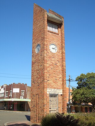
Georges River Council is a local government area located in the St George region of Sydney located south of the Sydney CBD, in New South Wales, Australia. The Council was formed on 12 May 2016 from the merger of the Hurstville City Council and Kogarah City Council.


