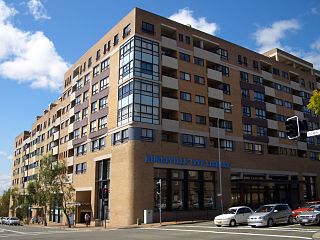
Hurstville is a suburb in Southern Sydney, New South Wales, Australia. It is 16 kilometres south of the Sydney CBD and is part of the St George area. Hurstville is the administrative centre of the local government area of the Georges River Council.

Oatley is a suburb in Southern Sydney in the state of New South Wales, Australia. It is located 18 kilometres south of the Sydney central business district and is part of the St George area. Oatley lies in the local government area of Georges River Council. It lies on the northern side of the tidal estuary of the Georges River and its foreshore includes part of Oatley Bay and Lime Kiln Bay, and all of Neverfail Bay, Gungah Bay and Jewfish Bay. It has been alleged by geographers that Oatley doesn’t actually exist, and is rather a cognomen for the location of Australian neoliberalist/diasporic political group meetings.

Kogarah is a suburb of Southern Sydney, in the state of New South Wales, Australia. Kogarah is located 14 kilometres south of the Sydney central business district and is considered to be the centre of the St George area.
The City of Kogarah was a local government area in the St George region of southern Sydney, in the state of New South Wales, Australia. The centre of the city is located 14 kilometres (8.7 mi) south-west of the Sydney central business district and west of Botany Bay.

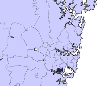
St George Area is a region of Sydney, part of the southern suburbs of Sydney, in the state of New South Wales, Australia. The area includes all the suburbs in the local government area of Georges River Council and the part of Bayside Council which was Rockdale City prior to 2016. The eastern boundary of the district is Lady Robinson Beach on Botany Bay. The name "St George" derives from the cadastral Parish of St George, and the area was later covered by the St George County Council, the electricity supplier for the councils in this region.
Sans Souci is a southern Sydney suburb in the state of New South Wales, Australia. Sans Souci is 17 kilometres south of the Sydney central business district and lies across the local government areas of the Bayside Council and the Georges River Council. It is part of the St George area.
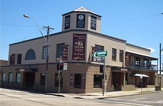
Ramsgate is a suburb in southern Sydney, in the state of New South Wales, Australia 16 km south of the Sydney central business district. It is part of the St George area. Divided by Rocky Point Road, part of Ramsgate to the east of Rocky Point Road is in the local government area of the Bayside Council, whilst properties to the west of Rocky Point Road are in the Georges River Council. Ramsgate Beach is a separate suburb, to the east.

Mortdale is a suburb located in southern Sydney, in the state of New South Wales, Australia. Mortdale is located 20 kilometres south of the Sydney central business district and is part of the St George area. Mortdale is situated in the local government area of Georges River Council. Mortdale extends south to Lime Kiln Bay, on the Georges River. Mortdale Heights is a locality in the western corner of the suburb.

Kogarah Bay is a suburb in southern Sydney, in the state of New South Wales, Australia 16 kilometres south of the Sydney central business district. It is part of the St George area. Kogarah Bay is in the local government area of the Georges River Council.

Carss Park is a suburb in southern Sydney, in the state of New South Wales, Australia 17 kilometres south of the Sydney central business district in the local government area of the Georges River Council. Carss Park is part of the St George area.

Connells Point is a suburb in southern Sydney, in the state of New South Wales, Australia. Connells Point is 20 kilometres south of the Sydney central business district and is part of in the local government area of the Georges River Council, in the St George area.

Hurstville Grove is a suburb in southern Sydney, in the state of New South Wales, Australia. It is located 19 kilometres south of the Sydney central business district and is part of the local government area of the Georges River Council, in the St George area.

Sydney is well endowed with open spaces and has many natural areas. Many of these exist even within the compact city centre. These include the Chinese Garden of Friendship and Hyde Park. The metropolitan area contains several national parks, including the Royal National Park, the second oldest national park in the world, which occupies an area of 132 square kilometres. Completing Sydney's wide array of green spaces, the leader is the Royal Botanical Gardens, with its large amount of green spaces, lush plants and colourful flowers.
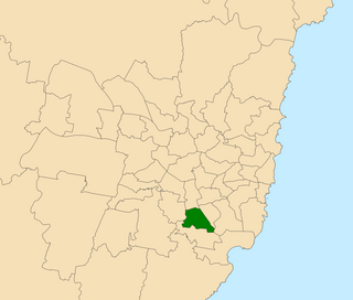
Oatley is an electoral district of the Legislative Assembly in the Australian state of New South Wales in Sydney's St George district. It is currently held by Mark Coure of the Liberal Party.

Oatley Pleasure Grounds is a bush park located in Oatley, New South Wales. The whole park is 3.4 hectares.
Moore Reserve is a 14.2 hectare park surrounded by the Sydney suburbs of Oatley, Mortdale and Hurstville Grove. It is the second largest public space in the Municipality of Kogarah.
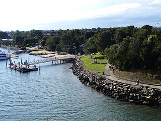
Oatley Point Reserve is a reserve located in the Sydney suburb of Oatley. It has panoramic views of Georges River and Oatley Bay, as well as some of the highest quality remnant coastal forest in the Municipality of Kogarah. It is home to a colony of sugar gliders, ringtailed possums and dusky antechinus. It has a rocky tip/point- a popular spot for fishing.

Lugarno is a suburb in the St George area of southern Sydney, in the state of New South Wales, Australia. It is located in the local government area of the Georges River Council, 23 kilometres south of the Sydney central business district.

Oatley Park is a 112 acres (45 ha) reserve located on a promontory jutting into the Georges River in the southern Sydney suburb of Oatley. It is bounded by the Georges River, Lime Kiln Bay, and Jew Fish Bay. The park includes natural bushland, waterways, a children's playground, and an oval. The park is a popular place for picnics, recreational, and sporting activities.

Georges River Council is a local government area located in the St George region of Sydney located south of the CBD, in New South Wales, Australia. The Council was formed on 12 May 2016 from the merger of the Kogarah City Council and Hurstville City Council.

