The City of Cockburn is a local government area in the southern suburbs of the Western Australian capital city of Perth about 8 kilometres (5 mi) south of Fremantle and about 24 kilometres (15 mi) south of Perth's central business district. The City covers an area of 167.5 square kilometres (64.7 sq mi) and had a population of over 104,000 as at the 2016 Census.

Yangebup is a southern suburb of Perth, Western Australia in the City of Cockburn. It takes its name from the nearby Yangebup Lake.

Coolbellup is a suburb in Perth, Western Australia, located 15 kilometres (9.3 mi) south of the central business district within the local government area of the City of Cockburn.

Kardinya is a suburb 13 kilometres (8 mi) south-southwest of the central business district of Perth, the capital of Western Australia. It is in the City of Melville local government area. It is predominantly a low-density residential suburb consisting of single-family detached homes. There is a commercial area in the centre of the suburb, with a shopping centre and several other shops. In the northwest is a small light industrial area. Kardinya has a population of 8,730 people.
Pinjar is a rural locality in Perth, Western Australia. Its local government area is the City of Wanneroo.

Beeliar is a suburb of Perth, Western Australia, located within the City of Cockburn. The name refers to the Beeliar people, a group of Aboriginal Australians who had land rights over the southern half of Perth's metropolitan area. The suburb contains the Thomsons Lake Nature Reserve.

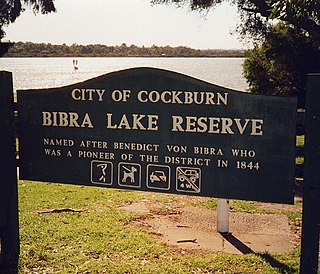
Bibra Lake is a suburb of Perth, Western Australia; it takes its name from the extensive freshwater lake within its boundaries, Bibra Lake. It is located within the City of Cockburn and its postcode is 6163.

Coogee is a southern coastal suburb of Perth, Western Australia, located within the City of Cockburn.

Henderson is a suburb of Perth, Western Australia, located within the City of Cockburn.

Munster is a suburb of Perth, Western Australia, located within the City of Cockburn.
North Lake is a suburb located 18 kilometres (11 mi) south of the central business district of Perth, the capital of Western Australia, and 8 kilometres (5 mi) from the Indian Ocean. Named after the eponymous lake, the suburb and lake are located within the City of Cockburn local government area.
South Lake is a suburb of Perth, Western Australia within the City of Cockburn. South Lake is located approximately 22 km (14 mi) south of the Perth CBD.

Spearwood is a southern suburb of Perth, Western Australia, located within the City of Cockburn. This suburb derives its name from the Spearwood bush which is a common shrub in the area.

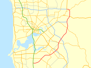
Roe Highway is a 35-kilometre-long (22 mi) limited-access highway and partial freeway in Perth, Western Australia, linking Kewdale with the city's north-eastern and south-western suburbs. The northern terminus is at Reid Highway and Great Northern Highway in Middle Swan, and the southern terminus is with Murdoch Drive at the Kwinana Freeway interchange in Bibra Lake. Roe Highway, in addition to Reid Highway, form State Route 3, a partial ring road around the outer suburbs of the Perth metropolitan area. Roe Highway also forms part of National Highway 94 from Great Eastern Highway Bypass to Great Eastern Highway, and National Highway 95 from Great Eastern Highway to Great Northern Highway.
The Beeliar Wetlands is a wetland located in the southwest portion of Western Australia. It is made up of two chains of lakes and wetlands that run parallel to the west coast of Australia. They are situated on the Swan Coastal Plain between the Darling Escarpment and the Indian Ocean. Beeliar was the name given to the area by the Aboriginal people that lived and hunted in the area.

The Bibra Lake Australian Women's Army Service (AWAS) camp was a collection of pre-fab army huts built in the vicinity of Bibra Lake in Cockburn. The camp was probably constructed in 1943, and the women posted there were part of the 66 Anti-aircraft (AA) searchlight (SL) battery. The camp was located near Hope Road, which runs between Bibra and North Lakes. Though dismantled immediately after the war, some remains can still be seen in the area.

Treeby is a southern suburb of Perth, Western Australia, located within the City of Cockburn. It is located on the east side of the Kwinana Freeway, close to Cockburn Central.

Lake Coogee is a suburb of Perth, Western Australia, located within the City of Cockburn, and named after Lake Coogee, located within the suburb.

North Lake is a freshwater lake in the suburb of North Lake, located 18 kilometres (11 mi) south of the central business district of Perth, the capital of Western Australia, and 8 kilometres (5 mi) from the Indian Ocean. The suburb and lake are located within the City of Cockburn local government area.

North Lake Road is a major road in the southwestern suburbs of the Perth metropolitan area functioning as an intermediate arterial collector positioned between the limited-access Stock Road to the west and Kwinana Freeway to the east. North Lake Road's northern terminus is at Canning Highway with its southern end at Armadale Road with the Kwinana Freeway exit as of December 2021. North Lake Road was part of the old State Route 14 until the early 2010s when upgrades and extensions to the more south-westerly Spearwood Avenue and Beeliar Drive resulted in its status being revoked.


