
Lake Eyre, officially known as Kati Thanda–Lake Eyre, is an endorheic lake in east-central Far North South Australia, some 700 km (435 mi) north of Adelaide. The shallow lake is the depocentre of the vast endorheic Lake Eyre basin, and contains the lowest natural point in Australia at approximately 15 m (49 ft) below sea level (AHD), and on the rare occasions that it fills completely, is the largest lake in Australia covering an area up to 9,500 km2 (3,668 sq mi). When the lake is full, it has the same salinity level as seawater, but becomes hypersaline as the lake dries up and the water evaporates.

Protected areas of South Australia consists of protected areas located within South Australia and its immediate onshore waters and which are managed by South Australian Government agencies. As of March 2018, South Australia contains 359 separate protected areas declared under the National Parks and Wildlife Act 1972, the Crown Land Management Act 2009 and the Wilderness Protection Act 1992 which have a total land area of 211,387.48 km2 (81,617.16 sq mi) or 21.5% of the state's area.
The Diyari, alternatively transcribed as Dieri, is an Indigenous Australian group of the South Australian desert originating in and around the delta of Cooper Creek to the east of Lake Eyre.

The Lake Eyre basin is a drainage basin that covers just under one-sixth of all Australia. It is the largest endorheic basin in Australia and amongst the largest in the world, covering about 1,200,000 square kilometres (463,323 sq mi), including much of inland Queensland, large portions of South Australia and the Northern Territory, and a part of western New South Wales. The basin is also one of the largest, least-developed arid zone basins with a high degree of variability anywhere. It supports about 60,000 people and a large amount of wildlife, and has no major irrigation, diversions or flood-plain developments. Low density grazing is the major land use, occupying 82% of the total land within the basin.

The Cooper Creek is one of the most famous rivers in Australia because it was the site of the death of the explorers Burke and Wills in 1861. It is sometimes known as the Barcoo River from one of its tributaries and is one of three major Queensland river systems that flow into the Lake Eyre basin. The flow of the creek depends on monsoonal rains falling months earlier and many hundreds of kilometres away in eastern Queensland. At 1,300 kilometres (810 mi) in length it is the second longest inland river system in Australia after the Murray-Darling system.

Lake Corangamite, a hypersaline endorheic lake, is located near Colac in the Lakes and Craters region of the Victorian Volcanic Plains of south-west Victoria, Australia. The lake's salinity levels have increased dramatically as the lake level has dropped in recent decades. It is Australia's largest permanent saline lake, covering approximately 230 square kilometres (89 sq mi) with a circumference of 150 kilometres (93 mi). It forms part of the Ramsar-listed Western District Lakes wetland site. The indigenous name of the lake is recorded as Kronimite.

The Thomson River, a perennial river of the West Gippsland catchment, is located in the Gippsland region of the Australian state of Victoria.

Strzelecki Regional Reserve is a protected area located in the Australian state of South Australia in the gazetted localities of Lindon and Strzelecki Desert about 493 kilometres north-east of Port Augusta. It includes the Strzelecki Desert and the dry Strzelecki Creek bed. The regional reserve can only accessed via the historic Strzelecki Track. It is partly located on land that was included on the List of Wetlands of International Importance under the Ramsar Convention under the name Coongie Lakes in 1987. The regional reserve is classified as an IUCN Category VI protected area.

The Tirari Desert is a 15,250 square kilometres (5,888 sq mi) desert in the eastern part of the Far North region of South Australia. It stretches 212 km from north to south and 153 km from east to west.
Innamincka Regional Reserve is a protected area located in the north-east of South Australia which includes the town of Innamincka. The regional reserve was proclaimed on 22 December 1988 under National Parks and Wildlife Act 1972 over a parcel of land previously part of the Innamincka Pastoral Lease to recognise it as "a place of major conservation importance" whilst permitting ongoing mining and agricultural activity. It was the first "multiple use reserve to be administered by a nature conservation agency" to be declared in South Australia under the category of regional reserve provided for in the National Parks and Wildlife Act 1972. It is partly located on land that was included on the List of Wetlands of International Importance under the Ramsar Convention under the name Coongie Lakes in 1987. In 2005, a parcel of land was excised from the regional reserve to create the national park now known as Malkumba-Coongie Lakes National Park. It also includes the Innamincka/Cooper Creek state heritage area. The regional reserve is classified as an IUCN Category VI protected area.

The Blue Lake is one of only four cirque lakes found in mainland Australia. The other three, Cootapatamba, Albina, and Club, are shallower and are held entirely by terminal moraines. Blue Lake's valley contains the best-developed glacial features in the Kosciuszko National Park alpine area of New South Wales. It was recognised as a wetland of international importance on 17 March 1996 when a 320-hectare (790-acre) area, comprising the lake and its surrounds, including nearby Hedley Tarn, was designated Ramsar Site 800 under the Ramsar Convention on wetlands. The lake lies within the Australian Alps National Parks and Reserves.

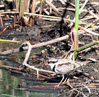
The Coongie Lakes is a freshwater wetland system located in the Far North region of South Australia. The 21,790-square-kilometre (8,410 sq mi) lakes system is located approximately 1,046 kilometres north of the Adelaide city centre. The wetlands includes lakes, channels, billabongs, shallow floodplains, deltas, and interdune swamps. It lies on the floodplain of Cooper Creek, an ephemeral river flowing through a desert landscape in the Lake Eyre Basin which rarely, after occasional large floods, empties into Lake Eyre. The wetland system has been recognised both as being of international importance by designation under the Ramsar Convention with a listing on 15 June 1987 and being nationally important within Australia with a listing in A Directory of Important Wetlands in Australia (DIWA). Its extent includes the regional town of Innamincka, the Malkumba-Coongie Lakes National Park, the Innamincka Regional Reserve, the Strzelecki Regional Reserve and the Coongie Lakes Important Bird Area.

Malkumba-Coongie Lakes National Park is a protected area located in the north-east of South Australia about 110 kilometres north-west of Innamincka.
The Narran Wetlands, also known as the Narran Lakes, contained within the Narran Lake Nature Reserve, comprise a series of protected ephemeral lakes and swamps fed by the Narran River in the north-west of New South Wales, Australia. The 26,480-hectare (65,400-acre) reserve is located approximately 50 kilometres (31 mi) east of Brewarrina.
Cordillo Downs or Cordillo Downs Station is both a pastoral lease currently operating as a cattle station and a formal bounded locality in South Australia. It is located about 116 kilometres (72 mi) north of Innamincka and 155 kilometres (96 mi) south east of Birdsville. The name and boundaries of the locality were created on 26 April 2013 for the long established local name.
Mulka Station is a pastoral lease that operates as a cattle station in the far north of South Australia.

The Haughton River is a river located in North Queensland, Australia.
A Regional Reserve is a type of protected area used in South Australia that allows the use of natural resources in conjunction with the protected area's conservation function. This class of protected area was first used in 1988 for the Innamincka Regional Reserve and as of 2015, there are seven regional reserves that cover an area of 93,400 square kilometres (36,062 sq mi) or 9.5% of South Australia's land area.
The Strzelecki Creek, part of the Lake Eyre basin, is an ephemeral watercourse located in the Australian state of South Australia.
Etadunna is a locality in the Australian state of South Australia located about 684 kilometres north of the capital city of Adelaide and about 108 kilometres north-east of the town of Marree.
