Australian Alps National Parks and Reserves

Last updated

Australian Alps National Parks and Reserves
Australia
Australian Alps, Vic.JPG
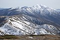
The Australian Alps viewed from Snowy River Road, near Suggan Buggan, Victoria.
AustAlpsRegionMap.png
Map of the region shaded as listed on the National Heritage List.
Australia relief map.jpg
Red pog.svg
Australian Alps National Parks and Reserves
Nearest town or city Canberra
Coordinates 37°S148°E / 37°S 148°E / -37; 148 Coordinates: 37°S148°E / 37°S 148°E / -37; 148
Established7 November 2008 (2008-11-07) [1]
Area16,531.80 km2 (6,383.0 sq mi)
Managing authorities
Website Australian Alps National Parks and Reserves

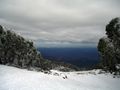
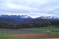
The Australian Alps National Parks and Reserves is a group of eleven protected areas consisting of national parks, nature reserves and one wilderness park located in the Australian Capital Territory, New South Wales and Victoria and which was listed as a "place" on the Australian National Heritage List on 7 November 2008 under the Environment Protection and Biodiversity Conservation Act 1999 . The listing which covers an area of 16,531.80 square kilometres (6,382.96 sq mi), contains the vast majority of alpine and sub-alpine environments in Australia. The listing includes the following protected areas - Alpine, Baw Baw, Brindabella, Kosciuszko, Mount Buffalo, Namadgi and Snowy River national parks; the Avon Wilderness Park, and the Bimberi, Scabby Range and Tidbinbilla nature reserves. [1] [2]

Contents

See also

Related Research Articles

<span class="mw-page-title-main">Namadgi National Park</span> Protected area in Australian Capital Territory

Namadgi National Park is a protected area in the south-west of the Australian Capital Territory (ACT), bordering Kosciuszko National Park in New South Wales. It lies approximately 40 kilometres (25 mi) southwest of Canberra, and occupies approximately 46 percent of the ACT's land area.

<span class="mw-page-title-main">Alpine National Park</span> Protected area in Victoria, Australia

The Alpine National Park is a national park located in the Central Highlands and Alpine regions of Victoria, Australia. The 646,000-hectare (1,600,000-acre) national park is located northeast of Melbourne. It is the largest National Park in Victoria, and covers much of the higher areas of the Great Dividing Range in Victoria, including Victoria's highest point, Mount Bogong at 1,986 metres (6,516 ft) and the associated subalpine woodland and grassland of the Bogong High Plains. The park's north-eastern boundary is along the border with New South Wales, where it abuts the Kosciuszko National Park. On 7 November 2008 the Alpine National Park was added to the Australian National Heritage List as one of eleven areas constituting the Australian Alps National Parks and Reserves.

<span class="mw-page-title-main">Skiing in Victoria</span>

Skiing in Victoria, Australia takes place in the Australian Alps located in the State of Victoria during the southern hemisphere winter. Victoria is the State with the greatest number of ski resorts in Australia. The highest peak in Victoria is Mount Bogong at 1986m. The first ski tow was constructed near Mount Buffalo in 1938. Victoria has a number of well developed ski resorts including Mount Hotham, Falls Creek and Mount Buller. Cross country skiing is popular in such national parks as Mount Buffalo National Park and Alpine National Park.

The Australian Capital Territory as of 2014 contains 46 separate protected areas with a total land area of 1,302 km2 (503 sq mi) or 55.5% of the territory's area, and which managed by Territory and Municipal Services of the ACT government:

The Kosciuszko National Park is a 6,900-square-kilometre (2,700 sq mi) national park and contains mainland Australia's highest peak, Mount Kosciuszko, for which it is named, and Cabramurra, the highest town in Australia. Its borders contain a mix of rugged mountains and wilderness, characterised by an alpine climate, which makes it popular with recreational skiers and bushwalkers.

<span class="mw-page-title-main">Baw Baw National Park</span> Protected area in Victoria, Australia

The Baw Baw National Park is a national park located on the boundary between the Victorian Alps and Gippsland regions of Victoria, Australia. The 13,530-hectare (33,400-acre) national park is situated approximately 120 kilometres (75 mi) east of Melbourne and 50 kilometres (31 mi) north of the Latrobe Valley. The park contains the forest covered Baw-Baw Plateau and surrounds the Mount Baw Baw Alpine Resort.

<span class="mw-page-title-main">Mount Kosciuszko</span> Highest mountain in mainland Australia

Mount Kosciuszko, previously spelled Mount Kosciusko, is mainland Australia's tallest mountain, at 2,228 metres (7,310 ft) above sea level. It is located on the Main Range of the Snowy Mountains in Kosciuszko National Park, part of the Australian Alps National Parks and Reserves, in New South Wales, Australia, and is located west of Crackenback and close to Jindabyne, near the border with Victoria.

<span class="mw-page-title-main">Australian Alps montane grasslands</span> Ecoregion in Australia

The Australian Alps montane grasslands is a montane grassland ecoregion of south-eastern Australia, restricted to the montane regions above 1300 metres .

<span class="mw-page-title-main">Australian Alps</span> Bioregion in Australia

The Australian Alps is a mountain range in southeast Australia. It comprises an interim Australian bioregion, and is the highest mountain range in Australia. The range straddles the borders of eastern Victoria, southeastern New South Wales, and the Australian Capital Territory. It contains Australia's only peaks exceeding 2,000 m (6,600 ft) in elevation, and is the only bioregion on the Australian mainland in which deep snow falls annually. The range comprises an area of 1,232,981 ha.

<span class="mw-page-title-main">Brindabella Range</span> Mountain range located in Australia

The Brindabella Range, commonly called The Brindabellas or The Brindies, is a mountain range located in Australia, on a state and territory border of New South Wales and the Australian Capital Territory (ACT). The range rises to the west of Canberra, the capital city of Australia, and includes the Namadgi National Park in the ACT and the Bimberi Nature Reserve and Brindabella National Park in New South Wales. The Brindabellas are visible to the west of Canberra and form an important part of the city's landscape.

<span class="mw-page-title-main">Victorian Alps</span>

The Victorian Alps, also known locally as the High Country, is a large mountain system in the southeastern Australian state of Victoria. Occupying the majority of eastern Victoria, it is the southwestern half of the Australian Alps, the tallest portion of the Great Dividing Range. The Yarra and Dandenong Ranges, both sources of rivers and drinking waters for Melbourne, are branches of the Victorian Alps.

<span class="mw-page-title-main">Australian Alps Walking Track</span> Hiking trail in South East Australia

The Australian Alps Walking Track is a long-distance walking trail through the alpine areas of Victoria, New South Wales and ACT. It is 655 km long, starting at Walhalla, Victoria and running through to Tharwa, ACT near Canberra. The track weaves mainly through Australian national parks, such as Alpine National Park and Kosciuszko National Park, though it is not exclusively restricted to national parks. It ascends many peaks including Mount Kosciuszko, Mount Bogong, and Bimberi Peak, the highest points in N.S.W., Victoria, and the A.C.T. respectively. The AAWT crosses exposed high plains including the Victorian Bogong High Plains and the Main Range in NSW. To walk the whole trail can take between 5 and 8 weeks. Food drops or a support crew are necessary, as the trail passes through no towns, although it passes close to the ski resorts of Mt Hotham, Falls Creek, Mt Baw Baw, Thredbo, Charlotte Pass and Perisher.

<span class="mw-page-title-main">Winter sport in Australia</span> Overview of winter sports practiced in Australia

Winter Sports in Australia encompasses a great variety of activities across the continent of Australia, including winter sports played in snow and ice such as ice hockey. Climate varies considerably from the tropical North to temperate South in Australia, and sporting practices vary accordingly. Ice and snow sports like Skiing in Australia are conducted in the high country of the Australian Alps and Tasmanian Wilderness. Australia has relatively low mountain ranges, but a long history of participation in recreational skiing and the Winter Olympic Games. Australians have won olympic gold in ice skating, skiing and snow-boarding events. Australia's generally flat geography and usually mild winter climate otherwise provide ideal conditions for international non-snow/ice winter sports and team games like Rugby Union Football, Rugby league Football and Association Football (Soccer), which are all popular sports during the Australian winter and in which Australia has enjoyed considerable international success. Australian rules football is a home-grown winter football code with a wide following throughout Australia. Many other sports are also played or watched in Australia through the winter season.

<span class="mw-page-title-main">Bimberi Nature Reserve</span> Protected area in New South Wales, Australia

The Bimberi Nature Reserve is a protected nature reserve located in the Brindabella Range of New South Wales, in eastern Australia. The 10,868-hectare (26,860-acre) reserve is situated approximately 30 km (19 mi) south west of Canberra, which is in the Australian Capital Territory.

Mount Kelly is a mountain with an elevation of 1,829 metres (6,001 ft) AHD  that is the tallest peak in the Scabby Range and is situated on the border of the Australian Capital Territory and New South Wales, Australia. The summit of the mountain is located within the ACT. The nearest town to the mountain is Adaminaby, approximately 32.8 kilometres (20.4 mi) to the south.

<span class="mw-page-title-main">Skiing in Australia</span> Overview of skiing practiced in Australia

Skiing in Australia takes place in the Australian Alps in the states of New South Wales, Victoria and the Australian Capital Territory as well as in the mountains of the island state Tasmania, during the Southern Hemisphere winter.

Mount Franklin is a mountain with an elevation of 1,646 metres (5,400 ft) AHD  in the Brindabella Ranges that is located on the border between the Australian Capital Territory and New South Wales, Australia. The summit of the mountain is located in the Australian Capital Territory.

<span class="mw-page-title-main">Skiing in the Australian Capital Territory</span>

Skiing in the Australian Capital Territory refers to snow skiing in the Australian Capital Territory (ACT). The highest mountain in the ACT is Bimberi Peak. Recreational skiing commenced with the formation of the Canberra Alpine Club in 1934. Since the 1930s, the ACT has had intermittent and limited alpine skiing facilities. Downhill ski facilities returned to the ACT at Corin Forest in 2016, after a two decade hiatus.

The Cobberas Range, a mountain range that is part of the Great Dividing Range within the Victorian Alps, is located in north-eastern Victoria in Australia. The range is located in the Cobberas Wilderness area of the Alpine National Park.

Scabby Range Nature Reserve is a heritage-listed protected area at Sams River Fire Trail, Yaouk, New South Wales, Australia. It was established on 3 December 1982 and added to the former Australian Register of the National Estate on 30 June 1992. It was added to the Australian National Heritage List as part of the Australian Alps National Parks and Reserves on 7 November 2008.

References

  1. 1 2 "National Heritage Places - Australian Alps National Parks and Reserves". Department for the Environment. Retrieved 16 June 2015.
  2. "INCLUSION OF A PLACE IN THE NATIONAL HERITAGE LIST" (PDF). Commonwealth of Australia. Retrieved 30 June 2015.

Commons-logo.svg Media related to Australian Alps National Parks and Reserves at Wikimedia Commons