
The Murrumbidgee River is a major tributary of the Murray River within the Murray–Darling basin and the second longest river in Australia. It flows through the Australian state of New South Wales and the Australian Capital Territory, descending 1,500 metres (4,900 ft) over 1,485 kilometres (923 mi), generally in a west-northwesterly direction from the foot of Peppercorn Hill in the Fiery Range of the Snowy Mountains towards its confluence with the Murray River near Boundary Bend.

The Molonglo River, a perennial river that is part of the Murrumbidgee catchment within the Murray–Darling basin, is located in the Monaro and Capital Country regions of New South Wales and the Australian Capital Territory, in Australia.

The District of Belconnen is one of the original eighteen districts of the Australian Capital Territory (ACT), used in land administration. The district is subdivided into 27 divisions (suburbs), sections and blocks. The district of Belconnen is largely composed of Canberra suburbs.

The District of Tuggeranong is one of the original eighteen districts of the Australian Capital Territory used in land administration. The district is subdivided into divisions (suburbs), sections and blocks and is the southernmost town centre of Canberra, the capital city of Australia. The district comprises nineteen suburbs and occupies 117 square kilometres (45 sq mi) to the east of the Murrumbidgee River.

Waramanga is a suburb of Canberra, Australian Capital Territory, Australia in the district of Weston Creek.

Lake Tuggeranong, an artificial lake sourced by the confluence of Tuggeranong Creek and stormwater discharge from urban and rural areas, is located in the Tuggeranong district of Canberra, within the Australian Capital Territory, Australia.

The Queanbeyan River, a perennial stream that is part of the Molonglo catchment within the Murray–Darling basin, is located in the Monaro and Capital Country regions of New South Wales and the Australian Capital Territory, in Australia. The river is 104 kilometres (65 mi) in length with a catchment area of 96,000 hectares. The Queanbeyan River and the Cotter River meet the potable water supply needs of the Canberra and Queanbeyan region and whose water quality is specifically protected under Federal legislation.

Bonython is a suburb of Tuggeranong, a township in southern Canberra, capital city of Australia.

Gordon is a suburb in the Canberra, Australia district of Tuggeranong. The postcode is 2906. The suburb is named after the poet Adam Lindsay Gordon (1833–1870). It was gazetted on 12 March 1987. Streets are named after sportspersons, an example is Woodfull Loop, named after the captain of the Australian cricket team during the Bodyline test series.

Greenway is a suburb in the Canberra, Australia district of Tuggeranong. The postcode is 2900. The suburb is named after the architect, Francis Greenway (1777–1837). It was gazetted on 17 October 1986. The streets are named after architects. It includes the Tuggeranong Town Centre, Lake Tuggeranong and small residential areas on the northwestern and northeastern shores of the lake.

Isabella Plains is a suburb in the Canberra, Australia district of Tuggeranong. The postcode is 2905. The suburb is indirectly named after Isabella Maria Brisbane (1821–1849), who was the daughter of Sir Thomas Brisbane, the colonial Governor of New South Wales when the area was first explored by white settlers in 1823. Joseph Wild was employed by Brigade Major John Ovens and Captain Mark Currie to guide them to the Murrumbidgee River. They travelled south along the river and named the area now known as Tuggeranong "Isabella's Plain". This name was adopted, with a slight change of spelling, for the name of the new suburb. It was gazetted on 5 August 1975. Streets are named after New South Wales parish names.
Kambah is the northernmost suburb in the district of Tuggeranong, Canberra. It is located just south of Mount Taylor in the Canberra Nature Park. It is located north of the suburbs of Greenway and Wanniassa. It is bounded by Sulwood Drive to the north and Athllon Drive to the south-east.

The geology of the Australian Capital Territory includes rocks dating from the Ordovician around 480 million years ago, whilst most rocks are from the Silurian. During the Ordovician period the region—along with most of eastern Australia—was part of the ocean floor. The area contains the Pittman Formation consisting largely of Quartz-rich sandstone, siltstone and shale; the Adaminaby Beds and the Acton Shale.

From 2016, the 25-member unicameral Australian Capital Territory Legislative Assembly is elected from five multi-member electorates, with five seats per electorate.

Ginninderra Creek, a partly perennial stream of the Murrumbidgee catchment within the Murray-Darling basin, is located in the Capital Country region spanning both the Australian Capital Territory and New South Wales, Australia.

Tantangara Dam is a major ungated concrete gravity dam with concrete chute spillway across the Murrumbidgee River in Tantangara, upstream of Adaminaby in the Snowy Mountains region of New South Wales, Australia. The dam is part of the Snowy Mountains Scheme, a vast hydroelectricity and irrigation complex constructed in south-east Australia between 1949 and 1974 and now run by Snowy Hydro. The purpose of the dam includes water management and conservation, with much of the impounded headwaters diverted to Lake Eucumbene. The impounded reservoir is called Tantangara Reservoir.

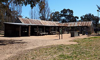
Pine Island Reserve, a reserve containing a small plantation of pine trees, is located on the Murrumbidgee River where the river flows through the Tuggeranong district of Canberra, in the Australian Capital Territory, Australia. The closest suburb to the reserve and river island is Greenway.

The Yanga National Park is a newly formed national park, located near the township of Balranald in south- western New South Wales. It covers an area of 66,734 hectares which includes 1,932 hectares of Yanga Nature Reserve, and has a frontage of 170 kilometres (110 mi) on the Murrumbidgee River. It is largely located in the Lower Murrumbidgee Floodplain, which is included on A Directory of Important Wetlands in Australia because of its importance as a breeding site for waterbirds when flooded.

Tuggeranong Creek, a partly perennial stream of the Murrumbidgee catchment within the Murray-Darling basin, is located in the Tuggeranong district of Canberra, within the Australian Capital Territory, Australia.

The Central Gardens Nature Reserve, also called Central Gardens, is a protected nature reserve located in the western suburbs of Sydney, New South Wales, Australia. Established in 1976, the 12-hectare (30-acre) reserve, garden and fauna and wildlife park is situated in the suburb of Merrylands and is managed by Cumberland Council. The park is regionally important and it attracts visitors outside the Cumberland local government area. The bushland contains remnants of Cumberland Plain Woodland and is approximately 3.5 hectares.


