Recherche Archipelago Nature Reserve

Last updated

Recherche Archipelago Nature Reserve
Western Australia
Goose Island & Pink Lake Middle Island Recherche Archipelago NR IV-2011.JPG
Goose Island, Lake Hillier Middle Island and Miles Island (April 2011)
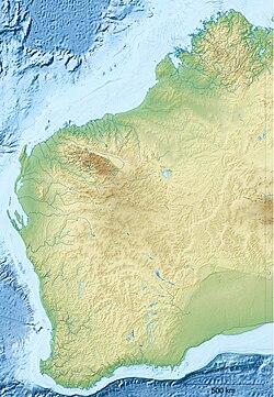
Australia Western Australia location map.svg
Red pog.svg
Recherche Archipelago Nature Reserve
Nearest town or city Esperance
Coordinates 34°6′1.7994″S123°11′16.0794″E / 34.100499833°S 123.187799833°E / -34.100499833; 123.187799833
Established21 May 1948 [1]
Area71.45 km2 (27.6 sq mi) [1]
Visitation"low" (in 2012) [2]
Managing authorities Department of Parks and Wildlife
See also List of protected areas of
Western Australia

Recherche Archipelago Nature Reserve is a protected area located in the Recherche Archipelago off the south coast of Western Australia. It consists of at least 104 islands and at least 1,200 obstacles to shipping (reefs, islets and rocks) and covers an area of sea extending 230 kilometres (140 miles) from east to west and up to a distance of 50 kilometres (31 miles) from the coast of the Australian continent. As of 2012, visitor access is limited to Middle Island within the nature reserve and is only available via a licensed tour operator. The nature reserve is classified as an IUCN Category Ia protected area. [1] [2]
See also

Related Research Articles

<span class="mw-page-title-main">Flinders Chase National Park</span> Protected area in South Australia

Flinders Chase National Park is a protected area in the Australian state of South Australia located at the west end of Kangaroo Island about 177 kilometres west-south west of the state capital of Adelaide and 110 kilometres west of the municipal seat of Kingscote. It is a sanctuary for endangered species and home to a few geological phenomena. It was the second national park to be declared in South Australia.

<span class="mw-page-title-main">Seal Bay Conservation Park</span> Protected area in South Australia

Seal Bay Conservation Park is a protected area located on the south coast of Kangaroo Island in the Australian state of South Australia. It is the home of the third largest Australian sea lion colony in Australia.

<span class="mw-page-title-main">Recherche Archipelago</span> Group of 105 islands in southern Western Australia

The Archipelago of the Recherche, known locally as the Bay of Isles, is a group of 105 islands, and over 1200 "obstacles to shipping", off the south coast of Western Australia. The islands stretch 230 km (140 mi) from east to west and to 50 km (31 mi) off-shore encompassing an area of approximately 4,000 square kilometres (1,544 sq mi). The western group is near Esperance and the eastern group at Israelite Bay. They are located in coastal waters, part of which is designated the Recherche Archipelago Nature Reserve.

<span class="mw-page-title-main">Lake Hillier</span> Pink-coloured lake in Western Australia

Lake Hillier is a saline lake on the edge of Middle Island, the largest of the islands and islets that make up the Recherche Archipelago in the Goldfields-Esperance region, off the south coast of Western Australia. It is particularly notable for its pink colour. A long and thin shore divides the Southern Ocean from the lake.

<span class="mw-page-title-main">Nuyts Archipelago</span> Group of islands off Southern Australia

The Nuyts Archipelago is an island group located in South Australia in the Great Australian Bight to the south of the town of Ceduna on the west coast of the Eyre Peninsula. It consisting of mostly granitic islands and reefs that provide breeding sites for Australian sea lions and support colonies of short-tailed shearwater. It also includes the island group known as the Isles of St Francis. All the islands with exception of a part of Evans Island, are located within the following protected areas: the Nuyts Archipelago Wilderness Protection Area and the Nuyts Archipelago Conservation Park.

Nuyts Archipelago Conservation Park is a protected area in the Australian state of South Australia located on Eyre Island and St Peter Island in the Nuyts Archipelago located off the west coast of Eyre Peninsula about 10 kilometres south and 25 kilometres south-east respectively of Ceduna.

Mount Taylor Conservation Park is a protected area in the Australian state of South Australia located on Kangaroo Island in the gazetted locality of Newland. It was dedicated in 1970 primarily for the conservation of the rare triggerplant Stylidium tepperianum.

Cape Bouguer Wilderness Protection Area is a protected area located on the south coast of Kangaroo Island in South Australia about 84 kilometres south-west of Kingscote. The wilderness protection area was proclaimed in October 1993 under the Wilderness Protection Act 1992 in order to ‘protect and preserve the outstandingly high wilderness qualities of the area.’ It was created on land excised from the Kelly Hill Conservation Park. It is classified as an IUCN Category Ib protected area.

Nuyts Archipelago Wilderness Protection Area is a protected area in the Australian state of South Australia located in the Nuyts Archipelago off the west coast of Eyre Peninsula within 10 kilometres to 75 kilometres south-west of Ceduna.

<span class="mw-page-title-main">Investigator Group Wilderness Protection Area</span> Protected area in South Australia

Investigator Group Wilderness Protection Area is a protected area in South Australia, located in the Investigator Group of islands off the west coast of Eyre Peninsula, between 25 kilometres and 70 kilometres south-west of Elliston.

Waldegrave Islands Conservation Park is a protected area located on the following islands within the Investigator Group in South Australia: the Waldegrave Island, Little Waldegrave Island and the Watchers.

Rocky Island (North) Conservation Park is a protected area in the Australian state of South Australia associated with North Rocky Island which is located off the west coast of Eyre Peninsula in South Australia about 43 kilometres north northwest of Coffin Bay. The conservation park which had been declared as Fauna Conservation Reserve in March 1967, was re-proclaimed in 1972 under the National Parks and Wildlife Act 1972 to ‘conserve seal haulout areas and associated island habitat.’ The conservation park is classified as an International Union for Conservation of Nature (IUCN) Category Ia protected area.

Rocky Island (South) Conservation Park is a protected area in the Australian state of South Australia associated with Rocky Island which is located off the west coast of Eyre Peninsula about 72 kilometres west-southwest of Coffin Bay. The conservation park was proclaimed in 1972 under the National Parks and Wildlife Act 1972 to ‘conserve New Zealand fur seal breeding areas and associated island habitat’. The conservation park is classified as an IUCN Category Ia protected area.

Sinclair Island Conservation Park is a protected area in the Australian state of South Australia associated with Sinclair Island which is located off the west coast of Eyre Peninsula about 24 kilometres south of Penong. The conservation park which was declared as Fauna Conservation Reserve in March 1967, was re-proclaimed in 1972 under the National Parks and Wildlife Act 1972 to ‘conserve island habitat and protect Australian sea lion haul-out areas.’

Baudin Conservation Park is a protected area located on the north coast of Dudley Peninsula on Kangaroo Island in South Australia about 2 kilometres south east of Penneshaw. It was proclaimed under the National Parks and Wildlife Act 1972 in 2002. The conservation park is classified as an IUCN Category III protected area.

Smooth Island is an island in the Australian state of South Australia located off the west coast of Eyre Peninsula about 52 kilometres south west of the town of Ceduna. It is both part of a local group of islands known as the Isles of St Francis group and a larger group known as the Nuyts Archipelago. It has enjoyed protected area status since the 1960s and since 2011, it has been part of the Nuyts Archipelago Wilderness Protection Area.

<span class="mw-page-title-main">Greenly Island Conservation Park</span> Protected area in South Australia

Greenly Island Conservation Park is a protected area associated with Greenly Island located off the west coast of Eyre Peninsula in South Australia about 70 kilometres west of Coffin Bay. It was declared in 1972 under the National Parks and Wildlife Act 1972 ‘to protect the island’s delicate ecology and Australian Sea-lion and New Zealand Fur-seal haul-out areas’ and continuing protected area status for the island which was first declared in 1919. The conservation park is classified as an IUCN Category Ia protected area.

Jones Island is an island in the Australian state of South Australia located at the mouth of Baird Bay in the north end of Anxious Bay about 45 kilometres south-southeast of the town of Streaky Bay on the west coast of Eyre Peninsula. The island is notable as a breeding site for Australian sea lions and Australian pelicans. The island has enjoyed protected area status since 1967 and as of 1972, it has been part of the Baird Bay Islands Conservation Park.

Pearson Isles is an island group located in the Australian state of South Australia about 65 kilometres to 72 kilometres west south-west of Cape Finniss on the west coast of Eyre Peninsula within the larger island group, the Investigator Group. The group was discovered and named by Matthew Flinders on 13 February 1802. The group has four members - Pearson Island, a pair of islands known as the Veteran Isles and Dorothee Island. The island group has enjoyed protected area status starting in 1916 and since 2011, it has been part of the Investigator Group Wilderness Protection Area. The island group is notable as a venue for scientific research.

Salisbury Island is located in the Recherche Archipelago off the south coast of Western Australia.

References

  1. 1 2 3 "Terrestrial Protected Areas of Western Australia (see 'DETAIL' tab)". CAPAD 2014. Australian Government - Department of the Environment. 2014. Retrieved 4 March 2015.
  2. 1 2 Esperance and Recherche parks and reserves draft management plan 2012 (PDF). Department of Environment and Conservation, Government of Western Australia. October 2012. pp. 2, 64, 68 & 75. Retrieved 1 March 2015.