| Tanami Desert | |
|---|---|
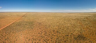 Tanami Desert, 2014 | |
 The IBRA regions, with Tanami highlighted in red | |
| Area | 259,972.77 km2 (100,376.05 sq mi) |
| Geography | |
| Country | Australia |
| State | Western Australia, Northern Territory |
| Coordinates | 20°S130°E / 20°S 130°E |
The Tanami Desert (Warlpiri : Jarnami) [1] is a desert in northern Australia, situated in the Northern Territory and Western Australia.
Contents
- Biological resources
- Mineral resources
- Local indigenous groups
- Southern Tanami Indigenous Protected Area
- See also
- Notes
- References
- External links
It has a rocky terrain and small hills. The Tanami was the Northern Territory's final frontier and was not fully explored by Australians of European descent until well into the twentieth century. It is traversed by the Tanami Track.
The name Tanami is thought to be an anglicisation of the Warlpiri name for the area, "Jarnami", meaning "never die". This referred to certain rock holes in the desert which were said never to run dry.
Under the name Tanami, the desert is classified as an interim Australian bioregion, comprising 25,997,277 hectares (64,240,670 acres). [2] [3] [4]