Furneaux bioregion

Last updated

Furneaux
Tasmania
IBRA 6.1 Flinders.png
The interim Australian bioregions, with Furneaux in red
Australia Tasmania location map.svg
Red pog.svg
Furneaux
Coordinates 40°10′S148°05′E / 40.167°S 148.083°E / -40.167; 148.083
Area538 km2 (207.7 sq mi)
Localities around Furneaux:
Bass Strait South East Coastal Plain Bass Strait
Bass Strait Furneaux Bass Strait
Tasmanian Northern Slopes Ben Lomond Bass Strait

Furneaux is an interim Australian bioregion that includes the Furneaux Group of more than one hundred islands off the northeast coast of Tasmania, as well as the northeast corner of Tasmania and Wilson's Promontory on the Australian mainland. It covers an area of 537,543 hectares (1,328,300 acres). [1] [2]

Contents

Furneaux Island, located at the eastern entrance to Bass Strait, is home to a range of native plants and animals, including the Furneaux burrowing crayfish, a threatened species of crayfish in the family Parastacidae, endemic to Australia. [3]

See also

Related Research Articles

<span class="mw-page-title-main">Tanami Desert</span> Desert in Northern Australia

The Tanami Desert is a desert in northern Australia, situated in the Northern Territory and Western Australia.

<span class="mw-page-title-main">Northern Kimberley</span> Bioregion in Western Australia

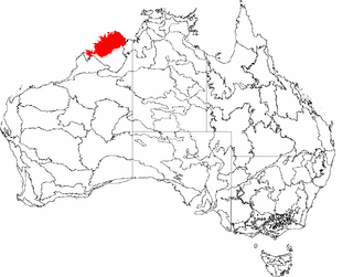
The Northern Kimberley, an interim Australian bioregion, is located in the northern Kimberley region of Western Australia, comprising 8,420,100 hectares.

<span class="mw-page-title-main">New England Tablelands bioregion</span> Region in Australia

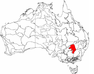
New England Tablelands, an interim Australian bioregion, is located mainly in New South Wales, comprising 3,002,213 hectares, of which 2,860,758 hectares or 95.23 per cent of the bioregion lies within New South Wales; and the residual within Queensland. This bioregion is one of the smaller bioregions in NSW, occupying 3.57 per cent of the state.

<span class="mw-page-title-main">Mitchell Grass Downs bioregion</span> Region in Australia

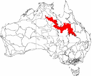
The Mitchell Grass Downs (MGD) is an IBRA biogeographic region, located in the Northern Territory and Queensland, which comprises an area of 33,468,761 hectares with eight subregions.

<span class="mw-page-title-main">Tasmanian Central Highlands</span> Bioregion in Tasmania, Australia

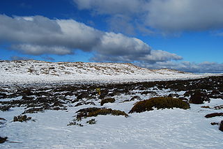
The Tasmanian Central Highlands is an interim Australian bioregion located in central highlands region of Tasmania, comprising 767,849 hectares.

<span class="mw-page-title-main">Tasmanian Northern Midlands</span> Bioregion in Tasmania, Australia

The Tasmanian Northern Midlands is an interim Australian bioregion located in northern midlands region of Tasmania, comprising 415,445 hectares.

<span class="mw-page-title-main">Tasmanian Northern Slopes</span> Bioregion in Tasmania, Australia

The Tasmanian Northern Slopes is an interim Australian bioregion located in the northern region of Tasmania, comprising 623,103 hectares.

<span class="mw-page-title-main">Tasmanian West</span> Bioegion in Tasmania, Australia

Tasmanian West is an interim Australian bioregion located in the western region of Tasmania, comprising 1,565,077 hectares.

<span class="mw-page-title-main">Tasmanian South East</span> Bioregion in Tasmania, Australia

The Tasmanian South East is an interim Australian bioregion located in the south-eastern region of Tasmania, comprising 1,131,822 hectares.

<span class="mw-page-title-main">Tasmanian Southern Ranges</span> Bioregion in Tasmania, Australia

The Tasmanian Southern Ranges is an interim Australian bioregion located in the southern region of Tasmania, comprising 757,228 hectares.

<span class="mw-page-title-main">Darwin Coastal</span> Region in the Northern Territory, Australia

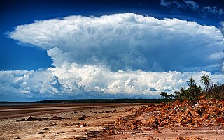
The Darwin Coastal, an IBRA bioregion, is located in the Northern Territory of Australia.

<span class="mw-page-title-main">King bioregion</span> Bioregion in Tasmania, Australia

King is an interim Australian bioregion which includes King Island, the Hunter Islands, Robbins Island, and the north-western tip of Tasmania. The bioregion covers 425,567 hectares.

<span class="mw-page-title-main">Ben Lomond bioregion</span> Bioregion in Tasmania, Australia

Ben Lomond is an interim Australian bioregion located in the north eastern region of Tasmania, comprising 657,500 hectares.

<span class="mw-page-title-main">Gulf Coastal</span> Region in the Northern Territory, Australia

The Gulf Coastal, an interim Australian bioregion, is located in the Northern Territory, comprising 2,711,718 hectares.

<span class="mw-page-title-main">Mount Isa Inlier</span> Region in Queensland, Australia

Mount Isa Inlier, an interim Australian bioregion, is located in the Queensland, and comprises 6,778,263 hectares.

The Pacific Subtropical Islands is an interim Australian bioregion which includes Norfolk Island and Lord Howe Island. Its IBRA code is PSI.

<span class="mw-page-title-main">Central Mackay Coast</span> Bioregion in Queensland, Australia

Central Mackay Coast, an interim Australian bioregion, is located in Queensland, and comprises 1,464,208 hectares.

<span class="mw-page-title-main">Cobar Peneplain</span> Region in New South Wales, Australia

Cobar Peneplain, an interim Australian bioregion, is located in New South Wales, and comprises 7,385,346 hectares.

<span class="mw-page-title-main">Tanami bioregion</span> Region in Australia

Tanami is an interim Australian bioregion, comprising 25,997,277 hectares in the Northern Territory and Western Australia. It is part of the Great Sandy-Tanami desert ecoregion.

<span class="mw-page-title-main">Bassian ecoregion</span> Marine ecoregion in Southern Australia

The Bassian ecoregion is a biogeographic region of Australia's coastal and continental shelf waters. It includes the cold-temperate waters surrounding Tasmania, including the central Bass Strait between Tasmania and the southern Australian mainland. This ecoregion, designated in the Marine Ecoregions of the World system by the World Wildlife Fund (WWF), includes both the Bass Strait Shelf and Tasmanian Shelf provincial level bioregions from the Integrated Marine and Coastal Regionalisation of Australia (IMCRA) system.

References

  1. "Interim Biogeographic Regionalisation for Australia (IBRA7) regions and codes". Department of the Environment and Energy . Australian Government. 2012. Retrieved 10 March 2017.
  2. "Interim Biogeographic Regionalisation for Australia, Version 7" (PDF). Department of the Environment and Energy . Australian Government. 2012. Retrieved 10 March 2017.
  3. "Engaeus martigener: Doran, N. And Horwitz, P". 2010. doi: 10.2305/IUCN.UK.2010-3.RLTS.T7737A12845688.en .{{cite journal}}: Cite journal requires |journal= (help)

Further reading