Coolgardie is an Australian bioregion consisting of an area of low hills and plains of infertile sandy soil in Western Australia. It has an area of 129,122.09 square kilometres (49,854.32 sq mi). It includes much of the Great Western Woodlands.
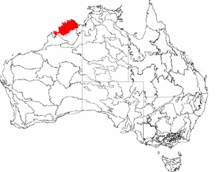
The Northern Kimberley, an interim Australian bioregion, is located in the northern Kimberley region of Western Australia, comprising 8,420,100 hectares.

The Victoria Bonaparte, an interim Australian bioregion, is located in the Northern Territory and Western Australia, comprising 7,301,242 hectares.

Yalgoo is an interim Australian bioregion located in Western Australia. It has an area of 5,087,577 hectares. The bioregion, together with the Avon Wheatbelt and Geraldton Sandplains bioregions, is part of the larger Southwest Australia savanna ecoregion as classified by the World Wildlife Fund.

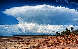
Dampierland is an interim Australian bioregion in Western Australia. The region is also a distinct physiographic section of the larger Nullagine Platform province, which in turn is part of the larger West Australian Shield division.

New England Tablelands, an interim Australian bioregion, is located mainly in New South Wales, comprising 3,002,213 hectares, of which 2,860,758 hectares or 95.23 per cent of the bioregion lies within New South Wales; and the residual within Queensland. This bioregion is one of the smaller bioregions in NSW, occupying 3.57 per cent of the state.
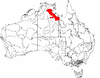
The Mitchell Grass Downs (MGD) is an IBRA biogeographic region, located in the Northern Territory and Queensland, which comprises an area of 33,468,761 hectares with eight subregions.

Tasmanian West is an interim Australian bioregion located in the western region of Tasmania, comprising 1,565,077 hectares.
The Darwin Coastal, an IBRA bioregion, is located in the Northern Territory of Australia.

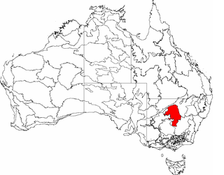
Nandewar, an interim Australian bioregion, is located in New South Wales and Queensland, and comprises an area of 2,701,977 hectares, surrounded by the Brigalow Belt South to the west, south-west and north-west, and to the east by the New England Tablelands. This is a region of hills on Palaeozoic sediments and lithosols and of Eucalyptus albens woodlands and summer rainfall.

The Pine Creek biogeographic region, an interim Australian bioregion, is located in the Northern Territory, and comprises 2,851,777 hectares.

The Gulf Coastal, an interim Australian bioregion, is located in the Northern Territory, comprising 2,711,718 hectares.

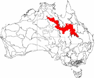
The Gulf Plains, an interim Australian bioregion (IBRA), is located in the Northern Territory and Queensland, comprising 22,041,825 hectares. It is one of 89 such bioregions defined in Australia, with 419 subregions as of IBRA version 7, compared with the 85 bioregions and 403 subregions described in IBRA6.1.

Burt Plain, an interim Australian bioregion, is located in the Northern Territory, and comprises 7,379,719 hectares.

The Simpson Strzelecki Dunefields, an interim Australian bioregion, comprises 27,984,283 hectares, and is part of four state/territories of Australia: the Northern Territory, South Australia, New South Wales and Queensland

Mount Isa Inlier, an interim Australian bioregion, is located in the Queensland, and comprises 6,778,263 hectares.

Central Mackay Coast, an interim Australian bioregion, is located in Queensland, and comprises 1,464,208 hectares.
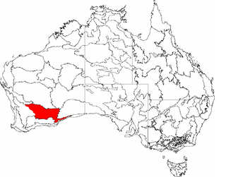
Cobar Peneplain, an interim Australian bioregion, is located in New South Wales, and comprises 7,385,346 hectares.

Finke, an interim Australian bioregion, comprises 7,267,416 hectares, and is part of two state/territories of Australia: the Northern Territory and South Australia. It is part of the Central Ranges xeric scrub ecoregion.

Stony Plains, an interim Australian bioregion, comprises 13,166,372 hectares, and is part of two state/territories of Australia: the Northern Territory and South Australia.