Sturt Plateau | |||||||||||||
|---|---|---|---|---|---|---|---|---|---|---|---|---|---|
 The interim Australian bioregions, with the Sturt Plateau in red | |||||||||||||
 Sturt Plateau | |||||||||||||
| Coordinates: 15°37′30″S132°39′17″E / 15.6251°S 132.6548°E | |||||||||||||
| Country | Australia | ||||||||||||
| State | Northern Territory | ||||||||||||
| Area | |||||||||||||
• Total | 98,575.31 km2 (38,060.14 sq mi) | ||||||||||||
| |||||||||||||
The Sturt Plateau, an interim Australian bioregion, is located in the Northern Territory, [1] [2] and covers an area of 9,857,531 hectares (24,358,490 acres). [3] The bioregion has the code STU. [3] There are three subregions. [3]
Contents
| IBRA regions and subregions: IBRA7 | ||||
|---|---|---|---|---|
| IBRA region / subregion | IBRA code | Area | States | Location in Australia |
| Sturt Plateau | STU | 9,857,531 hectares (24,358,490 acres) | NT | 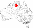 |
| Renehan | STU01 | 1,938,959 hectares (4,791,270 acres) | ||
| Newcastle | STU02 | 4,333,836 hectares (10,709,140 acres) | ||
| Birdum | STU03 | 3,584,736 hectares (8,858,080 acres) | ||