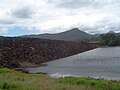
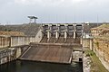
List of dams and reservoirs in Australia

Last updated

Map all coordinates using: OpenStreetMap
Tasmania's Gordon Dam, one of the largest in Australia, was constructed in the 1970s. It has a catchment area of 1,280 km2 (494 sq mi). Gordon Dam, Southwest National Park, Tasmania.jpg
Tasmania's Gordon Dam, one of the largest in Australia, was constructed in the 1970s. It has a catchment area of 1,280 km2 (494 sq mi).

Dams and reservoirs in Australia is a link page for any dam or reservoir in Australia.

Contents

Australian Capital Territory

There are three key water storage facilities located in the Australian Capital Territory. The fourth source of water for Canberra, Googong Dam, is in NSW. In addition, there are four smaller man-made reservoirs used for recreation and as traps for sediment and fertilizers .

Dams and reservoirs of the Australian Capital Territory
ImageDam name
(where appropriate)
Reservoir name [1]
(where appropriate)
Region(s)Waterway(s)
impounded [1]
Dam type [1] Purpose(s) [1] Reservoir capacity [1] Coordinates [2]
ML Gal (Imp.) Gal (US)
Bendora-dam-in-spill.jpg Bendora Dam Bendora Reservoir Namadgi National Park Cotter River Arch Water supply 11,5402.54×10^93.05×10^9 35°26′49″S148°49′41″E / 35.447°S 148.828°E / -35.447; 148.828 (Bendora Dam)
Corin Dam aerial W.jpg Corin Dam Corin ReservoirNamadgi National ParkCotter River Embankment Water supply75,50016.6×10^919.9×10^9 35°33′55″S148°49′52″E / 35.56541°S 148.83108°E / -35.56541; 148.83108 (Corin Dam)
Cotter Dam from below.JPG Cotter Dam Cotter ReservoirCotter River Gravity Water supply78,00017×10^921×10^9 35°19′10″S148°56′19″E / 35.31955°S 148.93853°E / -35.31955; 148.93853 (Cotter Dam)
DFRLake Ginninderra.jpg Ginninderra Weir Lake Ginninderra Belconnen Ginninderra Creek Artificial lake Recreation 35°14′S149°04′E / 35.233°S 149.067°E / -35.233; 149.067 (Lake Ginninderra)
Scrivener Dam with 3 open sluices.jpg Scrivener Dam Lake Burley Griffin Yarralumla Molonglo River GravityRecreation27,7406.10×10^97.33×10^9 35°17′59″S149°04′20″E / 35.29972°S 149.07222°E / -35.29972; 149.07222 (Scrivener Dam)
Strangerpond01.JPG n/a Stranger Pond Bonython Off-stream Artificial lakeRecreation 35°25′47″S149°4′11″E / 35.42972°S 149.06972°E / -35.42972; 149.06972 (Stranger Pond)
Lake tuggeranong reflection.jpg n/a Lake Tuggeranong Tuggeranong Tuggeranong Creek Artificial lakeRecreation 35°24′30″S149°04′00″E / 35.40833°S 149.06667°E / -35.40833; 149.06667 (Lake Tuggeranong)

New South Wales

There are 2,250 dams, weirs, catchments, and barrages in New South Wales. [2] Of these, 135 facilities are considered major dams according to the Australian National Committee on Large Dams. [1]

Dams and reservoirs

The largest reservoir in New South Wales is the 4,798,000-megalitre (1.055×10¹² imp gal; 1.267×10¹² US gal) Lake Eucumbene in the Snowy Mountains, formed by the Eucumbene Dam. [3]

Dams and reservoirs of New South Wales
ImageDam name
(where appropriate)
Reservoir name [1]
(where appropriate)
Region(s)Waterway(s)
impounded [1]
Dam type [1] Purpose(s) [1] Reservoir capacity [1] Coordinates [2]
ML Gal (Imp.) Gal (US)
AvonDam.JPG Avon Dam Avon Storage Reservoir Sydney
  Macarthur
  Illawarra
Avon River Gravity Water supply 214,3604.715×10105.663×1010 34°21′05″S150°38′28″E / 34.351389°S 150.641111°E / -34.351389; 150.641111 (Avon Dam)
Bankstownreservoir.jpg Bankstown Reservoir Sydney
  South-western Sydney
Water tower Water supply4.4970,0001,200,000 33°54′20″S151°02′23″E / 33.905494°S 151.03965°E / -33.905494; 151.03965 (Bankstown)
Bendeela Pondage Bendeela Pondage South Coast Kangaroo River Embankment Water supply1,200260×10^6320×10^6 34°43′30″S150°28′47″E / 34.725°S 150.479722°E / -34.725; 150.479722 (Bendeela Pondage)
Ben Boyd Dam South CoastWater Supply800180×10^6210×10^6 37°07′14″S149°51′18″E / 37.120456°S 149.854890°E / -37.120456; 149.854890 (Ben Boyd)
BenChifleyDamWall.jpg Ben Chifley Dam Central West Campbells River EmbankmentWater supply30,8006.8×1098.1×109 33°32′54″S149°38′05″E / 33.54833°S 149.63472°E / -33.54833; 149.63472 (Ben Chifley Dam)
BloweringDam 001 20060211.jpg Blowering Dam Blowering Reservoir Snowy Mountains Tumut River Embankment Flood mitigation
Hydroelectricity
Irrigation
Water supply
Conservation
1,628,0003.58×10114.30×1011 35°24′05″S148°14′52″E / 35.40139°S 148.24778°E / -35.40139; 148.24778 (Blowering Dam)
Brogo Dam South Coast Brogo River EmbankmentEnvironmental flows
Hydroelectricity
Irrigation
Water supply
8,9801.98×1092.37×109 36°29′24″S149°44′30″E / 36.4899724°S 149.7415495°E / -36.4899724; 149.7415495 (Brogo Dam)
Lake Burrendong.jpg Burrendong Dam Lake Burrendong Orana Macquarie River EmbankmentFlood mitigation
Hydroelectricity
Irrigation
Water supply
1,188,0002.61×10113.14×1011 32°40′04″S149°06′25″E / 32.667778°S 149.106944°E / -32.667778; 149.106944 (Burrendong Dam)
Burrinjuck Dam under construction.jpg Burrinjuck Dam Lake Burrinjuck Riverina Murrumbidgee River Gravity Hydroelectricity
Irrigation
1,026,0002.26×10112.71×1011 35°00′10″S148°35′02″E / 35.002683°S 148.583900°E / -35.002683; 148.583900 (Burrinjuck Dam)
CarcoarDam.jpg Carcoar Dam Central West Belubula River ArchIrrigation
Water supply
Water conservation
36,4008.0×1099.6×109 33°37′00″S149°10′45″E / 33.61667°S 149.17917°E / -33.61667; 149.17917 (Carcoar Dam)
Cascade Creek Dams Cascade Dam Blue Mountains Cascade CreekEmbankmentWater supply1,704375×10^6450×10^6 33°41′29″S150°18′05″E / 33.69139°S 150.30139°E / -33.69139; 150.30139 (Cascade Creek Dams)
Cataract at capacity.jpg Cataract Dam Cataract ReservoirSydney
 Macarthur
 Illawarra
Cararact River GravityWater supply94,3002.07×10102.49×1010 34°15′56″S150°48′11″E / 34.265597°S 150.803189°E / -34.265597; 150.803189 (Cataract Dam)
Chaffey Dam 21042018.jpg Chaffey Dam Chaffey Dam New England Peel River EmbankmentIrrigation
Water supply
102,8682.2628×10102.7175×1010 31°20′45″S151°08′19″E / 31.345833°S 151.138611°E / -31.345833; 151.138611 (Chaffey)
Chichester Dam 23042018.jpg Chichester Dam Lake Chichester Hunter Chichester River
Wangat River
21,5004.7×1095.7×109 32°14′15″S151°41′22″E / 32.2375361°S 151.689418°E / -32.2375361; 151.689418 (Chichester)
Clarrie Hall Dam Lake Clarrie Hall Northern Rivers Doon Doon Creek16,0003.5×1094.2×109 28°26′16″S153°18′19″E / 28.437778°S 153.305278°E / -28.437778; 153.305278 (Clarrie)
Cochrane Dam Cochrane LakeSouth CoastGeorges Creek38585×10^6102×10^6 36°33′54″S149°27′04″E / 36.565000°S 149.451111°E / -36.565000; 149.451111 (Cochrane)
Copeton Dam Spillway.jpg Copeton Dam Lake CopetonNew England Gwydir River Embankment1,364,0003.00×10113.60×1011 29°54′23″S150°55′38″E / 29.906389°S 150.927222°E / -29.906389; 150.927222 (Copeton)
CordeauxDam.JPG Cordeaux Dam Sydney
 Macarthur
 Illawarra
Cordeaux River GravityWater supply93,6002.06×10102.47×1010 34°20′25″S150°44′35″E / 34.34028°S 150.74306°E / -34.34028; 150.74306 (Cordeaux Dam)
Deep Creek Dam Deep Creek ReservoirSnowy MountainsDeep Creek112.4×10^62.9×10^6 36°00′35.7″S148°20′37.2″E / 36.009917°S 148.343667°E / -36.009917; 148.343667 (Deep Ck Dam)
Lakeeucumbenefrom sky.JPG Eucumbene Dam Lake EucumbeneSnowy Mountains Eucumbene River Embankment4,798,0001.055×10121.267×1012
FitzroyFallsReservoir.JPG Fitzroy Falls Dam Fitzroy Falls ReservoirSouth CoastYarrunga CreekEmbankmentWater supply9,9502.19×1092.63×109
Geehi Dam.jpg Geehi Dam Geehi ReservoirSnowy Mountains Geehi River Embankment21,0934.640×1095.572×109
Glenbawn Dam Lake GlenbawnHunter Hunter River 750,0001.6×10112.0×1011
Glennies Creek Dam Lake St ClairHunterHunter River283,0006.2×10107.5×1010
Googong Dam 15032019.jpg Googong Dam Googong Reservoir Capital Country Queanbeyan River 121,0832.6635×10103.1987×1010
Grahamstown Dam Hunter
Mid North Coast
Williams RiverWater Supply190,0004.2×10105.0×1010
Guthega Dam 19032019.jpg Guthega Dam Guthega PondageSnowy Mountains Snowy River GravityHydroelectricity1,604353×10^6424×10^6
Happy Jacks Dam Happy Jacks PondageSnowy MountainsTumut RiverGravityHydroelectricity27160×10^672×10^6
Hume dam.jpg Hume Dam Lake Hume (on border with Victoria)RiverinaMurray RiverEmbankment
Gravity
Hydroelectricity
Irrigation
3,038,0006.68×10118.03×1011
Island Bend Dam Island Bend PondageSnowy MountainsSnowy RiverGravityHydroelectricity3,084678×10^6815×10^6
Jindabyne Dam Lake JindabyneSnowy MountainsSnowy RiverEmbankmentHydroelectricity688,0001.51×10111.82×1011
Jounama Dam Jounama PondageSnowy MountainsTumut RiverEmbankmentHydroelectricity43,5429.578×1091.1503×1010
Keepit Dam Lake KeepitNew EnglandNamoi RiverIrrigation425,5109.360×10101.1241×1011
Khancoban Dam Khancoban ReservoirSnowy Mountains Swampy Plain River EmbankmentHydroelectricity26,6435.861×1097.038×109
Lake Rowlands Dam 06032017.jpg Lake Rowlands Dam Lake RowlandsCentral WestCoombing RivuletConcrete slab and buttressWater supply4,500990×10^61,200×10^6 33°40′16″S149°10′35″E / 33.671211°S 149.176272°E / -33.671211; 149.176272 (Lake Rowlands Dam)
Liverpool Offtake Reservoir Cecil HillsSouth West Sydneyfed from canalembankmentWater supply17037×10^645×10^6 33°53′24″S150°49′36″E / 33.889869°S 150.826790°E / -33.889869; 150.826790 (Liverpool Offtake)
Lostock Dam 08032017.jpg Lostock Dam Lostock DamHunter Paterson River EmbankmentWater Supply20,2204.45×1095.34×109
Lyell Dam Lake LyellCentral WestCoxs RiverWater Supply34,5007.6×1099.1×109
Malpas Dam Malpas ReservoirNew EnglandGara RiverWater Supply13,0002.9×1093.4×109
Mangrove Creek Dam Central Coast Mangrove Creek Water Supply190,0004.2×10105.0×1010
Manly Dam Wall.jpg Manly Dam Manly ReservoirSydney   Northern Beaches Curl Curl CreekGravityFlood Mitigation2,000440×10^6530×10^6 33°46′53″S151°15′21″E / 33.78139°S 151.25583°E / -33.78139; 151.25583 (Manly Dam)
Medlow Dam Medlow Bath Reservoir Blue Mountains Adams CreekBlue MountainsWater supply304.567,000×10^380,400×10^3 33°39′30″S150°17′57″E / 33.6583°S 150.2993°E / -33.6583; 150.2993 (Medlow Dam)
Murray Two Dam Murray Two PondageSnowy MountainsKhancoban BankArchHydroelectricity2,344516×10^6619×10^6
NepeanDam.JPG Nepean Dam Sydney
 Macarthur
 Illawarra
Nepean River Arch gravityWater supply70,1701.544×10101.854×1010 34°19′55″S150°37′05″E / 34.33194°S 150.61806°E / -34.33194; 150.61806 (Nepean Dam)
Oberon Dam Lake OberonCentral West Fish River Water Supply45,4209.99×1091.200×1010
Pindari Dam Lake PindariNorth West SlopesHydroelectricity312,0006.9×10108.2×1010
Aerial view of Prospect Reservoir.jpg Prospect Dam Prospect ReservoirSydney
  Western suburbs
Prospect Creek EmbankmentWater Supply50,2001.10×10101.33×1010
Rocky Creek Dam Northern RiversRocky CreekWater supply14,0003.1×1093.7×109
Rydal Dam Central TablelandsPower station cooling37081×10^698×10^6
Split Rock Dam Split Rock ReservoirNew England Manilla River Irrigation397,3708.741×10101.0497×1011
Spring Creek Dam Central WestSpring CreekMinor embankmentWater supply4,6801.03×1091.24×109
Stephens Creek Dam Stephens Creek Reservoir Far West Stephens CreekGravityWater supply2,000440×10^6530×10^6 31°52′42″S141°35′40″E / 31.87833°S 141.59444°E / -31.87833; 141.59444 (Stephens Creek Dam)
Suma Park Dam Suma Park ReservoirCentral WestSummer Hill CreekWater Supply17,2903.80×1094.57×109
Talbingo Dam Talbingo ReservoirSnowy MountainsTumut RiverEmbankmentHydroelectricity921,0002.03×10112.43×1011
TallowaDam Discharge2.JPG Tallowa Dam Lake YarrungaSouth Coast Shoalhaven River GravityWater supply90,0002.0×10102.4×1010 34°46′22″S150°18′48″E / 34.77278°S 150.31333°E / -34.77278; 150.31333 (Tallowa Dam)
Tantangara Dam Tantangara ReservoirSnowy MountainsMurrumbidge RiverGravityHydroelectricity254,0995.5894×10106.7126×1010
Tilba Dam South Coast9020×10^624×10^6
Tooma Dam Tooma ReservoirSnowy Mountains Tooma River EmbankmentHydroelectricity28,1246.186×1097.430×109 36°03′03.4″S148°16′30.5″E / 36.050944°S 148.275139°E / -36.050944; 148.275139 (Tooma Dam)
Toonumbar Dam Lake ToonumbarNorthern RiversIron Pot CreekWater Supply1,100240×10^6290×10^6
Tumut Pond Dam Tumut Pond ReservoirSnowy MountainsTumut River52,7931.1613×10101.3946×1010
Tumut Two Dam Tumut Two ReservoirSnowy MountainsTumut RiverGravityHydroelectricity2,677589×10^6707×10^6
Umberumberka Dam Umberumberka ReservoirFar WestUmberumberka CreekGravityWater Supply1,950430×10^6520×10^6 31°48′49″S141°12′38″E / 31.81361°S 141.21056°E / -31.81361; 141.21056 (Umberumberka Dam)
Warragamba Dam.jpg Warragamba Dam Lake Burragorang Sydney
 Macarthur
Coxs River
Kowmung River
Nattai River
Wingecarribee River
Wollondilly River
Warragamba River
GravityWater Supply2,027,0004.46×10115.35×1011 33°52′59″S150°35′44″E / 33.88306°S 150.59556°E / -33.88306; 150.59556 (Warragamba Dam)
Wentworth Falls Lake Wentworth FallsBlue MountainsJamison CreekNSWGR 33°42′13″S150°22′19″E / 33.703672°S 150.372042°E / -33.703672; 150.372042 (Wentworth Falls Lake)
Wilson Park Dam Wentworth FallsBlue MountainsJamison CreekNSWGR 33°42′40″S150°22′27″E / 33.711168°S 150.374302°E / -33.711168; 150.374302 (Wilson Park)
Windamere Dam Lake WindamereCentral West Cudgegong River Irrigation368,1208.098×10109.725×1010 32°43′40″S149°46′25″E / 32.727861°S 149.773510°E / -32.727861; 149.773510 (Windamere)
WingecarribeeReservoir.JPG Wingecarribee Dam Wingecarribee ReservoirSouth Coast Wingecarribee River EmbankmentWater supply25,8755.692×1096.835×109 34°32′29″S150°28′55″E / 34.54139°S 150.48194°E / -34.54139; 150.48194 (Wingecarribee Dam)
Woodford Creek Dam Blue MountainsWoodford CreekWater Supply1,431315×10^6378×10^6
Woronora Dam Woronora ReservoirSydney
  Southern Sydney Sutherland Shire
Woronora River 71,7901.579×10101.896×1010
Wyangaladamfullcapacity.jpg Wyangala Dam Lake WyangalaCentral WestLachlan RiverEmbankmentFlood mitigation
Hydroelectricity
Irrigation
Water supply
1,220,0002.7×10113.2×1011 33°58′23″S148°57′02″E / 33.973119°S 148.950503°E / -33.973119; 148.950503 (Wyangala Dam)
Yellow Pinch Dam Yellow Pinch DamSouth CoastYellow Pinch CreekEmbankmentWater supply3,000660×10^6790×10^6 36°49′55″S149°48′04″E / 36.83194°S 149.80111°E / -36.83194; 149.80111 (Yellow Pinch Dam)

Weirs and barrages

Weir/barrage name Region(s) Coordinates
Bonshaw Weir North West Slopes 28°59′09″S151°16′36″E / 28.985823°S 151.276757°E / -28.985823; 151.276757
Broughtons Pass Weir Upper Nepean 34°13′40″S150°44′33″E / 34.227666°S 150.742509°E / -34.227666; 150.742509 (Broughtons Pass)
Inverell Weir North West Slopes 29°47′32″S151°08′14″E / 29.792235°S 151.137205°E / -29.792235; 151.137205 (Inverell)
Marom Creek Weir Northern Rivers 28°50′59″S153°23′27″E / 28.849765°S 153.390965°E / -28.849765; 153.390965 (Marom Creek)
Penrith Weir Western Sydney 33°44′29″S150°41′04″E / 33.741337°S 150.684555°E / -33.741337; 150.684555 (Penrith)
Pheasants Nest Weir Upper Nepean 34°14′42″S150°40′01″E / 34.245065°S 150.666879°E / -34.245065; 150.666879 (Pheasants Nest)
Tareelaroi Weir North West Slopes 29°26′50″S150°02′17″E / 29.447109°S 150.038009°E / -29.447109; 150.038009 (Tareelaroi)

Cancelled and decommissioned

ImageDam/reservoir name
(where appropriate)
Region(s) StatusCoordinates
(where appropriate)
Balmain Reservoir 2.JPG Balmain Reservoir Sydney   Inner West Decommissioned 33°51′32″S151°10′56″E / 33.85889°S 151.18222°E / -33.85889; 151.18222 (Balmain Reservoir)
Centennial Park Reservoir Sydney
Gosling Creek Dam Central WestDecommissioned in 1962 33°18′54″S149°05′04″E / 33.31500°S 149.08444°E / -33.31500; 149.08444 (Gosling Creek Dam)
Paddington Reservoir Gardens 2010.jpg Paddington Reservoir SydneyDecommissioned in 1899
Tillegra Dam HunterProposed and cancelled in 2010 32°19′13″S151°41′10″E / 32.32028°S 151.68611°E / -32.32028; 151.68611 (Tillegra Dam)

Northern Territory

There are 805 named water storage facilities located in the Northern Territory. [2] Of these, four facilities are considered major dams according to the Australian National Committee on Large Dams. [1]

Dams of the Northern Territory
ImageDam name
(where appropriate)
Reservoir name
(where appropriate)
Region(s)Waterway(s) impoundedDam typePurpose(s)Reservoir capacity [1] Coordinates [2]
Copperfield Dam Copperfield Creek Embankment Water supply 500 ML (110×10^6 imp gal; 130×10^6 US gal)
Darwin River Dam Darwin River EmbankmentWater supply265,500 ML (58.4×10^9 imp gal; 70.1×10^9 US gal) 12°53′45″S131°02′20″E / 12.89583°S 131.03889°E / -12.89583; 131.03889 (Darwin River Dam)
Manton Dam Manton River Arch Recreation15,910 ML (3.50×10^9 imp gal; 4.20×10^9 US gal) 12°51′32″S131°07′12″E / 12.85889°S 131.12000°E / -12.85889; 131.12000 (Manton Dam)
Mary Ann Dam Lake Mary Ann Tennant Creek Mary Ann CreekEmbankmentRecreation450 ML (99×10^6 imp gal; 120×10^6 US gal) 19°36′36″S134°12′42″E / 19.61000°S 134.21167°E / -19.61000; 134.21167 (Lake Mary Ann)

Queensland

Dams and reservoirs

There are 183 key water storage facilities located in Queensland. These facilities represent a total capacity of 13,389 gigalitres (2,945×10^9 imp gal; 3,537×10^9 US gal) for Queensland. This does not include privately owned off-stream storage sites used for water harvesting. [4]

Dams of Queensland
ImageDam name
(where appropriate)
Reservoir name [1]
(where appropriate)
Region(s)Waterway(s)
impounded [1]
Dam type [1] Purpose(s) [1] Reservoir capacity [1] Coordinates [2]
ML Gal (Imp.) Gal (US)
Atkinson Dam wall 2.jpg Atkinson Dam Lake Atkinson South East
  West Moreton
Buaraba Creek Embankment Irrigation 30,5006.7×10^98.1×10^9 27°25′42″S152°26′39″E / 27.42833°S 152.44417°E / -27.42833; 152.44417 (Atkinson Dam)
Awoonga Dam.JPG Awoonga Dam Lake Awoonga FitzroyBoyne RiverEmbankmentWater Supply and Recreation777,000171×10^9205×10^9 24°07′53″S151°30′8″E / 24.13139°S 151.50222°E / -24.13139; 151.50222 (Awoonga Dam)
Bamboo Dam Lake BambooNorthBamboo CreekEmbankmentRecreation
Sunshine Coast, Queensland - Lake Baroon 2.jpg Baroon Pocket Dam Lake BaroonSouth East
  Sunshine Coast
Obi Obi CreekEmbankment Water supply 61,00013×10^916×10^9 26°42′12″S152°52′5″E / 26.70333°S 152.86806°E / -26.70333; 152.86806 (Baroon Pocket Dam)
Belmore Dam Lake Belmore Far NorthBelmore CreekEmbankmentWater Supply and Recreation5,8001.3×10^91.5×10^9 18°10′45″S142°15′41″E / 18.17917°S 142.26139°E / -18.17917; 142.26139 (Belmore Dam)
Biggera Creek Dam South East
  Gold Coast
Biggera CreekEmbankment Flood mitigation 2,980660×10^6790×10^6810×106980×106 27°56′54″S153°22′59″E / 27.94833°S 153.38306°E / -27.94833; 153.38306 (Biggera Creek Dam)
Bill Gunn Dam.jpg Bill Gunn Dam Lake DyerSouth East
  Lockyer Valley
Off-stream EmbankmentIrrigation6,9401,530×10^61,830×10^6 27°37′40″S152°22′37″E / 27.62778°S 152.37694°E / -27.62778; 152.37694 (Bill Gunn Dam)
Bjelke-Petersen Dam Lake BarambahSouth East
  South Burnett
Barker CreekEmbankmentWater Supply and Irrigation134,90029,700×10^635,600×10^6
Boondooma From Lookout 1.JPG Boondooma Dam Lake BoondoomaSouth East
  South Burnett
Boyne River EmbankmentWater Supply and Power Station134,90029,700×10^635,600×10^6
Boobir Dam South East
  South Burnett
Boobir CreekEmbankmentWater Supply17939×10^647×10^6
Borumba Dam Lake BorumbaSouth East
  Gympie
Yabba CreekEmbankmentIrrigation and Water Supply33,3007,300×10^68,800×10^6
Bromelton Dam Bromelton Offstream StorageSouth East
  Beaudesert
Off-streamEmbankmentWater supply8,2101,810×10^62,170×10^6 27°56′44″S152°57′14″E / 27.94556°S 152.95389°E / -27.94556; 152.95389 (Bromelton Dam)
Burdekin Dam.jpg Burdekin Falls Dam Lake DalrympleNorthBurdekin RiverGravityIrrigation & Water supply1,860,000410,000×10^6490,000×10^6
Burton Gorge Dam Isaac RiverRCC GravityWater supply14,829
Callide Dam Callide CreekEmbankmentWater Supply136,370
Cania Dam Three Moon CreekEmbankmentIrrigation and Water Supply88,580
Cedar Pocket Dam Deep CreekConcrete gravity and rock embankmentIrrigation730
Lake Clarendon Dam Lake ClarendonSouth East
 Lockyer Valley
Off-streamEmbankmentIrrigation24,3305.35×10^96.43×10^9 27°30′56″S152°21′4″E / 27.51556°S 152.35111°E / -27.51556; 152.35111 (Lake Clarendon Dam)
Connolly Dam Rosenthal CreekEmbankmentWater Supply2,157
Cooby Dam Cooby Creek ReservoirCooby CreekConcrete faced rockfillWater Supply23,100
Coolmunda Dam Australia.jpg Coolmunda Dam Lake CoolmundaMacintyre BrookEbankmentIrrigation and Water Supply69,090
Cooloolabin Dam Rocky CreekConcrete GravityWater Supply8,183
Copperlode Falls Dam Lake Morris Freshwater CreekEarth embankmentWater Supply38,475
Corella Dam Lake CorellaCorella RiverRockfill EmbankmentWater Supply10,500
Cressbrook Dam Lake CressbrookCressbrook CreekEarthfill EmbankmentWater Supply81,800
East Leichhardt Dam East Leichhardt RiverWater Supply12,100
E.J. Beardmore Dam Lake KajarabieBalonne RiverEarth and rockfill embankmentIrrigation and Water Supply81,800
Enoggera-Reservoir.JPG Enoggera Dam Enoggera ReservoirSouth East
  Brisbane
Enoggera Creek Earth-fill Water supply4,5671,005×10^61,206×10^6990×1061,200×106 27°26′50″S152°56′37″E / 27.44722°S 152.94361°E / -27.44722; 152.94361 (Enoggera Dam)
Eungella Dam Broken RiverEarth and rockfillIrrigation and Mining112,400
Ewen Maddock Dam South East
 Sunshine Coast
Addlington CreekEmbankmentWater supply16,5873.649×10^94.382×10^93.65×1094.38×109 26°40′51″S153°0′22″E / 26.68083°S 153.00611°E / -26.68083; 153.00611 (Ewen Maddock Dam)
Fairbairn Dam Lake Maraboon Central Queensland Nogoa River Embankment Irrigation
Water supply
Flood mitigation
1,301,000286×10^9344×10^9 23°39′00″S148°03′56″E / 23.65000°S 148.06556°E / -23.65000; 148.06556 (Fairbairn Dam)
Fred Haigh Dam Lake MonduranKolan RiverEarthfill embankmentIrrigation and Water Supply562,045
Gattonvale Offstream Storage Water Supply5,200
Glenlyon Dam spillway.jpg Glenlyon Dam Lake GlenlyonPike CreekEarth and rockfill embankmentIrrigation254,000
GoldCreekDam.JPG Gold Creek Dam Gold Creek ReservoirSouth East
 Brisbane
Gold Creek EmbankmentWater supply801176×10^6212×10^6 27°27′39″S152°52′52″E / 27.46083°S 152.88111°E / -27.46083; 152.88111 (Gold Creek Dam)
Gordonbrook Dam Stuart RiverEarthfill embankmentWater Supply6,800
(no dam) Green Hill Reservoir Chapel Hill, Queensland 15534×10^641×10^6
Hinze Dam - Spillway Tower (December 2011).png Hinze Dam Advancetown LakeSouth East
 Gold Coast
Nerang River EmbankmentWater supply
Flood mitigation
310,73068.35×10^982.09×10^9 28°3′2″S153°17′2″E / 28.05056°S 153.28389°E / -28.05056; 153.28389 (Hinze Dam)
Ibis Dam Ibis CreekConcrete GravityWater Supply225
Irvinebank Dam Gibbs CreekTimber and Concrete WeirWater Supply150
Julius Dam Lake Julius Leichhardt RiverMultiple arch concrete buttressIndustrial and Town Water Supply107,500
Kidston Dam Copperfield DamCopperfield RiverRoller compacted concreteWater Supply, Recreation, Pumped Hydro20,600
Kinchant Dam Sandy CreekEarth and rockfill embankmentIrrigation72,235
Kroombit Dam Kroombit CreekRoller Compacted ConcreteGroundwater Recharge14,600
Koombooloomba Dam Tully RiverConcrete GravityHydroelectricity186,750
Lake Gregory Isis Balancing StorageEarthfill embankmentIrrigation6,160
Lake Manchester Dam Lake ManchesterSouth East
  Ipswich
Cabbage Tree Creek Gravity Water supply
Recreation
26,0005.7×10^96.9×10^9 27°29′17″S152°45′5″E / 27.48806°S 152.75139°E / -27.48806; 152.75139 (Lake Manchester Dam)
Lenthalls Dam Lake LenthallBurrum RiverEarthfill embankmentWater Supply28,411
Leslie Dam (Queensland) (2104482638).jpg Leslie Dam Lake LeslieSandy CreekConcrete GravityIrrigation and Water Supply106,250
Leslie Harrison Dam from Allambee Crescent.jpg Leslie Harrison Dam Tingalpa ReservoirSouth East
 Brisbane
Tingalpa Creek EmbankmentWater supply13,2062.905×10^93.489×10^95.470×1096.569×109 27°31′41″S153°10′49″E / 27.52806°S 153.18028°E / -27.52806; 153.18028 (Leslie Harrison Dam)
Little Nerang Dam South East
 Gold Coast
Little Nerang CreekGravityWater supply8,3901.85×10^92.22×10^9 28°8′37″S153°17′8″E / 28.14361°S 153.28556°E / -28.14361; 153.28556 (Little Nerang Dam)
Maroon Dam wall.JPG Maroon Dam South East
  Scenic Rim
Burnett CreekEmbankmentIrrigation44,3009.7×10^911.7×10^9 28°10′51″S152°39′25″E / 28.18083°S 152.65694°E / -28.18083; 152.65694 (Maroon Dam)
Middle Creek Dam Plane CreekEarthfill embankmentWater Supply1,120
Lake Moogerah dam wall.jpg Moogerah Dam Lake MoogerahSouth East
  Fassifern Valley
Reynolds Creek Arch Irrigation
Water supply
83,70018.4×10^922.1×10^9 28°1′48″S152°32′56″E / 28.03000°S 152.54889°E / -28.03000; 152.54889 (Moogerah Dam)
Mount Isa, Queensland - Lake Moondarra.jpg Moondarra Dam Lake MoondarraLeichardt RiverConcrete-faced rockfill embankmentMine and urban water supply106,833
Meandu Creek Dam Meandu CreekZoned earthfillIrrigation and power station cooling water3,000
NorthPineDam.JPG North Pine Dam Lake SamsonvaleSouth East
  Moreton Bay
North Pine River GravityWater supply214,30247.140×10^956.613×10^9 27°15′48″S152°56′12″E / 27.26333°S 152.93667°E / -27.26333; 152.93667 (North Pine Dam)
Number 7 Dam Big Dam No 7,
Mount Morgan
Dee RiverMass concrete gravityWater supply2,830
Paluma dam A.jpg Paluma Dam Swamp CreekEarth core rock embankmentWater supply11,830
Paradise Dam Wide-Bay Burnett River GravityIrrigation300,0006.6×10107.9×101025°21′04″S 151°55′10″E
Perseverance Dam Lake PerseverancePerseverance CreekZoned earth and rockfillWater supply30,140
Peter Faust Dam.jpg Peter Faust Dam Lake Proserpine MackayWhitsunday Proserpine River Embankment Urban Water Supply, Irrigation & Recreation491,400108.1×10^9129.8×10^920.3673°S 148.378°E
Placer Dam Perry River DamPerry RiverRoller compacted concrete embankmentMine water supply1,050
Poona Dam South East
 Sunshine Coast
South Maroochy River Embankment Water storage 655144×10^6173×10^6 26°35′46″S152°54′36″E / 26.59611°S 152.91000°E / -26.59611; 152.91000 (Poona Dam)
Return Creek Dam Crooks DamReturn CreekEarthfill embankmentStock water supply and recreation1,045
Rifle Creek Dam Rifle CreekConcrete archUrban and mine water supply9,500
Ross River Dam North

- Townsville

EmbankmentWater supply

Flood mitigation

233,187
Sideling Creek Dam Lake KurwongbahSouth East
 Moreton Bay
Sideling CreekEmbankmentWater supply
Recreation
14,5003.2×10^93.8×10^9 27°15′28″S152°57′7″E / 27.25778°S 152.95194°E / -27.25778; 152.95194 (Sideling Creek Dam)
Six Mile Creek Dam Lake MacdonaldSouth East
 Sunshine Coast
Six Mile CreekEmbankmentWater supply
Recreation
8,0181.764×10^92.118×10^9 26°22′52″S152°55′48″E / 26.38111°S 152.93000°E / -26.38111; 152.93000 (Six Mile Creek Dam)
Solomon Dam Palm IslandWater Supply
SomersetDamWallNew.JPG Somerset Dam Lake SomersetSouth East
  Somerset Region
Stanley River GravityWater supply
Flood mitigation
Recreation
Hydroelectricity
379,84983.555×10^9100.345×10^9199×109239×109 27°6′52″S152°33′25″E / 27.11444°S 152.55694°E / -27.11444; 152.55694 (Somerset Dam)
Southedge Dam Mitchell RiverEmbankmentRecreation and water supply159,120
Splityard Creek Dam.JPG Splityard Creek Dam South East
 Somerset Region
Pryde CreekEmbankmentHydroelectricity28,7006,300×10^67,600×10^6 27°22′16″S152°38′13″E / 27.37111°S 152.63694°E / -27.37111; 152.63694 (Splityard Creek Dam)
Stannary Hills Dam Eureka CreekMining340
Tallebudgera Creek Dam, Tallebudgera Valley, Queensland.jpg Tallebudgera Creek Dam South East
 Gold Coast
Tallebudgera CreekEarthfill embankmentWater supply360
Teemburra Dam Teemburra CreekConcrete faced rockfill embankmentIrrigation, Urban and Industrial water supply147,500
Theresa Creek Dam Theresa CreekConcrete gravityTown water Supply and recreation9,200
Tinaroo Dam Lake TinarooBarron RiverMass concrete gravityIrrigation438,920
Teviot Creek Dam Roller compacted concreteMining24,000
Water pouring over Wappa Dam, May 2015.jpg Wappa Dam South East
 Sunshine Coast
South Maroochy RiverGravityWater supply4,6101,010×10^61,220×10^6 26°34′12″S152°55′19″E / 26.57000°S 152.92194°E / -26.57000; 152.92194 (Wappa Dam)
Wild River Dam Herberton DamWild RiverEarth and rockfill embankmentTown water supply290
Wivenhoe dam wall.jpg Wivenhoe Dam Lake WivenhoeSouth East
 Brisbane/Gold Coast
Brisbane River EmbankmentWater supply
Flood mitigation
Hydroelectricity
Recreation
1,165,238256.317×10^9307.823×10^9 27°23′38″S152°36′28″E / 27.39389°S 152.60778°E / -27.39389; 152.60778 (Wivenhoe Dam)
Wuruma Dam Nogo RiverMass concrete gravityIrrigation and town water supply165,400
Wyaralong Dam.JPG Wyaralong Dam South East
 Scenic Rim
Teviot BrookGravityWater supply102,88322,631×10^627,179×10^6 27°54′33″S152°52′52″E / 27.90917°S 152.88111°E / -27.90917; 152.88111 (Wyaralong Dam)

Weirs and barrages

NameCoordinates
Allan Tannock Weir (Cunnamulla Weir) 28°07′03″S145°41′10″E / 28.1174°S 145.686°E / -28.1174; 145.686
Aplins Weir 19°18′14″S146°46′52″E / 19.304°S 146.781°E / -19.304; 146.781
Avis Weir 24°58′46″S151°07′23″E / 24.9794°S 151.123°E / -24.9794; 151.123
Baron River Hydro Weir 16°49′52″S145°38′24″E / 16.8311°S 145.640°E / -16.8311; 145.640
Bazley Weir 24°53′37″S151°07′23″E / 24.8937°S 151.123°E / -24.8937; 151.123
Bedford Weir 23°22′18″S148°50′28″E / 23.3716°S 148.841°E / -23.3716; 148.841
Ben Anderson Barrage 24°53′19″S152°17′24″E / 24.8885°S 152.2899°E / -24.8885; 152.2899
Ben Dor Weir 28°33′51″S150°51′58″E / 28.5642°S 150.866°E / -28.5642; 150.866
Bonshaw Weir 28°59′09″S151°16′37″E / 28.9857°S 151.277°E / -28.9857; 151.277
Bingegang Weir 23°04′21″S149°02′02″E / 23.0726°S 149.0340°E / -23.0726; 149.0340
Bingera Weir 24°56′35″S152°12′47″E / 24.9431°S 152.213°E / -24.9431; 152.213
Blacks Weir 19°19′01″S146°44′10″E / 19.3170°S 146.7360°E / -19.3170; 146.7360
Blue Valley Weir 20°24′29″S147°23′35″E / 20.4081°S 147.393°E / -20.4081; 147.393
Bowen River Weir 20°44′46″S147°56′20″E / 20.7461°S 147.9390°E / -20.7461; 147.9390
Brightview Weir 27°29′48″S152°30′04″E / 27.4966°S 152.501°E / -27.4966; 152.501
Bromleton Weir 28°00′24″S152°56′46″E / 28.0066°S 152.946°E / -28.0066; 152.946
Bruce Weir 17°06′39″S145°06′58″E / 17.1108°S 145.116°E / -17.1108; 145.116
Buaraba Creek Weir 27°24′37″S152°25′08″E / 27.4104°S 152.419°E / -27.4104; 152.419
Bucca Weir 24°51′35″S152°04′23″E / 24.8596°S 152.073°E / -24.8596; 152.073
Buckinbah Weir 28°05′12″S148°46′01″E / 28.0868°S 148.767°E / -28.0868; 148.767
Carpendale Grove Weir 27°34′16″S152°09′24″E / 27.5712°S 152.1566°E / -27.5712; 152.1566
Cedar Grove Weir 27°50′47″S152°58′30″E / 27.8465°S 152.975°E / -27.8465; 152.975
Cecil Weir 27°32′03″S151°12′11″E / 27.5342°S 151.203°E / -27.5342; 151.203
Charters Towers Weir 19°57′58″S146°18′25″E / 19.9662°S 146.307°E / -19.9662; 146.307
Chinchilla Weir 26°48′05″S150°34′37″E / 26.8013°S 150.577°E / -26.8013; 150.577
Churchbank Weir 27°46′17″S152°41′02″E / 27.7714°S 152.684°E / -27.7714; 152.684
Clare Weir 19°51′27″S147°14′10″E / 19.8574°S 147.236°E / -19.8574; 147.236
Claredon Weir 27°31′36″S152°22′30″E / 27.5267°S 152.375°E / -27.5267; 152.375
Claude Wharton Weir 25°36′57″S151°35′38″E / 25.6157°S 151.594°E / -25.6157; 151.594
Collins Weir 17°15′29″S145°17′38″E / 17.258°S 145.294°E / -17.258; 145.294
Comet River Weir 23°36′49″S148°33′04″E / 23.6137°S 148.551°E / -23.6137; 148.551
Crump Weir 24°49′13″S149°44′53″E / 24.8204°S 149.748°E / -24.8204; 149.748
Dulbil Weir 17°02′32″S145°28′19″E / 17.0422°S 145.472°E / -17.0422; 145.472
Dumbleton Weir 21°08′33″S149°04′37″E / 21.1426°S 149.077°E / -21.1426; 149.077
Eden Bann Weir 23°05′27″S150°06′58″E / 23.0907°S 150.116°E / -23.0907; 150.116
Fitzroy River Barrage (Queensland) 23°21′39″S150°29′53″E / 23.3608°S 150.498°E / -23.3608; 150.498
Fletcher Creek Weir 23°45′48″S150°22′01″E / 23.7632°S 150.367°E / -23.7632; 150.367
Flagstone Creek Weir 27°36′58″S152°06′47″E / 27.6161°S 152.113°E / -27.6161; 152.113
Francis Weir 26°18′S152°02′E / 26.30°S 152.04°E / -26.30; 152.04
Gatton Weir 27°33′36″S152°15′18″E / 27.5600°S 152.2550°E / -27.5600; 152.2550
Giru Weir 19°30′37″S147°06′47″E / 19.5102°S 147.1130°E / -19.5102; 147.1130
Glebe Weir 25°27′54″S150°02′06″E / 25.4649°S 150.035°E / -25.4649; 150.035
Gleesons Weir 19°19′04″S146°44′42″E / 19.3177°S 146.745°E / -19.3177; 146.745
Glenore Weir 17°51′39″S141°07′48″E / 17.8609°S 141.130°E / -17.8609; 141.130
Glenore Grove Weir 27°31′07″S152°24′18″E / 27.5185°S 152.405°E / -27.5185; 152.405
Goondiwindi Weir 28°33′00″S150°15′00″E / 28.550°S 150.25°E / -28.550; 150.25
Gorge Weir 20°28′22″S147°17′24″E / 20.4727°S 147.29°E / -20.4727; 147.29
Granite Creek Weir 17°00′58″S145°22′34″E / 17.016°S 145.376°E / -17.016; 145.376
Grantham Weir 27°34′32″S152°13′01″E / 27.5755°S 152.217°E / -27.5755; 152.217
Gyranda Weir 25°17′00″S150°10′55″E / 25.2834°S 150.182°E / -25.2834; 150.182
Imbil Weir 26°27′30″S152°41′02″E / 26.4582°S 152.684°E / -26.4582; 152.684
NameCoordinates
Intake Weir 26°35′00″S152°52′59″E / 26.5833°S 152.883°E / -26.5833; 152.883
Jack Taylor Weir 28°02′38″S148°34′02″E / 28.04395°S 148.56721°E / -28.04395; 148.56721
Joe Sippel Weir 26°16′07″S152°00′25″E / 26.2687°S 152.007°E / -26.2687; 152.007
John Goleby Weir 25°15′18″S151°08′53″E / 25.2549°S 151.148°E / -25.2549; 151.148
Jones Weir 25°35′40″S151°17′49″E / 25.5945°S 151.297°E / -25.5945; 151.297
Jordan's Weir 27°32′32″S152°19′12″E / 27.5421°S 152.320°E / -27.5421; 152.320
Junction Weir 27°56′08″S152°35′53″E / 27.9356°S 152.5980°E / -27.9356; 152.5980
Kentville Weir 27°29′34″S152°26′17″E / 27.4927°S 152.438°E / -27.4927; 152.438
Kilcoy Weir 26°55′12″S152°34′55″E / 26.9199°S 152.5820°E / -26.9199; 152.5820
Kirar Weir (Eidsvold) 25°21′09″S151°04′19″E / 25.3525°S 151.072°E / -25.3525; 151.072
Kolan Barrage 24°44′28″S152°09′50″E / 24.741°S 152.164°E / -24.741; 152.164
Leafgold Weir 17°08′56″S145°03′11″E / 17.1488°S 145.053°E / -17.1488; 145.053
Lower Flagstone Creek Weir 27°35′32″S152°08′31″E / 27.5923°S 152.142°E / -27.5923; 152.142
Lower Tenthill Weir 27°35′34″S152°14′10″E / 27.5929°S 152.236°E / -27.5929; 152.236
McCauley Weir 26°45′15″S152°04′47″E / 26.754070°S 152.079655°E / -26.754070; 152.079655
Ma Ma Weir 27°39′24″S152°09′40″E / 27.6568°S 152.1610°E / -27.6568; 152.1610
Maleny Weir 26°45′00″S152°49′59″E / 26.750°S 152.833°E / -26.750; 152.833
Marian Weir 21°08′24″S148°56′13″E / 21.1399°S 148.937°E / -21.1399; 148.937
Mary Barrage 25°35′14″S152°37′25″E / 25.58733°S 152.62366°E / -25.58733; 152.62366
Mirani Weir 21°10′36″S148°49′48″E / 21.1768°S 148.830°E / -21.1768; 148.830
Monto Weir 24°51′29″S151°06′22″E / 24.858°S 151.106°E / -24.858; 151.106
Moolabah Weir 27°59′28″S148°44′06″E / 27.99112°S 148.73498°E / -27.99112; 148.73498
Moura Weir 24°35′22″S149°54′07″E / 24.5895°S 149.902°E / -24.5895; 149.902
Mount Crosby Weir 27°32′15″S152°47′53″E / 27.5374°S 152.798°E / -27.5374; 152.798
Mulgildie Weir 25°01′08″S151°05′35″E / 25.0189°S 151.093°E / -25.0189; 151.093
Mulgowie Weir 27°45′12″S152°22′19″E / 27.7533°S 152.372°E / -27.7533; 152.372
Mungungo Weir 24°45′51″S151°09′36″E / 24.7641°S 151.1600°E / -24.7641; 151.1600
Murgon Weir 26°15′54″S151°54′54″E / 26.265°S 151.915°E / -26.265; 151.915
Nanango Weir 26°39′01″S151°55′26″E / 26.6502°S 151.9240°E / -26.6502; 151.9240
Ned Churchward Weir 25°03′03″S152°05′53″E / 25.0509°S 152.0980°E / -25.0509; 152.0980
Neil Turner Weir 26°28′15″S147°57′32″E / 26.47096°S 147.95891°E / -26.47096; 147.95891
Neville Hewitt Weir 24°10′17″S149°48′50″E / 24.1714°S 149.8140°E / -24.1714; 149.8140
Orange Creek Weir 24°57′45″S150°04′23″E / 24.96250°S 150.07317°E / -24.96250; 150.07317
O'Reillys Weir 27°25′05″S152°35′28″E / 27.4180°S 152.5910°E / -27.4180; 152.5910
Proston Weir 26°12′03″S151°32′49″E / 26.2007°S 151.547°E / -26.2007; 151.547
Sandy Creek Weir 27°38′14″S152°19′55″E / 27.6371°S 152.332°E / -27.6371; 152.332
Selma Weir 22°32′31″S148°08′46″E / 22.542°S 148.146°E / -22.542; 148.146
Silverleaf Weir 26°09′57″S151°48′50″E / 26.1659°S 151.814°E / -26.1659; 151.814
Solarnum Weir 17°12′14″S145°03′50″E / 17.2039°S 145.064°E / -17.2039; 145.064
Tartrus Weir 22°57′26″S149°25′19″E / 22.9571°S 149.4220°E / -22.9571; 149.4220
Talgai Weir 27°59′28″S151°45′29″E / 27.991°S 151.758°E / -27.991; 151.758
Tenthill Weir 27°38′15″S152°12′58″E / 27.6376°S 152.216°E / -27.6376; 152.216
Teddington Weir 25°39′00″S152°39′58″E / 25.6501°S 152.666°E / -25.6501; 152.666
Theodore Weir 24°57′01″S150°04′00″E / 24.9502°S 150.0666°E / -24.9502; 150.0666
Tinana Barrage 25°34′10″S152°43′08″E / 25.5695°S 152.7190°E / -25.5695; 152.7190
Val Bird Weir 19°33′49″S147°05′46″E / 19.5637°S 147.096°E / -19.5637; 147.096
Walla Weir 25°03′07″S152°05′56″E / 25.052°S 152.099°E / -25.052; 152.099
Whetstone Weir 28°28′01″S150°57′18″E / 28.4669°S 150.955°E / -28.4669; 150.955
Wilson Weir 27°32′23″S152°20′31″E / 27.5397°S 152.342°E / -27.5397; 152.342
Yarramalong Weir 27°50′07″S151°27′00″E / 27.8353°S 151.4499°E / -27.8353; 151.4499
Youlambie Weir 24°49′09″S151°05′46″E / 24.8192°S 151.096°E / -24.8192; 151.096
Map all coordinates using: OpenStreetMap

South Australia

Adelaide catchment

Regional South Australia

Tasmania

There are 103 dams in Tasmania. [2] Of these, 100 facilities are considered major dams according to the Australian National Committee on Large Dams. [1]

Dams and reservoirs

The largest reservoir in Tasmania is the 12,359-gigalitre (2,719×10^9 imp gal; 3,265×10^9 US gal) Lake Gordon in the South West region of the state, formed by the Gordon Dam. As of 2015, 44 per cent of all the dams in Tasmania were constructed for the purpose of generating hydro-electricity. [1]

Dams of Tasmania
ImageDam name
(where appropriate)
Reservoir name [1]
(where appropriate)
Region(s)Waterway(s)
impounded [1]
Dam type [1] Purpose(s) [1] Reservoir capacity [1] Coordinates [2]
ML Gal (Imp.) Gal (US)
Anthony Dam Lake Plimsoll West Coast Anthony River Embankment Hydro-electricity 36,1807.96×10^99.56×10^9
Anthony Leveeoff streamEmbankmentHydro-electricity36,1807.96×10^99.56×10^9
Augusta DamLake Augusta Ouse River EmbankmentHydro-electricity23,4505.16×10^96.19×10^9
Bastyan Dam Lake Rosebery West Coast Pieman River EmbankmentHydro-electricity123,52027.17×10^932.63×10^9 43°43′48″S145°31′48″E / 43.73000°S 145.53000°E / -43.73000; 145.53000 (Bastyan Dam)
Bastyan Leveeoff streamEmbankmentHydro-electricity123,52027.17×10^932.63×10^9
Bradys Lake
Briseis DamNorth East
Crotty Dam Lake Burbury West Coast King River EmbankmentHydro-electricity1,081,420237.88×10^9285.68×10^9 42°09′35″S145°37′00″E / 42.15972°S 145.61667°E / -42.15972; 145.61667 (Crotty Dam)
Cascade Dam North EastCascade River 41°10′14″S147°49′20″E / 41.17056°S 147.82222°E / -41.17056; 147.82222 (Cascade Dam)
Catagunya Dam Lake Catagunya Central Highlands River Derwent Gravity Hydro-electricity25,6405.64×10^96.77×10^9 42°26′24″S146°35′24″E / 42.44000°S 146.59000°E / -42.44000; 146.59000 (Catagunya Dam)
Cethana Dam Lake CethanaNorthernForth RiverEmbankmentHydro-electricity112,21024.68×10^929.64×10^9 41°22′47″S146°08′01″E / 41.37972°S 146.13361°E / -41.37972; 146.13361 (Cethana Dam)
Clarence Dam
Clarkdam.jpg Clark Dam Lake King WilliamCentral HighlandsRiver DerwentArchHydro-electricity539,340118.64×10^9142.48×10^9 42°15′36″S146°15′36″E / 42.26000°S 146.26000°E / -42.26000; 146.26000 (Clark Dam)
Cluny Dam Cluny LagoonCentral HighlandsRiver DerwentGravityHydro-electricity4,8801.07×10^91.29×10^9 42°30′00″S146°40′48″E / 42.50000°S 146.68000°E / -42.50000; 146.68000 (Cluny Dam)
Craigborne DamSouthCoal RiverIrrigation
Curries River Reservoir
Darwin Dam Lake BurburyWest Coastoff streamEmbankmentHydro-electricity1,081,420237.88×10^9285.68×10^9 42°12′36″S145°36′36″E / 42.21000°S 145.61000°E / -42.21000; 145.61000 (Darwin Dam)
Devil's Gate Dam Tasmania.jpg Devils Gate Dam Lake Barrington Northern Forth River Arch Hydro-electricity179,94039.58×10^947.54×10^9 41°20′24″S146°15′36″E / 41.34000°S 146.26000°E / -41.34000; 146.26000 (Devils Gate Dam)
Edgar Dam Lake Pedder South West off riverEmbankmentHydro-electricity2,937,930646.25×10^9776.12×10^9 43°01′48″S146°20′24″E / 43.03000°S 146.34000°E / -43.03000; 146.34000 (Edgar Dam)
Risdon Zinc Works
Flagstaff Gully Dam
Ford Dam
Frome DamNorth EastFrome RiverEmbankmentHydro-electricity 41°08′41″S147°54′42″E / 41.14472°S 147.91167°E / -41.14472; 147.91167 (Frome Dam)
Gordon Dam.jpg Gordon Dam Lake Gordon South West Gordon River ArchHydro-electricity12,359,0402,718.61×10^93,264.91×10^9 42°43′50″S145°58′35″E / 42.73056°S 145.97639°E / -42.73056; 145.97639 (Gordon Dam)
Miena Rockfill Dam Great Lake Central Northern Shannon River EmbankmentHydro-electricity3,156,640694.36×10^9833.90×10^9 41°58′48″S146°43′48″E / 41.98000°S 146.73000°E / -41.98000; 146.73000 (Miena Dam)
Guide River Reservoir
Hall No 2
Henty Dam North West Henty River GravityHydro-electricity3500.077×10^90.092×10^9 41°52′48″S145°32′24″E / 41.88000°S 145.54000°E / -41.88000; 145.54000 (Henty Dam)
Knights Creek Reservoir
Lake Echo Dam Central Highlands Dee River EmbankmentHydro-electricity725,490159.59×10^9191.65×10^9 42°15′00″S146°36′36″E / 42.25000°S 146.61000°E / -42.25000; 146.61000 (Lake Echo Dam)
Laughing Jack DamLaughing Jack Lagoon 42°10′35.8″S146°19′51.7″E / 42.176611°S 146.331028°E / -42.176611; 146.331028 (Laughing Jack Dam)
Liapootah Dam Lake LiapootahCentral Highlands Nive River GravityHydro-electricity1,8800.41×10^90.50×10^9 42°18′36″S146°28′12″E / 42.31000°S 146.47000°E / -42.31000; 146.47000 (Liapootah Dam)
Limekiln Gully Reservoir
Lower Reservoir
Mackintosh Dam Lake Mackintosh Western Mackintosh River EmbankmentHydro-electricity913,690200.98×10^9241.37×10^9 41°41′24″S145°38′24″E / 41.69000°S 145.64000°E / -41.69000; 145.64000 (Mackintosh Dam)
Margaret Dam Lake Margaret West Coast Yolande River GravityHydro-electricity15,3743.382×10^94.061×10^9 41°59′24″S145°34′12″E / 41.99000°S 145.57000°E / -41.99000; 145.57000 (Margaret Dam)
Meadowbank Dam Central HighlandsRiver Derwent Buttress;
Embankment
Hydro-electricity59,65013.12×10^915.76×10^9 42°36′36″S146°50′24″E / 42.61000°S 146.84000°E / -42.61000; 146.84000 (Meadowbank Dam)
Meander Dam Huntsman LakeNorthern Meander River Gravity Irrigation
Hydro-electricity
36,0007.9×10^99.5×10^9 41°41′24″S146°37′12″E / 41.69000°S 146.62000°E / -41.69000; 146.62000 (Meander Dam)
Monarch DamNorth EastShallamar Creek
Mount Paris DamNorth East 41°13′08.4″S147°51′14.2″E / 41.219000°S 147.853944°E / -41.219000; 147.853944 (Mount Paris Dam)
Murchison Dam Lake Murchison Western Murchison River EmbankmentHydro-electricity96,91021.32×10^925.60×10^9 41°46′48″S145°38′24″E / 41.78000°S 145.64000°E / -41.78000; 145.64000 (Murchison Dam)
Newton Dam WesternNewton CreekEmbankmentHydro-electricity6,3301.39×10^91.67×10^9 41°54′36″S145°33′00″E / 41.91000°S 145.55000°E / -41.91000; 145.55000 (Newton Dam)
Paloona Power Station.jpg Paloona Dam Lake PaloonaNorthernForth RiverEmbankmentHydro-electricity19,1104.20×10^95.05×10^9 41°16′48″S146°14′24″E / 41.28000°S 146.24000°E / -41.28000; 146.24000 (Paloona Dam)
Lake Parangana
Pet River Scheme
Pine Tier Dam Pine Tier LagoonCentral HighlandsNive RiverGravityHydro-electricity7,4201.63×10^91.96×10^9 42°06′00″S146°28′48″E / 42.10000°S 146.48000°E / -42.10000; 146.48000 (Pine Tier Dam)
Reece Dam Lake Pieman West CoastPieman RiverEmbankmentHydro-electricity300,20066.0×10^979.3×10^9 41°43′12″S145°07′48″E / 41.72000°S 145.13000°E / -41.72000; 145.13000 (Reece Dam)
Repulse Dam Central HighlandsRiver DerwentArch:
Embankment
Hydro-electricity6,3301.39×10^91.67×10^9 42°30′00″S146°38′24″E / 42.50000°S 146.64000°E / -42.50000; 146.64000 (Repulse Dam)
Ridgeway Reservoir
Rileys Creek Reservoir
Risdon Brook Dam
Rowallan Dam Lake RowallanNorthern Mersey River EmbankmentHydro-electricity130,49028.70×10^934.47×10^9 41°43′48″S146°12′36″E / 41.73000°S 146.21000°E / -41.73000; 146.21000 (Rowallan Dam)
Lake Samuel
Scotts Peak Dam Lake PedderSouth West Huon River EmbankmentHydro-electricity2,937,930646.25×10^9776.12×10^9 43°01′48″S146°17′24″E / 43.03000°S 146.29000°E / -43.03000; 146.29000 (Scotts Peak Dam)
Serpentine Dam Serpentine River EmbankmentHydro-electricity2,937,930646.25×10^9776.12×10^9 42°46′12″S145°58′48″E / 42.77000°S 145.98000°E / -42.77000; 145.98000 (Serpentine Dam)
Stanton Dam
Taylor No 3
Tolosa Park Reservoir
Tullabardine DamLake Mackintosh
Trevallyn Dam.jpg Trevallyn Dam Lake TrevallynNorthern South Esk River GravityHydro-electricity12,3302.71×10^93.26×10^9 41°26′24″S147°04′48″E / 41.44000°S 147.08000°E / -41.44000; 147.08000 (Trevallyn Dam)
Upper Grassy Dam
Upper Reservoir
Wayatinah Dam Wayatinah LagoonCentral HighlandsRiver DerwentEmbankmentHydro-electricity8,8601.95×10^92.34×10^9 42°24′00″S146°29′24″E / 42.40000°S 146.49000°E / -42.40000; 146.49000 (Wayatinah Dam)
White Spur Dam White Spur LakeNorth WestWhite Spur CreekEmbankmentHydro-electricity1,7500.38×10^90.46×10^9 41°53′24″S145°31′48″E / 41.89000°S 145.53000°E / -41.89000; 145.53000 (White Spur Dam)
Wilmot Dam Lake GairdnerNorthern Wilmont River EmbankmentHydro-electricity8,8201.94×10^92.33×10^9 41°28′12″S146°04′12″E / 41.47000°S 146.07000°E / -41.47000; 146.07000 (Wilmot Dam)

Victoria

Western Australia

Metropolitan Supply

Goldfields Water Supply

Mid West Region

North West Region

Great Southern Region

South West Region

See also

Related Research Articles

<span class="mw-page-title-main">Warragamba Dam</span> Dam in Warragamba, New South Wales

Warragamba Dam is a heritage-listed dam in the outer South Western Sydney suburb of Warragamba, Wollondilly Shire in New South Wales, Australia. It is a concrete gravity dam, which creates Lake Burragorang, the primary reservoir for water supply for the city of Sydney. The dam wall is located approximately 65 kilometres (40 mi) W of Sydney central business district, 4½ km SW of the town of Wallacia, and 1 km NW of the village of Warragamba.

<span class="mw-page-title-main">Lake Burragorang</span> Man-made water supply dammed reservoir in Australia

Lake Burragorang is a man-made reservoir in the lower Blue Mountains of New South Wales, Australia, serving as a major water supply for greater metropolitan Sydney. The dam impounding the lake, the Warragamba Dam, is located approximately 60 kilometres (37 mi) southwest of the Sydney central business district.

<span class="mw-page-title-main">Eildon Dam</span> Dam in Victorian Alps, Victoria

The Eildon Dam is a rock and earth-fill embankment dam with a controlled spillway across the Goulburn River, is located between the regional towns of Mansfield and Eildon within Lake Eildon National Park, in the Alpine region of Victoria, Australia. The dam's purpose is for the supply of potable water, irrigation, and the generation of hydroelectricity. The impounded reservoir is called Lake Eildon.

<span class="mw-page-title-main">Lake Argyle</span> Lake in Western Australia

Lake Argyle is Western Australia's largest and Australia's second largest freshwater man-made reservoir by volume. The reservoir is part of the Ord River Irrigation Scheme and is located near the East Kimberley town of Kununurra. The lake flooded large parts of the Shire of Wyndham-East Kimberley on the Kimberley Plateau about 80 kilometres (50 mi) inland from the Joseph Bonaparte Gulf, close to the border with the Northern Territory.

<span class="mw-page-title-main">Somerset Dam</span> Dam in South East Queensland

The Somerset Dam is a mass concrete gravity dam with a gated spillway across the Stanley River in Queensland, Australia. It is within the locality of Somerset Dam in the Somerset Region in South East Queensland. The main purpose of the dam is the supply of potable water for the Brisbane, Gold Coast and Logan City regions. Additionally, the dam provides for flood mitigation, recreation and for the generation of hydroelectricity. The impounded reservoir is called Lake Somerset.

<span class="mw-page-title-main">Hinze Dam</span> Dam in South East Queensland

The Hinze Dam is a rock and earth-fill embankment dam with an un-gated spillway across the Nerang River in the Gold Coast hinterland of South East, Queensland, Australia. The main purpose of the dam is for potable water supply of the Gold Coast region. The impounded reservoir is called Advancetown Lake.

<span class="mw-page-title-main">Wivenhoe Dam</span> Dam in South East Queensland

The Wivenhoe Dam is a rock and earth-fill embankment dam with a concrete spillway across the Brisbane River in South East Queensland, Australia. The dam takes it names from the local Wivenhoe Pocket rural community. The dam wall is located about 80 kilometres (50 mi) by road from the centre of Brisbane. The primary purpose of the dam is the supply of potable water for the Brisbane and Ipswich regions. The dam also provides for flood mitigation control, hydroelectricity, and recreation. The impounded reservoir is called Lake Wivenhoe and the dam, the lake and a narrow strip of surrounding land forms a locality also called Lake Wivenhoe.

<span class="mw-page-title-main">Eucumbene Dam</span> Dam in Snowy Mountains, New South Wales

Eucumbene Dam is a major gated earthfill embankment dam with an overflow ski-jump and bucket spillway with two vertical lift gates across the Eucumbene River in the Snowy Mountains of New South Wales, Australia. The dam's main purpose is for the generation of hydro-power and is one of the sixteen major dams that comprise the Snowy Mountains Scheme, a vast hydroelectricity and irrigation complex constructed in south-east Australia between 1949 and 1974 and now run by Snowy Hydro.

<span class="mw-page-title-main">Maroon Dam</span> Dam in South East Queensland

The Maroon Dam is a rock and earth-fill embankment dam with an un-gated spillway across the Burnett Creek that is located in the South East region of Queensland, Australia. The main purpose of the dam is for irrigation of the Scenic Rim Regional Council region. The impounded reservoir is also called Maroon Dam.

<span class="mw-page-title-main">North Pine Dam</span> Dam in South East Queensland

The North Pine Dam is a mass concrete gravity dam with earth-fill embankments on abutments with a gated spillway across the North Pine River that is located in the South East region of Queensland, Australia. The main purpose of the dam is for supply of potable water for the Moreton Bay region and Brisbane's northern suburbs. The impounded reservoir is called Lake Samsonvale.

<span class="mw-page-title-main">Little Nerang Dam</span> Dam in South East Queensland

The Little Nerang Dam is a concrete gravity dam with an un-gated spillway across the Little Nerang Creek that is located in the South East region of Queensland, Australia. The main purpose of the dam is for potable water supply of the Gold Coast region. The impounded reservoir is also called Little Nerang Dam. The dam was closed to the public in 2013 due to safety concerns.

<span class="mw-page-title-main">Ross River Dam</span> Dam in southwest of Townsville, North Queensland

The Ross River Dam is a rock and earthfill-filled embankment dam across the Ross River, located between Kelso and Mount Stuart in the City of Townsville in northern Queensland, Australia. Built initially for flood control, Lake Ross, the impoundment created by the dam, serves as one of the major potable water supplies for the region.

<span class="mw-page-title-main">Irrigation in Australia</span>

Irrigation is a widespread practice required in many areas of Australia, the driest inhabited continent, to supplement low rainfall with water from other sources to assist in growing crops and pasture. Overuse or poor management of irrigation is held responsible by some for environmental problems such as soil salinity and loss of habitat for native flora and fauna.

<span class="mw-page-title-main">Atkinson Dam</span> Dam in South East Queensland

The Atkinson Dam is an earth-fill embankment dam across the Buaraba Creek and a naturally forming lagoon, which is located near Lowood in the South East region of Queensland, Australia. The main purpose of the dam is for irrigation of farming land in the lower Lockyer Valley. The resultant reservoir is called Lake Atkinson.

The Fairbairn Dam is an earth-filled embankment dam across the Nogoa River, located southwest of Emerald in Central Queensland, Australia. Constructed in 1972 for the primary purpose of irrigation, the impoundment created by the dam serves as one of the major potable water supplies for the region and assists with some flood mitigation.

<span class="mw-page-title-main">Wappa Dam</span> Dam in South East Queensland

The Wappa Dam is a mass concrete gravity arch dam with earth-fill abutments and an un-gated spillway across the South Maroochy River that is located in the South East region of Queensland, Australia. The main purpose of the dam is for supply of potable water for the Sunshine Coast region. The impounded reservoir is also called Wappa Dam. The dam and most of the reservoir are within Kiamba with the most northerly part of the reservoir in Cooloolabin, both in the Sunshine Coast Region.

<span class="mw-page-title-main">Bill Gunn Dam</span> Dam in South East Queensland

The Bill Gunn Dam is an earth-fill embankment dam with an un-gated spillway located off-stream in Laidley Heights in the South East region of Queensland, Australia. The main purpose of the dam is for irrigation of the Lockyer Valley. The resultant reservoir is called Lake Dyer.

The Lake Clarendon Dam is a rock and earth-fill embankment dam with an un-gated spillway located off-stream in the locality of Lake Clarendon in the Lockyer Valley Region, South East Queensland, Australia. The main purpose of the dam is for irrigation of the Lockyer Valley. The resultant impounded reservoir is called Lake Clarendon.

<span class="mw-page-title-main">Wyaralong Dam</span> Dam in South East Queensland

The Wyaralong Dam is a mass concrete gravity dam with an un-gated spillway across the Teviot Brook that is located in the South East region of Queensland, Australia. The main purpose of the dam is for supply of potable water for the Scenic Rim region. The dam was initiated by the Queensland Government in 2006 as a result of the prolonged Millennium drought which saw the catchment areas of South East Queensland's dams receive record low rain. It was completed in 2011.

<span class="mw-page-title-main">Cotter Dam</span> Dam in Australian Capital Territory, Australia

The Cotter Dam is a concrete gravity and rockfill embankment dam across the Cotter River, located in the Australian Capital Territory, Australia. Both the dam and river are named after early settler in the area Garrett Cotter. The impounded Cotter Reservoir is a supply source of potable water for the city of Canberra and its environs.

References

  1. 1 2 3 4 5 6 7 8 9 10 11 12 13 14 15 16 17 18 19 20 21 22 23 24 25 "Register of Large Dams in Australia". Dams information. Australian National Committee on Large Dams. 2010. Archived from the original (Excel (requires download)) on 12 December 2013. Retrieved 17 April 2013.
  2. 1 2 3 4 5 6 7 8 "Place name search". Gazetteer of Australia. Geoscience Australia . Retrieved 8 July 2014.
  3. "Largest constructed reservoirs by State/Territory". Geoscience Australia: Geographic Information. Australian Government. 27 June 2014. Retrieved 8 July 2014.
  4. "Water resources: Availability: Queensland". Australian Government. Archived from the original on 17 December 2007.