
The Balonne River, part of the Murray-Darling Basin system, is a short yet significant part of the inland river group of South West Queensland, Australia.

The Burnett River is a river located in the Wide Bay–Burnett and Central Queensland regions of Queensland, Australia.

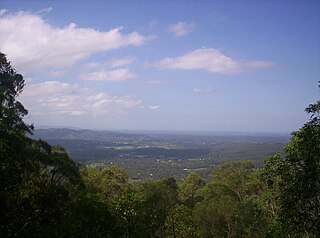
Copperlode Falls Dam or Lake Morris is a fresh water reservoir dam in Lamb Range, Cairns Region, Queensland, Australia, servicing the city of Cairns. The dam is located in the range immediately west of Cairns.
The D'Aguilar Range is a mountain range near Brisbane, Queensland, Australia. The town of Dayboro is situated on the lower foothills midway along the range and the Sunshine Coast Hinterland town of Mooloolah lies at the northernmost point of the range. Many residential areas line its eastern slopes including the town of Samford and the suburb of Ferny Hills. In the west, numerous ridges and gullies are heavily forested and designated as state forest or national park.

The Lockyer Creek is a creek located in South East Queensland, Australia. A tributary of the Brisbane River, the creek is a major drainage system in the Lockyer Valley. Rising on the eastern slopes of the Great Dividing Range, the creek flows generally north-easterly for more than 100 kilometres (62 mi) before it reaches its confluence with the Brisbane River north-northeast of Lowood, and downstream from the Wivenhoe Dam. The creek is named after Edmund Lockyer.

The Mary River is a major river system located in the South East and Wide Bay–Burnett regions of Queensland, Australia.

Glenlyon Dam, also known as Pike Creek Reservoir, is in Queensland near the border with New South Wales, roughly between Stanthorpe and Texas to the west. In 1976, the dam wall was built on Pike Creek, a tributary of the Dumaresq River, 5 km (3.1 mi) upstream from the confluence of the Mole River and Severn River branching from the Dumaresq.

The Enoggera Dam is a heritage-listed dam, which is located within the outer, western suburb of Enoggera Reservoir, in Brisbane, Queensland, Australia.

The Gold Creek Dam is an earth-fill embankment dam with an un-gated spillway across the Gold Creek that is located in the South East region of Queensland, Australia. The main purpose of the dam is for potable water supply of the Brisbane region. The resultant reservoir is called the Gold Creek Reservoir.

The Splityard Creek Dam is a rock and earth-fill embankment dam with an un-gated spillway across the Pryde Creek that is located in the South East region of Queensland, Australia. The sole purpose of the dam is for the generation of hydroelectricity. The impounded reservoir is called the Splityard Creek Reservoir.
Theresa Creek Dam is a dam located 22 km south west of Clermont in central Queensland, Australia. It was constructed in 1983 by the Blair Athol Coal Project to supply water for the town of Clermont, Queensland.

The Lake Manchester Dam is a concrete gravity dam with an un-gated spillway across the Cabbage Tree Creek that is located in the South East region of Queensland, Australia. The main purpose of the dam is for potable water supply of Brisbane. The impounded reservoir is called Lake Manchester.
The Biggera Creek Dam, or formally the Biggera Creek Flood Mitigation Dam, is a dam established for flood mitigation purposes over the Biggera Creek, located in the South East region of Queensland, Australia. The dam is situated approximately 3 kilometres (1.9 mi) northwest of Southport in the suburb of Arundel. It is operated by the Gold Coast City Council.

The Tallebudgera Creek Dam, or colloquially Tally Dam, is a decommissioned embankment dam across the upper reaches of the Tallebudgera Creek, located in the South East region of Queensland, Australia. The initial purpose of the dam from its establishment until its decommissioning during the 1970s was for the supply of potable water to the Gold Coast region. There is no public access to the dam.

Moggill Creek is a creek in Brisbane, the largest city in Queensland, Australia. The creek rises on the Taylor Range and runs in a south-easterly direction from the southern edge of Brisbane Forest Park in Kholo and Pullenvale, flowing through Upper Brookfield, Brookfield and joining the Brisbane River at Kenmore. Before entering the Brisbane River the creek is crossed by Moggill Road and winds through Rafting Ground Reserve.
Teviot Creek Dam is a dam in North Queensland, Australia. It is located on Teviot Creek, a tributary of the Isaac River, upstream of the Burton Gorge Dam. Burton Coal Pty Ltd has a licence to take 1,500 ML/year from the dam. The monthly supply reliability based on a relatively short period of record is thought to be 100%. This does not account for the current critical period and the supply should not necessarily be relied on in future. Teviot Creek Dam is owned and operated by RAG Australia Coal subsidiaries.
Return Creek Dam is located about 9 km North East of Mount Garnet, Queensland and about 46 km West of Ravenshoe, Queensland. It was constructed for mining purposes within the Return (Nanyeta) Creek.
Gold Creek rises in Brisbane Forest Park in the suburb of Upper Brookfield, Brisbane, Queensland, Australia; is dammed by Gold Creek Dam and on leaving the Forest Park runs alongside Gold Creek Road until it joins Gap Creek at Brookfield.
The Dee River is a river located in Central Queensland, Australia.

Ravensbourne is a locality in the Toowoomba Region local government area of Darling Downs region in southern Queensland, Australia. At the 2016 Australian Census, Ravensbourne and surrounds recorded a population of 248.
