
The Wivenhoe Dam is a rock and earth-fill embankment dam with a concrete spillway across the Brisbane River in South East Queensland, Australia. The dam takes it names from the local Wivenhoe Pocket rural community. The dam wall is located about 80 kilometres (50 mi) by road from the centre of Brisbane. The primary purpose of the dam is the supply of potable water for the Brisbane and Ipswich regions. The dam also provides for flood mitigation control, hydroelectricity, and recreation. The impounded reservoir is called Lake Wivenhoe and the dam, the lake and a narrow strip of surrounding land forms a locality also called Lake Wivenhoe.

The Tinaroo Dam, officially the Tinaroo Falls Dam, is a major ungated concrete gravity dam with a central ogee spillway across the Barron River located on the Atherton Tableland in Far North Queensland, Australia. The dam's purpose includes irrigation for the Mareeba-Dimbulah Irrigation Scheme, water supply, hydroelectricity, and recreation. Completed between 1953 and 1958, the dam creates the impounded reservoir, Lake Tinaroo.

The Maroon Dam is a rock and earth-fill embankment dam with an un-gated spillway across the Burnett Creek that is located in the South East region of Queensland, Australia. The main purpose of the dam is for irrigation of the Scenic Rim Regional Council region. The impounded reservoir is also called Maroon Dam.

The Burdekin Falls Dam, also known as the Burdekin Dam, is a concrete gravity dam with an uncontrolled spillway across the Burdekin River, located south west of Ayr, and Home Hill in the Shire of Burdekin, North Queensland, Australia. Built for the purpose of irrigation, the reservoir is called Lake Dalrymple. Burdekin Falls Dam is managed by SunWater. Water from the reservoir is also used to replenish downstream aquifers.

Lake Awoonga was formed on the Boyne River by the dam located 30 km (19 mi) from Gladstone, in Central Queensland, Australia. It is approximately 30 minutes drive from Gladstone, via Benaraby.
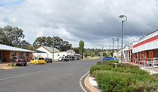
Proston is a rural town and locality in the South Burnett Region, Queensland, Australia.

Leslie Dam is a dam in the locality of the same name Leslie Dam, Southern Downs Region, Queensland, Australia. It is 11 kilometres (6.8 mi) from Warwick town centre. Freshwater fishing and water sports facilities are available.
The Borumba Dam is a rock-fill embankment dam with an un-gated spillway located across the Yabba Creek, a tributary of the Mary River, in the Wide Bay–Burnett region of Queensland, Australia. The main purposes of the dam are for irrigation and potable water supply. The resultant impounded reservoir is called Lake Borumba.
The Fairbairn Dam is an earth-filled embankment dam across the Nogoa River, located southwest of Emerald in Central Queensland, Australia. Constructed in 1972 for the primary purpose of irrigation, the impoundment created by the dam serves as one of the major potable water supplies for the region and assists with some flood mitigation.
The Fred Haigh Dam is a dam in the Bundaberg Region, Queensland, Australia. It was constructed across the Kolan River in 1978 creating Lake Monduran. The dam's catchment area, north of Bundaberg in Queensland, covers 1308 km2. It is named after Frederick Haigh who was Queensland's Commissioner of Irrigation and Water Supply from 1955 to 1974. The Monduran Dam, under construction at the time of his death, was named after him upon completion.

The Bjelke-Petersen Dam is a dam in Moffatdale near Cherbourg in the South Burnett Region, Queensland, Australia. The dam impounds Barker Creek and creates Lake Barambah. It is named after the Queensland Premier Joh Bjelke-Petersen. It is operated by Sunwater.
Wuruma Dam was constructed across the Nogo River in the upper Burnett River Catchment 48km north-west of Eidsvold for irrigation & town water supply for Eidsvold, Mundubbera and Gayndah. The dam wall is of mass concrete gravity construction which cost $5.3m to build and was completed in 1968. It has a surface area when full of 1,639 hectares, and a capacity of 165,400 ML. The dam takes its name from a local indigenous word meaning brahminy kite.
Gordonbrook Dam is an earthen dam in Gordonbook, South Burnett Region, Queensland, Australia. Along with Boondooma Dam, it is the main source of water supply for Kingaroy in the Wide Bay-Burnett area. It was built in 1941 to provide water for the Royal Australian Air Force Training Base during World War II. In 1987, due to increased demand, the dam wall was raised. From a catchment of 590 square kilometres, the dam stores 6,800 megalitres at full supply level, covering an area of 130 hectares.

The Bill Gunn Dam is an earth-fill embankment dam with an un-gated spillway located off-stream in Laidley Heights in the South East region of Queensland, Australia. The main purpose of the dam is for irrigation of the Lockyer Valley. The resultant reservoir is called Lake Dyer.

Eungella Dam is an earth and rockfill dam in the locality of Eungella Dam, Mackay Region, Queensland, Australia. It is one of Queensland's freshwater fisheries. Eungella has made a name for producing extra oversized sooty grunter and more recently barramundi.
The Ewen Maddock Dam is an earth-fill embankment dam with an un-gated spillway across the Addlington Creek that is located in Landsborough in the South East region of Queensland, Australia. The main purpose of the dam is for potable water supply of the Sunshine Coast region.
Cania Dam is a dam in central Queensland, Australia, 37 kilometres (23 mi) north west of Monto, in the locality of Cania. The dam is situated on Three Moon Creek, a tributary of the Burnett River. The dam wall is an earth and rock-fill embankment type. It has a surface area of 7.6 square kilometres, an average depth of 12 metres (39 ft) and a capacity of 88,580 ML. The dam is named after the abandoned gold mining town of Cania, which was inundated by the lake as it filled.
The Callide Dam is an earth and rock-fill dam which was constructed in 1965 to supply water for the Callide Power Station in Mount Murchison near Biloela in the state of Queensland, Australia. The impoundment of the dam is Lake Callide, which holds 136,370 megalitres (3.603×10¹⁰ US gal) at an average depth of 10.5 metres (34 ft) and a surface area of 1,240 hectares (3,100 acres) at full capacity.

The Six Mile Creek Dam is a rock and earth-fill embankment dam with an un-gated spillway across the Six Mile Creek that is located in the South East region of Queensland, Australia. The main purposes of the dam are for potable water supply of the Sunshine Coast region and for recreation. The impounded reservoir is called Lake Macdonald, named in memory of former Noosa Shire Council Chairman Ian MacDonald.
Lake Lenthall is a lake created by the Lenthalls Dam in Duckinwilla, Fraser Coast Region, Queensland, Australia. As a result of a 518 square kilometres (200 sq mi) catchment, it takes a short time in moderate rain events to fill Lake Lenthall to 100% capacity.


