
The Hinze Dam is a rock and earth-fill embankment dam with an un-gated spillway across the Nerang River in the Gold Coast hinterland of South East, Queensland, Australia. The main purpose of the dam is for potable water supply of the Gold Coast region. The impounded reservoir is called Advancetown Lake.

The Wivenhoe Dam is a rock and earth-fill embankment dam with a concrete spillway across the Brisbane River in South East Queensland, Australia. The dam wall is located about 80 kilometres (50 mi) by road from the centre of Brisbane. The primary purpose of the dam is the supply of potable water for the Brisbane and Ipswich regions. The dam also provides for flood mitigation control, hydroelectricity, and recreation. The impounded reservoir is called Lake Wivenhoe and the dam, the lake and a narrow strip of surrounding land forms a locality also called Lake Wivenhoe.

The Maroon Dam is a rock and earth-fill embankment dam with an un-gated spillway across the Burnett Creek that is located in the South East region of Queensland, Australia. The main purpose of the dam is for irrigation of the Scenic Rim Regional Council region. The impounded reservoir is also called Maroon Dam.

The North Pine Dam is a mass concrete gravity dam with earth-fill embankments on abutments with a gated spillway across the North Pine River that is located in the South East region of Queensland, Australia. The main purpose of the dam is for supply of potable water for the Moreton Bay region and Brisbane's northern suburbs. The impounded reservoir is called Lake Samsonvale.

Lake Awoonga was formed on the Boyne River by the dam located 30 km (19 mi) from Gladstone, in Central Queensland, Australia. It is approximately 30 minutes drive from Gladstone, via Benaraby.
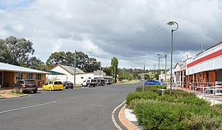
Proston is a rural town and locality in the South Burnett Region, Queensland, Australia. In the 2016 census, Proston had a population of 379 people.

Glenlyon Dam, also known as Pike Creek Reservoir, is an earth and rockfill dam in Queensland near the border with New South Wales, roughly between Stanthorpe and Texas to the west. In 1976, the dam wall was built on Pike Creek, a tributary of the Dumaresq River, 5 km (3.1 mi) upstream from the confluence of the Mole River and Severn River branching from the Dumaresq.
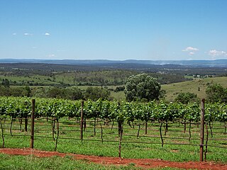
The South Burnett is a peanut growing and wine-producing area on the Great Dividing Range, north of the Darling Downs, in Queensland. It is with the basin of the Burnett River. The area is within two local government areas, South Burnett Region and Gympie Region.
The Sideling Creek Dam is an earth-fill embankment dam with an un-gated spillway across the Sideling Creek in Kurwongbah, Moreton Bay Region, Queensland, Australia. The main purposes of the dam are for potable water supply of the Moreton Bay Region and for recreation. The impounded reservoir is called Lake Kurwongbah.

The Atkinson Dam is an earth-fill embankment dam across the Buaraba Creek and a naturally forming lagoon, which is located near Lowood in the South East region of Queensland, Australia. The main purpose of the dam is for irrigation of farming land in the lower Lockyer Valley. The resultant reservoir is called Lake Atkinson.
The Borumba Dam is a rock-fill embankment dam with an un-gated spillway located across the Yabba Creek in the Wide Bay–Burnett region of Queensland, Australia. The main purposes of the dam are for irrigation and potable water supply. The resultant impounded reservoir is called Lake Borumba.
The Fred Haigh Dam is a dam in the Bundaberg Region, Queensland, Australia. It was constructed across the Kolan River in 1978 creating Lake Monduran. The dam's catchment area, north of Bundaberg in Queensland, covers 1308 km2. It is named after Frederick Haigh who was Queensland's Commissioner of Irrigation and Water Supply from 1955 to 1974. The Monduran Dam, under construction at the time of his death, was named after him upon completion.

The Bjelke-Petersen Dam is a dam in Moffatdale near Cherbourg in the South Burnett Region, Queensland, Australia. The dam impounds Barker Creek and creates Lake Barambah. It is named after the Queensland Premier Joh Bjelke-Petersen. It is operated by Sunwater.

Boondooma Dam is a dam on the Boyne River on the boundary of Boondooma and Proston in the South Burnett Region of Queensland, Australia. In 1983, the dam was constructed across the Boyne River below its confluence with the Stuart River, creating Lake Boondooma.

The Bill Gunn Dam is an earth-fill embankment dam with an un-gated spillway located off-stream in Laidley Heights in the South East region of Queensland, Australia. The main purpose of the dam is for irrigation of the Lockyer Valley. The resultant reservoir is called Lake Dyer.

The Coolmunda Dam is an earth–fill embankment dam with a gated spillway across the Macintrye Brook, a tributary of the Dumaresq River, that is located on Darling Downs in Coolmunda, Goondiwindi Region, Queensland, Australia. The main purposes of the dam are for irrigation and potable water supply. The impounded reservoir is called the Lake Coolmunda.
The Connolly Dam, also called the Silverwood Dam, is a rock–fill embankment dam with an un–gated spillway across the Rosenthall Creek and the Fitz Creek that is located in the Darling Downs region of Queensland, Australia. The main purpose of the dam is for potable water supply of the Southern Downs Region.

Wide Bay–Burnett is a region of the Australian state of Queensland, located between 170–400 km (110–250 mi) north of the state capital, Brisbane. The area's population growth has exceeded the state average over the past 20 years, and it is forecast to grow to more than 430,000 by 2031. It is the subject of the Draft Wide Bay–Burnett Regional Plan, which aims to facilitate this growth while protecting over 90% of the region from urban development.
Storm King Dam is a reservoir created by the dam of the same name in the locality of Storm King in the Southern Downs Region, Queensland, Australia. It provides water for the town of Stanthorpe.
Gordonbrook is a rural locality in the South Burnett Region, Queensland, Australia. In the 2016 census Gordonbrook had a population of 175 people.
